Burn House Clough

Valley in Yorkshire Ribble Valley

England

Burn House Clough

Ordnance Survey Cut Mark This mark can be found on the roadside wall of a former farm building - now holiday accommodation - at Laythams Farm.
The benchmark has a recorded height of 204.2374 metres above sea level.
For more detail see : <span class="nowrap"><a title="https://www.bench-marks.org.uk/bm152241" rel="nofollow ugc noopener" href="https://www.bench-marks.org.uk/bm152241">Link</a><img style="margin-left:2px;" alt="External link" title="External link - shift click to open in new window" src="https://s1.geograph.org.uk/img/external.png" width="10" height="10"/></span>
Ordnance Survey Cut Mark Credit: Peter Wood

Burn House Clough is a picturesque valley located in Yorkshire, England. Nestled within the stunning countryside, this idyllic area offers visitors a tranquil retreat away from the hustle and bustle of city life.

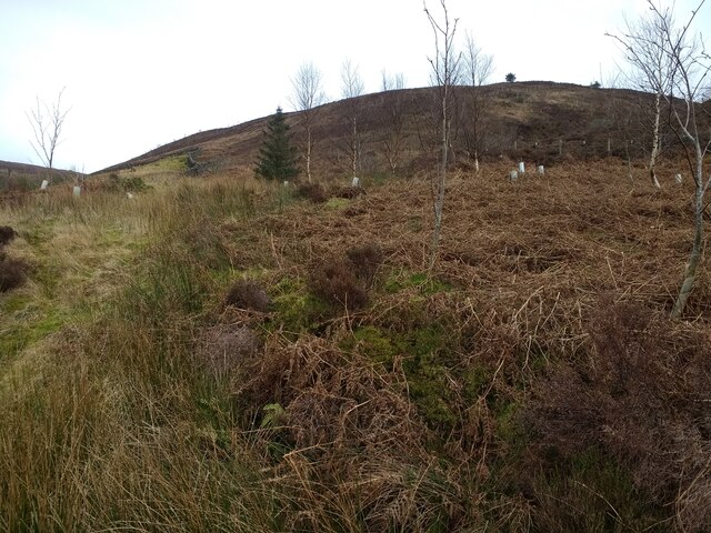
The valley is renowned for its natural beauty, with lush green meadows, rolling hills, and a meandering river that runs through its heart. The landscape is dotted with charming stone cottages and quaint farms, adding to the area's rustic charm.

Nature lovers will be delighted by the diverse flora and fauna that call Burn House Clough home. The valley boasts an array of native wildflowers, including bluebells and primroses, which create a vibrant carpet of color in the springtime. In addition, the area is a haven for birdwatchers, with a variety of species such as kingfishers and owls often spotted along the riverbanks.

For those seeking adventure, Burn House Clough offers numerous walking trails and hiking routes, providing an opportunity to explore the valley's hidden gems. The paths wind through ancient woodlands, offering panoramic views of the surrounding countryside and the chance to spot wildlife in its natural habitat.

Local amenities in the area include charming country pubs and cozy tearooms, where visitors can indulge in traditional Yorkshire cuisine and enjoy a warm welcome from the friendly locals.

In conclusion, Burn House Clough is a breathtaking valley in Yorkshire that offers visitors a peaceful and picturesque retreat. With its stunning natural landscapes, abundant wildlife, and charming rural atmosphere, it is a must-visit destination for nature enthusiasts and those seeking a break from the hustle and bustle of everyday life.

If you have any feedback on the listing, please let us know in the comments section below.

Burn House Clough Images

Images are sourced within 2km of 53.970724/-2.4978204 or Grid Reference SD6752. Thanks to Geograph Open Source API. All images are credited.

Ordnance Survey Cut Mark This mark can be found on the roadside wall of a former farm building - now holiday accommodation - at Laythams Farm.
The benchmark has a recorded height of 204.2374 metres above sea level.
For more detail see : <span class="nowrap"><a title="https://www.bench-marks.org.uk/bm152241" rel="nofollow ugc noopener" href="https://www.bench-marks.org.uk/bm152241">Link</a><img style="margin-left:2px;" alt="External link" title="External link - shift click to open in new window" src="https://s1.geograph.org.uk/img/external.png" width="10" height="10"/></span>
Ordnance Survey Cut Mark
This mark can be found on the roadside wall of a former farm building - now holiday accommodation - at Laythams Farm. The benchmark has a recorded height of 204.2374 metres above sea level. For more detail see : LinkExternal link
Looking up Beatrix Fell from the path
Dilworth Barn View of Dilworth Barn with Dunsop Fell in the background.
Dilworth Barn
View of Dilworth Barn with Dunsop Fell in the background.
Brunghill Moor Brunghill Moor Farm.
Brunghill Moor
Brunghill Moor Farm.
Cairn on the western edge of Beatrix Fell Seen from the footpath on the eastern side of Whitendale. The cairn, named as "Stone Haw Guide" on larger scale maps, is very prominent and marked on the O.S. map.
Cairn on the western edge of Beatrix Fell
Seen from the footpath on the eastern side of Whitendale. The cairn, named as "Stone Haw Guide" on larger scale maps, is very prominent and marked on the O.S. map.
Engineering support for the aqueduct There must have been a significant landslip at some time in the past, as the aqueduct pipe is carried in a concrete frame for a distance of about 90m.  The concrete frame looks several decades old, but below it is an extensive area of much fresher looking rock fill with massive gabions at the toe, suggesting a more recent movement of the hillside.  See also <a href="https://www.geograph.org.uk/photo/4301263">SD6654 : Geoengineering on the path on the east bank of the Whitendale River near Stony Clough</a> taken the previous year.
Engineering support for the aqueduct
There must have been a significant landslip at some time in the past, as the aqueduct pipe is carried in a concrete frame for a distance of about 90m. The concrete frame looks several decades old, but below it is an extensive area of much fresher looking rock fill with massive gabions at the toe, suggesting a more recent movement of the hillside. See also SD6654 : Geoengineering on the path on the east bank of the Whitendale River near Stony Clough taken the previous year.
Path along the aqueduct The public footpath runs on top of the Whitendale aqueduct for a considerable distance.
Path along the aqueduct
The public footpath runs on top of the Whitendale aqueduct for a considerable distance.
Water board marker post BCWW is Blackburn Corporation Water Works, who laid the aqueduct (raw water main) beneath this track.
Water board marker post
BCWW is Blackburn Corporation Water Works, who laid the aqueduct (raw water main) beneath this track.
Little Costy Clough  Seen from across Costy Clough.
Little Costy Clough
Seen from across Costy Clough.
Aqueduct crossing Costy Clough  A short enough span for the spigot-and-socket pipes to need no intermediate support; the timber bridge simply takes the public footpath across the stream.
Aqueduct crossing Costy Clough
A short enough span for the spigot-and-socket pipes to need no intermediate support; the timber bridge simply takes the public footpath across the stream.
Aqueduct crossing Little Costy Clough  A short enough span for the spigot-and-socket pipes to need no intermediate support; the timber bridge simply takes the public footpath across the stream.
Aqueduct crossing Little Costy Clough
A short enough span for the spigot-and-socket pipes to need no intermediate support; the timber bridge simply takes the public footpath across the stream.
Waterfall in Costy Clough  Viewed from the taking the public footpath across the stream <a href="https://www.geograph.org.uk/photo/4907443">SD6553 : Aqueduct crossing Costy Clough </a>.
Waterfall in Costy Clough
Viewed from the taking the public footpath across the stream SD6553 : Aqueduct crossing Costy Clough .
Cascade in Little Costy Clough  Viewed from the taking the public footpath across the stream <a href="https://www.geograph.org.uk/photo/4907447">SD6553 : Aqueduct crossing Little Costy Clough </a>.
Cascade in Little Costy Clough
Viewed from the taking the public footpath across the stream SD6553 : Aqueduct crossing Little Costy Clough .
Waterworks building by the Whitendale River There are several valves and other bits of plant nearby, probably relating to the (now disused) water intake in the clough nearby <a href="https://www.geograph.org.uk/photo/4372678">SD6653 : Water Intake, Costy Clough</a>. The building itself may have been nothing more than a store. For a view of the interior, see <a href="https://www.geograph.org.uk/photo/4301250">SD6553 : Interior of small building on east bank of Whitendale River</a>.
Waterworks building by the Whitendale River
There are several valves and other bits of plant nearby, probably relating to the (now disused) water intake in the clough nearby SD6653 : Water Intake, Costy Clough. The building itself may have been nothing more than a store. For a view of the interior, see SD6553 : Interior of small building on east bank of Whitendale River.
Mystery object at the waterworks Outside a small stone building <a href="https://www.geograph.org.uk/photo/4907462">SD6553 : Waterworks building by the Whitendale River</a>.  It consists of a pair of iron collars, one fastened to an upright iron post.  Was the other end originally fastened to a similar post (and why?) or was it perhaps for tying up a horse?
Mystery object at the waterworks
Outside a small stone building SD6553 : Waterworks building by the Whitendale River. It consists of a pair of iron collars, one fastened to an upright iron post. Was the other end originally fastened to a similar post (and why?) or was it perhaps for tying up a horse?
Site of a landslip All along the Dunsop and Whitendale valleys we saw evidence of former landslips.  In this instance at least, the cause seems to have been a geological fault, as the exposed ground was highly fractured shale rather than the more solid rock either side.  But the angle of the tree trunks suggests continual movement in the hillside here.
Site of a landslip
All along the Dunsop and Whitendale valleys we saw evidence of former landslips. In this instance at least, the cause seems to have been a geological fault, as the exposed ground was highly fractured shale rather than the more solid rock either side. But the angle of the tree trunks suggests continual movement in the hillside here.
Water valves  One of many such installations along the valley bottom.
Water valves
One of many such installations along the valley bottom.
Fallen tree Adjacent to the Whitendale river.  Possibly brought down by the floods of December 2015.
Fallen tree
Adjacent to the Whitendale river. Possibly brought down by the floods of December 2015.
Show me another place!

Burn House Clough is located at Grid Ref: SD6752 (Lat: 53.970724, Lng: -2.4978204)

Division: West Riding

Administrative County: Lancashire

District: Ribble Valley

Police Authority: Lancashire

What 3 Words

///shrug.economics.bricks. Near Waddington, Lancashire

Nearby Locations

Burn House Clough

Related Wikis

River Dunsop

The River Dunsop is a river in the Forest of Bowland in Northern England. It flows into the River Hodder at Dunsop Bridge.It begins at the confluence of...

Bowland Forest High

Bowland Forest High is a civil parish in the Ribble Valley district of Lancashire, England, covering some 20,000 acres (80 km2) of the Forest of Bowland...

Dunsop Bridge

Dunsop Bridge is a village in the civil parish of Bowland Forest High, in the borough of Ribble Valley, Lancashire, England, 9 miles (14 km) north-west...

Dunsop Bridge (structure)

Dunsop Bridge is a bridge in the English village of the same name. The structure, which dates to the early 19th century, crosses the River Dunsop. A Grade...

Nearby Amenities

Located within 500m of 53.970724,-2.4978204
Barrier: cattle_grid
Bicycle: yes
Foot: yes
Lat/Long: 53.9675934/-2.4925076
Historic: aircraft_wreck
Lat/Long: 53.9731093/-2.5027288
Ox Rig
Place: locality
Lat/Long: 53.9730598/-2.5039198
The data included in this document is from www.openstreetmap.org. The data is made available under ODbL.

Have you been to Burn House Clough?

Leave your review of Burn House Clough below (or comments, questions and feedback).