Black Cleugh
Valley in Northumberland
England
Black Cleugh

Black Cleugh is a picturesque valley located in the county of Northumberland, England. Nestled amidst the stunning scenery of the North Pennines, this secluded valley offers visitors a tranquil and unspoiled retreat from the bustling cities.
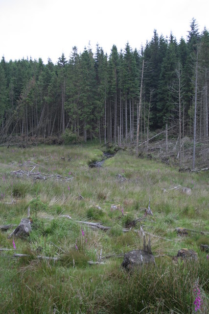
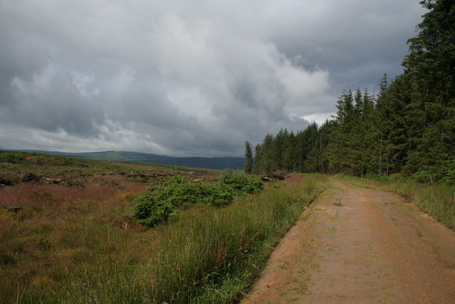
The valley is characterized by its dramatic landscapes, with steep slopes covered in heather and grasses, interspersed with scattered trees and rocky outcrops. A small stream meanders through the valley, adding to its charm and providing a habitat for various wildlife species.
Black Cleugh is a haven for nature lovers and outdoor enthusiasts. The valley is home to a diverse range of flora and fauna, including rare bird species, such as curlews and lapwings, as well as numerous wildflowers and mosses. The surrounding hills provide ample opportunities for hiking, offering breathtaking views of the valley and the surrounding countryside.
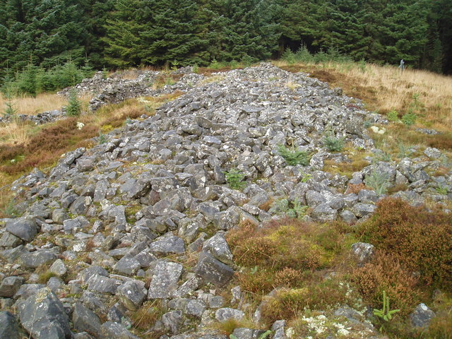
The valley also holds historical significance, with remnants of mining and quarrying activities from the 19th century still visible in the area. These remnants serve as a reminder of the valley's industrial past and add an intriguing dimension to its natural beauty.
Access to Black Cleugh is limited, with only a few winding country lanes leading to the valley. This seclusion adds to its appeal, allowing visitors to truly immerse themselves in the tranquility and serenity of the area.
Overall, Black Cleugh in Northumberland is a hidden gem, offering visitors a chance to escape the hustle and bustle of modern life and connect with nature in a truly awe-inspiring setting.
If you have any feedback on the listing, please let us know in the comments section below.
Black Cleugh Images
Images are sourced within 2km of 55.23303/-2.5143986 or Grid Reference NY6793. Thanks to Geograph Open Source API. All images are credited.


Black Cleugh is located at Grid Ref: NY6793 (Lat: 55.23303, Lng: -2.5143986)
Unitary Authority: Northumberland
Police Authority: Northumbria
What 3 Words
///poster.stags.imprinted. Near Rochester, Northumberland
Nearby Locations
Related Wikis

Plashetts
Plashetts is a small settlement in Northumberland, in England south east of Kielder, Northumberland. It is about 22 miles (35 km) north west of Hexham...

Kielder Forest
Kielder Forest is a large forestry plantation in Northumberland, England, surrounding Kielder village and the Kielder Water reservoir. It is the largest...
Devil's Lapful
Devil's Lapful is an archaeological site in Northumberland, England, in Kielder Forest about 0.8 miles (1.3 km) south-east of Kielder. The site, a Neolithic...
Plashetts railway station
Plashetts railway station is a closed stone built railway station that served the mining hamlet of Plashetts, in Northumberland, England, which is now...
Nearby Amenities
Located within 500m of 55.23303,-2.5143986Have you been to Black Cleugh?
Leave your review of Black Cleugh below (or comments, questions and feedback).