Bleashaw Clough

Valley in Yorkshire Ribble Valley

England

Bleashaw Clough

Track to Langden Castle The track above Langden Intake reaches into the heart of the Bowland Fells.
Track to Langden Castle Credit: Oliver Dixon

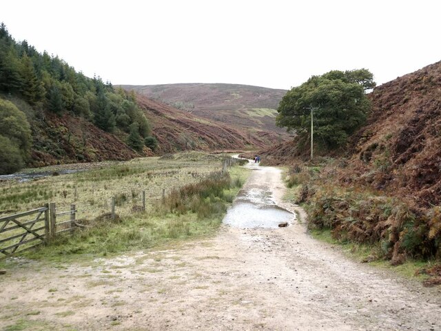
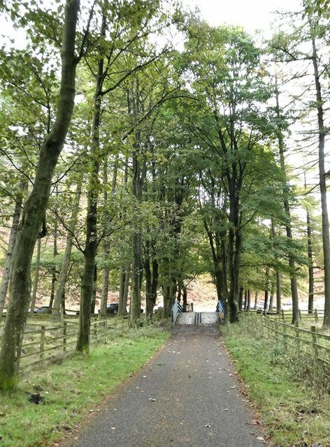
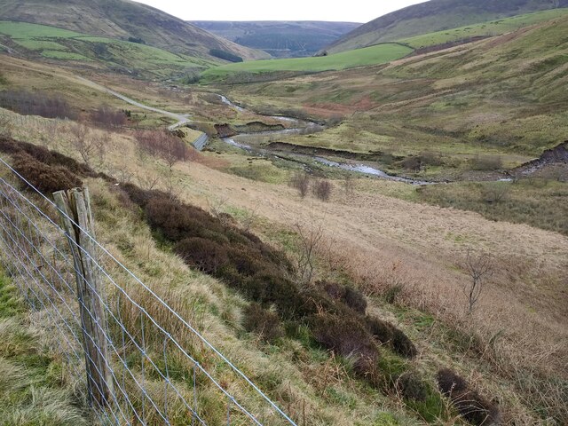
Bleashaw Clough is a picturesque valley located in Yorkshire, England. Nestled within the larger Pennines mountain range, this stunning landscape is known for its natural beauty and tranquil atmosphere. The clough, or gorge, is situated in the heart of the Yorkshire Dales National Park, making it a popular destination for nature enthusiasts and hikers.

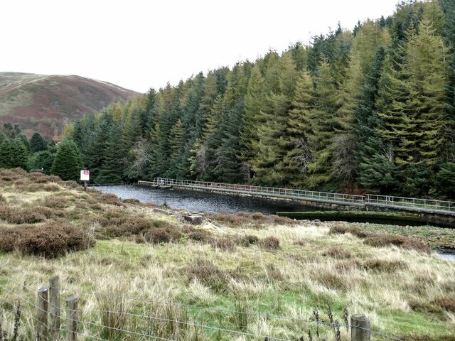
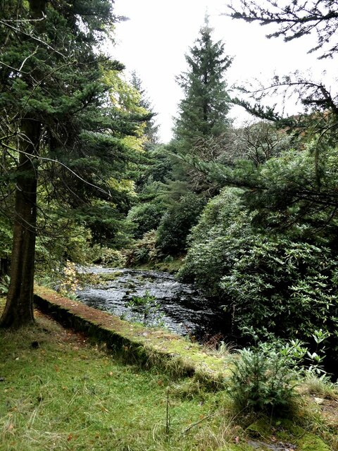
The valley is characterized by its steep sides and rocky terrain, which were carved out over centuries by the flowing waters of the Bleashaw Beck, a small river that meanders through the clough. The river's gentle babbling and the surrounding lush vegetation create a serene ambiance, providing a peaceful escape from the hustle and bustle of everyday life.

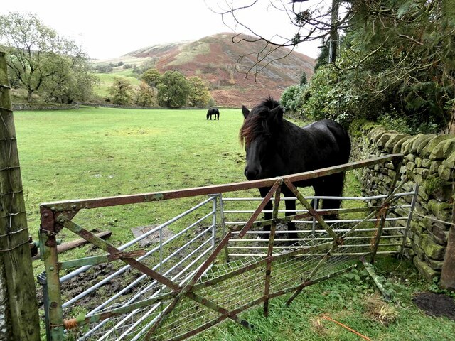
The diverse flora and fauna found in Bleashaw Clough add to its charm. The valley is home to a variety of plant species, including heather, ferns, and mosses, which blanket the slopes and add vibrant hues to the landscape. Wildlife such as birds, rabbits, and deer can often be spotted in the area, making it a haven for animal lovers and birdwatchers.

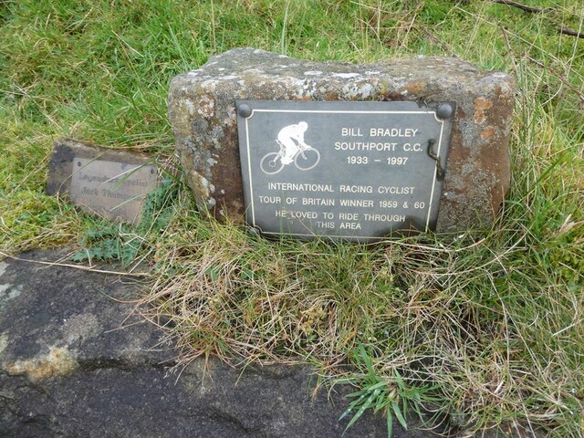
For those seeking outdoor adventures, the clough offers several walking trails that cater to different skill levels. From leisurely strolls along the riverbank to more challenging hikes up the rocky cliffs, there is something for everyone. The valley also features several picnic spots, allowing visitors to relax and enjoy the breathtaking views while savoring a packed lunch.

Bleashaw Clough is a hidden gem in Yorkshire, offering a tranquil escape and a chance to connect with nature in its purest form. Its stunning beauty and diverse wildlife make it a must-visit destination for anyone exploring the Yorkshire Dales.

If you have any feedback on the listing, please let us know in the comments section below.

Bleashaw Clough Images

Images are sourced within 2km of 53.967414/-2.5537246 or Grid Reference SD6352. Thanks to Geograph Open Source API. All images are credited.

Track to Langden Castle The track above Langden Intake reaches into the heart of the Bowland Fells.
Track to Langden Castle
The track above Langden Intake reaches into the heart of the Bowland Fells.
Langden Intake Lagoon Part of the infrastructure for the Preston water supply.
Langden Intake Lagoon
Part of the infrastructure for the Preston water supply.
Settling tanks at  Langden Intake Part of the infrastructure for the Preston water supply.
Settling tanks at Langden Intake
Part of the infrastructure for the Preston water supply.
Horses in field near Langden Intake Sykes Nab <a href="https://www.geograph.org.uk/gridref/SD6351">SD6351</a> in the background.
Horses in field near Langden Intake
Sykes Nab SD6351 in the background.
Langden Brook The well-wooded stretch of the Brook below Langden Intake.
Langden Brook
The well-wooded stretch of the Brook below Langden Intake.
Cyclists' memorials at the Trough of Bowland About the year 2000 give or take a year, I cycled up to the Trough of Bowland to witness the Tour of Britain passing through. Amongst the many cyclists assembled there, I witnessed a small group intent on inaugurating this memorial stone. It never occurred to me to photograph this event (it was of course before Geograph days) and indeed I had no idea of the significance of the event.

This understated memorial reads 

Bill Bradley, Southport CC, 1933-1997
International Racing Cyclist
Tour of Britain winner 1959 and 1960
He loved to ride through the area

An even more modest memorial stone has subsequently been added to the left of the original memorial. It reads:

Legendary Cyclist 
Jack Thompson
1912-2003

Up until 2010, the second stone rested on top of the original - see <a href="https://www.geograph.org.uk/photo/1900323">SD6253 : Cyclists' memorials, Trough of Bowland</a>, but by 2012 it had been moved to the side <a href="https://www.geograph.org.uk/photo/2960819">SD6253 : Memorial stones, Trough of Bowland</a>.
Cyclists' memorials at the Trough of Bowland
About the year 2000 give or take a year, I cycled up to the Trough of Bowland to witness the Tour of Britain passing through. Amongst the many cyclists assembled there, I witnessed a small group intent on inaugurating this memorial stone. It never occurred to me to photograph this event (it was of course before Geograph days) and indeed I had no idea of the significance of the event. This understated memorial reads Bill Bradley, Southport CC, 1933-1997 International Racing Cyclist Tour of Britain winner 1959 and 1960 He loved to ride through the area An even more modest memorial stone has subsequently been added to the left of the original memorial. It reads: Legendary Cyclist Jack Thompson 1912-2003 Up until 2010, the second stone rested on top of the original - see SD6253 : Cyclists' memorials, Trough of Bowland, but by 2012 it had been moved to the side SD6253 : Memorial stones, Trough of Bowland.
Cyclists' memorials at the Trough of Bowland Just visible above the low wall are the understated memorials to two distinguished cyclists. For details, see <a href="https://www.geograph.org.uk/photo/7002538">SD6253 : Cyclists' memorials at the Trough of Bowland</a>.
Cyclists' memorials at the Trough of Bowland
Just visible above the low wall are the understated memorials to two distinguished cyclists. For details, see SD6253 : Cyclists' memorials at the Trough of Bowland.
Cattle grid at the Trough of Bowland A famous mountain road between Clitheroe and Lancaster.
Cattle grid at the Trough of Bowland
A famous mountain road between Clitheroe and Lancaster.
Service road from Langden Intake The tree-lined service road from the Preston waterworks crosses the Losterdale Brook by a reinforced bridge.
Service road from Langden Intake
The tree-lined service road from the Preston waterworks crosses the Losterdale Brook by a reinforced bridge.
View down the Brennand Valley from the aqueduct near Well Springs Clough intake
Track bridge from Folds Clough aqueduct
Looking east down the Brennand valley from the aqueduct near the Brennand screen chamber
Eroded slope below Brennand screen chamber
Looking down the Brennand valley from just below the Brennand screen chamber
Spillway from Brennand screen chamber
View down Brennand valley from inside the Brennand screen chamber fencing
Looking down the Brennand valley from the level of the aqueduct
Looking east towards Brennand screen chamber along the covered aqueduct
Show me another place!

Bleashaw Clough is located at Grid Ref: SD6352 (Lat: 53.967414, Lng: -2.5537246)

Division: West Riding

Administrative County: Lancashire

District: Ribble Valley

Police Authority: Lancashire

What 3 Words

///professes.emeralds.terribly. Near Waddington, Lancashire

Related Wikis

Trough of Bowland

The Trough of Bowland is a valley and high pass in the Forest of Bowland Area of Outstanding Natural Beauty, Lancashire, England. The pass, reaching 968...

Sykes Smelt Mill

Sykes Smelt Mill was a mediaeval mill located between Sykes and Hareden in Bowland Forest High, Lancashire, England. It stood on the banks of Langden Brook...

Grey Stone of Trough

The Grey Stone of Trough is an historic boundary marker in Bowland Forest High, in the Trough of Bowland, Lancashire, England. A Grade II listed structure...

Forest of Bowland

The Forest of Bowland, also known as the Bowland Fells and formerly the Chase of Bowland, is an area of gritstone fells, deep valleys and peat moorland...

Nearby Amenities

Located within 500m of 53.967414,-2.5537246
Ford: yes
Lat/Long: 53.9688171/-2.5512545
Ford: yes
Lat/Long: 53.9686562/-2.5505215
Barrier: water_gate
Lat/Long: 53.9682064/-2.5481414
Barrier: water_gate
Lat/Long: 53.9641031/-2.5531134
Turner Hill
Place: locality
Lat/Long: 53.965779/-2.5543626
Barrier: water_gate
Lat/Long: 53.96727/-2.5489838
Barrier: water_gate
Lat/Long: 53.9665152/-2.5499839
Barrier: water_gate
Lat/Long: 53.9654998/-2.5516802
Barrier: water_gate
Lat/Long: 53.9643956/-2.5527339
The data included in this document is from www.openstreetmap.org. The data is made available under ODbL.

Have you been to Bleashaw Clough?

Leave your review of Bleashaw Clough below (or comments, questions and feedback).