Dimples Clough

Valley in Yorkshire Ribble Valley

England

Dimples Clough

Fresh eggs for sale at Higher Fence Wood Farmhouse
Fresh eggs for sale at Higher Fence Wood Farmhouse Credit: Raymond Knapman

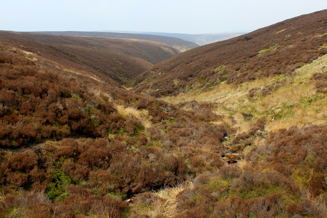
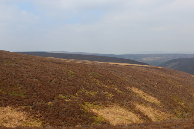
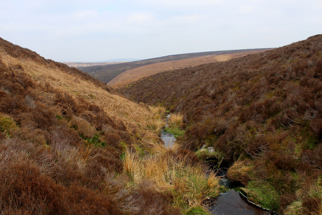
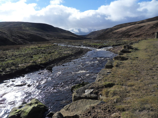
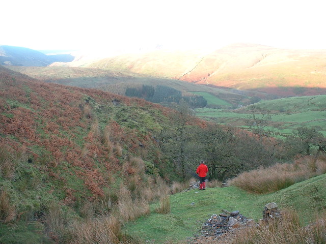
Dimples Clough is a picturesque valley located in the county of Yorkshire, England. Nestled amidst the stunning countryside, this valley offers a tranquil retreat for nature lovers and outdoor enthusiasts alike. The name "Dimples Clough" originates from the Old English word "clōh," meaning a narrow valley or ravine, which perfectly describes the landscape of this area.

Surrounded by rolling hills and dense woodlands, Dimples Clough boasts breathtaking views and an abundance of wildlife. The valley is home to a diverse range of flora and fauna, with rare plants and animals often spotted by visitors. The area's rich biodiversity contributes to its status as a designated Area of Outstanding Natural Beauty.

Visitors to Dimples Clough can explore the numerous walking trails that wind through the valley, offering opportunities to discover hidden waterfalls, meandering streams, and peaceful picnic spots. The valley also features several well-maintained cycling routes, providing an exhilarating way to experience the area's natural beauty.

History enthusiasts will find interest in Dimples Clough's past, as remnants of ancient settlements and archaeological sites can be found scattered throughout the valley. These historical artifacts offer a glimpse into the lives of the people who once inhabited this area.

In addition to its natural beauty and historical significance, Dimples Clough offers a range of amenities for visitors. The valley is home to charming bed and breakfasts, quaint country pubs, and local shops, ensuring a comfortable and enjoyable stay for those who wish to explore this hidden gem in Yorkshire.

If you have any feedback on the listing, please let us know in the comments section below.

Dimples Clough Images

Images are sourced within 2km of 53.933651/-2.5719659 or Grid Reference SD6248. Thanks to Geograph Open Source API. All images are credited.

Fresh eggs for sale at Higher Fence Wood Farmhouse
Path through Felled Forest on Whitemore Evidence of the plantation having been replanted, after previous felling.
Path through Felled Forest on Whitemore
Evidence of the plantation having been replanted, after previous felling.
Access Lane to Whitemore (1) Section of a very long access lane to Whitemore - the saddle between Whitemore Fell and Fair Oak Fell can be seen in the background.
Access Lane to Whitemore (1)
Section of a very long access lane to Whitemore - the saddle between Whitemore Fell and Fair Oak Fell can be seen in the background.
Access Lane to Whitemore (2)
Bridleway below the Plantation on Whitemore A bridleway offering fine views of the Southern Bowland Fells
Bridleway below the Plantation on Whitemore
A bridleway offering fine views of the Southern Bowland Fells
Below Bleadale Grains Several narrow watercourses meet down here to form a tributary headwater for Bleadale Water.
Below Bleadale Grains
Several narrow watercourses meet down here to form a tributary headwater for Bleadale Water.
A Southern Bowland View
A View from beside a Tributary of Bleadale Water This took a fair bit of effort, fighting through knee high heather to negotiate myself into the extreme south eastern corner of this square.
A View from beside a Tributary of Bleadale Water
This took a fair bit of effort, fighting through knee high heather to negotiate myself into the extreme south eastern corner of this square.
Young trees at Whitemore Soon the view up the Hodder Valley from this part of the bridleway will be lost as the conifers shoot upwards again.
Young trees at Whitemore
Soon the view up the Hodder Valley from this part of the bridleway will be lost as the conifers shoot upwards again.
Cattle below Mellor Knoll By the bridleway which traverses the broad flat col between the knoll and Totridge Fell.
Cattle below Mellor Knoll
By the bridleway which traverses the broad flat col between the knoll and Totridge Fell.
Beasley's Steady An area of tough heather moorland dropping towards the head of Bleadale.
Beasley's Steady
An area of tough heather moorland dropping towards the head of Bleadale.
Stile and bridle gate
Fog Hill Ford This ford on the Hareden Brook is found at Fog Hill.
<span class="nowrap"><a title="http://youtu.be/fjW6KAg9MT0" rel="nofollow ugc noopener" href="http://youtu.be/fjW6KAg9MT0">Link</a><img style="margin-left:2px;" alt="External link" title="External link - shift click to open in new window" src="https://s1.geograph.org.uk/img/external.png" width="10" height="10"/></span>
Fog Hill Ford
This ford on the Hareden Brook is found at Fog Hill. LinkExternal link
Langden Brook near the confluence with Little Harden Clough Little Harden Clough joins Langden Brook from the south (left). The words clough and brook both derive from Old English but the former term, which refers to a steep stream and its ravine, seems more restricted to the north of England. There was heavy snow in Lancashire the day before this photo was taken but not even a flake is visible today.
Langden Brook near the confluence with Little Harden Clough
Little Harden Clough joins Langden Brook from the south (left). The words clough and brook both derive from Old English but the former term, which refers to a steep stream and its ravine, seems more restricted to the north of England. There was heavy snow in Lancashire the day before this photo was taken but not even a flake is visible today.
Hareden Fell Looking west to Bleadale Moss on the summit ridge of Hareden Fell Forest of Bowland. I added some stones to the guide cairn
Hareden Fell
Looking west to Bleadale Moss on the summit ridge of Hareden Fell Forest of Bowland. I added some stones to the guide cairn
Bleadale Water A rough track follows Bleadale Water up towards Hareden Fell. Leave the path at your peril as it's virgin territory
Bleadale Water
A rough track follows Bleadale Water up towards Hareden Fell. Leave the path at your peril as it's virgin territory
Alders Lane Foot Brook On the slopes of Totridge the Brook flows down grassy ravines. Above the picture is a spoil heap associated with previous mining activity.Many watercourses in Bowland are named 'Brook' which is contrary to the usual local Norse term 'Beck'.
Alders Lane Foot Brook
On the slopes of Totridge the Brook flows down grassy ravines. Above the picture is a spoil heap associated with previous mining activity.Many watercourses in Bowland are named 'Brook' which is contrary to the usual local Norse term 'Beck'.
At Lane Foot Brook Steep grassy ravines on the North flank of Totridge are the source of Lane Foot Brook a tiny mountain stream which is pleasantly wooded in parts in contrast to the bleak fellside.Trough of Bowland in the distance.
At Lane Foot Brook
Steep grassy ravines on the North flank of Totridge are the source of Lane Foot Brook a tiny mountain stream which is pleasantly wooded in parts in contrast to the bleak fellside.Trough of Bowland in the distance.
Show me another place!

Dimples Clough is located at Grid Ref: SD6248 (Lat: 53.933651, Lng: -2.5719659)

Division: West Riding

Administrative County: Lancashire

District: Ribble Valley

Police Authority: Lancashire

What 3 Words

///dissolves.slant.amplifier. Near Waddington, Lancashire

Nearby Locations

Dimples Clough

Related Wikis

Forest of Bowland

The Forest of Bowland, also known as the Bowland Fells and formerly the Chase of Bowland, is an area of gritstone fells, deep valleys and peat moorland...

Sykes Smelt Mill

Sykes Smelt Mill was a mediaeval mill located between Sykes and Hareden in Bowland Forest High, Lancashire, England. It stood on the banks of Langden Brook...

Bowland Forest High milestone

The Bowland Forest High milestone is an historic milestone marker in the English parish of Bowland Forest High, in the Trough of Bowland, Lancashire. A...

Langden Brook

Langden Brook is a watercourse in the Trough of Bowland, Lancashire, England. A tributary of the River Hodder, its source is near the summit of Hawthornthwaite...

Have you been to Dimples Clough?

Leave your review of Dimples Clough below (or comments, questions and feedback).