The Gully

Valley in Gloucestershire

England

The Gully

Fingerpost over a village pump At the bottom of the High St, Thornbury. The location is also called  "The Plain". This fingerpost hangs over a village pump within a horseshoe of iron railings. Context (reverse) view see <a href="https://www.geograph.org.uk/photo/7020690">ST6390 : Village Pump & fingerpost, High Street</a>

Inscription: To Gloucester ☛

Milestone Society National ID: GL_ST6390
Fingerpost over a village pump Credit: Mr Red

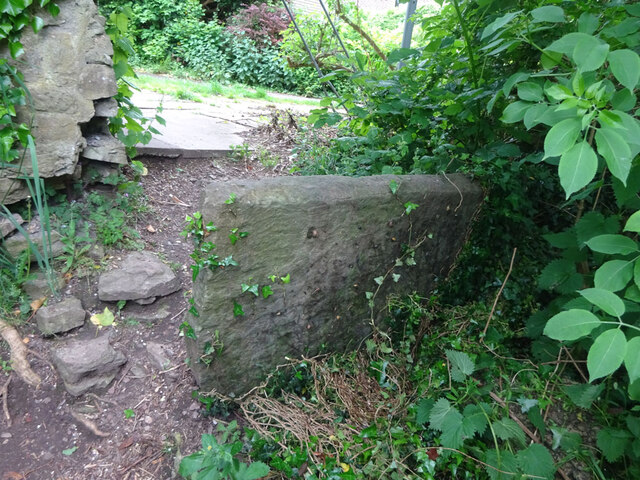
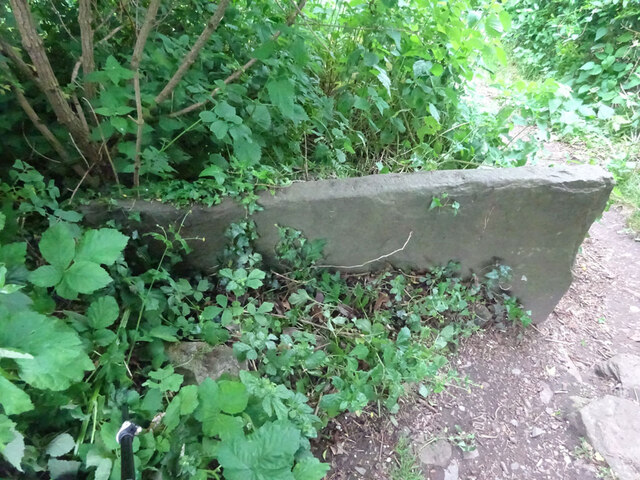
The Gully is a picturesque valley located in the county of Gloucestershire, England. Nestled in the heart of the Cotswolds, this charming landscape offers a tranquil retreat for nature lovers and outdoor enthusiasts alike. The valley is renowned for its stunning natural beauty, with rolling hills, lush greenery, and meandering streams that create a soothing ambiance.

One of the main attractions of The Gully is its diverse wildlife. The valley is home to a wide range of species, including rabbits, foxes, badgers, and various bird species. Nature enthusiasts can enjoy exploring the valley's many walking trails and observe the native flora and fauna in their natural habitat.

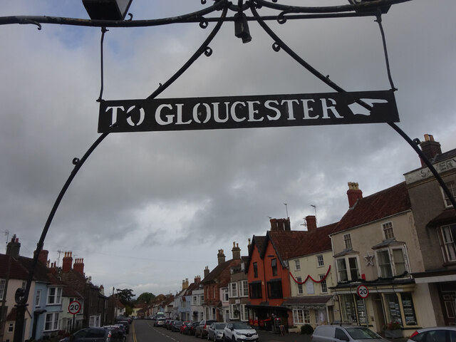
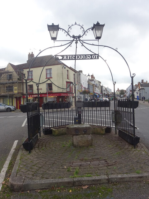
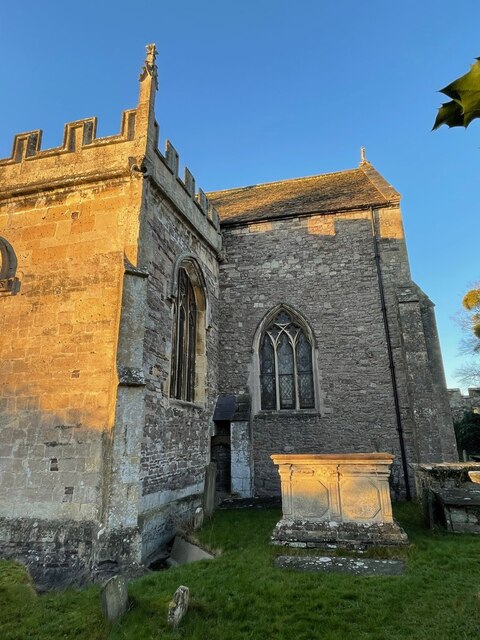
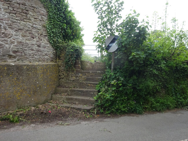
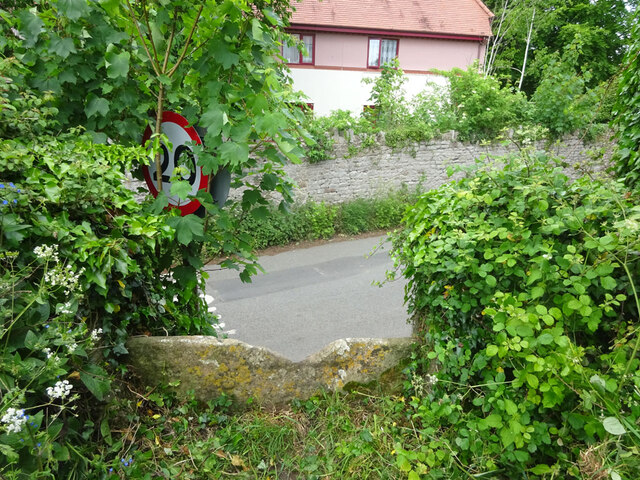
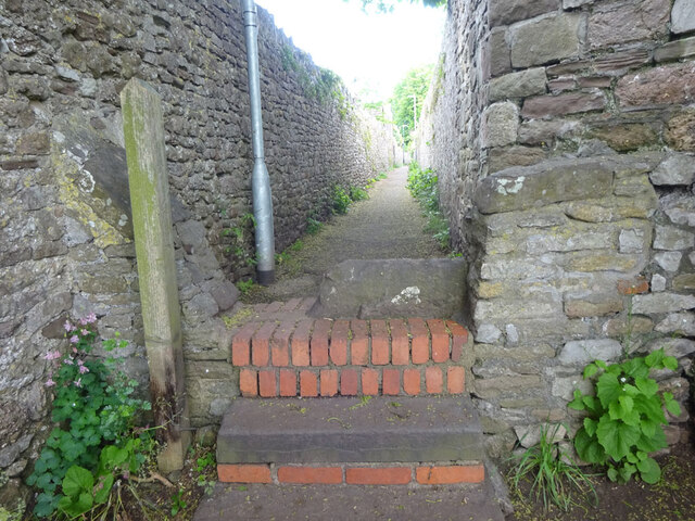
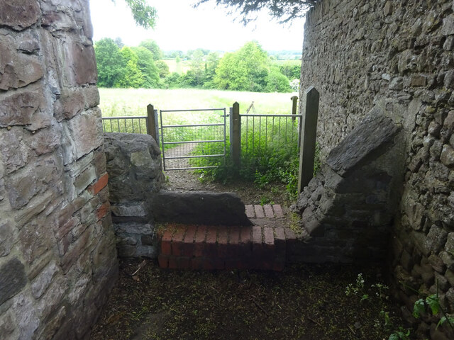
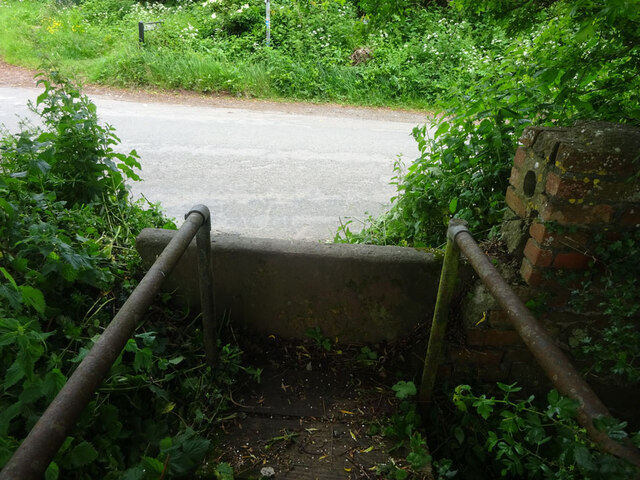
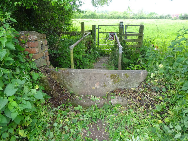
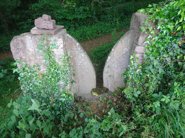
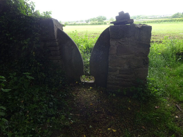
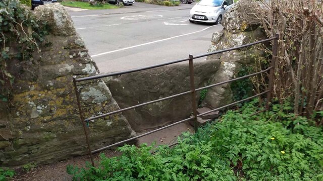
The Gully also boasts several historical landmarks that add to its charm. The remnants of ancient settlements and stone structures can be found scattered throughout the valley, providing a glimpse into the area's rich history. Additionally, there are several quaint villages in the vicinity of The Gully, where visitors can experience the traditional Cotswold architecture and enjoy the local hospitality.

For those seeking outdoor activities, The Gully offers ample opportunities for hiking, cycling, and picnicking. The valley's well-maintained trails cater to all skill levels, making it a popular destination for both casual walkers and avid adventurers. The serene atmosphere and breathtaking vistas make The Gully an ideal spot for relaxation and rejuvenation.

In summary, The Gully in Gloucestershire is a stunning valley that showcases the beauty of the Cotswolds. With its diverse wildlife, historical landmarks, and outdoor activities, it is a destination that appeals to nature enthusiasts and history buffs alike.

If you have any feedback on the listing, please let us know in the comments section below.

The Gully Images

Images are sourced within 2km of 51.611498/-2.5446986 or Grid Reference ST6290. Thanks to Geograph Open Source API. All images are credited.

Fingerpost over a village pump At the bottom of the High St, Thornbury. The location is also called  "The Plain". This fingerpost hangs over a village pump within a horseshoe of iron railings. Context (reverse) view see <a href="https://www.geograph.org.uk/photo/7020690">ST6390 : Village Pump & fingerpost, High Street</a>

Inscription: To Gloucester ☛

Milestone Society National ID: GL_ST6390
Fingerpost over a village pump
At the bottom of the High St, Thornbury. The location is also called "The Plain". This fingerpost hangs over a village pump within a horseshoe of iron railings. Context (reverse) view see ST6390 : Village Pump & fingerpost, High Street Inscription: To Gloucester ☛ Milestone Society National ID: GL_ST6390
Village Pump & fingerpost, High Street Bottom of the High Street, Thornbury. The location is also called  "The Plain". Surrounded by railings in a horseshoe pattern, with a fingerpost sign hanging above. Twin, old fashioned style lamps above. Obverse view of fingerpost see <a href="https://www.geograph.org.uk/photo/7020649">ST6390 : Fingerpost over a village pump</a>

Inscription: To Gloucester ☛

Milestone Society National ID: GL_ST6390
Village Pump & fingerpost, High Street
Bottom of the High Street, Thornbury. The location is also called "The Plain". Surrounded by railings in a horseshoe pattern, with a fingerpost sign hanging above. Twin, old fashioned style lamps above. Obverse view of fingerpost see ST6390 : Fingerpost over a village pump Inscription: To Gloucester ☛ Milestone Society National ID: GL_ST6390
Flush Bracket OSBM 102: Thornbury, St. Mary's Church This Ordnance Survey benchmark is located on a small buttress in an internal angle near the south-east corner of the church.  See <a title="https://www.geograph.org.uk/photo/7074287" href="https://www.geograph.org.uk/photo/7074287">Link</a> for a wider view and <span class="nowrap"><a title="https://www.bench-marks.org.uk/bm9770" rel="nofollow ugc noopener" href="https://www.bench-marks.org.uk/bm9770">Link</a><img style="margin-left:2px;" alt="External link" title="External link - shift click to open in new window" src="https://s1.geograph.org.uk/img/external.png" width="10" height="10"/></span> for details of the mark.
Flush Bracket OSBM 102: Thornbury, St. Mary's Church
This Ordnance Survey benchmark is located on a small buttress in an internal angle near the south-east corner of the church. See Link for a wider view and LinkExternal link for details of the mark.
Part of Thornbury Church An Ordnance Survey benchmark is located on the small buttress in the internal angle shown near the south-east corner of the church.  See <a title="https://www.geograph.org.uk/photo/7074281" href="https://www.geograph.org.uk/photo/7074281">Link</a> for a closer view and <span class="nowrap"><a title="https://www.bench-marks.org.uk/bm9770" rel="nofollow ugc noopener" href="https://www.bench-marks.org.uk/bm9770">Link</a><img style="margin-left:2px;" alt="External link" title="External link - shift click to open in new window" src="https://s1.geograph.org.uk/img/external.png" width="10" height="10"/></span> for details of the mark.
Part of Thornbury Church
An Ordnance Survey benchmark is located on the small buttress in the internal angle shown near the south-east corner of the church. See Link for a closer view and LinkExternal link for details of the mark.
Stone Stile, Thornbury Of Kington Lane on Gloucestershire footpath OTH/43 leading ultimately to Munday Playing Fields. The view looking back to the road is <a href="https://www.geograph.org.uk/photo/7175478">ST6389 : Stone Stile, Thornbury</a>.
Stone Stile, Thornbury
Of Kington Lane on Gloucestershire footpath OTH/43 leading ultimately to Munday Playing Fields. The view looking back to the road is ST6389 : Stone Stile, Thornbury.
Stone Stile, Thornbury Of Kington Lane on Gloucestershire footpath OTH/43 leading ultimately to Munday Playing Fields. The view looking from the road is <a href="https://www.geograph.org.uk/photo/7175482">ST6390 : Stone Stile, Thornbury</a>.
Stone Stile, Thornbury
Of Kington Lane on Gloucestershire footpath OTH/43 leading ultimately to Munday Playing Fields. The view looking from the road is ST6390 : Stone Stile, Thornbury.
Stone Stile, Thornbury From Castle Street on Gloucestershire walled footpath OTH/46 as it enters the field. This is looking into the path, the view looking out is <a href="https://www.geograph.org.uk/photo/7175500">ST6390 : Stone Stile, Thornbury</a>.
Stone Stile, Thornbury
From Castle Street on Gloucestershire walled footpath OTH/46 as it enters the field. This is looking into the path, the view looking out is ST6390 : Stone Stile, Thornbury.
Stone Stile, Thornbury From Castle Street on Gloucestershire walled footpath OTH/46 as it enters the field. This is looking from the path, the view looking back is <a href="https://www.geograph.org.uk/photo/7175499">ST6390 : Stone Stile, Thornbury</a>.
Stone Stile, Thornbury
From Castle Street on Gloucestershire walled footpath OTH/46 as it enters the field. This is looking from the path, the view looking back is ST6390 : Stone Stile, Thornbury.
Stone Stile, Thornbury At the junction of Kington Lane & Kington Road leading SW across a ditch, on Gloucestershire footpath OTH/31. The view looking from the road is <a href="https://www.geograph.org.uk/photo/7175546">ST6290 : Stone Stile, Thornbury</a>.
Stone Stile, Thornbury
At the junction of Kington Lane & Kington Road leading SW across a ditch, on Gloucestershire footpath OTH/31. The view looking from the road is ST6290 : Stone Stile, Thornbury.
Stone Stile, Thornbury At the junction of Kington Lane & Kington Road leading SW across a ditch, on Gloucestershire footpath OTH/31. The view looking to the road is <a href="https://www.geograph.org.uk/photo/7175542">ST6290 : Stone Stile, Thornbury</a>.
Stone Stile, Thornbury
At the junction of Kington Lane & Kington Road leading SW across a ditch, on Gloucestershire footpath OTH/31. The view looking to the road is ST6290 : Stone Stile, Thornbury.
Stone Stile, Thornbury Beside Gloucestershire footpath OTH/35 looking SE in a copse. The view looking out of the woods is <a href="https://www.geograph.org.uk/photo/7175556">ST6290 : Stone Stile, Thornbury</a>.
Stone Stile, Thornbury
Beside Gloucestershire footpath OTH/35 looking SE in a copse. The view looking out of the woods is ST6290 : Stone Stile, Thornbury.
Stone Stile, Thornbury Beside Gloucestershire footpath OTH/35 looking NW from a copse. The view looking into the woods is <a href="https://www.geograph.org.uk/photo/7175553">ST6290 : Stone Stile, Thornbury</a>.
Stone Stile, Thornbury
Beside Gloucestershire footpath OTH/35 looking NW from a copse. The view looking into the woods is ST6290 : Stone Stile, Thornbury.
Stone Stile, Thornbury On Gloucestershire footpath OTH/84 from a bridge over a stream looking towards Corn Rows. The view looking back towards the stream is <a href="https://www.geograph.org.uk/photo/7175594">ST6391 : Stone Stile, Thornbury</a>.
Stone Stile, Thornbury
On Gloucestershire footpath OTH/84 from a bridge over a stream looking towards Corn Rows. The view looking back towards the stream is ST6391 : Stone Stile, Thornbury.
Stone Stile, Thornbury On Gloucestershire footpath OTH/84 from a bridge over a stream looking towards the stream. The view looking back towards Corn Rows is <a href="https://www.geograph.org.uk/photo/7175592">ST6391 : Stone Stile, Thornbury</a>.
Stone Stile, Thornbury
On Gloucestershire footpath OTH/84 from a bridge over a stream looking towards the stream. The view looking back towards Corn Rows is ST6391 : Stone Stile, Thornbury.
Thornbury Castle from the walled garden
Stone Stile, Park Road GS9529 Off Park Road, near Manorbrook School on Gloucestershire footpath OTH/83 looking North.
The view South is <a href="https://www.geograph.org.uk/photo/7346176">ST6490 : Stone Stile, Park Road GS9529</a>.
Stone Stile, Park Road GS9529
Off Park Road, near Manorbrook School on Gloucestershire footpath OTH/83 looking North. The view South is ST6490 : Stone Stile, Park Road GS9529.
Stone Stile, Park Road GS9529 Off Park Road, near Manorbrook School on Gloucestershire footpath OTH/83 looking South from the road.
The view North is <a href="https://www.geograph.org.uk/photo/7346175">ST6490 : Stone Stile, Park Road GS9529</a>.
Stone Stile, Park Road GS9529
Off Park Road, near Manorbrook School on Gloucestershire footpath OTH/83 looking South from the road. The view North is ST6490 : Stone Stile, Park Road GS9529.
Stone Stile, Thornbury On Gloucestershire footpath OTH/45 looking from the direction of Kington Lane and Hollow Meadow View.
The view looking back is <a href="https://www.geograph.org.uk/photo/7346341">ST6390 : Stone Stile, Thornbury</a>.
Stone Stile, Thornbury
On Gloucestershire footpath OTH/45 looking from the direction of Kington Lane and Hollow Meadow View. The view looking back is ST6390 : Stone Stile, Thornbury.
Show me another place!

The Gully is located at Grid Ref: ST6290 (Lat: 51.611498, Lng: -2.5446986)

Unitary Authority: South Gloucestershire

Police Authority: Avon and Somerset

What 3 Words

///spud.spin.rope. Near Thornbury, Gloucestershire

Related Wikis

Related Videos

Thornbury to Chepstow - training day 9 (17 mile hike) over the bridge

Today we hiked from Thornbury to Chepstow walking the River Severn Bridge twice (there and back). It was a bit noisy with the ...

Visit THORNBURY, Historic English Market Town

Visit THORNBURY, Historic English Market Town Thornbury is a market town in South Gloucestershire, England, about 12 miles ...

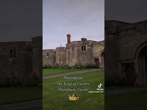
Thornbury Castle Hotel UK ☆ Bistrol ☆ Provokátor

Provokátor The King of Castles 4 Thornbury Castle Hotel UK ...

Nearby Amenities

Located within 500m of 51.611498,-2.5446986
Post Box
Post Box Type: wall
Postal Code: BS35
Ref: BS35 134
Royal Cypher: VR
Royal Cypher Wikidata: Q33102356
Lat/Long: 51.6117432/-2.5495501
Bus Stop
Cross Hands Farm
Bench: no
Bin: no
Bus: yes
Lit: no
Naptan AtcoCode: 0170SGB20693
Naptan Bearing: N
Naptan CommonName: Cross Hands Farm
Naptan Crossing: Kington Lane
Naptan NaptanCode: sglawap
Naptan Street: Kington Road
Naptan Verified: no
Public Transport: platform
Shelter: no
Source: naptan_import
Tactile Paving: no
Lat/Long: 51.6119717/-2.550299
Bus Stop
Cross Hands Farm
Bench: no
Bin: no
Bus: yes
Lit: no
Naptan AtcoCode: 0170SGB20694
Naptan Bearing: S
Naptan CommonName: Cross Hands Farm
Naptan Crossing: Kington Lane
Naptan NaptanCode: sglawdj
Naptan Street: Kington Road
Naptan Verified: no
Public Transport: platform
Shelter: no
Source: naptan_import
Tactile Paving: no
Lat/Long: 51.6119417/-2.5500385
Barrier: kissing_gate
Lat/Long: 51.6115036/-2.5498383
Barrier: stile
Material: wood
Step Count: 2
Stile: stepover
Lat/Long: 51.6115244/-2.5495528
Barrier: stile
Lat/Long: 51.6119463/-2.5479324
Barrier: kissing_gate
Lat/Long: 51.612745/-2.5424572
Barrier: stile
Lat/Long: 51.6133197/-2.5403681
Kington
Place: hamlet
Lat/Long: 51.6080812/-2.5463309
The data included in this document is from www.openstreetmap.org. The data is made available under ODbL.

Have you been to The Gully?

Leave your review of The Gully below (or comments, questions and feedback).