Butler's Gully

Valley in Somerset

England

Butler's Gully

The end of the Byway The byway ends with a broad muddy area in front of the double gated field entrance.
The end of the Byway Credit: James Ayres

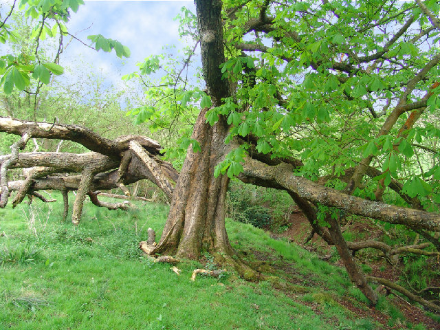
Butler's Gully, Somerset Valley, is a picturesque and tranquil area located in Somerset, a county in South West England. Nestled amidst rolling hills and lush greenery, the gully offers a serene escape from the hustle and bustle of urban life. The valley is named after the Butler family, who were prominent landowners in the region.

The gully itself is a natural formation, carved out by a small stream that meanders through the valley. The stream is fed by several springs and tributaries, creating a babbling brook that adds to the area's charm. The gully is surrounded by dense woodlands, comprising a variety of tree species such as oak, beech, and ash, which provide a rich habitat for diverse flora and fauna.

The area is a popular spot for hikers and nature enthusiasts, offering idyllic walking trails that wind through the valley and its surrounding hills. The trails provide stunning views of the countryside and the opportunity to spot wildlife, including birds, squirrels, and deer. During spring, the gully is adorned with vibrant wildflowers, adding a burst of color to the landscape.

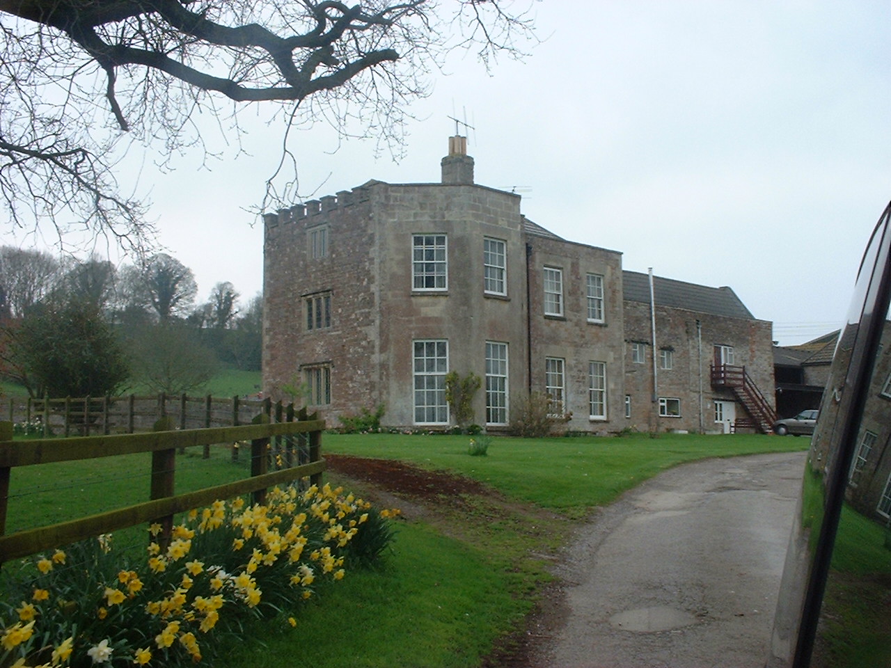
In addition to its natural beauty, Butler's Gully is also steeped in history. Ruins of an old mill can be found along the stream, serving as a reminder of the area's industrial past. The gully and its surroundings are also dotted with charming cottages and farmhouses, showcasing the region's architectural heritage.

Overall, Butler's Gully, Somerset Valley, offers a captivating blend of natural splendor and historical significance, making it a must-visit destination for those seeking a peaceful retreat in the heart of the English countryside.

If you have any feedback on the listing, please let us know in the comments section below.

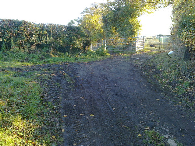
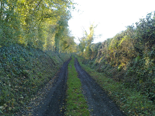
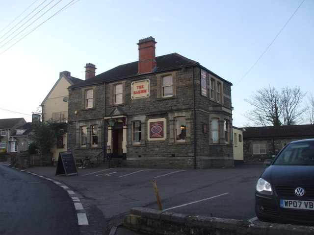
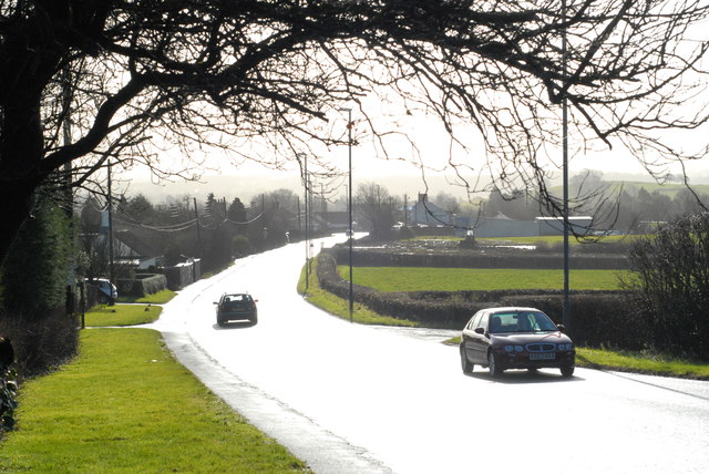
Butler's Gully Images

Images are sourced within 2km of 51.345276/-2.5558786 or Grid Reference ST6160. Thanks to Geograph Open Source API. All images are credited.

The end of the Byway The byway ends with a broad muddy area in front of the double gated field entrance.
The end of the Byway
The byway ends with a broad muddy area in front of the double gated field entrance.
Well used Byway This short section of 'Byway Open to All Traffic' provides access to fields for large tractors and other vehicles.
Well used Byway
This short section of 'Byway Open to All Traffic' provides access to fields for large tractors and other vehicles.
The Railway Inn, Clutton
Featherbed Lane, Clutton Leading to nowhere in particular.
Featherbed Lane, Clutton
Leading to nowhere in particular.
A37 at Clutton The sun had just come out after a short sharp rainstorm. The reflections on the wet road made this tricky to photograph (taking pictures like this makes you realise just how sophisticated the human eye is!), but I like the result.
A37 at Clutton
The sun had just come out after a short sharp rainstorm. The reflections on the wet road made this tricky to photograph (taking pictures like this makes you realise just how sophisticated the human eye is!), but I like the result.
Duckpond with duckhouse at Stowey Manor
Magnificent Oak Tree in autumn colours reflected in Stowey Manor duckpond
Field Near Temple Cloud
The Railway Inn Clutton Alas the railway is long gone but the inn remains to remind us of a local line.
The Railway Inn Clutton
Alas the railway is long gone but the inn remains to remind us of a local line.
Highways Agency salt store Clutton These curious tall dome shaped buildings can be seen dotted around the country, built out of wood (one may speculate they are less prone to corrosion) and operated by the Highways Agency, they are often sited near steep hills on main routes.
Highways Agency salt store Clutton
These curious tall dome shaped buildings can be seen dotted around the country, built out of wood (one may speculate they are less prone to corrosion) and operated by the Highways Agency, they are often sited near steep hills on main routes.
2009 : The Warwick Arms, Clutton The A37 passes its door.
The main part of the village is to the east of the main road, a ready made bypass.
All the land in the parish of Clutton once belonged to the Earl of Warwick.
2009 : The Warwick Arms, Clutton
The A37 passes its door. The main part of the village is to the east of the main road, a ready made bypass. All the land in the parish of Clutton once belonged to the Earl of Warwick.
2009 : Clutton Post Office, Station Road There is an interesting village website <span class="nowrap"><a title="http://www.clutton.org.uk/" rel="nofollow ugc noopener" href="http://www.clutton.org.uk/">Link</a><img style="margin-left:2px;" alt="External link" title="External link - shift click to open in new window" src="https://s1.geograph.org.uk/img/external.png" width="10" height="10"/></span>
2009 : Clutton Post Office, Station Road
There is an interesting village website LinkExternal link
2009 : The A37 at Clutton Or, more accurately, at the western edge of Clutton. Heading north to Pensford and Bristol.
2009 : The A37 at Clutton
Or, more accurately, at the western edge of Clutton. Heading north to Pensford and Bristol.
2009 : Rogers Close, Clutton A residential side road off the A37 with a pleasant view of Clutton Hill.
2009 : Rogers Close, Clutton
A residential side road off the A37 with a pleasant view of Clutton Hill.
2009 : From Curl's Wood If we follow <a href="https://www.geograph.org.uk/photo/163500">ST5961 : Track to Woods</a> to the top of the hill we come to this delightful scene, taken from what appears to be an ancient earthwork.
2009 : From Curl's Wood
If we follow ST5961 : Track to Woods to the top of the hill we come to this delightful scene, taken from what appears to be an ancient earthwork.
2009 : Curl's Wood A small wood, not much more than a spinney, lies between two Curl's Farms.
2009 : Curl's Wood
A small wood, not much more than a spinney, lies between two Curl's Farms.
2009 : Outliers from Curl's Wood A few trees seem to have fallen off the southern end of Curl's Wood.
2009 : Outliers from Curl's Wood
A few trees seem to have fallen off the southern end of Curl's Wood.
Show me another place!

Butler's Gully is located at Grid Ref: ST6160 (Lat: 51.345276, Lng: -2.5558786)

Unitary Authority: Bath and North East Somerset

Police Authority: Avon and Somerset

What 3 Words

///pounce.town.saddens. Near Clutton, Somerset

Related Wikis

Folly Farm, Somerset

Folly Farm is a traditionally managed working farm and nature reserve run by the Avon Wildlife Trust. It is located between Stowey, Clutton and Stanton...

Sutton Court

Sutton Court is an English house remodelled by Thomas Henry Wyatt in the 1850s from a manor house built in the 15th and 16th centuries around a 14th-century...

Clutton Rural District

Clutton was a rural district in Somerset, England, from 1894 to 1974. It was created in 1894 under the Local Government Act 1894 as a successor to the...

Clutton, Somerset

Clutton is a village and civil parish on the eastern edge of the affluent Chew Valley, close to the Cam Brook river, in the Bath and North East Somerset...

Stowey

Stowey is a small village and former civil parish, now in the parish of Stowey Sutton, in the Bath and North East Somerset district, in the ceremonial...

Church of St Nicholas and the Blessed Virgin Mary, Stowey

The Anglican Parish Church of St Nicholas and the Blessed Virgin Mary at Stowey within the English county of Somerset dates from the 13th century. It is...

Clutton railway station

Clutton railway station served the village of Clutton, Somerset, England from 1873 to 1959 on the Bristol and North Somerset Railway. == History == The...

Cholwell, Cameley

Cholwell is a historic hamlet and manor in the parish of Cameley, Somerset, England. The manor house, Cholwell House, was rebuilt in 1855 by William Rees...

Nearby Amenities

Located within 500m of 51.345276,-2.5558786
Barrier: kissing_gate
Lat/Long: 51.3436394/-2.560754
Bench
Backrest: no
Lat/Long: 51.3411439/-2.5542493
Power: pole
Lat/Long: 51.3419985/-2.551917
Power: pole
Lat/Long: 51.3429912/-2.5521042
Power: pole
Lat/Long: 51.3439456/-2.5522981
Power: pole
Lat/Long: 51.3452167/-2.5525431
Power: pole
Lat/Long: 51.3463241/-2.5527575
Power: pole
Lat/Long: 51.3471572/-2.5529175
Power: pole
Lat/Long: 51.34778/-2.5527745
Power: pole
Lat/Long: 51.3488788/-2.552567
Power: pole
Lat/Long: 51.3496483/-2.5571566
Power: pole
Lat/Long: 51.3494573/-2.5559985
Power: pole
Lat/Long: 51.3492575/-2.5548566
Power: pole
Lat/Long: 51.349081/-2.5538292
Power: pole
Lat/Long: 51.3468638/-2.5528498
Power: pole
Lat/Long: 51.3468425/-2.5534982
Power: pole
Lat/Long: 51.3467194/-2.5566286
Power: pole
Lat/Long: 51.3460631/-2.5572047
Power: pole
Lat/Long: 51.3467527/-2.555651
Power: pole
Lat/Long: 51.3455668/-2.5576612
Power: pole
Lat/Long: 51.3450566/-2.557645
The data included in this document is from www.openstreetmap.org. The data is made available under ODbL.

Have you been to Butler's Gully?

Leave your review of Butler's Gully below (or comments, questions and feedback).