Birch Clough

Valley in Yorkshire Ribble Valley

England

Birch Clough

Langden Brook
Langden Brook Credit: Richard Cooke

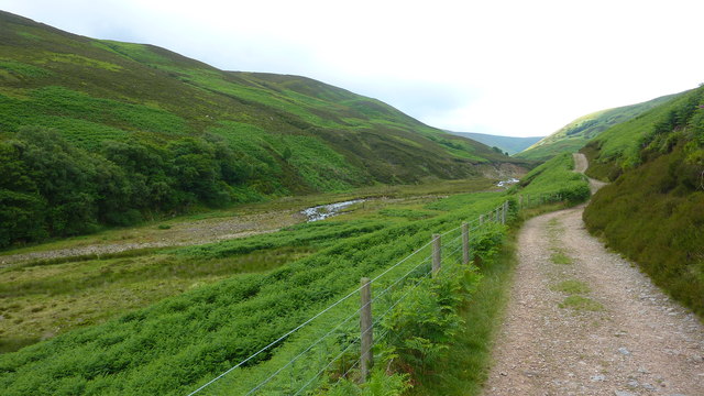
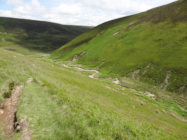
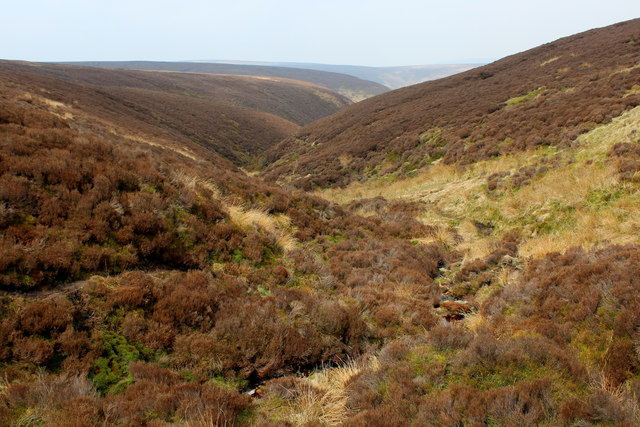
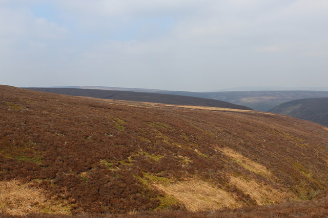
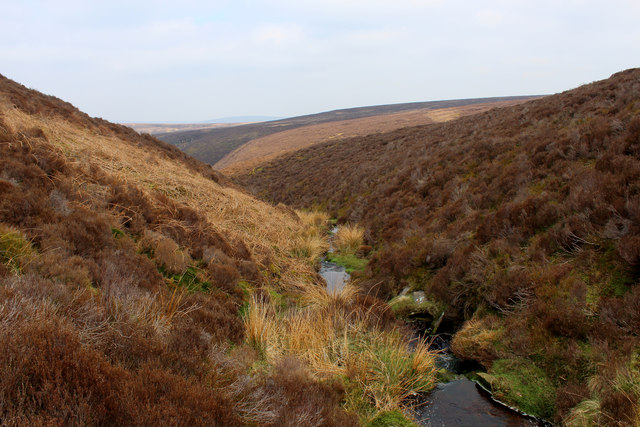
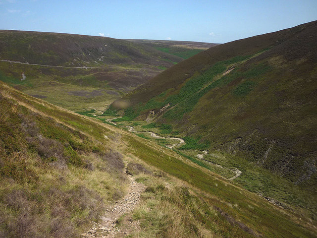
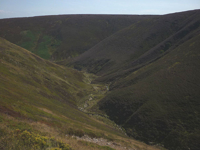
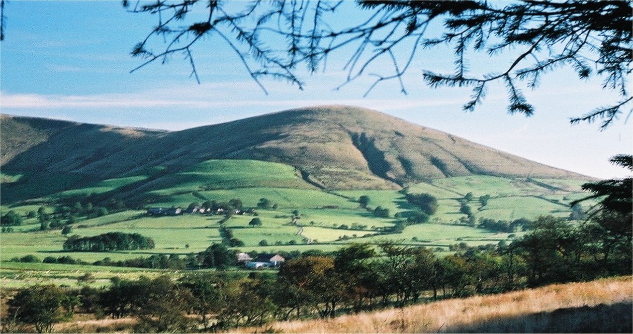
Birch Clough is a picturesque valley located in Yorkshire, England. Nestled in the heart of the Peak District National Park, this idyllic landscape offers visitors a captivating and tranquil escape from the bustling city life. The valley is renowned for its natural beauty, with lush greenery, rocky outcrops, and a charming stream that meanders through its heart.

The valley is home to a diverse range of flora and fauna, making it a haven for nature enthusiasts and wildlife lovers. Visitors can expect to encounter an array of bird species, including buzzards, peregrine falcons, and owls, as well as the occasional sighting of deer, foxes, and hares.

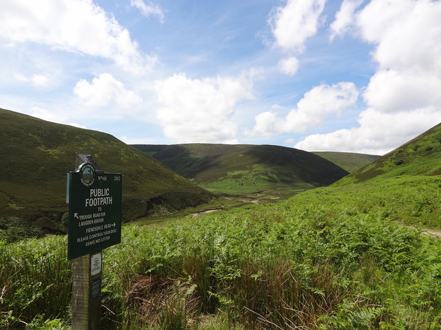
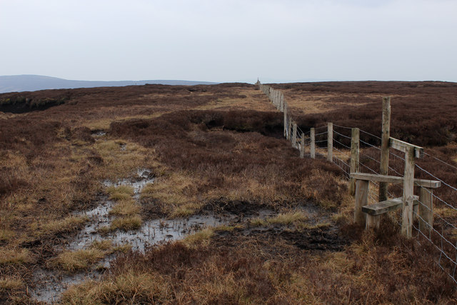
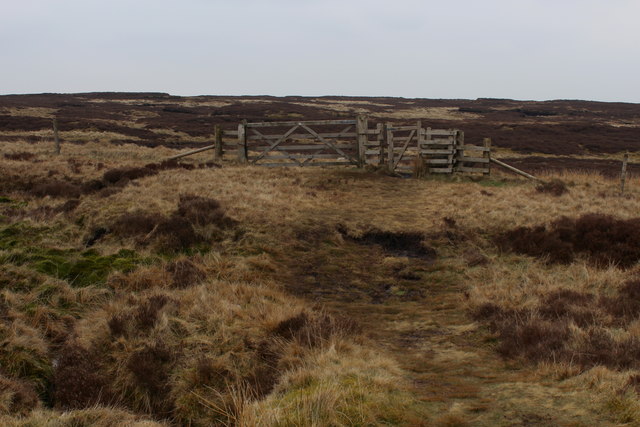
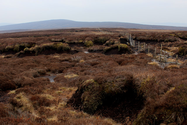
The area surrounding Birch Clough is crisscrossed by a network of walking trails, providing ample opportunities for hikers and ramblers to explore the enchanting landscape. The trails vary in difficulty, catering to both seasoned adventurers and casual walkers. Along the way, walkers can enjoy breathtaking views of the valley, as well as the surrounding moorlands and limestone cliffs.

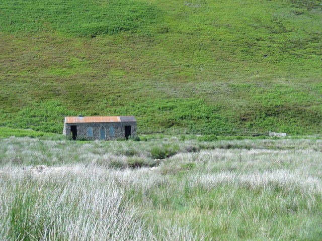
For those seeking a more leisurely experience, there are several picnic spots dotted throughout the valley, allowing visitors to relax and take in the natural beauty. Additionally, the valley is home to a number of historical landmarks, including ancient burial mounds and the remains of old lead mines, adding an intriguing historical dimension to the area.

Birch Clough truly offers a captivating blend of natural beauty, wildlife, and history, making it a must-visit destination for anyone seeking a peaceful retreat in the heart of Yorkshire.

If you have any feedback on the listing, please let us know in the comments section below.

Birch Clough Images

Images are sourced within 2km of 53.933302/-2.5921728 or Grid Reference SD6148. Thanks to Geograph Open Source API. All images are credited.

Langden Brook
Langden Brook
Langden Castle OS map days "Langden Castle (ruin)" but it's not a castle and it's not a ruin.  Probably originally a shooting lodge.  not sure what it's used for now but it's well secured.
Langden Castle
OS map days "Langden Castle (ruin)" but it's not a castle and it's not a ruin. Probably originally a shooting lodge. not sure what it's used for now but it's well secured.
The path towards Fiendsdale Head Peaks and Northern Footpaths Society signpost no. 418
The path towards Fiendsdale Head
Peaks and Northern Footpaths Society signpost no. 418
Fiendsdale meanders Fiendsdale Water meanders before it joins Langden Beck.
Fiendsdale meanders
Fiendsdale Water meanders before it joins Langden Beck.
Fenceline on Saddle Fell The path on the watershed beside the fence is a trial of fortitude, especially in wet conditions
Fenceline on Saddle Fell
The path on the watershed beside the fence is a trial of fortitude, especially in wet conditions
Access Gate on Saddle Fell
Bleadale Water Tributary Headwaters Following the watershed on Saddle Fell has its problems.  This is one of them, a mass of soft wet peat in the form of groughs and haggs, which form pools of sluggish puddles, that gradually trickle northwards to form the headwaters of Bleadale Water.
Bleadale Water Tributary Headwaters
Following the watershed on Saddle Fell has its problems. This is one of them, a mass of soft wet peat in the form of groughs and haggs, which form pools of sluggish puddles, that gradually trickle northwards to form the headwaters of Bleadale Water.
Below Bleadale Grains Several narrow watercourses meet down here to form a tributary headwater for Bleadale Water.
Below Bleadale Grains
Several narrow watercourses meet down here to form a tributary headwater for Bleadale Water.
A Southern Bowland View
A View from beside a Tributary of Bleadale Water This took a fair bit of effort, fighting through knee high heather to negotiate myself into the extreme south eastern corner of this square.
A View from beside a Tributary of Bleadale Water
This took a fair bit of effort, fighting through knee high heather to negotiate myself into the extreme south eastern corner of this square.
The path up Fiendsdale Nab A steep and sweaty climb today during the prolonged drought of summer 2018.
The path up Fiendsdale Nab
A steep and sweaty climb today during the prolonged drought of summer 2018.
Fiendsdale The middle section of this wild moorland clough. Due to the prolonged drought there is very little water in the brook and the heather bloom has been virtually burnt off.
Fiendsdale
The middle section of this wild moorland clough. Due to the prolonged drought there is very little water in the brook and the heather bloom has been virtually burnt off.
Webster's Meadow An odd name for an area of heather moorland. Ward's Stone is the high point on the skyline.
Webster's Meadow
An odd name for an area of heather moorland. Ward's Stone is the high point on the skyline.
High on Fairsnape Fell Up near the highest point of the fell the heather seems to have escaped the parching of the drought lower down.
High on Fairsnape Fell
Up near the highest point of the fell the heather seems to have escaped the parching of the drought lower down.
Peat grough, Fairsnape Fell Looking east towards Totridge (496m).
Peat grough, Fairsnape Fell
Looking east towards Totridge (496m).
Beasley's Steady An area of tough heather moorland dropping towards the head of Bleadale.
Beasley's Steady
An area of tough heather moorland dropping towards the head of Bleadale.
Relics at the memorial A few small pieces of twisted alloy at <a href="https://www.geograph.org.uk/photo/4264062">SD6150 : New air crash memorial, Langden Valley</a>. Presumably, they are aircraft wreckage collected from one or all of the crash sites.
Relics at the memorial
A few small pieces of twisted alloy at SD6150 : New air crash memorial, Langden Valley. Presumably, they are aircraft wreckage collected from one or all of the crash sites.
Langden Castle Fancy shooting hut, Forest of Bowland.
Langden Castle
Fancy shooting hut, Forest of Bowland.
Show me another place!

Birch Clough is located at Grid Ref: SD6148 (Lat: 53.933302, Lng: -2.5921728)

Division: West Riding

Administrative County: Lancashire

District: Ribble Valley

Police Authority: Lancashire

What 3 Words

///shelving.composts.contained. Near Longridge, Lancashire

Nearby Locations

Birch Clough

Related Wikis

Forest of Bowland

The Forest of Bowland, also known as the Bowland Fells and formerly the Chase of Bowland, is an area of gritstone fells, deep valleys and peat moorland...

Sykes Smelt Mill

Sykes Smelt Mill was a mediaeval mill located between Sykes and Hareden in Bowland Forest High, Lancashire, England. It stood on the banks of Langden Brook...

Parlick

Parlick (also known as Parlick Pike) is an approximately cone-shaped steep-sided hill at the extreme south of the main range of Bowland fells in Lancashire...

Trough of Bowland

The Trough of Bowland is a valley and high pass in the Forest of Bowland Area of Outstanding Natural Beauty, Lancashire, England. The pass, reaching 968...

Nearby Amenities

Located within 500m of 53.933302,-2.5921728
Ford: yes
Lat/Long: 53.9364637/-2.5937124
Hunting Stand
Hunting Stand: grouse_butt
Lat/Long: 53.9336086/-2.5848762
Hunting Stand
Hunting Stand: grouse_butt
Lat/Long: 53.9340083/-2.5853614
Hunting Stand
Hunting Stand: grouse_butt
Lat/Long: 53.934383/-2.5858521
The data included in this document is from www.openstreetmap.org. The data is made available under ODbL.

Have you been to Birch Clough?

Leave your review of Birch Clough below (or comments, questions and feedback).