Brown Berry Clough

Valley in Yorkshire Ribble Valley

England

Brown Berry Clough

On Holme House Fell From the steep cloughs in the north eastern corner of the square looking towards Fair Snape Fell. Should be last picture for Hectad SD54.
On Holme House Fell Credit: Michael Graham

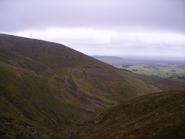
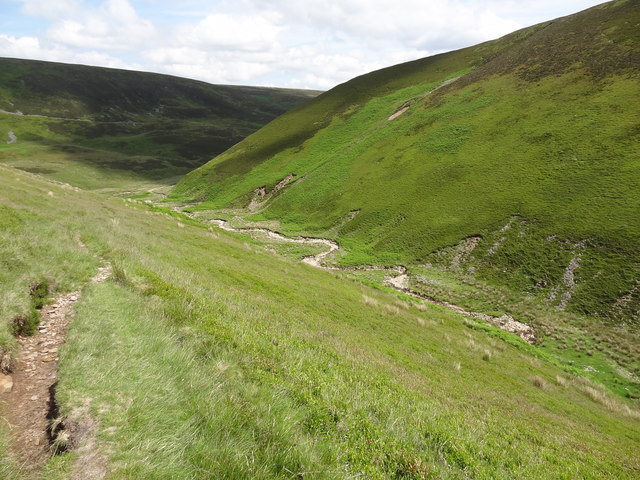
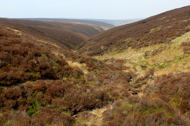
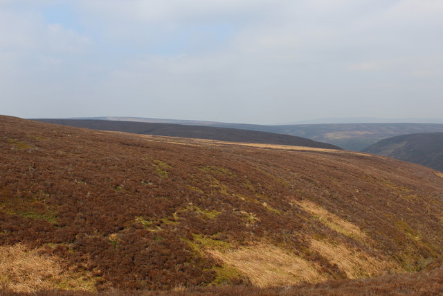
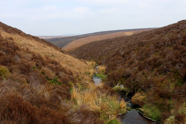
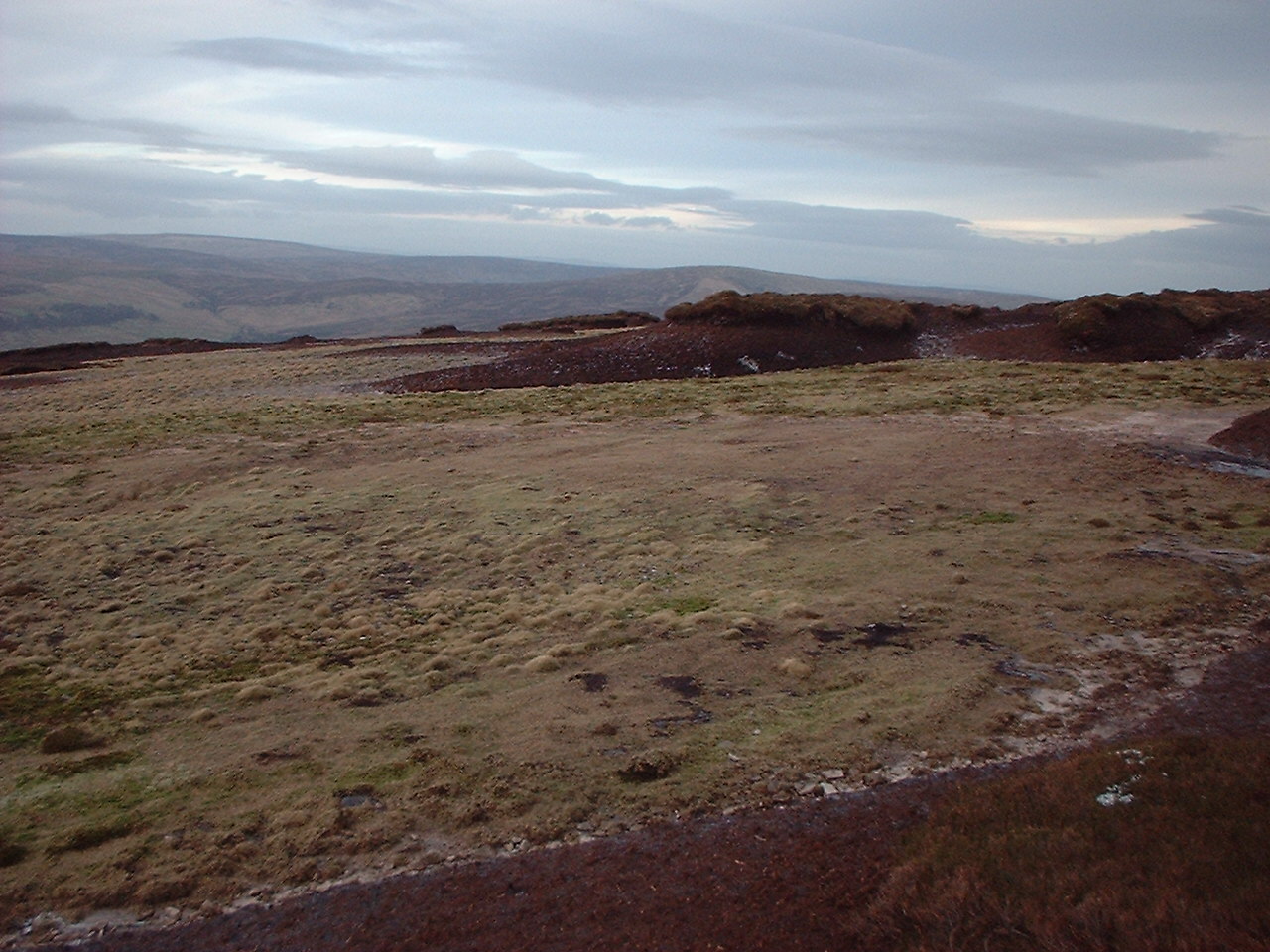
Brown Berry Clough is a picturesque valley located in the Yorkshire Dales National Park, in Northern England. It is situated near the village of Hebden, approximately 10 miles north of Skipton. The valley is renowned for its stunning natural beauty, with its rugged terrain, cascading waterfalls, and lush vegetation.

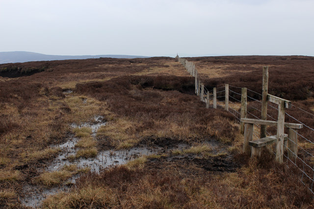
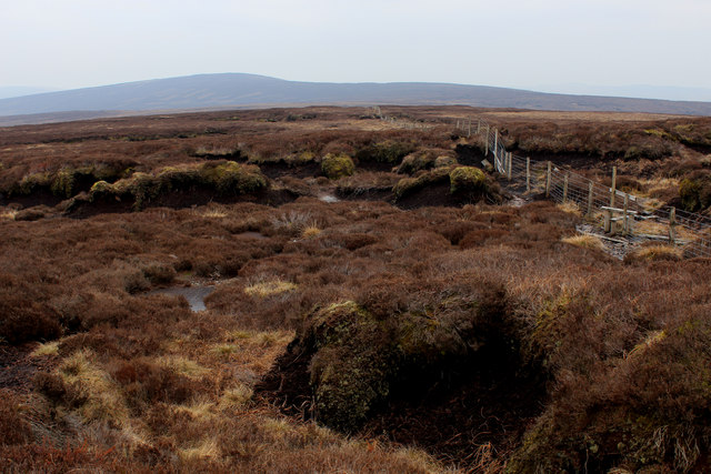
The valley is characterized by its steep-sided slopes, which are covered with heather, bracken, and a variety of wildflowers. The River Hebden flows through the valley, creating a series of small waterfalls and cascades that add to the area's charm. The sound of flowing water can be heard throughout the valley, providing a soothing soundtrack to visitors.

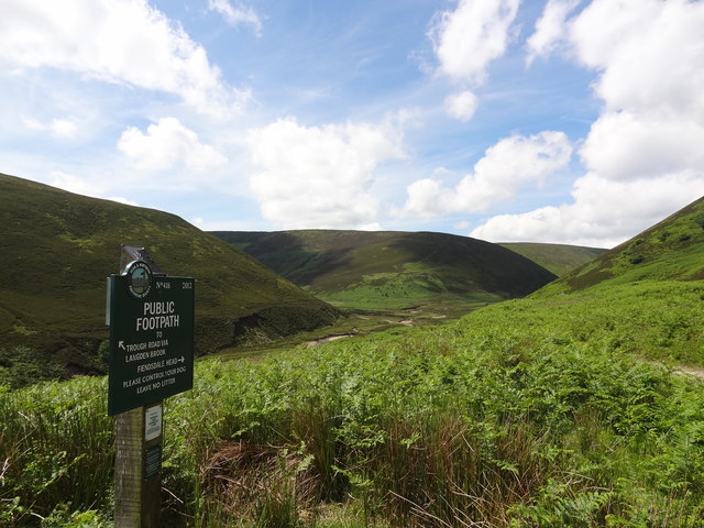
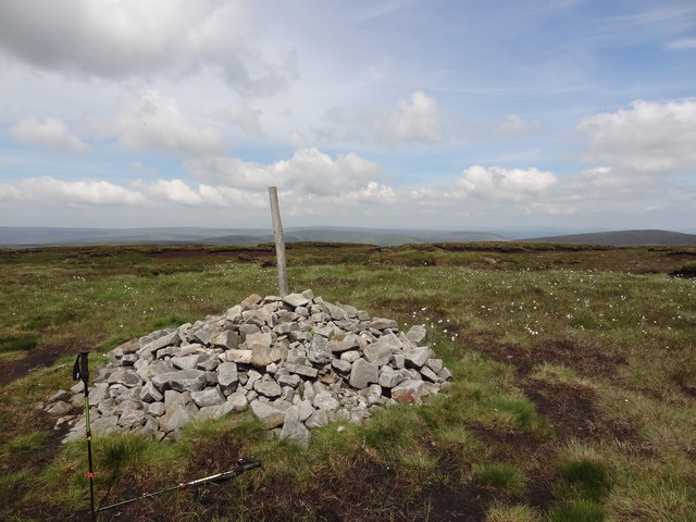
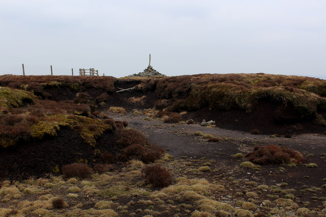
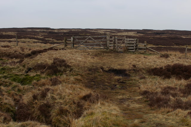
Brown Berry Clough is a popular destination for hikers and nature enthusiasts due to its extensive network of walking trails. These trails offer breathtaking views of the surrounding countryside and provide opportunities to spot wildlife such as red deer, grouse, and various bird species.

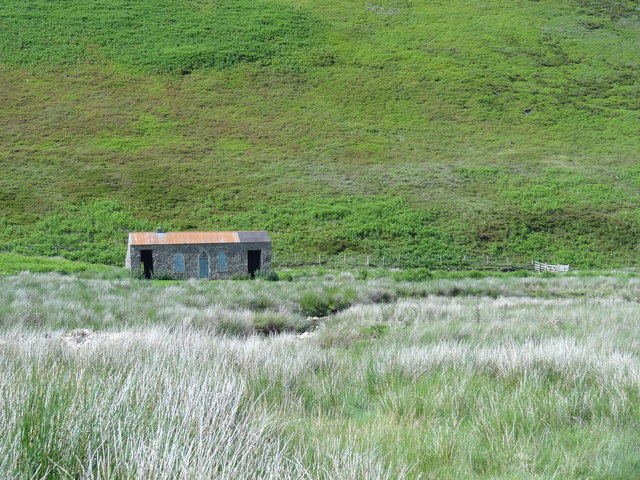
The valley also has historical significance, as remnants of old lead mining operations can be found in the area. These mining ruins serve as a reminder of the valley's industrial past and add an element of intrigue to the landscape.

Visitors to Brown Berry Clough can enjoy a tranquil and peaceful atmosphere, away from the hustle and bustle of city life. Whether it's exploring the walking trails, immersing oneself in nature, or simply admiring the stunning scenery, this valley offers a truly unforgettable experience for all who venture here.

If you have any feedback on the listing, please let us know in the comments section below.

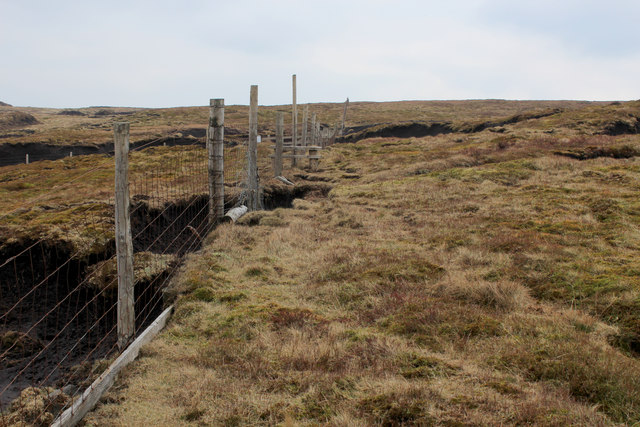
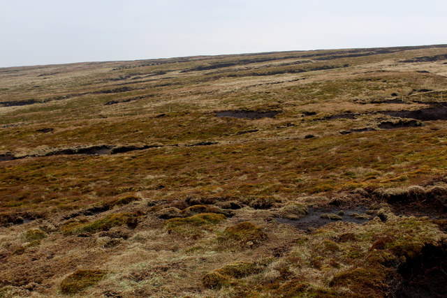
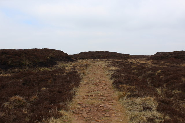
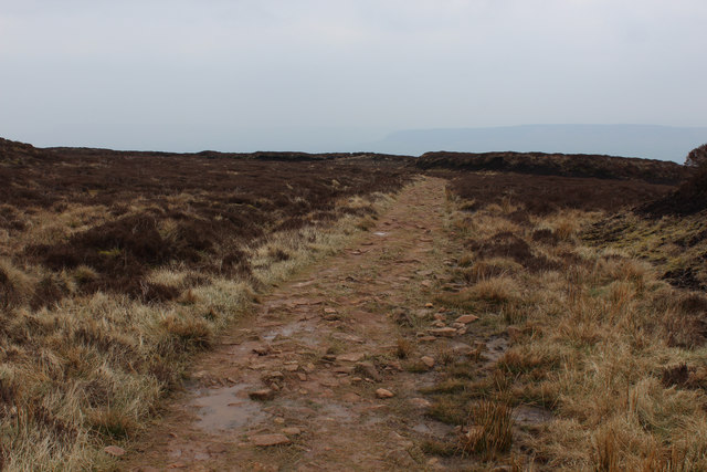
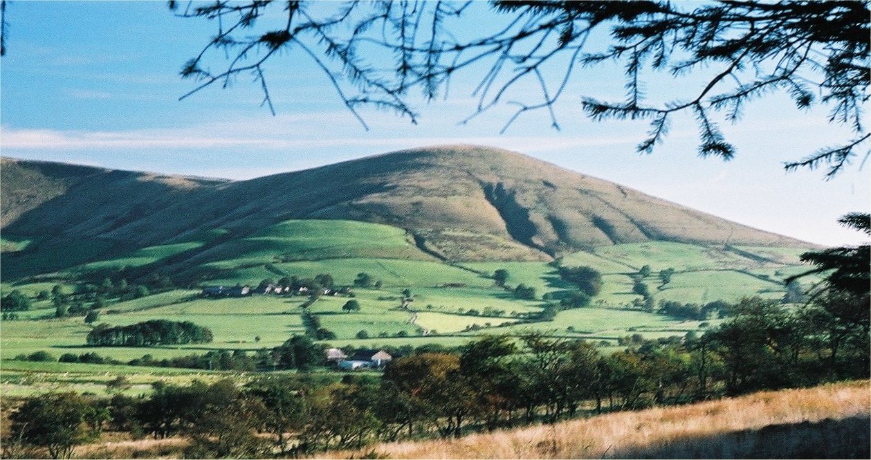
Brown Berry Clough Images

Images are sourced within 2km of 53.931547/-2.6052614 or Grid Reference SD6048. Thanks to Geograph Open Source API. All images are credited.

On Holme House Fell From the steep cloughs in the north eastern corner of the square looking towards Fair Snape Fell. Should be last picture for Hectad SD54.
On Holme House Fell
From the steep cloughs in the north eastern corner of the square looking towards Fair Snape Fell. Should be last picture for Hectad SD54.
Fair Snape Fell trig
Langden Castle OS map days "Langden Castle (ruin)" but it's not a castle and it's not a ruin.  Probably originally a shooting lodge.  not sure what it's used for now but it's well secured.
Langden Castle
OS map days "Langden Castle (ruin)" but it's not a castle and it's not a ruin. Probably originally a shooting lodge. not sure what it's used for now but it's well secured.
The path towards Fiendsdale Head Peaks and Northern Footpaths Society signpost no. 418
The path towards Fiendsdale Head
Peaks and Northern Footpaths Society signpost no. 418
Fiendsdale meanders Fiendsdale Water meanders before it joins Langden Beck.
Fiendsdale meanders
Fiendsdale Water meanders before it joins Langden Beck.
Cairn on the top With views across Bowland towards the Pennines
Cairn on the top
With views across Bowland towards the Pennines
Highest Point on Fair Snape Fell This lonely cairn marks the highest point on the Fair Snape Fell plateau, a good kilometre away from the trig point.
Highest Point on Fair Snape Fell
This lonely cairn marks the highest point on the Fair Snape Fell plateau, a good kilometre away from the trig point.
Boundary Fencing on the Fair Snape Fell Plateau
Fence on Fair Snape Fell
Peat Moor Landscape looking towards Holme House Fell Inhospitable landscape on the flanks of Fair Snape Fell
Peat Moor Landscape looking towards Holme House Fell
Inhospitable landscape on the flanks of Fair Snape Fell
Track on Wolf Fell (1) Well made narrow track on Wolf Fell, roughly heading west. It crosses inhospitable peaty terrain - without it progress would be slowed down to a crawl
Track on Wolf Fell (1)
Well made narrow track on Wolf Fell, roughly heading west. It crosses inhospitable peaty terrain - without it progress would be slowed down to a crawl
Track on Wolf Fell (2) Well made path heading roughly west over the peaty heather landscape at the top of Wolf Fell.
Track on Wolf Fell (2)
Well made path heading roughly west over the peaty heather landscape at the top of Wolf Fell.
Fenceline on Saddle Fell The path on the watershed beside the fence is a trial of fortitude, especially in wet conditions
Fenceline on Saddle Fell
The path on the watershed beside the fence is a trial of fortitude, especially in wet conditions
Access Gate on Saddle Fell
Bleadale Water Tributary Headwaters Following the watershed on Saddle Fell has its problems.  This is one of them, a mass of soft wet peat in the form of groughs and haggs, which form pools of sluggish puddles, that gradually trickle northwards to form the headwaters of Bleadale Water.
Bleadale Water Tributary Headwaters
Following the watershed on Saddle Fell has its problems. This is one of them, a mass of soft wet peat in the form of groughs and haggs, which form pools of sluggish puddles, that gradually trickle northwards to form the headwaters of Bleadale Water.
Below Bleadale Grains Several narrow watercourses meet down here to form a tributary headwater for Bleadale Water.
Below Bleadale Grains
Several narrow watercourses meet down here to form a tributary headwater for Bleadale Water.
A Southern Bowland View
A View from beside a Tributary of Bleadale Water This took a fair bit of effort, fighting through knee high heather to negotiate myself into the extreme south eastern corner of this square.
A View from beside a Tributary of Bleadale Water
This took a fair bit of effort, fighting through knee high heather to negotiate myself into the extreme south eastern corner of this square.
Show me another place!

Brown Berry Clough is located at Grid Ref: SD6048 (Lat: 53.931547, Lng: -2.6052614)

Division: West Riding

Administrative County: Lancashire

District: Ribble Valley

Police Authority: Lancashire

What 3 Words

///resonates.spreads.increased. Near Longridge, Lancashire

Nearby Locations

Brown Berry Clough

Related Wikis

Forest of Bowland

The Forest of Bowland, also known as the Bowland Fells and formerly the Chase of Bowland, is an area of gritstone fells, deep valleys and peat moorland...

Parlick

Parlick (also known as Parlick Pike) is an approximately cone-shaped steep-sided hill at the extreme south of the main range of Bowland fells in Lancashire...

Hawthornthwaite Fell

Hawthornthwaite Fell is one of the larger hills in the Forest of Bowland in the north west of England. Hawthornthwaite Fell marks the extreme western limit...

Sykes Smelt Mill

Sykes Smelt Mill was a mediaeval mill located between Sykes and Hareden in Bowland Forest High, Lancashire, England. It stood on the banks of Langden Brook...

Bleasdale

Bleasdale is a village and civil parish in the Wyre district of Lancashire, England, in the Forest of Bowland Area of Outstanding Natural Beauty. The two...

National nature reserves in Lancashire

National nature reserves in Lancashire in England are established by Natural England. There are two national nature reserves in Lancashire, both of which...

Bowland-with-Leagram

Bowland-with-Leagram is a civil parish in the Ribble Valley district of Lancashire, England, covering part of the Forest of Bowland. According to the census...

Trough of Bowland

The Trough of Bowland is a valley and high pass in the Forest of Bowland Area of Outstanding Natural Beauty, Lancashire, England. The pass, reaching 968...

Nearby Amenities

Located within 500m of 53.931547,-2.6052614
The data included in this document is from www.openstreetmap.org. The data is made available under ODbL.

Have you been to Brown Berry Clough?

Leave your review of Brown Berry Clough below (or comments, questions and feedback).