Black Crane Cleuch

Valley in Roxburghshire

Scotland

Black Crane Cleuch

'The Forks' Rally stage 10 Nearing the Scottish border.
'The Forks' Rally stage 10 Credit: T Eyre

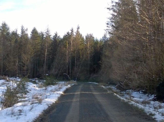
Black Crane Cleuch is a picturesque valley located in Roxburghshire, Scotland. Situated in the southern part of the country, it is known for its natural beauty and tranquility. The valley stretches for approximately 5 miles, with the Black Crane River flowing through its heart.

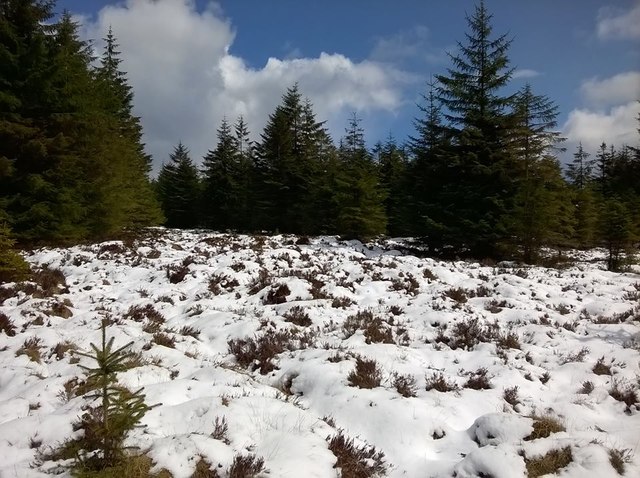
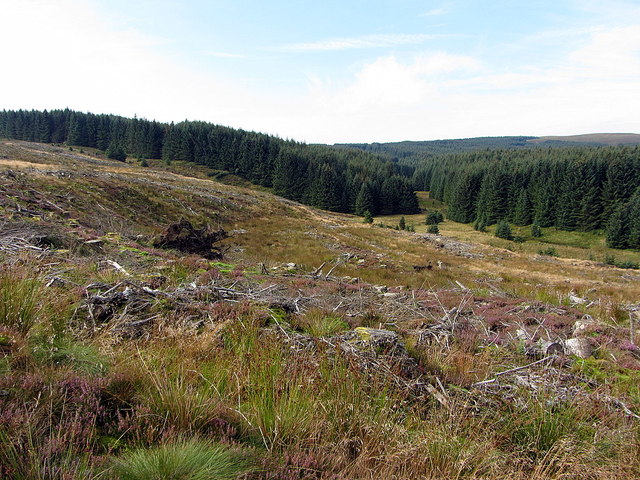
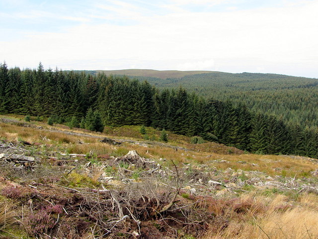
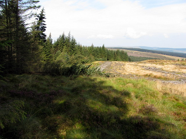
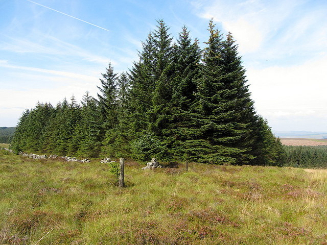
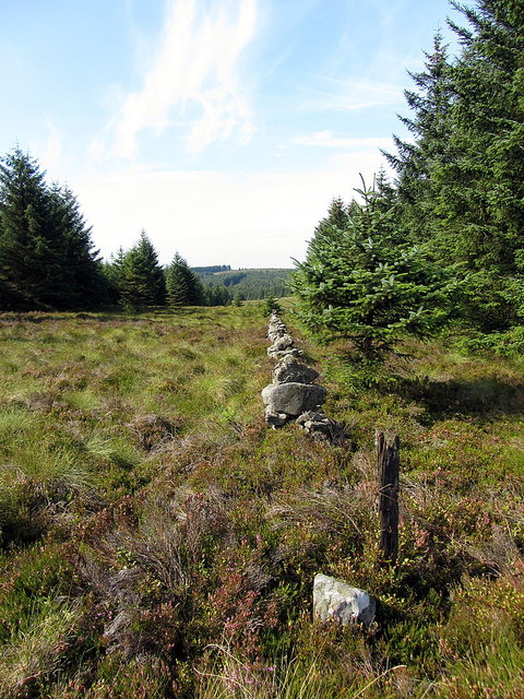
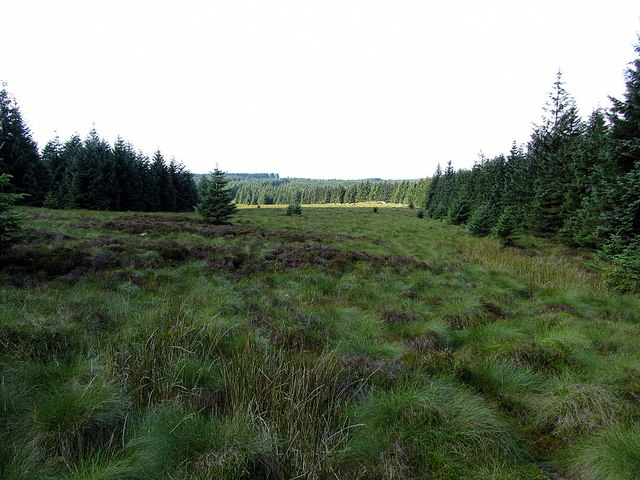
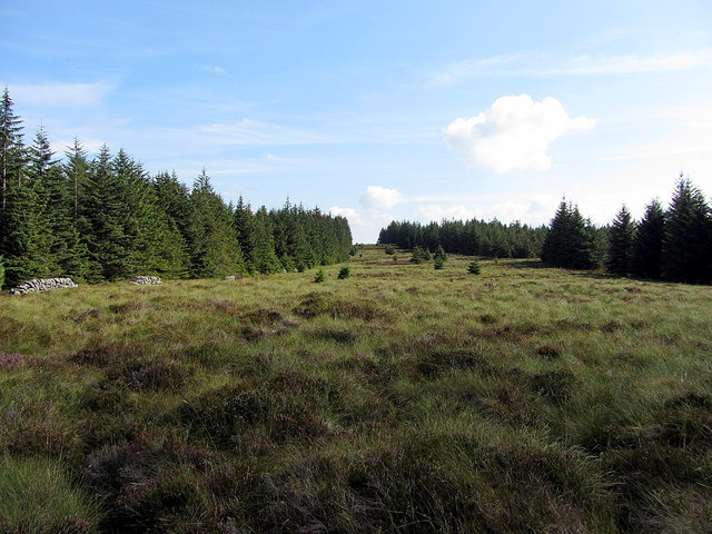
The landscape of Black Crane Cleuch is characterized by rolling hills, lush green meadows, and dense woodlands, creating a haven for wildlife and nature enthusiasts. The valley is home to a diverse range of flora and fauna, including various species of birds, mammals, and plants.

The river that runs through the valley, the Black Crane River, is a tributary of the River Teviot. It adds to the charm of the area, with its crystal-clear waters and gentle flow. The river is also a popular spot for fishing, particularly for salmon and trout.

The valley offers numerous walking and hiking trails, allowing visitors to explore its scenic beauty. These trails provide stunning views of the surrounding countryside, including the nearby Cheviot Hills. It is not uncommon to encounter sheep grazing peacefully in the meadows, adding to the idyllic ambiance of the area.

Black Crane Cleuch is a peaceful retreat, perfect for those seeking serenity and a connection with nature. Its unspoiled landscape and tranquil atmosphere make it an ideal destination for outdoor activities such as picnicking, photography, or simply enjoying a leisurely stroll.

In conclusion, Black Crane Cleuch is a hidden gem in Roxburghshire, Scotland, offering a slice of untouched natural beauty. With its stunning landscapes, abundant wildlife, and peaceful ambiance, it is a paradise for nature lovers and a must-visit destination for those seeking a tranquil escape.

If you have any feedback on the listing, please let us know in the comments section below.

Black Crane Cleuch Images

Images are sourced within 2km of 55.227976/-2.6474181 or Grid Reference NY5892. Thanks to Geograph Open Source API. All images are credited.

'The Forks' Rally stage 10 Nearing the Scottish border.
'The Forks' Rally stage 10
Nearing the Scottish border.
'The Forks' Rally stage 11 In Scotland, with lots of snow.
'The Forks' Rally stage 11
In Scotland, with lots of snow.
Scottish Border The Scottish border on the last day of April.
Scottish Border
The Scottish border on the last day of April.
Near the Scottish border This is on the English side.
Near the Scottish border
This is on the English side.
'The Forks' Rally stage 12 Still in Scotland.
'The Forks' Rally stage 12
Still in Scotland.
Bells Burn Bridge crossing Bells Burn, the border between England and Scotland.
Bells Burn
Bridge crossing Bells Burn, the border between England and Scotland.
Sheepfold by March Sike over Bells Burn The name March Sike might indicate that this was a former course of the England - Scotland Border, although that now follows Bells Burn.
Sheepfold by March Sike over Bells Burn
The name March Sike might indicate that this was a former course of the England - Scotland Border, although that now follows Bells Burn.
Bells Burn The Scotland - England Border closely follows the course of the burn down from high ground. There is a view of the burn below the bridge here <a href="https://www.geograph.org.uk/photo/743251">NY5993 : Bells Burn</a>

Not far upstream, the Border leaves the main valley to follow the minor valley of Berkey Sike to gain the high ground near Purdom's Pike. As felling has taken place on the English side, the edge of uncut forest in the distance shows its line climbing the hillside.
Bells Burn
The Scotland - England Border closely follows the course of the burn down from high ground. There is a view of the burn below the bridge here NY5993 : Bells Burn Not far upstream, the Border leaves the main valley to follow the minor valley of Berkey Sike to gain the high ground near Purdom's Pike. As felling has taken place on the English side, the edge of uncut forest in the distance shows its line climbing the hillside.
Kielder Forest route choice Which way to go: right for Foulmire, or left for Drowning Sike?
Kielder Forest route choice
Which way to go: right for Foulmire, or left for Drowning Sike?
Junction of Bells Burn & Berkey Sike The map shows a cairn on the bank of Bells Burn which marks the point where the Border Line turns from the main valley to climb the hill via a minor water-course, Berkey Sike. Before this point, on the England side of the Border is Duke's Well, presumably referring to the Duke of Northumberland. I had I every intention of visiting these important landmarks along the Border Line to record them for Geograph but crossing this clear-felled land is not without its problems and I preferred a slightly easier, but less interesting line. I suspect Duke's Well is just a more boggy patch of land anyway but if I'm ever here again (unlikely) I'll visit.

The Northumberland archaeology site, Keys to the Past says: 'A well is shown on an Ordnance Survey map of 1824-26.' proving that they haven't visited either.

The forest has been felled and replanted on the English side (apart from the former system of forest rides) right up to the Border line.
Junction of Bells Burn & Berkey Sike
The map shows a cairn on the bank of Bells Burn which marks the point where the Border Line turns from the main valley to climb the hill via a minor water-course, Berkey Sike. Before this point, on the England side of the Border is Duke's Well, presumably referring to the Duke of Northumberland. I had I every intention of visiting these important landmarks along the Border Line to record them for Geograph but crossing this clear-felled land is not without its problems and I preferred a slightly easier, but less interesting line. I suspect Duke's Well is just a more boggy patch of land anyway but if I'm ever here again (unlikely) I'll visit. The Northumberland archaeology site, Keys to the Past says: 'A well is shown on an Ordnance Survey map of 1824-26.' proving that they haven't visited either. The forest has been felled and replanted on the English side (apart from the former system of forest rides) right up to the Border line.
The Border at Berkey Sike View of the Larriston Fells, where I'm headed along the Border Line and outside this infernal forest. Trees have been felled on the English side right up to the Border.
The Border at Berkey Sike
View of the Larriston Fells, where I'm headed along the Border Line and outside this infernal forest. Trees have been felled on the English side right up to the Border.
The Border Line above Berkey Sike Marked here only by occasional wooden stakes of an old fence and the uncut forest edge.
The Border Line above Berkey Sike
Marked here only by occasional wooden stakes of an old fence and the uncut forest edge.
Bend in Border Line near Buckside Knowe The England - Scotland Border makes an acute angle here as (going westwards) it turns from its south-easterly direction uphill along Berkley Sike from Bells Burn, to west, following a ruined wall along a wide forest ride. A boundary stone marks the angle. The continuing line of stakes to the left (south-east) leads to the nearby flat hilltop of Purdom's Pike which has always been a large unplanted clearing in the English Kielder Forest.
Bend in Border Line near Buckside Knowe
The England - Scotland Border makes an acute angle here as (going westwards) it turns from its south-easterly direction uphill along Berkley Sike from Bells Burn, to west, following a ruined wall along a wide forest ride. A boundary stone marks the angle. The continuing line of stakes to the left (south-east) leads to the nearby flat hilltop of Purdom's Pike which has always been a large unplanted clearing in the English Kielder Forest.
Border Line towards Buckside Knowe Following the wall along the wide forest ride that separates England from Scotland is the toughest piece of walking I have yet found along the Border. I shall not be back. The boundary stone in the foreground was carved on two sides, an 'N' on one and what appeared to be an 'S' on the other.

Keys to the Past has a placemark located in the vicinity of Purdom Pikes further south with the caption:
"A line of stones inscribed with 'N' for Northumberland on one side and 'S' for Scotland on the other can be seen here, marking a previous border between Northumberland and Scotland. At the same location, the remains of a ditch can be seen. Archaeologists don't known when these border markers were created."

The 1898 OS Map shows a line of stones crossing the hilltop in a south-easterly direction towards the interestingly named March Head, maintaining this direction to Capon Hassock but then apparently turning east to Dinmont Lairs and the valley of the River North Tyne (now dammed at Bakethin Reservoir), in the vicinity of Lewie. Was this really a former line of the Scotland-England Border or simply a boundary between English estates?
Border Line towards Buckside Knowe
Following the wall along the wide forest ride that separates England from Scotland is the toughest piece of walking I have yet found along the Border. I shall not be back. The boundary stone in the foreground was carved on two sides, an 'N' on one and what appeared to be an 'S' on the other. Keys to the Past has a placemark located in the vicinity of Purdom Pikes further south with the caption: "A line of stones inscribed with 'N' for Northumberland on one side and 'S' for Scotland on the other can be seen here, marking a previous border between Northumberland and Scotland. At the same location, the remains of a ditch can be seen. Archaeologists don't known when these border markers were created." The 1898 OS Map shows a line of stones crossing the hilltop in a south-easterly direction towards the interestingly named March Head, maintaining this direction to Capon Hassock but then apparently turning east to Dinmont Lairs and the valley of the River North Tyne (now dammed at Bakethin Reservoir), in the vicinity of Lewie. Was this really a former line of the Scotland-England Border or simply a boundary between English estates?
The Border towards Buckside Knowe No one comes this way and who can blame them?
The Border towards Buckside Knowe
No one comes this way and who can blame them?
The Border east from Buckside Knowe No sane person has ever been here. There is no path and no animal tracks. The ruined wall close to the left-hand forest edge marks the Border. English forest is on the right and Scottish forest on the left. Most of the ride is English and I suspect the Scots wouldn't want it.
The Border east from Buckside Knowe
No sane person has ever been here. There is no path and no animal tracks. The ruined wall close to the left-hand forest edge marks the Border. English forest is on the right and Scottish forest on the left. Most of the ride is English and I suspect the Scots wouldn't want it.
Border wall west of Buckside Knowe Here, even the wall builders had had enough. Perhaps the rest has just sunk into the bog.
Border wall west of Buckside Knowe
Here, even the wall builders had had enough. Perhaps the rest has just sunk into the bog.
Boardwalk for Kielder cycle path at Buck Lakes The boardwalk has been made for one of the Kielder cycle routes here running west to east just south of the Border. This area is called Buck Lakes.
Boardwalk for Kielder cycle path at Buck Lakes
The boardwalk has been made for one of the Kielder cycle routes here running west to east just south of the Border. This area is called Buck Lakes.
Show me another place!

Black Crane Cleuch is located at Grid Ref: NY5892 (Lat: 55.227976, Lng: -2.6474181)

Unitary Authority: The Scottish Borders

Police Authority: The Lothians and Scottish Borders

What 3 Words

///storeroom.curries.chatting. Near Teviothead, Scottish Borders
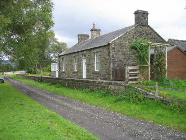
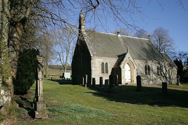
Related Wikis

Kielder Forest Star Camp

The Kielder Forest Star Camp is an annual star party held each autumn and spring in Kielder Forest. The five night event is based on the Kielder Campsite...

Kielder railway station

Kielder railway station is a closed railway station that served the village hamlet of Kielder, Northumberland. == History == Kielder railway station was...

Deadwater, Northumberland

Deadwater is a small settlement in Northumberland, England, about 3 miles (5 km) north west of Kielder, Northumberland, on the English side of the border...

Kielder

Kielder is a small, remote village in western Northumberland, England. Located at the head of Kielder Water and in the north west of Kielder Forest, the...

Deadwater railway station

Deadwater railway station is a closed railway station situated on the border between England and Scotland at the head of the North Tyne River. The station...

Butteryhaugh

Butteryhaugh is a village in Northumberland, in England. It is situated a short distance to the south-east of Kielder. Although a separate "village" from...

Saughtree

Saughtree is a hamlet in the Scottish Borders at the junction of the B6357 and an unnamed road from Kielder village in Northumberland, England. It is at...
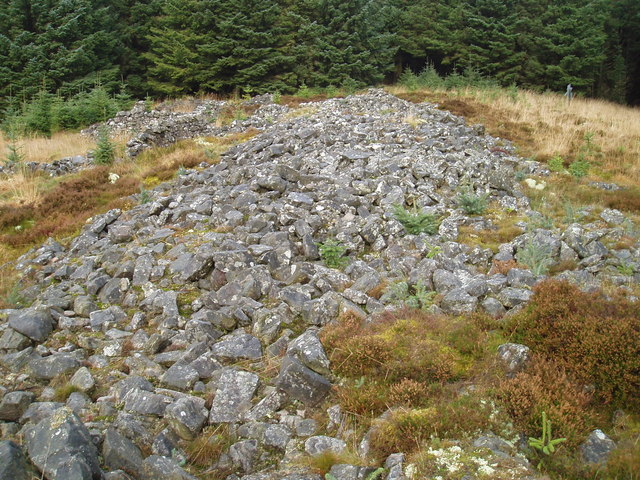
Devil's Lapful

Devil's Lapful is an archaeological site in Northumberland, England, in Kielder Forest about 0.8 miles (1.3 km) south-east of Kielder. The site, a Neolithic...

Nearby Amenities

Located within 500m of 55.227976,-2.6474181
Source: npe
Lat/Long: 55.2287729/-2.6540943
The data included in this document is from www.openstreetmap.org. The data is made available under ODbL.

Have you been to Black Crane Cleuch?

Leave your review of Black Crane Cleuch below (or comments, questions and feedback).