Hyndlee Glen

Valley in Roxburghshire

Scotland

Hyndlee Glen

Forestry road, Wigg Plantation
Forestry road, Wigg Plantation Credit: Steven Brown

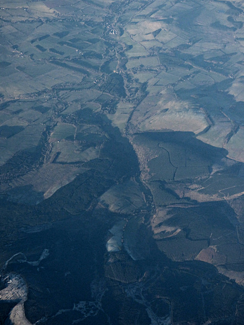
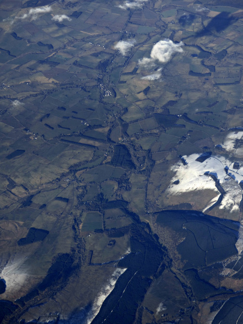
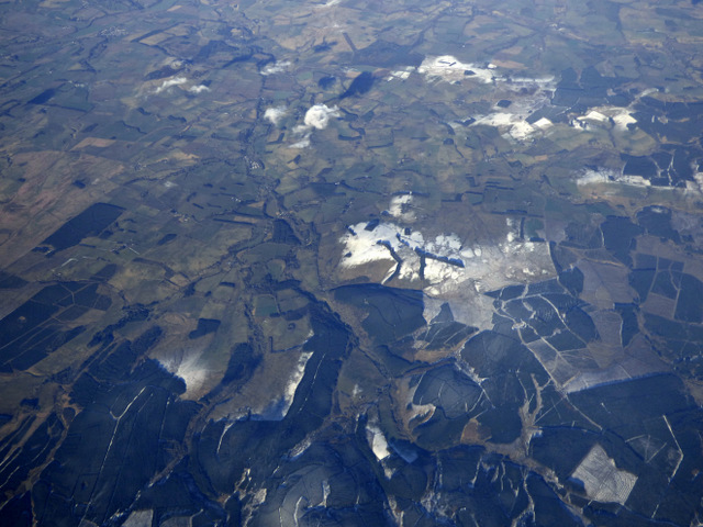
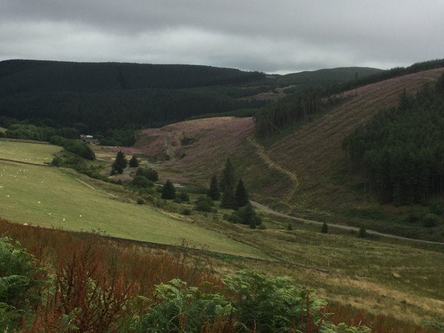
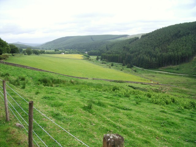
Hyndlee Glen is a picturesque valley located in Roxburghshire, in the southern part of Scotland. This stunning valley is nestled between rolling hills and is renowned for its natural beauty and tranquil atmosphere. The glen is situated near the small village of Hyndlee, which adds to its charm and rustic appeal.

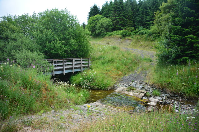
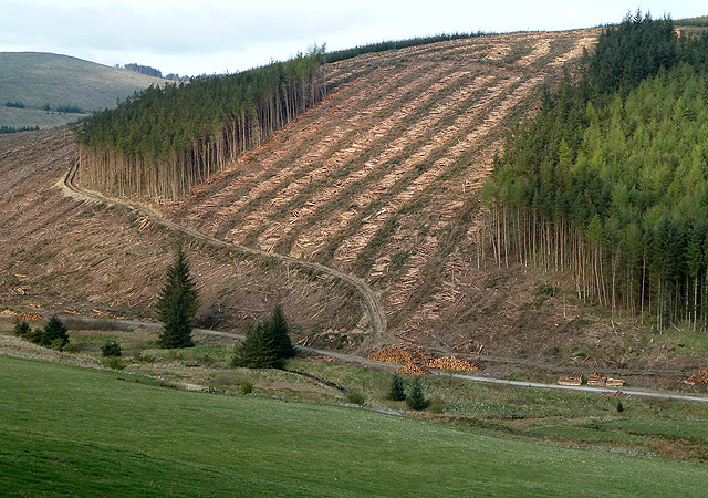
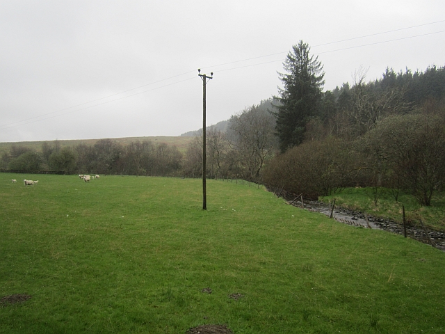
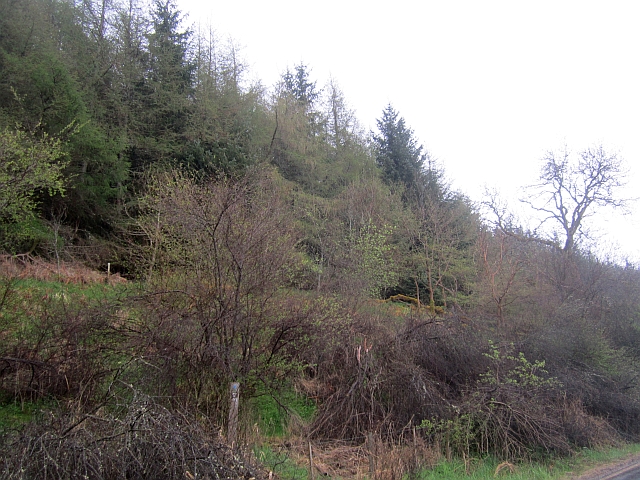
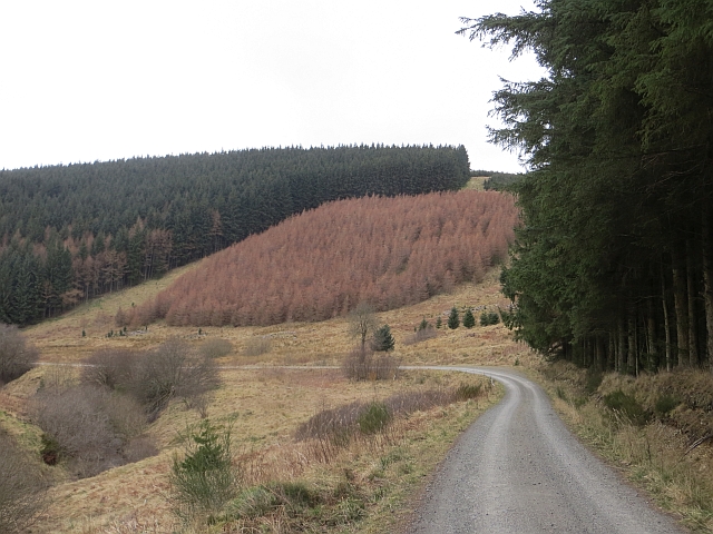
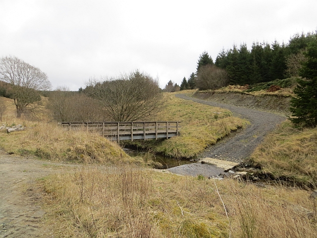
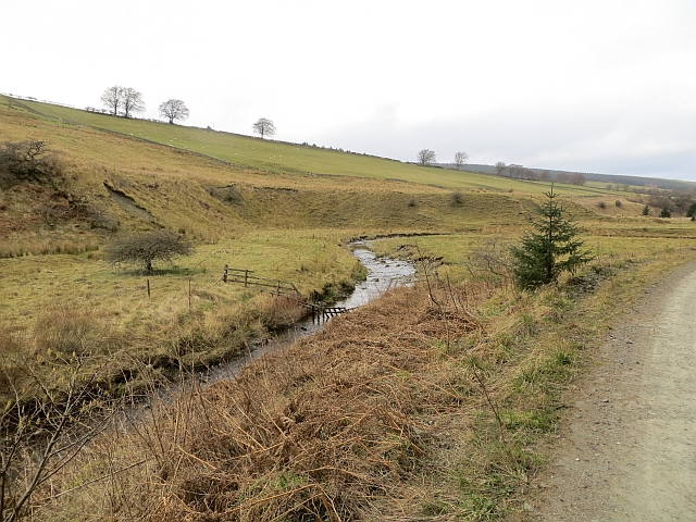
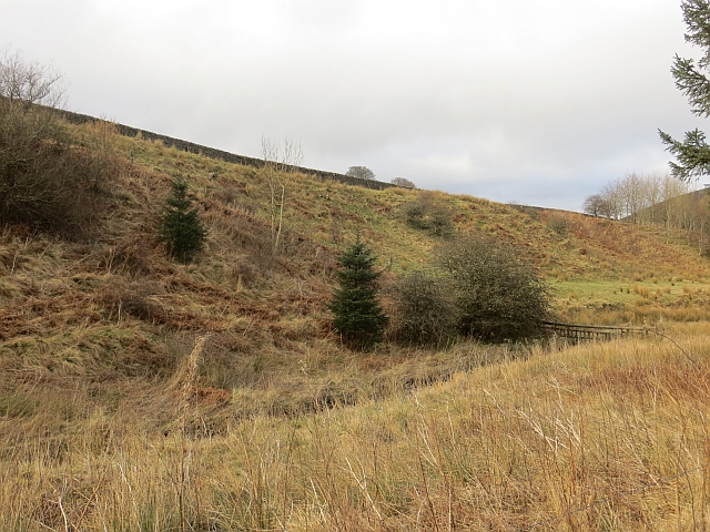
The valley is dotted with lush green meadows, dense woodlands, and meandering streams, making it a haven for nature enthusiasts and outdoor lovers. The glen is home to a diverse range of flora and fauna, with many rare and protected species found within its boundaries. The surrounding hills offer breathtaking panoramic views of the valley, making it a popular spot for hikers and photographers.

Hyndlee Glen is also steeped in history, with several ancient sites and ruins scattered throughout the area. These include old farmsteads, stone circles, and remnants of old settlements, providing a glimpse into the region's rich past. Visitors can explore these historical landmarks and learn about the area's fascinating heritage.

The glen is a tranquil escape from the bustling city life, offering a peaceful retreat for those seeking solace in nature. It provides ample opportunities for activities such as hiking, birdwatching, and picnicking. The valley is also a popular destination for wildlife enthusiasts, as it is home to various species of birds, mammals, and reptiles.

Overall, Hyndlee Glen in Roxburghshire is a hidden gem that offers a perfect blend of natural beauty, rich history, and serenity. Whether you are a nature lover, history buff, or simply looking to unwind in a peaceful setting, this valley is sure to captivate your senses.

If you have any feedback on the listing, please let us know in the comments section below.
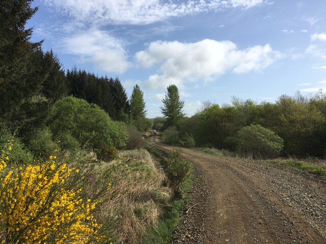
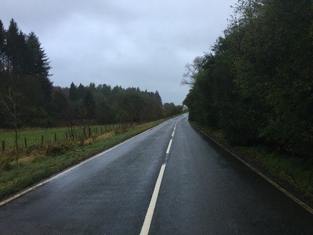
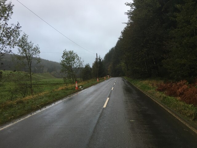
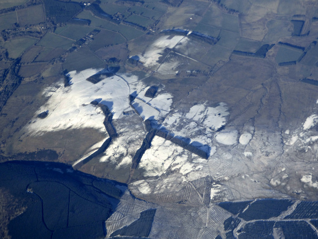
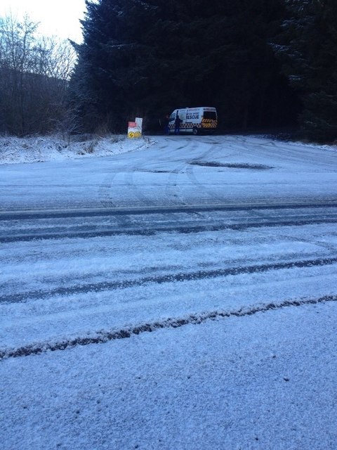
Hyndlee Glen Images

Images are sourced within 2km of 55.345501/-2.651211 or Grid Reference NT5805. Thanks to Geograph Open Source API. All images are credited.

Forestry road, Wigg Plantation
B6357 towards Bonchester Bridge
B6357 near Hyndlee
B6357 near Hyndlee
Wolfelee Hill from the air The distinctive strip woods make this hill easy to identify from the air.
Wolfelee Hill from the air
The distinctive strip woods make this hill easy to identify from the air.
Hyndlee Glen from the air Looking north along the B6357 towards Bonchester Bridge.
Hyndlee Glen from the air
Looking north along the B6357 towards Bonchester Bridge.
Wolfelee from the air Bonchester Bridge can be seen in the distance, Wolfelee Hill is in the right foreground.
Wolfelee from the air
Bonchester Bridge can be seen in the distance, Wolfelee Hill is in the right foreground.
Wauchope Forest from the air Wolfelee Hill can be seen near the centre of the photo.
Wauchope Forest from the air
Wolfelee Hill can be seen near the centre of the photo.
Hyndlee Burn Ford This ford on The Hyndlee Burn is found on the Forestry Commission track. The exact location of the ford suggests that the OS map is incorrect. A 2014 image of the ford can be seen at::
<a title="https://www.geograph.org.uk/photo/3899124" href="https://www.geograph.org.uk/photo/3899124">Link</a>
Hyndlee Burn Ford
This ford on The Hyndlee Burn is found on the Forestry Commission track. The exact location of the ford suggests that the OS map is incorrect. A 2014 image of the ford can be seen at:: Link
Hyndlee Glen Field in a predominately forested area.
Hyndlee Glen
Field in a predominately forested area.
Hyndlee Glen
Hyndlee Glen
Timber harvesting on Brockie Law This was viewed from the B6357.
Timber harvesting on Brockie Law
This was viewed from the B6357.
Hyndlee Burn A field beside the Hyndlee Burn. Cheap point hunters will have to stop and get out here, the road stays stubbonly east of the grid line.  
The area is mostly forested.
Hyndlee Burn
A field beside the Hyndlee Burn. Cheap point hunters will have to stop and get out here, the road stays stubbonly east of the grid line. The area is mostly forested.
Cragbank Woods National Nature Reserve Tail end of a steep slope clad in ancient deciduous woodland. There is an encroachment by the usual "weeds" above, but the wood is somewhat thicker further north.
Cragbank Woods National Nature Reserve
Tail end of a steep slope clad in ancient deciduous woodland. There is an encroachment by the usual "weeds" above, but the wood is somewhat thicker further north.
Snow covered B6357 and forest entrance This was the entrance to Stage 1 of the 2014 Border Counties Rally.
Snow covered B6357 and forest entrance
This was the entrance to Stage 1 of the 2014 Border Counties Rally.
Logging road, Wauchope Forest Beside the Hyndlee Burn.
Logging road, Wauchope Forest
Beside the Hyndlee Burn.
Hyndlee Burn Ford and footbridge on the Hyndlee Burn.
Hyndlee Burn
Ford and footbridge on the Hyndlee Burn.
Hyndlee Burn Edge of Wauchope Forest.
Hyndlee Burn
Edge of Wauchope Forest.
Hyndlee Burn
Hyndlee Burn
Show me another place!

Hyndlee Glen is located at Grid Ref: NT5805 (Lat: 55.345501, Lng: -2.651211)

Unitary Authority: The Scottish Borders

Police Authority: The Lothians and Scottish Borders

What 3 Words

///into.acclaimed.spark. Near Hawick, Scottish Borders

Related Wikis

Wauchope, Scottish Borders

Wauchope is a hamlet in the Scottish Borders council area of Scotland, near Southdean. Wauchope House was demolished in 1932. == See also == Wauchope Forest...

Wauchope Forest

Wauchope Forest is a forest on the Rule Water, in the Scottish Borders area of Scotland, south of Hawick, and including the A6088, the A68 and the B6357...

Hobkirk

Hobkirk (Scottish Gaelic: Eaglais Ruail) is a village and civil parish in the Scottish Borders area of Scotland, by the Rule Water, south-west of Jedburgh...

Southdean

Southdean is a hamlet in the Scottish Borders area of Scotland, on the A6088, by the Jed Water and in the Wauchope Forest area. Other settlements nearby...

Nearby Amenities

Located within 500m of 55.345501,-2.651211
Passing Place
Lat/Long: 55.3422982/-2.6476848
Power: pole
Lat/Long: 55.349499/-2.6479622
Power: pole
Lat/Long: 55.3487653/-2.6478947
Power: pole
Lat/Long: 55.3480309/-2.6481467
Power: pole
Lat/Long: 55.3473211/-2.6483872
Power: pole
Lat/Long: 55.3465765/-2.6486366
Power: pole
Lat/Long: 55.3458703/-2.6488759
Power: pole
Lat/Long: 55.3453898/-2.6496941
Power: pole
Lat/Long: 55.3449846/-2.6503826
Power: pole
Lat/Long: 55.3445946/-2.6510405
Power: pole
Lat/Long: 55.3442292/-2.6517213
Power: pole
Lat/Long: 55.343486/-2.6519974
Power: pole
Lat/Long: 55.3427566/-2.6522799
Power: pole
Lat/Long: 55.3420286/-2.6525472
Power: pole
Lat/Long: 55.341289/-2.6528271
The data included in this document is from www.openstreetmap.org. The data is made available under ODbL.

Have you been to Hyndlee Glen?

Leave your review of Hyndlee Glen below (or comments, questions and feedback).