Dead Man's Stake Clough

Valley in Yorkshire Ribble Valley

England

Dead Man's Stake Clough

Moorland between Greave Clough Head and the Upper Calder Tramping over virgin moor from the boundary fence near Greave Clough Head and the upper reaches of the Calder - an experience I care not to repeat
Moorland between Greave Clough Head and the Upper Calder Credit: Chris Heaton

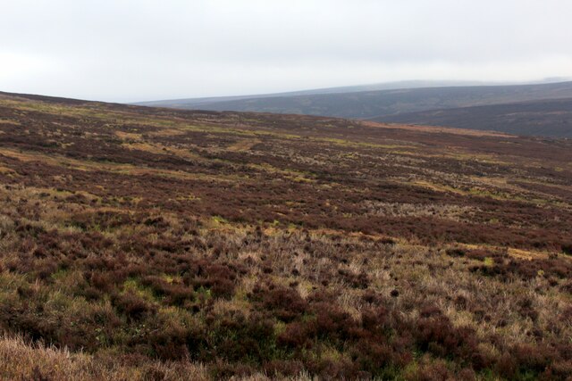
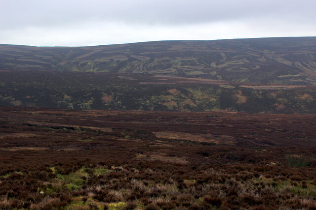
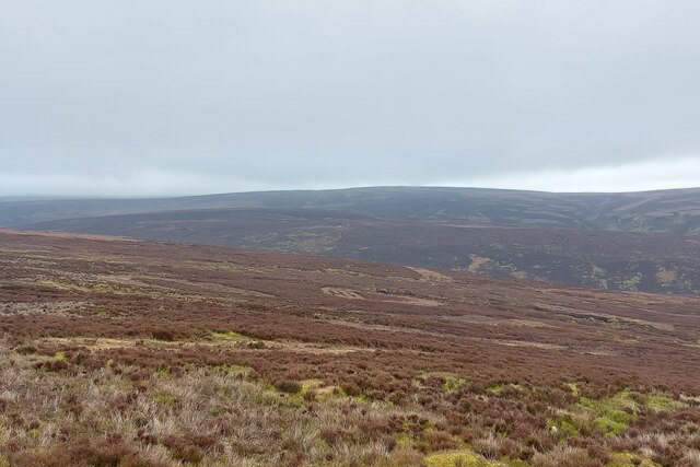
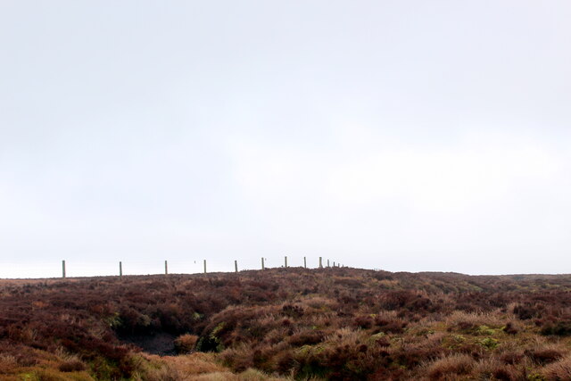
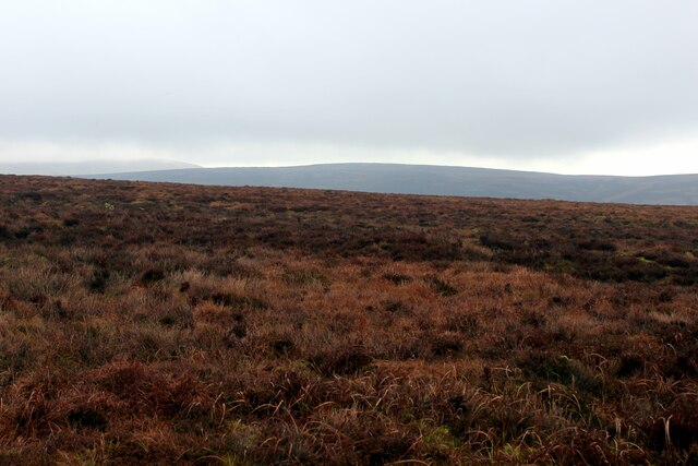
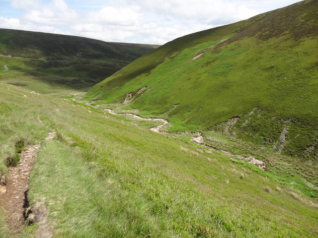
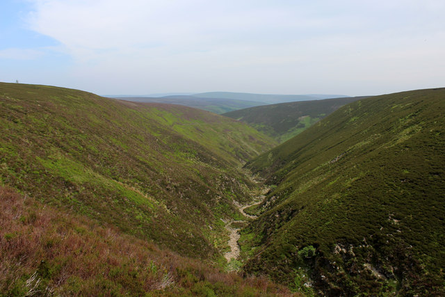
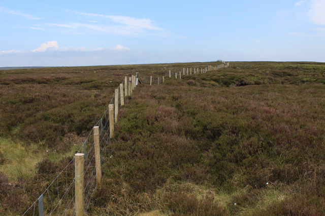
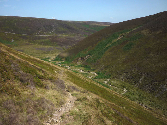
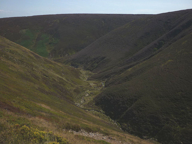
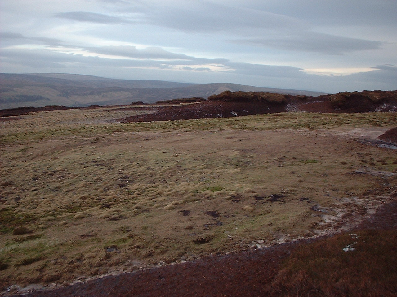
Dead Man's Stake Clough is a picturesque valley located in Yorkshire, England. Nestled amidst the beautiful countryside, this enchanting landscape is a popular destination for nature enthusiasts and hikers alike. The valley is known for its dramatic cliffs, lush greenery, and tranquil streams.

The name "Dead Man's Stake" is derived from a local folklore tale, which tells the story of a mysterious stake that was placed in the clough to mark the site of a tragic event. While the exact origins of this tale remain uncertain, it adds an air of mystique to the area.

The valley boasts a diverse range of flora and fauna, making it a haven for wildlife. Visitors can expect to encounter various species of birds, including the elusive kingfisher, as well as small mammals such as rabbits and squirrels. The clough is also home to a variety of plant life, with vibrant wildflowers adorning the landscape during the spring and summer months.

For outdoor enthusiasts, Dead Man's Stake Clough offers a network of walking trails, ranging from gentle strolls to more challenging hikes. The trails meander through the valley, offering breathtaking vistas at every turn. Photographers will find plenty of opportunities to capture the natural beauty of the area, with its cascading waterfalls, rocky outcrops, and ancient woodland.

Whether one seeks solitude in nature or a thrilling adventure, Dead Man's Stake Clough is a captivating destination that showcases the best of Yorkshire's countryside.

If you have any feedback on the listing, please let us know in the comments section below.

Dead Man's Stake Clough Images

Images are sourced within 2km of 53.951967/-2.6314464 or Grid Reference SD5850. Thanks to Geograph Open Source API. All images are credited.

Moorland between Greave Clough Head and the Upper Calder Tramping over virgin moor from the boundary fence near Greave Clough Head and the upper reaches of the Calder - an experience I care not to repeat
Moorland between Greave Clough Head and the Upper Calder
Tramping over virgin moor from the boundary fence near Greave Clough Head and the upper reaches of the Calder - an experience I care not to repeat
Descending over Moorland towards the Upper Calder A pretty remote corner of Bowland.
Descending from the boundary fence near Greave Clough Head towards the infant River Calder with Luddock's Fell behind.
All colours in the landscape appear to be shades of chocolate brown
Descending over Moorland towards the Upper Calder
A pretty remote corner of Bowland. Descending from the boundary fence near Greave Clough Head towards the infant River Calder with Luddock's Fell behind. All colours in the landscape appear to be shades of chocolate brown
Looking over the headwater catchment area of the River Calder The south-west corner of the 'Forest of Bowland'
Looking over the headwater catchment area of the River Calder
The south-west corner of the 'Forest of Bowland'
Boundary Fence West of Greave Clough Head Deep furrows of exposed peat, straggly heather, tussocks and ancillary vegetation makes progress difficult and tiresome
Boundary Fence West of Greave Clough Head
Deep furrows of exposed peat, straggly heather, tussocks and ancillary vegetation makes progress difficult and tiresome
Boundary Fence between Grizedale Head and Greave Clough Head There is a very faint path beside the fence, which blends in with the chocolate brown colour scheme of the local landscape
Boundary Fence between Grizedale Head and Greave Clough Head
There is a very faint path beside the fence, which blends in with the chocolate brown colour scheme of the local landscape
Gradual ascent of Greave Clough Head from the West
On the Fellside below Greave Head Clough
Peat bank on White Moss Starting our boggy descent among the catchment headwaters of the River Calder
Peat bank on White Moss
Starting our boggy descent among the catchment headwaters of the River Calder
Fiendsdale meanders Fiendsdale Water meanders before it joins Langden Beck.
Fiendsdale meanders
Fiendsdale Water meanders before it joins Langden Beck.
Looking down Fiendsdale Water Running down a deep cleft on the moorland landscape, Fiendsdale Water acts as one of the main tributaries for Langdon Brook.
The footpath runs high up on the western bank.
Looking down Fiendsdale Water
Running down a deep cleft on the moorland landscape, Fiendsdale Water acts as one of the main tributaries for Langdon Brook. The footpath runs high up on the western bank.
Grouse Butts below Fiendsdale Head A line of grouse butts stretching down towards the upper reaches of the Calder.
Grouse Butts below Fiendsdale Head
A line of grouse butts stretching down towards the upper reaches of the Calder.
Boundary Fence above Fiendsdale Newly erected, by looking at the freshness of the fence posts.
Boundary Fence above Fiendsdale
Newly erected, by looking at the freshness of the fence posts.
Upper Reaches of the Infant River Calder One of three River Calders that assist in draining different parts of the North of England.
This one rises in south west Bowland, before joining the River Wyre and entering the Irish Sea at Fleetwood.
Upper Reaches of the Infant River Calder
One of three River Calders that assist in draining different parts of the North of England. This one rises in south west Bowland, before joining the River Wyre and entering the Irish Sea at Fleetwood.
The path up Fiendsdale Nab A steep and sweaty climb today during the prolonged drought of summer 2018.
The path up Fiendsdale Nab
A steep and sweaty climb today during the prolonged drought of summer 2018.
Fiendsdale The middle section of this wild moorland clough. Due to the prolonged drought there is very little water in the brook and the heather bloom has been virtually burnt off.
Fiendsdale
The middle section of this wild moorland clough. Due to the prolonged drought there is very little water in the brook and the heather bloom has been virtually burnt off.
Head of Catshaw Greave
On top of White Moss Not quite the 464m spot height but near enough.
On top of White Moss
Not quite the 464m spot height but near enough.
Shooting Track along the Foot of Hawthornthwaite Fell
Show me another place!

Dead Man's Stake Clough is located at Grid Ref: SD5850 (Lat: 53.951967, Lng: -2.6314464)

Division: West Riding

Administrative County: Lancashire

District: Ribble Valley

Police Authority: Lancashire

What 3 Words

///casino.goods.twit. Near Bay Horse, Lancashire

Related Wikis

Hawthornthwaite Fell

Hawthornthwaite Fell is one of the larger hills in the Forest of Bowland in the north west of England. Hawthornthwaite Fell marks the extreme western limit...

National nature reserves in Lancashire

National nature reserves in Lancashire in England are established by Natural England. There are two national nature reserves in Lancashire, both of which...

Forest of Bowland

The Forest of Bowland, also known as the Bowland Fells and formerly the Chase of Bowland, is an area of gritstone fells, deep valleys and peat moorland...

Abbeystead House

Abbeystead House is a large country house to the east of the village of Abbeystead, Lancashire, England, some 12 km (7 miles) south-east of Lancaster....

William Molyneux, 4th Earl of Sefton

William Philip Molyneux, 4th Earl of Sefton, (14 October 1835 – 27 June 1897) was a British peer. == Biography == Born Viscount Molyneux, he was the eldest...

Abbeystead

Abbeystead is a small hamlet located in the Forest of Bowland Area of Outstanding Natural Beauty, in Lancashire, England. Abbeystead lies close to the...

Over Wyresdale

Over Wyresdale is a civil parish and a parish of the Church of England in the City of Lancaster in the English county of Lancashire. It has a population...

Grey Stone of Trough

The Grey Stone of Trough is an historic boundary marker in Bowland Forest High, in the Trough of Bowland, Lancashire, England. A Grade II listed structure...

Nearby Amenities

Located within 500m of 53.951967,-2.6314464
The data included in this document is from www.openstreetmap.org. The data is made available under ODbL.

Have you been to Dead Man's Stake Clough?

Leave your review of Dead Man's Stake Clough below (or comments, questions and feedback).