Bretherdale

Valley in Westmorland Eden

England

Bretherdale

Crookdale Crag At 1404ft, Crookdale Crag is in the Eastern Fells
Crookdale Crag Credit: Eirian Evans

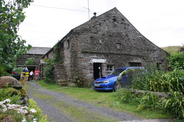
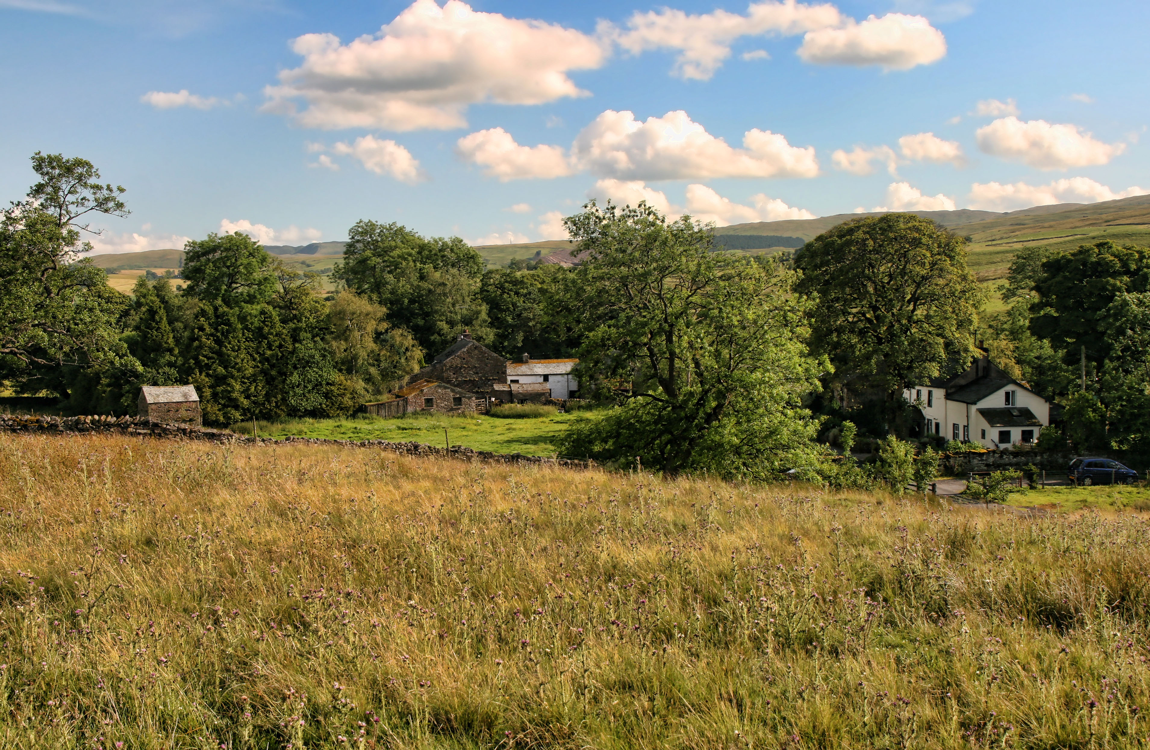
Bretherdale is a picturesque valley located in the county of Westmorland, in the northwestern region of England. Nestled in the ruggedly beautiful landscape of the Lake District National Park, Bretherdale is renowned for its unspoiled natural beauty and tranquil atmosphere.

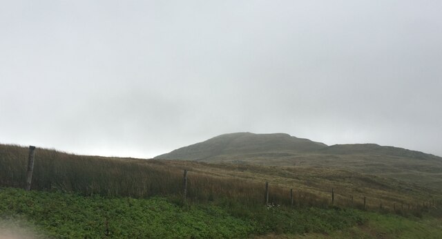
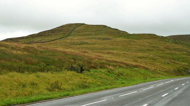
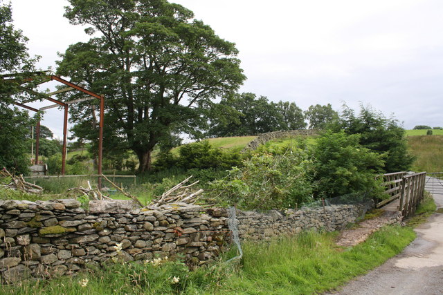
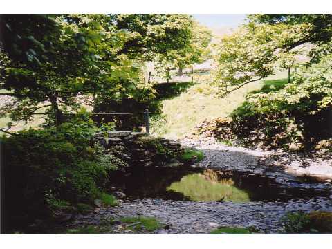
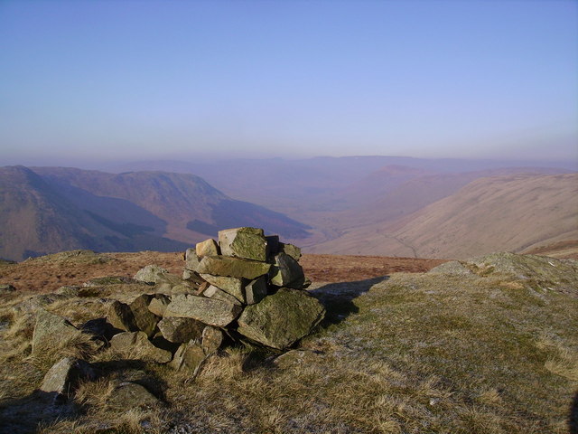
The valley is characterized by rolling hills, verdant meadows, and meandering streams, all surrounded by majestic mountains. The predominant feature of Bretherdale is the meandering River Lyvennet, which flows through the valley, adding to its idyllic charm.

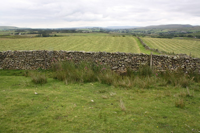
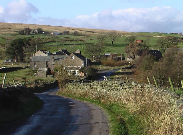
Bretherdale is sparsely populated, with only a handful of small hamlets and scattered farmhouses dotting the landscape. The community here is tight-knit and revolves around agriculture, with sheep farming being the primary occupation.

The valley is a haven for outdoor enthusiasts, offering a multitude of activities such as hiking, cycling, and fishing. The surrounding hills provide excellent opportunities for hiking, with various trails catering to different levels of difficulty. The river is known for its abundant trout, making it a popular spot for anglers.

Bretherdale also boasts an abundance of wildlife, including red deer, wild birds, and rare plant species. The valley is a designated Site of Special Scientific Interest (SSSI) due to its diverse flora and fauna.

Despite its remote location, Bretherdale is within easy reach of nearby towns and attractions. The market town of Kendal lies approximately 15 miles to the south, offering a range of amenities and cultural attractions. Additionally, the stunning Lake District National Park is just a short drive away, providing endless opportunities for exploration and adventure.

If you have any feedback on the listing, please let us know in the comments section below.

Bretherdale Images

Images are sourced within 2km of 54.439865/-2.656539 or Grid Reference NY5705. Thanks to Geograph Open Source API. All images are credited.

Crookdale Crag At 1404ft, Crookdale Crag is in the Eastern Fells
Crookdale Crag
At 1404ft, Crookdale Crag is in the Eastern Fells
Crookdale Crag Towering above the A6 road
Crookdale Crag
Towering above the A6 road
Dry stone wall beside minor road at Ewelock Bank
Benchmark on 'Scalegill' Ordnance Survey rivet benchmark described on the Bench Mark Database at <span class="nowrap"><a title="http://www.bench-marks.org.uk/bm69618" rel="nofollow ugc noopener" href="http://www.bench-marks.org.uk/bm69618">Link</a><img style="margin-left:2px;" alt="External link" title="External link - shift click to open in new window" src="https://s1.geograph.org.uk/img/external.png" width="10" height="10"/></span>
Benchmark on 'Scalegill'
Ordnance Survey rivet benchmark described on the Bench Mark Database at LinkExternal link
'Scalegill' There is an OS benchmark <a href="https://www.geograph.org.uk/photo/4646906">NY5805 : Benchmark on 'Scalegill'</a> on the left hand side of the house at the front crner
'Scalegill'
There is an OS benchmark NY5805 : Benchmark on 'Scalegill' on the left hand side of the house at the front crner
Benchmark on stone at base of wall near Eskew Beck House Ordnance Survey rivet benchmark described on the Bench Mark Database at <span class="nowrap"><a title="http://www.bench-marks.org.uk/bm69619" rel="nofollow ugc noopener" href="http://www.bench-marks.org.uk/bm69619">Link</a><img style="margin-left:2px;" alt="External link" title="External link - shift click to open in new window" src="https://s1.geograph.org.uk/img/external.png" width="10" height="10"/></span>
Benchmark on stone at base of wall near Eskew Beck House
Ordnance Survey rivet benchmark described on the Bench Mark Database at LinkExternal link
Footbridge and ford on minor road for Eskew Beck There is an OS benchmark <a href="https://www.geograph.org.uk/photo/4646930">NY5805 : Benchmark on stone at base of wall near Eskew Beck House</a> on a stone at the base of the wall on the left hand side of the image
Footbridge and ford on minor road for Eskew Beck
There is an OS benchmark NY5805 : Benchmark on stone at base of wall near Eskew Beck House on a stone at the base of the wall on the left hand side of the image
Damaged culvert top beside road south of Eskew Beck House
Benchmark on stone in wall north of High Whinhowe Ordnance Survey benchmark described on the Bench Mark Database at <span class="nowrap"><a title="http://www.bench-marks.org.uk/bm69620" rel="nofollow ugc noopener" href="http://www.bench-marks.org.uk/bm69620">Link</a><img style="margin-left:2px;" alt="External link" title="External link - shift click to open in new window" src="https://s1.geograph.org.uk/img/external.png" width="10" height="10"/></span>
Benchmark on stone in wall north of High Whinhowe
Ordnance Survey benchmark described on the Bench Mark Database at LinkExternal link
Dry stone wall beside minor road north of High Whinhowe There is an OS benchmark <a href="https://www.geograph.org.uk/photo/4646987">NY5805 : Benchmark on stone in wall north of High Whinhowe</a> on a stone in front of the wall near the right hand side of the image
Dry stone wall beside minor road north of High Whinhowe
There is an OS benchmark NY5805 : Benchmark on stone in wall north of High Whinhowe on a stone in front of the wall near the right hand side of the image
Ruined farm buildings at High Whinhowe
Benchmark on gatepost between High Whinhowe and Low Whinhowe Ordnance Survey cut mark benchmark described on the Bench Mark Database at <span class="nowrap"><a title="http://www.bench-marks.org.uk/bm69780" rel="nofollow ugc noopener" href="http://www.bench-marks.org.uk/bm69780">Link</a><img style="margin-left:2px;" alt="External link" title="External link - shift click to open in new window" src="https://s1.geograph.org.uk/img/external.png" width="10" height="10"/></span>
Benchmark on gatepost between High Whinhowe and Low Whinhowe
Ordnance Survey cut mark benchmark described on the Bench Mark Database at LinkExternal link
Gateway on path from High Whinhowe to Low Whinhowe There is an OS benchmark <a href="https://www.geograph.org.uk/photo/4647035">NY5905 : Benchmark on gatepost between High Whinhowe and Low Whinhowe</a> on the stone gatepost
Gateway on path from High Whinhowe to Low Whinhowe
There is an OS benchmark NY5905 : Benchmark on gatepost between High Whinhowe and Low Whinhowe on the stone gatepost
Benchmark on building at Low Whinhowe Ordnance Survey cut mark benchmark described on the Bench Mark Database at <span class="nowrap"><a title="http://www.bench-marks.org.uk/bm69781" rel="nofollow ugc noopener" href="http://www.bench-marks.org.uk/bm69781">Link</a><img style="margin-left:2px;" alt="External link" title="External link - shift click to open in new window" src="https://s1.geograph.org.uk/img/external.png" width="10" height="10"/></span>
Benchmark on building at Low Whinhowe
Ordnance Survey cut mark benchmark described on the Bench Mark Database at LinkExternal link
Farm building at Low Whinhowe There is an OS benchmark <a href="https://www.geograph.org.uk/photo/4647173">NY5905 : Benchmark on building at Low Whinhowe</a> on the near corner of the building right hand face, on the quoin covered with white lichen
Farm building at Low Whinhowe
There is an OS benchmark NY5905 : Benchmark on building at Low Whinhowe on the near corner of the building right hand face, on the quoin covered with white lichen
Ruined stone hut and old farm equipment at Low Whinhowe
Benchmark on gatepost on path near High Whinhowe Ordnance Survey cut mark benchmark described on the Bench Mark Database at <span class="nowrap"><a title="http://www.bench-marks.org.uk/bm69782" rel="nofollow ugc noopener" href="http://www.bench-marks.org.uk/bm69782">Link</a><img style="margin-left:2px;" alt="External link" title="External link - shift click to open in new window" src="https://s1.geograph.org.uk/img/external.png" width="10" height="10"/></span>
Benchmark on gatepost on path near High Whinhowe
Ordnance Survey cut mark benchmark described on the Bench Mark Database at LinkExternal link
Gateway across track from High Whinhowe There is an OS benchmark <a href="https://www.geograph.org.uk/photo/4647232">NY5805 : Benchmark on gatepost on path near High Whinhowe</a> on the left hand gatepost
Gateway across track from High Whinhowe
There is an OS benchmark NY5805 : Benchmark on gatepost on path near High Whinhowe on the left hand gatepost
Show me another place!

Bretherdale is located at Grid Ref: NY5705 (Lat: 54.439865, Lng: -2.656539)

Administrative County: Cumbria

District: Eden

Police Authority: Cumbria

What 3 Words

///objective.positives.limes. Near Shap, Cumbria

Nearby Locations

Bretherdale

Related Wikis

Bretherdale Head

Bretherdale Head is a hamlet in Cumbria, England. Meaning "Valley of the Brother", it was referred to as Britherdal in the 12th century. == References ==

Birkbeck Fells

Birkbeck Fells is a township located in part of the parishes of Crosby Ravensworth, Orton and Shap in the historic county of Westmorland. It is a large...

Winterscleugh

Winterscleugh is a hill of 464 metres (1,522 ft) in Cumbria, England, to the east of the Lake District. It is in the far east of the Lake District National...

Borrowdale, Westmorland

Borrowdale is a valley in the English Lake District. It is located in the county of Westmorland, and is sometimes referred to as Westmorland Borrowdale...

Greenholme

Greenholme is a hamlet in Cumbria, England.The Greenholme Gala and Agricultural Show is held there annually.Greenholme Bridge crosses the Birk Beck in...

Scout Green

Scout Green is a hamlet and small area of farm land near the village of Tebay in Cumbria, England. == History == It is best known among railway enthusiasts...

Tebay Services

Tebay Services are motorway service stations on the M6 motorway in the Westmorland and Furness district of Cumbria, England. The northbound opened in 1972...

Birk Beck

Birk Beck is a minor river in Cumbria.Rising on the fells near Shap, Birk Beck runs south-by-south east, picking up Wasdale Beck (running east and draining...

Nearby Amenities

Located within 500m of 54.439865,-2.656539
Created By: Potlatch 0.10b
Note: farm buildings
Lat/Long: 54.4382206/-2.6550865
Ford: yes
Lat/Long: 54.4392601/-2.656747
The data included in this document is from www.openstreetmap.org. The data is made available under ODbL.

Have you been to Bretherdale?

Leave your review of Bretherdale below (or comments, questions and feedback).