Ashy Cleugh

Valley in Cumberland Carlisle

England

Ashy Cleugh

On a track near Crossgreens This track links Crossgreens, Bewcastle with Spadeadam Forest crossing rather bleak grazing moorland for the most part.

This photograph was taken during the Coronavirus (COVID-19) pandemic of 2020/21.
On a track near Crossgreens Credit: James T M Towill

Ashy Cleugh, Cumberland (Valley) is a picturesque valley located in the county of Cumbria, England. Nestled amidst the stunning countryside of the Lake District National Park, Ashy Cleugh offers a serene and idyllic retreat for nature lovers and outdoor enthusiasts.

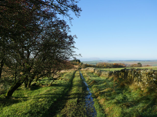
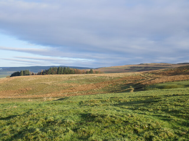
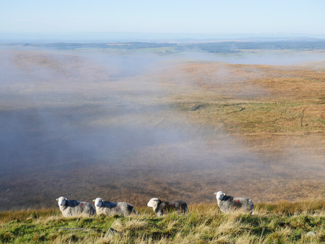
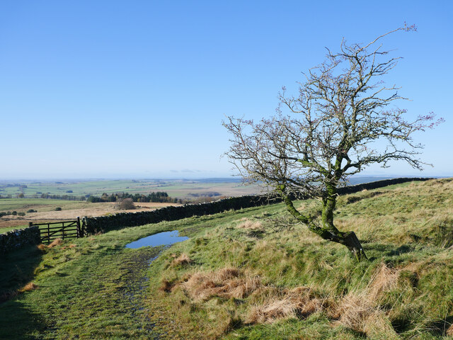
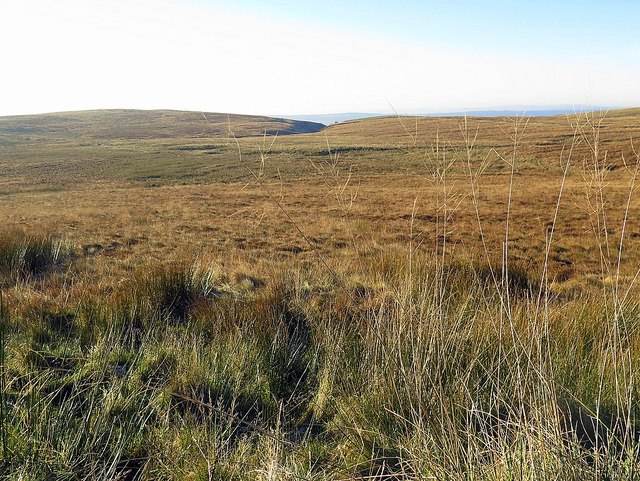
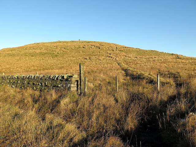
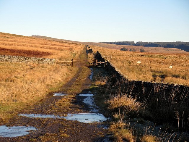
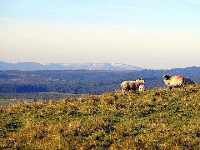
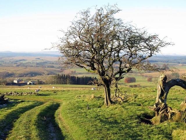
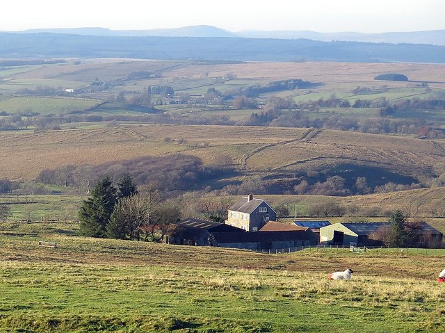
The valley is characterized by its verdant rolling hills, lush meadows, and meandering streams that flow through the landscape. The surrounding area is abundant in diverse flora and fauna, making it a haven for wildlife enthusiasts and birdwatchers. Visitors can spot a variety of species, from red deer and red squirrels to rare birds such as the pied flycatcher and redstart.

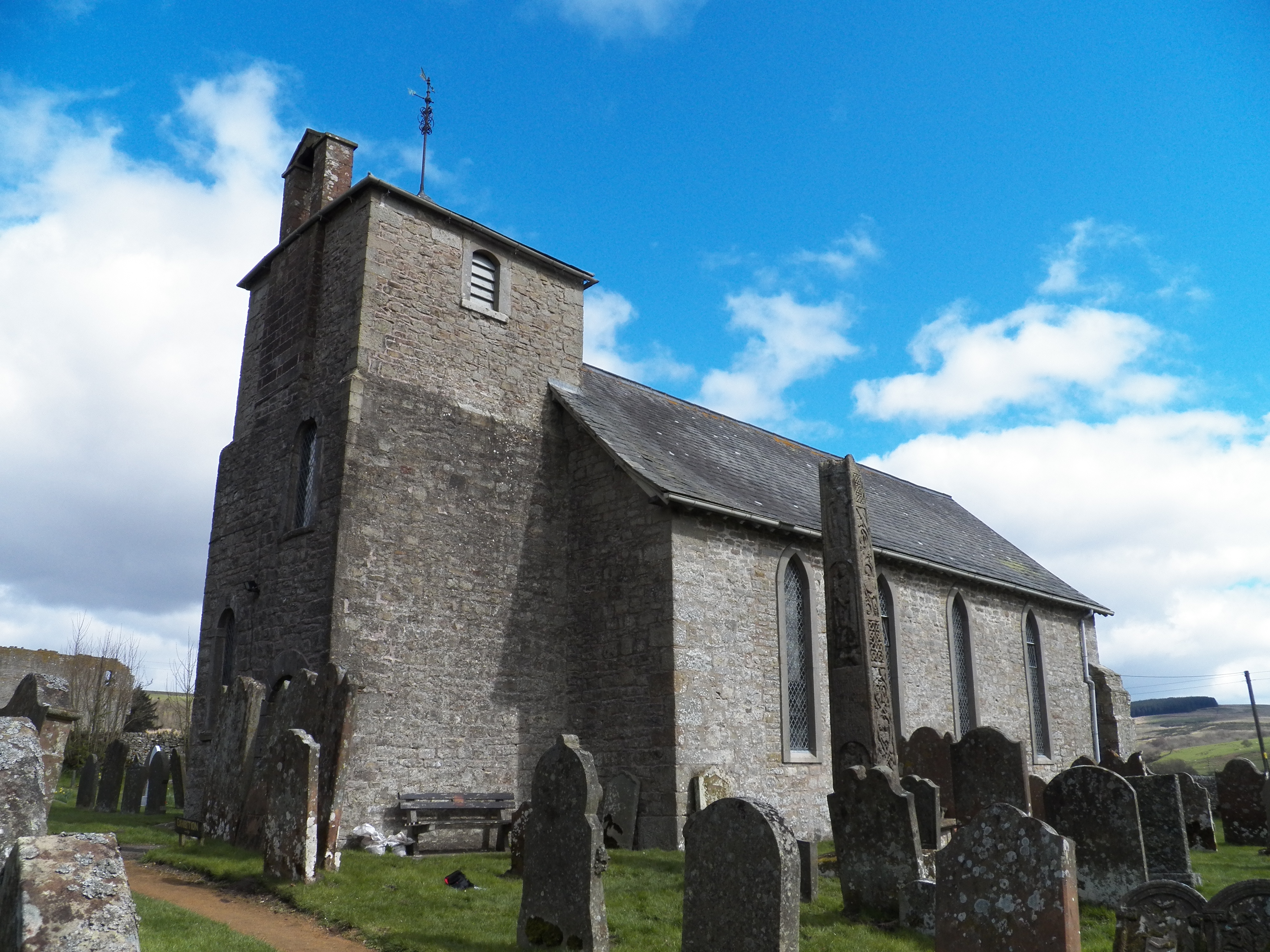
Ashy Cleugh is also known for its rich history and cultural heritage. The valley is home to several ancient sites, including stone circles, burial mounds, and remnants of medieval settlements. These archaeological treasures provide insight into the region's past and offer visitors a glimpse into the lives of its early inhabitants.

Outdoor activities abound in Ashy Cleugh, with numerous hiking trails and scenic walks that cater to all levels of fitness. The valley offers breathtaking vistas and panoramic views, making it a popular destination for photographers and artists seeking inspiration.

For those seeking a peaceful and tranquil getaway, Ashy Cleugh provides a perfect escape. Its unspoiled natural beauty, combined with its historical significance, offers visitors a unique and immersive experience in the heart of the English countryside.

If you have any feedback on the listing, please let us know in the comments section below.

Ashy Cleugh Images

Images are sourced within 2km of 55.08378/-2.6715759 or Grid Reference NY5776. Thanks to Geograph Open Source API. All images are credited.

On a track near Crossgreens This track links Crossgreens, Bewcastle with Spadeadam Forest crossing rather bleak grazing moorland for the most part.

This photograph was taken during the Coronavirus (COVID-19) pandemic of 2020/21.
On a track near Crossgreens
This track links Crossgreens, Bewcastle with Spadeadam Forest crossing rather bleak grazing moorland for the most part. This photograph was taken during the Coronavirus (COVID-19) pandemic of 2020/21.
Grazings at The Pike Uplands illuminated by November morning sun.

This photograph was taken during the Coronavirus (COVID-19) pandemic of 2020/21.
Grazings at The Pike
Uplands illuminated by November morning sun. This photograph was taken during the Coronavirus (COVID-19) pandemic of 2020/21.
A track on Grey Hill A rough track linking Crossgreens with the Spadeadam Forest.

This photograph was taken during the Coronavirus (COVID-19) pandemic of 2020/21.
A track on Grey Hill
A rough track linking Crossgreens with the Spadeadam Forest. This photograph was taken during the Coronavirus (COVID-19) pandemic of 2020/21.
Black Preston in view The end point of a short Cumbrian walk is in view.  Spadeadam Forest can be noted in the distance.

This photograph was taken during the Coronavirus (COVID-19) pandemic of 2020/21.
Black Preston in view
The end point of a short Cumbrian walk is in view. Spadeadam Forest can be noted in the distance. This photograph was taken during the Coronavirus (COVID-19) pandemic of 2020/21.
Bewcastle Hammer on Black Preston 'Bewcastle Hammer' is the name given by another Geograph contributor to this installation on Black Preston.  Retreating valley fog can be noted in the distance.

This photograph was taken during the Coronavirus (COVID-19) pandemic of 2020/21.
Bewcastle Hammer on Black Preston
'Bewcastle Hammer' is the name given by another Geograph contributor to this installation on Black Preston. Retreating valley fog can be noted in the distance. This photograph was taken during the Coronavirus (COVID-19) pandemic of 2020/21.
Herdwick sheep on Black Preston All manner of noises were used to get this part of a flock of Herdwick sheep to look at the camera: mixed results in the end!

This photograph was taken during the Coronavirus (COVID-19) pandemic of 2020/21.
Herdwick sheep on Black Preston
All manner of noises were used to get this part of a flock of Herdwick sheep to look at the camera: mixed results in the end! This photograph was taken during the Coronavirus (COVID-19) pandemic of 2020/21.
Millennium Cairn on Black Preston Erected by a local farmer to commemorate his family's link to this land.  A beautiful view of this corner of Cumbria can be obtained after the short climb from the nearby track.

This photograph was taken during the Coronavirus (COVID-19) pandemic of 2020/21.
Millennium Cairn on Black Preston
Erected by a local farmer to commemorate his family's link to this land. A beautiful view of this corner of Cumbria can be obtained after the short climb from the nearby track. This photograph was taken during the Coronavirus (COVID-19) pandemic of 2020/21.
Hawthorn on the bend An old weather-beaten Hawthorn tree on the track between Crossgreens and Spadeadam Forest. 

This photograph was taken during the Coronavirus (COVID-19) pandemic of 2020/21.
Hawthorn on the bend
An old weather-beaten Hawthorn tree on the track between Crossgreens and Spadeadam Forest. This photograph was taken during the Coronavirus (COVID-19) pandemic of 2020/21.
Lady Moss
Lady Moss
Black Preston A large cairn has been constructed on the hill <a href="https://www.geograph.org.uk/photo/1868739">NY5876 : Millennium cairn on Black Preston (3)</a>
Black Preston
A large cairn has been constructed on the hill NY5876 : Millennium cairn on Black Preston (3)
Track near Black Moss Black Preston is in the distance.
Track near Black Moss
Black Preston is in the distance.
Black Moss High Grains farm is just visible right of centre <a href="https://www.geograph.org.uk/photo/239634">NY5875 : High Grains</a>
Black Moss
High Grains farm is just visible right of centre NY5875 : High Grains
Cairn south of track near Grey Hill
Track near Grey Hill
Track near The Pike
Track near The Pike
Sheep on The Pike In the distance, the Cheviot Hills above Kielder Forest.
Sheep on The Pike
In the distance, the Cheviot Hills above Kielder Forest.
Track near The Pike
Track near The Pike
Park Head from the south-east
Show me another place!

Ashy Cleugh is located at Grid Ref: NY5776 (Lat: 55.08378, Lng: -2.6715759)

Administrative County: Cumbria

District: Carlisle

Police Authority: Cumbria

What 3 Words

///often.nipping.impresses. Near Brampton, Cumbria

Nearby Locations

Grey Hill Ashy Cleugh

Related Wikis

Have you been to Ashy Cleugh?

Leave your review of Ashy Cleugh below (or comments, questions and feedback).