Blind Slack
Valley in Cumberland Carlisle
England
Blind Slack

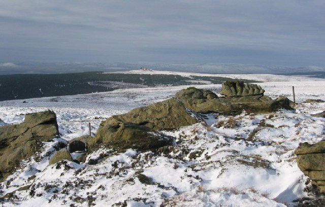
Blind Slack is a geological feature located in the Cumberland Valley region of England. It is a narrow, deep, and elongated gorge that stretches for approximately 7 miles. The term "slack" refers to a valley with a shallow gradient, often formed by glacial processes.
Blind Slack is characterized by its steep sides and dense vegetation, which includes a variety of trees, shrubs, and wildflowers. The area is known for its rich biodiversity, with numerous species of birds, insects, and mammals calling it home. The dense vegetation provides a habitat for a wide range of wildlife, making it a popular destination for nature enthusiasts and birdwatchers.
The gorge itself was formed during the last Ice Age, when the movement of glaciers carved out the landscape, leaving behind deep channels and valleys. Blind Slack is believed to have been formed by the erosive power of meltwater, which cut through the bedrock over thousands of years.
Visitors to Blind Slack can enjoy scenic walks along the gorge, taking in the stunning views of the surrounding countryside. There are also several hiking trails that wind through the area, providing opportunities for exploration and discovery. The site is well-maintained, with designated paths and information boards that educate visitors about the geological history and natural features of Blind Slack.
Overall, Blind Slack is a fascinating and picturesque geological feature, offering visitors a glimpse into the dynamic forces that shaped the Cumberland Valley region. Its natural beauty and diverse wildlife make it an appealing destination for outdoor enthusiasts and nature lovers alike.
If you have any feedback on the listing, please let us know in the comments section below.
Blind Slack Images
Images are sourced within 2km of 55.138878/-2.6965175 or Grid Reference NY5582. Thanks to Geograph Open Source API. All images are credited.
Blind Slack is located at Grid Ref: NY5582 (Lat: 55.138878, Lng: -2.6965175)
Administrative County: Cumbria
District: Carlisle
Police Authority: Cumbria
What 3 Words
///fluid.shins.remaking. Near Langholm, Dumfries & Galloway
Nearby Locations
Related Wikis
Sighty Crag
Sighty Crag is a hill in the southern part of the Kielder Forest region in northern England, a region which also includes its fellow Marilyns of Peel Fell...
Scottish Marches
Scottish Marches was the term used for the Anglo-Scottish border during the late medieval and early modern eras, characterised by violence and cross-border...
Blackpool Gate
Blackpool Gate is a settlement in the civil parish of Bewcastle, which is in the district of the City of Carlisle in the county of Cumbria, England. It...
Alston Formation
The Alston Formation is a geologic formation in England. It preserves fossils dating back to the Viséan to Serpukhovian (Asbian, Brigantian and Pendleian...
Have you been to Blind Slack?
Leave your review of Blind Slack below (or comments, questions and feedback).


