Borrowdale

Valley in Westmorland South Lakeland

England

Borrowdale

Crookdale Crag At 1404ft, Crookdale Crag is in the Eastern Fells
Crookdale Crag Credit: Eirian Evans

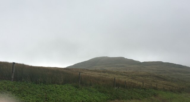
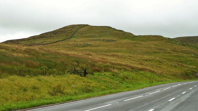
Borrowdale, located in the historic county of Westmorland in North West England, is a picturesque valley renowned for its breathtaking natural beauty. Nestled within the Lake District National Park, Borrowdale is often regarded as one of the most stunning valleys in the region.

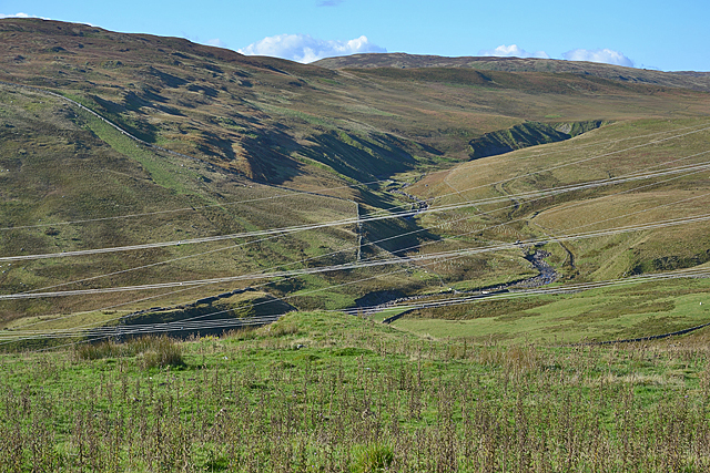
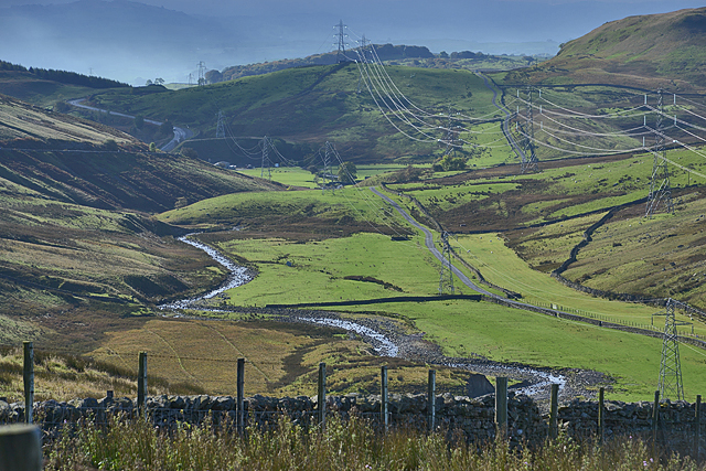
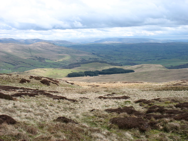
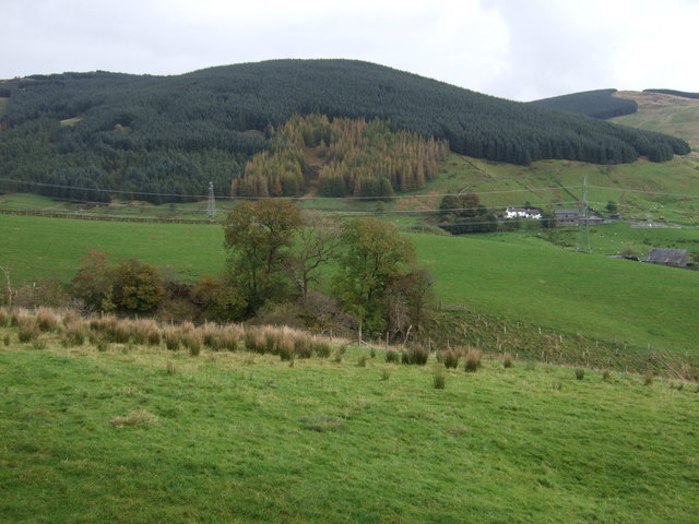
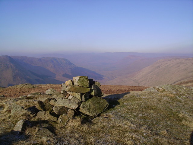
The valley is surrounded by magnificent fells, including the famous Scafell Pike, England's highest peak. With its rugged mountains, cascading waterfalls, and crystal-clear lakes, Borrowdale offers an idyllic setting for outdoor enthusiasts and nature lovers alike.

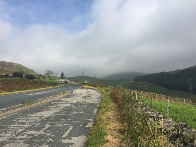
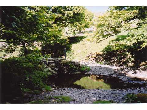
Visitors to Borrowdale can explore numerous scenic walking trails, ranging from leisurely strolls along the river to more challenging hikes up the hills. The area is dotted with charming villages and hamlets, such as Grange and Rosthwaite, where visitors can find cozy accommodations, traditional pubs, and local shops.

Borrowdale is also home to several noteworthy landmarks and attractions. The picturesque Derwentwater, a glacial lake, is a popular spot for boating, kayaking, and fishing. The ancient stone circle of Castlerigg, dating back to the Neolithic era, is another must-visit site, offering panoramic views of the surrounding landscape.

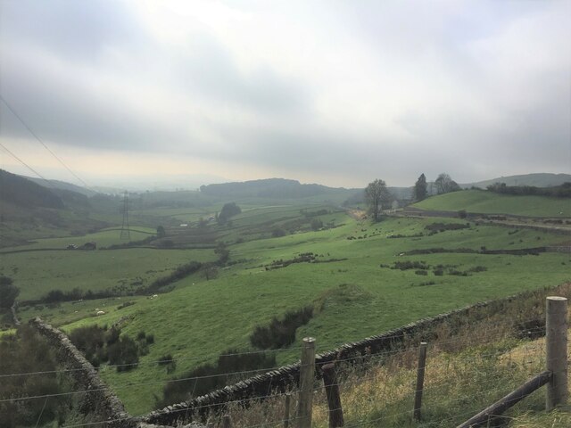
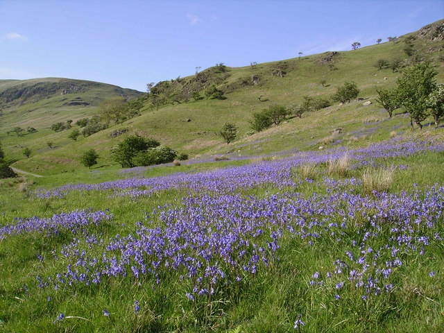
The valley is rich in wildlife, and visitors may spot red squirrels, deer, and a wide variety of bird species during their explorations. In addition, Borrowdale is renowned for its vibrant flora, with fields of wildflowers adding bursts of color to the landscape during the summer months.

Whether it is hiking, wildlife spotting, or simply immersing oneself in the tranquility of nature, Borrowdale offers a captivating experience for all who venture into its breathtaking surroundings.

If you have any feedback on the listing, please let us know in the comments section below.

Borrowdale Images

Images are sourced within 2km of 54.430869/-2.7013303 or Grid Reference NY5404. Thanks to Geograph Open Source API. All images are credited.

Crookdale Crag At 1404ft, Crookdale Crag is in the Eastern Fells
Crookdale Crag
At 1404ft, Crookdale Crag is in the Eastern Fells
The A6 descending to Borrowdale The A6 is Britain's fourth longest road and one of the main historic north-south roads in England. It currently runs for 299 miles from Luton in Bedfordshire to Carlisle in Cumbria, although it formerly started at a junction with the A1 at Barnet.

Running north west from Luton, the road travels through Bedford, bypasses Rushden, Kettering and Market Harborough, continues through Leicester, Loughborough, Derby and Matlock before going through the Peak District to Bakewell, Buxton, Stockport, Manchester, Salford, Pendleton, Irlams o' th' Height, Pendlebury, Swinton, Walkden, Little Hulton, Bolton, Chorley, Preston, Lancaster, Kendal and Penrith before reaching Carlisle.

See <span class="nowrap"><a title="http://en.wikipedia.org/wiki/A6_road_(England)" rel="nofollow ugc noopener" href="http://en.wikipedia.org/wiki/A6_road_(England)">Link</a><img style="margin-left:2px;" alt="External link" title="External link - shift click to open in new window" src="https://s1.geograph.org.uk/img/external.png" width="10" height="10"/></span> (Wikipedia) and <span class="nowrap"><a title="http://www.sabre-roads.org.uk/wiki/index.php?title=A6" rel="nofollow ugc noopener" href="http://www.sabre-roads.org.uk/wiki/index.php?title=A6">Link</a><img style="margin-left:2px;" alt="External link" title="External link - shift click to open in new window" src="https://s1.geograph.org.uk/img/external.png" width="10" height="10"/></span> (SABRE) for more information.
The A6 descending to Borrowdale
The A6 is Britain's fourth longest road and one of the main historic north-south roads in England. It currently runs for 299 miles from Luton in Bedfordshire to Carlisle in Cumbria, although it formerly started at a junction with the A1 at Barnet. Running north west from Luton, the road travels through Bedford, bypasses Rushden, Kettering and Market Harborough, continues through Leicester, Loughborough, Derby and Matlock before going through the Peak District to Bakewell, Buxton, Stockport, Manchester, Salford, Pendleton, Irlams o' th' Height, Pendlebury, Swinton, Walkden, Little Hulton, Bolton, Chorley, Preston, Lancaster, Kendal and Penrith before reaching Carlisle. See LinkExternal link (Wikipedia) and LinkExternal link (SABRE) for more information.
Borrow Beck at Huck's Bridge Ashstead Fell on the horizon
Borrow Beck at Huck's Bridge
Ashstead Fell on the horizon
Newly planted trees On the lower slopes of Ashstead Fell
Newly planted trees
On the lower slopes of Ashstead Fell
Breasthigh Road A mountain track from Borrowdale, crossing Borrow Beck at a ford and climbing to Bretherdale Head
Breasthigh Road
A mountain track from Borrowdale, crossing Borrow Beck at a ford and climbing to Bretherdale Head
Lay-by on the A6 Between Martclose Farm and Hollowgate Farm
Lay-by on the A6
Between Martclose Farm and Hollowgate Farm
Ashstead Beck valley Rough grazing up here
Ashstead Beck valley
Rough grazing up here
Old Boundary Marker on the A6 Parish Boundary Marker against a drystone wall on the northwest side of the A6 south of Hucks Bridge. Fawcett Forest parish became part of Selside and Fawcett Forest parish in 2020. See also <span class="nowrap"><a title="http://www.geog.port.ac.uk/webmap/thelakes/photos/bnk42.jpg" rel="nofollow ugc noopener" href="http://www.geog.port.ac.uk/webmap/thelakes/photos/bnk42.jpg">Link</a><img style="margin-left:2px;" alt="External link" title="External link - shift click to open in new window" src="https://s1.geograph.org.uk/img/external.png" width="10" height="10"/></span>. In 2009 the stone was reported to have been knocked over in a collision, see <span class="nowrap"><a title="https://www.lakesguides.co.uk/html/lgaz/LK13914.htm" rel="nofollow ugc noopener" href="https://www.lakesguides.co.uk/html/lgaz/LK13914.htm">Link</a><img style="margin-left:2px;" alt="External link" title="External link - shift click to open in new window" src="https://s1.geograph.org.uk/img/external.png" width="10" height="10"/></span>.

Milestone Society National ID: WE_KDSP08pb
Old Boundary Marker on the A6
Parish Boundary Marker against a drystone wall on the northwest side of the A6 south of Hucks Bridge. Fawcett Forest parish became part of Selside and Fawcett Forest parish in 2020. See also LinkExternal link. In 2009 the stone was reported to have been knocked over in a collision, see LinkExternal link. Milestone Society National ID: WE_KDSP08pb
Lonely phone box In the A6 road lay-by south of Huck's Bridge
Lonely phone box
In the A6 road lay-by south of Huck's Bridge
Crookdale Crag Towering above the A6 road
Crookdale Crag
Towering above the A6 road
View up Crookdale Somewhat ruined by the number of power lines.
View up Crookdale
Somewhat ruined by the number of power lines.
View down Crookdale On an improving morning as rain creeps away.
View down Crookdale
On an improving morning as rain creeps away.
Sheep at High House The shepherd has gathered his flock to await the attention of the tups
Sheep at High House
The shepherd has gathered his flock to await the attention of the tups
Borrow Beck A major feeder of the River Lune
Borrow Beck
A major feeder of the River Lune
South-eastern slopes of The Forest Ahead is the only steep slope on the Bannisdale Horseshoe. In descent I found this quite awkward.
South-eastern slopes of The Forest
Ahead is the only steep slope on the Bannisdale Horseshoe. In descent I found this quite awkward.
Hillside grazing towards Wolf Howe
Grazing and woodland View across the valley.
Grazing and woodland
View across the valley.
A6 towards Shap Looking north.
A6 towards Shap
Looking north.
Show me another place!

Borrowdale is located at Grid Ref: NY5404 (Lat: 54.430869, Lng: -2.7013303)

Administrative County: Cumbria

District: South Lakeland

Police Authority: Cumbria

What 3 Words

///flank.brightens.professed. Near Burneside, Cumbria

Nearby Locations

High House Bank Borrowdale

Related Wikis

Crookdale Horseshoe

The Crookdale Horseshoe is a group of hills on the eastern edge of the English Lake District, in Cumbria, west of the A6 road. They are the subject of...

Lowbridge Estate

The Lowbridge Estate is a country estate of approximately 2000 acres in the Lake District region of England that was in the continuous ownership of the...

Borrowdale, Westmorland

Borrowdale is a valley in the English Lake District. It is located in the county of Westmorland, and is sometimes referred to as Westmorland Borrowdale...

Bannisdale Horseshoe

The Bannisdale Horseshoe is an upland area in Cumbria, England, near the eastern boundary of the Lake District National Park, surrounding the valley of...

Fawcett Forest

Fawcett Forest is a former civil parish, now in the parish of Selside and Fawcett Forest, in the South Lakeland district of the English county of Cumbria...

Bretherdale Head

Bretherdale Head is a hamlet in Cumbria, England. Meaning "Valley of the Brother", it was referred to as Britherdal in the 12th century. == References ==

Winterscleugh

Winterscleugh is a hill of 464 metres (1,522 ft) in Cumbria, England, to the east of the Lake District. It is in the far east of the Lake District National...

Wasdale Horseshoe

The Wasdale Horseshoe is a group of hills on the eastern fringe of the English Lake District, to the west of the A6, south of Shap, Cumbria. They surround...

Nearby Amenities

Located within 500m of 54.430869,-2.7013303
Borrowdale Head
Place: hamlet
Source: npe
Lat/Long: 54.4305411/-2.7042866
Power: pole
Source: Bing
Lat/Long: 54.4328334/-2.7070278
Power: pole
Source: Bing
Lat/Long: 54.433196/-2.7078096
Power: pole
Source: Bing
Lat/Long: 54.4296922/-2.70128
Power: pole
Source: Bing
Lat/Long: 54.4307226/-2.7024977
Power: pole
Source: Bing
Lat/Long: 54.4318333/-2.7048545
Barrier: cattle_grid
Source: Bing
Lat/Long: 54.432319/-2.7059111
Ford: yes
Source: Bing
Lat/Long: 54.4295016/-2.7069271
Power: pole
Source: Bing
Lat/Long: 54.4312772/-2.7036746
Power: pole
Source: Bing
Lat/Long: 54.4323904/-2.7060652
Power: pole
Lat/Long: 54.4276463/-2.6988797
Power: pole
Lat/Long: 54.4283236/-2.6996666
Power: pole
Lat/Long: 54.4285865/-2.6980632
Power: pole
Lat/Long: 54.4288591/-2.6965114
Power: pole
Lat/Long: 54.4289415/-2.7002623
Power: pole
Lat/Long: 54.4290245/-2.6954305
Power: pole
Lat/Long: 54.4292001/-2.6943436
Power: pole
Lat/Long: 54.4295149/-2.6975799
Power: pole
Lat/Long: 54.4307016/-2.6969006
Ford: yes
Lat/Long: 54.4274742/-2.6985488
Power: pole
Lat/Long: 54.4334562/-2.6954726
Power: pole
Lat/Long: 54.4328429/-2.6958021
Power: pole
Lat/Long: 54.4321827/-2.6961243
Power: pole
Lat/Long: 54.4314942/-2.6965221
The data included in this document is from www.openstreetmap.org. The data is made available under ODbL.

Have you been to Borrowdale?

Leave your review of Borrowdale below (or comments, questions and feedback).