Caudle Cleugh

Valley in Roxburghshire

Scotland

Caudle Cleugh

Benchmark Covered with Moss Old benchmark on the gable of Leysburnfoot.
Photo taken on the 16th January, 2022.
Benchmark Covered with Moss Credit: Rab McMurdo

Caudle Cleugh is a picturesque valley located in the county of Roxburghshire, Scotland. Situated in the southern part of the country, it is known for its stunning natural beauty, abundant wildlife, and rich history.

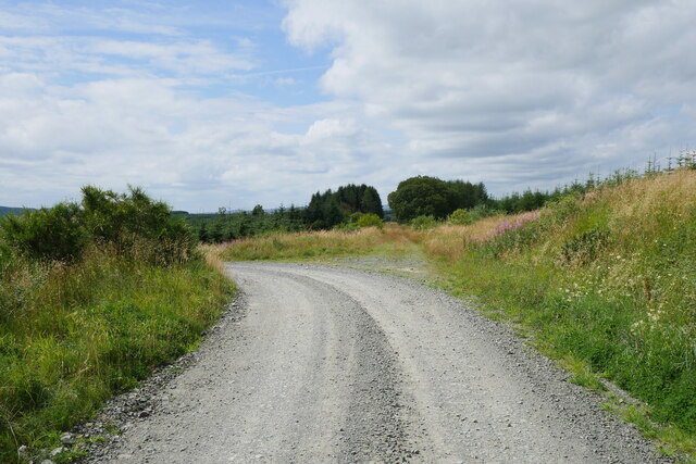
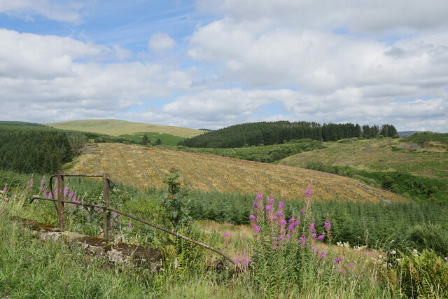
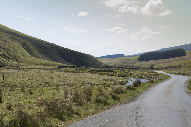
The valley is nestled between rolling hills and is characterized by its lush green landscapes and meandering streams. It is a haven for nature enthusiasts, offering various walking trails and opportunities for wildlife spotting. The area is home to a diverse range of flora and fauna, including rare species such as otters, red squirrels, and various bird species.

Caudle Cleugh is also steeped in history, with evidence of human settlement dating back thousands of years. Archaeological sites and ancient ruins can be found throughout the valley, giving visitors a glimpse into the region's past. The valley was once a thriving agricultural area, and remnants of old farmsteads and stone walls can still be seen.

In addition to its natural and historical attractions, Caudle Cleugh offers a tranquil and peaceful environment, making it an ideal destination for those seeking a rural escape. The valley is dotted with charming cottages and farmhouses, providing visitors with the opportunity to experience authentic rural life.

Overall, Caudle Cleugh is a hidden gem in Roxburghshire, offering breathtaking scenery, a rich cultural heritage, and a sense of serenity that is sure to captivate anyone who visits.

If you have any feedback on the listing, please let us know in the comments section below.

Caudle Cleugh Images

Images are sourced within 2km of 55.254104/-2.7292571 or Grid Reference NY5395. Thanks to Geograph Open Source API. All images are credited.

Benchmark Covered with Moss Old benchmark on the gable of Leysburnfoot.
Photo taken on the 16th January, 2022.
Benchmark Covered with Moss
Old benchmark on the gable of Leysburnfoot. Photo taken on the 16th January, 2022.
A logging track meets the trackbed of the former Waverley Route This image is taken with an aspect looking back along the former Waverley Route; a logging track from the nearby minor road joins from the left.

This photograph was taken during the Coronavirus (COVID-19) pandemic of 2020/21/22.
A logging track meets the trackbed of the former Waverley Route
This image is taken with an aspect looking back along the former Waverley Route; a logging track from the nearby minor road joins from the left. This photograph was taken during the Coronavirus (COVID-19) pandemic of 2020/21/22.
Leysburnfoot Alternatively known as 'Will's Bothy', this site is under the care of the Mountain Bothies Association - refer to <span class="nowrap"><a title="https://www.mountainbothies.org.uk/bothies/southern-scotland/leysburnfoot-wills-bothy/" rel="nofollow ugc noopener" href="https://www.mountainbothies.org.uk/bothies/southern-scotland/leysburnfoot-wills-bothy/">Link</a><img style="margin-left:2px;" alt="External link" title="External link - shift click to open in new window" src="https://s1.geograph.org.uk/img/external.png" width="10" height="10"/></span>  The building is captured here partially illuminated by strong sunshine no longer obscured by a passing cloud.

This photograph was taken during the Coronavirus (COVID-19) pandemic of 2020/21/22.
Leysburnfoot
Alternatively known as 'Will's Bothy', this site is under the care of the Mountain Bothies Association - refer to LinkExternal link The building is captured here partially illuminated by strong sunshine no longer obscured by a passing cloud. This photograph was taken during the Coronavirus (COVID-19) pandemic of 2020/21/22.
A view to Catscleuch Culvert Catscleuch Culvert can clearly be seen in the middle of this image, just below the mature conifer plantation.  Catscleuch Culvert is a major feature on the former Border Counties Railway just south of Riccarton Junction whilst the photograph is taken standing above a cattle creep on the former Waverley Route.

This photograph was taken during the Coronavirus (COVID-19) pandemic of 2020/21/22.
A view to Catscleuch Culvert
Catscleuch Culvert can clearly be seen in the middle of this image, just below the mature conifer plantation. Catscleuch Culvert is a major feature on the former Border Counties Railway just south of Riccarton Junction whilst the photograph is taken standing above a cattle creep on the former Waverley Route. This photograph was taken during the Coronavirus (COVID-19) pandemic of 2020/21/22.
Signpost at Riccarton Junction At the point where the Border Counties Railway met the Waverley Line, indicating Whitrope Siding 2.5mi, Hawick 15mi and Kielder 15mi.
Signpost at Riccarton Junction
At the point where the Border Counties Railway met the Waverley Line, indicating Whitrope Siding 2.5mi, Hawick 15mi and Kielder 15mi.
Riccarton Junction former track routes To the left is the Waverley Line coming in from Whitrope, R of centre is the forest road from the B6399 and to the right the Border Counties Line arriving from Hexham. The renovated schoolmaster's house is in view.
Riccarton Junction former track routes
To the left is the Waverley Line coming in from Whitrope, R of centre is the forest road from the B6399 and to the right the Border Counties Line arriving from Hexham. The renovated schoolmaster's house is in view.
Waverley Line south from Riccarton Junction Looking along the Waverley Line on its way south to Newcastleton and Carlisle.
Waverley Line south from Riccarton Junction
Looking along the Waverley Line on its way south to Newcastleton and Carlisle.
Milepost and trackside bin, Riccarton Junction Edinburgh 66 miles, just outside Riccarton Junction.
Milepost and trackside bin, Riccarton Junction
Edinburgh 66 miles, just outside Riccarton Junction.
Border Counties Railway near Riccarton Junction Looking across from the Waverley Line to the former route from Hexham.
Border Counties Railway near Riccarton Junction
Looking across from the Waverley Line to the former route from Hexham.
Former bridge abutment, Riccarton Junction On the Waverley Line a short distance south of the junction. See also <a href="https://www.geograph.org.uk/photo/4148966">NY5397 : 206</a> by James Towill (2014).
Former bridge abutment, Riccarton Junction
On the Waverley Line a short distance south of the junction. See also NY5397 : 206 by James Towill (2014).
Riccarton Hope A valley on the east side of Blackwood Hill, seen from the former Waverley Line.
Riccarton Hope
A valley on the east side of Blackwood Hill, seen from the former Waverley Line.
Waverley Line below Blackwood Hill The former line heading south down to Newcastleton.
Waverley Line below Blackwood Hill
The former line heading south down to Newcastleton.
Remains of platform, Riccarton Junction Once an important stop on the Edinburgh - Carlisle line, now overgrown with grass and shrubs.
Remains of platform, Riccarton Junction
Once an important stop on the Edinburgh - Carlisle line, now overgrown with grass and shrubs.
Generator building, Riccarton Junction A partly restored building alongside the platforms.
Generator building, Riccarton Junction
A partly restored building alongside the platforms.
A very empty looking valley This road is the B6357 hardly a B class road as it is really a single track road with passing places. The valley is used for sheep and cattle grazing.
A very empty looking valley
This road is the B6357 hardly a B class road as it is really a single track road with passing places. The valley is used for sheep and cattle grazing.
An Oxeye Daisy At Riccarton Junction Much of the route to Riccarton Junction, as well as the former junction site, features an array of Oxeye Daisies.
An Oxeye Daisy At Riccarton Junction
Much of the route to Riccarton Junction, as well as the former junction site, features an array of Oxeye Daisies.
Southbound Platform Remains, Riccarton Junction Rebar is now showing through in this damaged section of the southbound platform at Riccarton Junction.
Southbound Platform Remains, Riccarton Junction
Rebar is now showing through in this damaged section of the southbound platform at Riccarton Junction.
Riccarton Junction The oft-photographed sign at Riccarton Junction.
Riccarton Junction
The oft-photographed sign at Riccarton Junction.
Show me another place!

Caudle Cleugh is located at Grid Ref: NY5395 (Lat: 55.254104, Lng: -2.7292571)

Unitary Authority: The Scottish Borders

Police Authority: The Lothians and Scottish Borders

What 3 Words

///scowls.trouser.sunblock. Near Teviothead, Scottish Borders

Nearby Locations

Caudle Cleugh

Related Wikis

Riccarton Junction railway station

Riccarton Junction, in the county of Roxburghshire in the Scottish Borders, was a railway village and station. In its heyday it had 118 residents and its...

Hermitage Water

The Hermitage Water is a river in Liddesdale, in the Scottish Borders area of Scotland. Among its many feeder burns are Braidley Burn, Dinley Burn, Gorrenberry...

Ninestane Rig

Ninestane Rig (English: Nine Stone Ridge) is a small stone circle in Scotland near the English border. Located in Roxburghshire, near to Hermitage Castle...

Steele Road railway station

Steele Road railway station served the hamlet of Steele Road, Scottish Borders, Scotland, from 1862 to 1969 on the Border Union Railway. == History... ==

Have you been to Caudle Cleugh?

Leave your review of Caudle Cleugh below (or comments, questions and feedback).