Belmont Combe

Valley in Somerset

England

Belmont Combe

Flax Bourton Church, Somerset The church of St Michael and All Angels by the busy A370 Bristol to Weston-super-Mare road. Getting the rainbow was a bonus.
Flax Bourton Church, Somerset Credit: Anthony Brunning

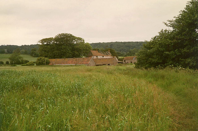
Belmont Combe is a picturesque valley located in Somerset, England. Nestled in the heart of the Mendip Hills, this idyllic area offers breathtaking views, lush greenery, and a tranquil atmosphere. The valley is surrounded by rolling hills and is known for its natural beauty, making it a popular destination for nature lovers and hikers.

Belmont Combe is home to a diverse range of flora and fauna, including a variety of wildflowers, trees, and bird species. The valley is crisscrossed by a network of footpaths and trails, allowing visitors to explore its stunning landscapes and discover hidden gems along the way.

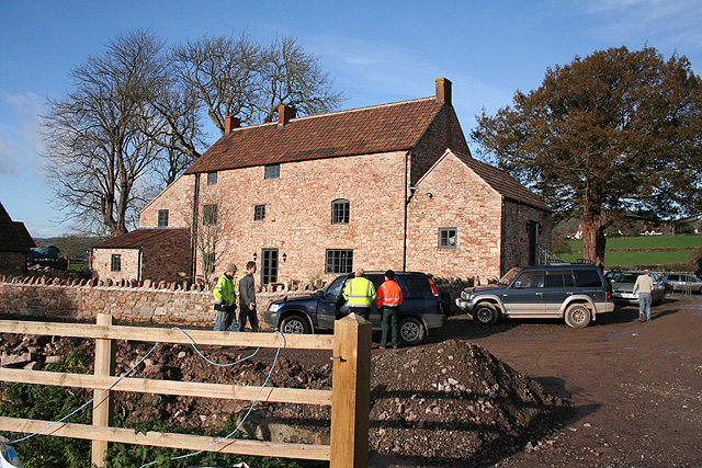
The area also boasts a rich history, with evidence of human habitation dating back to the prehistoric era. There are several archaeological sites in Belmont Combe, including ancient burial mounds and remnants of Roman settlements. These historical sites offer a glimpse into the valley's past and provide an opportunity for visitors to learn about the area's heritage.

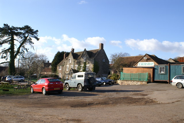
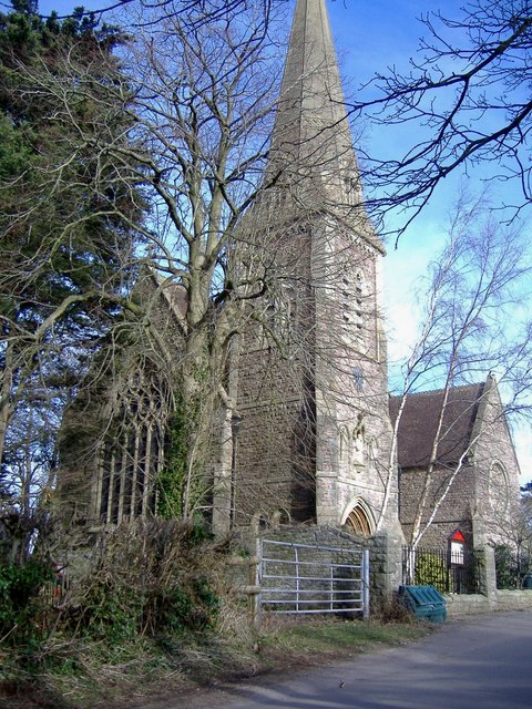
In addition to its natural beauty and historical significance, Belmont Combe is also home to a number of charming villages and towns. These communities offer a warm welcome to visitors, with cozy pubs and quaint shops selling local produce and crafts.

Overall, Belmont Combe is a truly enchanting destination that offers a perfect blend of natural wonders, rich history, and warm community spirit. Whether you're seeking a peaceful retreat or an adventure in the great outdoors, this Valley in Somerset will surely captivate your heart.

If you have any feedback on the listing, please let us know in the comments section below.

Belmont Combe Images

Images are sourced within 2km of 51.436175/-2.6999236 or Grid Reference ST5171. Thanks to Geograph Open Source API. All images are credited.

Flax Bourton Church, Somerset The church of St Michael and All Angels by the busy A370 Bristol to Weston-super-Mare road. Getting the rainbow was a bonus.
Flax Bourton Church, Somerset
The church of St Michael and All Angels by the busy A370 Bristol to Weston-super-Mare road. Getting the rainbow was a bonus.
Wraxall: footpath to Watercress Farm The path runs from Backwell Bow and crosses the Land Yeo on or near the site of the vanished Backwell Mill. Watercress Farm looks derelict here. It had suffered a fire. A leat system and headpond powered a small waterwheel in a hut by the farm in 1988, purpose not known, but possibly with the wheel working as a water pump
Wraxall: footpath to Watercress Farm
The path runs from Backwell Bow and crosses the Land Yeo on or near the site of the vanished Backwell Mill. Watercress Farm looks derelict here. It had suffered a fire. A leat system and headpond powered a small waterwheel in a hut by the farm in 1988, purpose not known, but possibly with the wheel working as a water pump
Bare Tree On the outskirts of Flax Bourton
Bare Tree
On the outskirts of Flax Bourton
Gatcombe Farm & Shop
Gatcombe Farm Geese
Gatcombe Farm Geese
Long Ashton: aqueduct over railway An aqueduct carries the Land Yeo, a river, across the Bristol and Exeter railway. The bridge also provides access to a farm on Cambridge Batch. Looking south east
Long Ashton: aqueduct over railway
An aqueduct carries the Land Yeo, a river, across the Bristol and Exeter railway. The bridge also provides access to a farm on Cambridge Batch. Looking south east
Wraxall: Watercress Farm The farm at one time belonged to the Tyntesfield estate, now National Trust. The farmhouse has been rebuilt following a fire in the 1980s. Work is now in progress to convert outbuildings. Two little water-powered pump houses here provided water for Tyntesfield House. Looking north west
Wraxall: Watercress Farm
The farm at one time belonged to the Tyntesfield estate, now National Trust. The farmhouse has been rebuilt following a fire in the 1980s. Work is now in progress to convert outbuildings. Two little water-powered pump houses here provided water for Tyntesfield House. Looking north west
Arable land, Flax Bourton
The Dew Drop Inn, Flax Bourton If you like puns, no doubt you will do as you are invited.
The Dew Drop Inn, Flax Bourton
If you like puns, no doubt you will do as you are invited.
Parish Church, Flax Bourton
Communications Centre, Flax Bourton The green plaque announces: Winner of the Armstrong Cup for Avon Small Villages, 1993
Communications Centre, Flax Bourton
The green plaque announces: Winner of the Armstrong Cup for Avon Small Villages, 1993
Cycle track and ploughed field A beautiful Spring morning cycling out of Bristol, alongside the hidden railway that heads West towards Weston Super Mare.
Cycle track and ploughed field
A beautiful Spring morning cycling out of Bristol, alongside the hidden railway that heads West towards Weston Super Mare.
Rapeseed field, Flax Bourton A view from the A370. On the other side of the hedge on the right is the cricket ground.
Rapeseed field, Flax Bourton
A view from the A370. On the other side of the hedge on the right is the cricket ground.
Cricket ground, Flax Bourton The Flaxmead ground and its pavilion, seen from the A370.
Cricket ground, Flax Bourton
The Flaxmead ground and its pavilion, seen from the A370.
Field, Flax Bourton A tarmac footpath provides a safe alternative to walking along Station Road, which runs parallel to the left. On the right is <a href="https://www.geograph.org.uk/photo/127997">ST5169 : Bare Tree</a>, which has lost a good deal of its height in just over four years.
Field, Flax Bourton
A tarmac footpath provides a safe alternative to walking along Station Road, which runs parallel to the left. On the right is ST5169 : Bare Tree, which has lost a good deal of its height in just over four years.
B3130 at Cambridge Batch The B road dips underneath the A370, with a slip road to the left.
B3130 at Cambridge Batch
The B road dips underneath the A370, with a slip road to the left.
Pine tree A single pine tree stands out between the fields of oil seed rape.
Pine tree
A single pine tree stands out between the fields of oil seed rape.
Bluebells in the trees Good bluebells here at this time of year.
Bluebells in the trees
Good bluebells here at this time of year.
Show me another place!

Belmont Combe is located at Grid Ref: ST5171 (Lat: 51.436175, Lng: -2.6999236)

Unitary Authority: North Somerset

Police Authority: Avon and Somerset

What 3 Words

///that.sage.zoom. Near Long Ashton, Somerset

Related Wikis

Failand

Failand is a village in Somerset, England. It lies within the civil parish of Wraxall and Failand and the unitary authority area of North Somerset. The...

Tyntesfield

Tyntesfield (TINTS-feeld) is a Victorian Gothic Revival country house and estate near Wraxall, North Somerset, England. The house is a Grade I listed building...

North Somerset Show

The North Somerset Show is an agricultural show held annually in May at Wraxall, North Somerset, England. It is organised by the North Somerset Agricultural...

Wraxall Camp

Wraxall Camp, or Failand Camp, is a small round earthwork in Somerset. The remains are indistinct and thickly covered by woods, but it appears to have...

Nearby Amenities

Located within 500m of 51.436175,-2.6999236
Bicycle: yes
Hiking: yes
Information: map
Map Size: site
Map Type: topo
Tourism: information
Lat/Long: 51.4362233/-2.6931772
Crossing
Crossing: unmarked
Crossing Markings: no
Tactile Paving: yes
Lat/Long: 51.4374838/-2.694069
Information: board
Tourism: information
Lat/Long: 51.4366994/-2.6937358
Man Made: street_cabinet
Lat/Long: 51.4366835/-2.6937851
Post Box
Operator: Royal Mail
Operator Wikidata: Q638098
Post Box Type: lamp
Ref: BS8 268
Lat/Long: 51.4367657/-2.6938954
Fire Hydrant
Emergency: fire_hydrant
Fire Hydrant Diameter: 100
Fire Hydrant Position: lane
Fire Hydrant Type: underground
Lat/Long: 51.4366658/-2.6938149
Fire Hydrant
Emergency: fire_hydrant
Fire Hydrant Diameter: 100
Fire Hydrant Position: sidewalk
Fire Hydrant Type: underground
Lat/Long: 51.4383152/-2.6943038
Letter Box
Lat/Long: 51.4369899/-2.6930951
The data included in this document is from www.openstreetmap.org. The data is made available under ODbL.

Have you been to Belmont Combe?

Leave your review of Belmont Combe below (or comments, questions and feedback).