Ham's Gully

Valley in Somerset

England

Ham's Gully

Beam Engine at Blagdon Pumping Station Part of the massive pumping engines at Blagdon
Beam Engine at Blagdon Pumping Station Credit: Richard Law

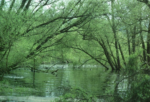
Ham's Gully, also known as Ham's Valley, is a picturesque and serene location situated in Somerset, England. It is nestled in the heart of the beautiful countryside, surrounded by rolling hills and lush greenery. The gully stretches for approximately two miles, offering a tranquil retreat for nature lovers and outdoor enthusiasts alike.

The gully is formed by the River Ham, which meanders through the landscape, creating a serene and calming atmosphere. The river is flanked by towering trees and vibrant wildflowers, adding to the area's natural beauty. The gentle sound of the flowing water creates a soothing ambiance, making it a perfect spot for relaxation and contemplation.

Ham's Gully is a haven for wildlife, attracting a diverse range of species. Birdwatchers will be delighted to spot various species of birds, including kingfishers, herons, and ducks. The surrounding woodlands are home to squirrels, foxes, and even deer, providing ample opportunities for wildlife enthusiasts to observe and appreciate the local fauna.

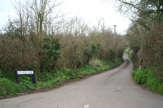
For those seeking outdoor activities, Ham's Gully offers numerous walking trails and hiking routes. The well-maintained paths provide breathtaking views of the valley and its surrounding countryside. Visitors can explore the gully at their own pace, taking in the sights and sounds of nature along the way.

Ham's Gully is a hidden gem in Somerset, offering a peaceful and idyllic escape from the hustle and bustle of daily life. Whether you are looking to enjoy a leisurely stroll, engage in wildlife spotting, or simply immerse yourself in the tranquility of nature, this enchanting valley is a must-visit destination.

If you have any feedback on the listing, please let us know in the comments section below.

Ham's Gully Images

Images are sourced within 2km of 51.351313/-2.7010992 or Grid Reference ST5161. Thanks to Geograph Open Source API. All images are credited.

Beam Engine at Blagdon Pumping Station Part of the massive pumping engines at Blagdon
Beam Engine at Blagdon Pumping Station
Part of the massive pumping engines at Blagdon
View towards the Mendip Hills Looking across the Yeo Valley near Blagdon Water.
View towards the Mendip Hills
Looking across the Yeo Valley near Blagdon Water.
Blagdon Lake View from the New Inn car park
Blagdon Lake
View from the New Inn car park
Aldwick Lane, Aldwick, Somerset The lane is a narrow one with only a few properties on it. The house in the centre marks the point where the lane turns south (to the right).
Aldwick Lane, Aldwick, Somerset
The lane is a narrow one with only a few properties on it. The house in the centre marks the point where the lane turns south (to the right).
View across Blagdon Lake, Somerset The image was taken from just inside the southern edge of the square and is to the north-east. The lake is owned by Bristol Water Company, which also owns the larger Chew Valley Lake to the east of here. The land beyond the lake is in ST5160.
View across Blagdon Lake, Somerset
The image was taken from just inside the southern edge of the square and is to the north-east. The lake is owned by Bristol Water Company, which also owns the larger Chew Valley Lake to the east of here. The land beyond the lake is in ST5160.
Blagdon Pumping Station - steam engine One of the two preserved engines. Is opened on summer Sundays and turned by an electric motor.
The station straddles the grid line with the preserved engines to the south.
Blagdon Pumping Station - steam engine
One of the two preserved engines. Is opened on summer Sundays and turned by an electric motor. The station straddles the grid line with the preserved engines to the south.
Blagdon Lake The lake in late evening sun.
Blagdon Lake
The lake in late evening sun.
Blagdon Lake The lake in evening sun.
Blagdon Lake
The lake in evening sun.
Blagdon Lake The lake in late evening sun.
Blagdon Lake
The lake in late evening sun.
Blagdon Lake
Blagdon Lake
Blagdon Lake - Bristol Water Company's Reservoir This lake must be about 2.5 km long and about 0.5km wide. Along with the nearby Chew Lake it provides Bristol with its water supply. The river Yeo was dammed to form the lake in the 1890s. There is a footpath along the north west side from where this photo was taken. The lake is stocked with trout.

Bristol Water have regular open days when the Victorian pumping engine may be seen. See
<span class="nowrap"><a title="http://www.bristol-water.co.uk/leisure/blagdon-openDays.asp" rel="nofollow ugc noopener" href="http://www.bristol-water.co.uk/leisure/blagdon-openDays.asp">Link</a><img style="margin-left:2px;" alt="External link" title="External link - shift click to open in new window" src="https://s1.geograph.org.uk/img/external.png" width="10" height="10"/></span>
Blagdon Lake - Bristol Water Company's Reservoir
This lake must be about 2.5 km long and about 0.5km wide. Along with the nearby Chew Lake it provides Bristol with its water supply. The river Yeo was dammed to form the lake in the 1890s. There is a footpath along the north west side from where this photo was taken. The lake is stocked with trout. Bristol Water have regular open days when the Victorian pumping engine may be seen. See LinkExternal link
Blagdon Lake - Bristol Water Company's Reservoir This photo was taken at the north end of Blagdon lake where a stream enters the lake. See square for ST5060 for more information.
Blagdon Lake - Bristol Water Company's Reservoir
This photo was taken at the north end of Blagdon lake where a stream enters the lake. See square for ST5060 for more information.
Hill and tree beyond Blagdon Lake Photo was taken looking north east away from the lake. Butcombe is over the hill. The fields around here have many wild flowers.
Hill and tree beyond Blagdon Lake
Photo was taken looking north east away from the lake. Butcombe is over the hill. The fields around here have many wild flowers.
Blagdon Pumping Station Built 1902 and contains two preserved beam engines.
Blagdon Pumping Station
Built 1902 and contains two preserved beam engines.
Down Hill Lumps Looking toward Butcombe
Down Hill Lumps
Looking toward Butcombe
Show me another place!

Ham's Gully is located at Grid Ref: ST5161 (Lat: 51.351313, Lng: -2.7010992)

Unitary Authority: North Somerset

Police Authority: Avon and Somerset

What 3 Words

///perform.eruptions.worlds. Near Butcombe, Somerset

Nearby Locations

Butcombe Ham's Gully

Related Wikis

Butcombe

Butcombe is a village and civil parish in Somerset, England. The village is situated just north of Blagdon Lake, in North Somerset. The parish has a population...

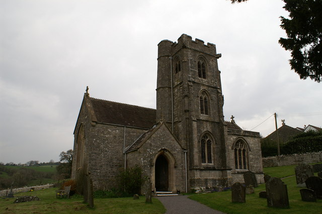
Church of St Michael and All Angels, Butcombe

The Anglican Church of St Michael and All Angels at Butcombe in the English county of Somerset was built in the 15th century and restored in 1868. It is...

Fairy Toot

The Fairy Toot is an extensive oval barrow in the civil parish of Nempnett Thrubwell, Somerset, England (grid reference ST520618). It is an example of...
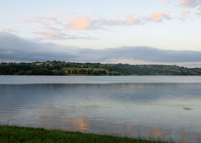
Blagdon Lake

Blagdon Lake lies in a valley at the northern edge of the Mendip Hills, close to the village of Blagdon and approximately 10 miles (16 km) south of Bristol...

Nearby Amenities

Located within 500m of 51.351313,-2.7010992
Butcombe
Is In: North Somerset, England, UK
Place: village
Source: npe
Wikidata: Q2916887
Lat/Long: 51.3497168/-2.698813
Ele: 127
Natural: peak
Source: NPE
Lat/Long: 51.3545578/-2.7057521
Bus Stop
Old Post Office
Bus: yes
Naptan AtcoCode: 0190NSC31094
Naptan Bearing: SW
Naptan CommonName: Old Post Office
Naptan Crossing: The Batch
Naptan NaptanCode: wsmjapj
Naptan Street: Mill Lane
Naptan Verified: no
Public Transport: platform
Source: naptan_import
Lat/Long: 51.3514614/-2.6984275
Bus Stop
Old Post Office
Bus: yes
Naptan AtcoCode: 0190NSC31095
Naptan Bearing: NE
Naptan CommonName: Old Post Office
Naptan Crossing: The Batch
Naptan NaptanCode: wsmjapd
Naptan Street: Mill Lane
Naptan Verified: no
Public Transport: platform
Source: naptan_import
Lat/Long: 51.3514448/-2.6985314
Post Box
Post Box Type: lamp
Ref: BS40 317
Royal Cypher: EIIR
Royal Cypher Wikidata: Q33102113
Lat/Long: 51.3515696/-2.6982783
Telephone
Defibrillator
Booth: K6
Colour: red
Covered: booth
Defibrillator Location: inside red phone box, Green Lane, Butcombe
Emergency: defibrillator
Man Made: telephone_box
Lat/Long: 51.3496837/-2.6990578
Power: pole
Lat/Long: 51.3550697/-2.6992707
Power: pole
Lat/Long: 51.3546711/-2.7001204
Power: pole
Lat/Long: 51.3535375/-2.7003216
Power: pole
Lat/Long: 51.3525777/-2.7004883
Power: pole
Lat/Long: 51.3519112/-2.7005777
Power: pole
Lat/Long: 51.3507179/-2.7009436
Power: pole
Lat/Long: 51.3502939/-2.700531
Power: pole
Lat/Long: 51.3499917/-2.7000797
Power: pole
Lat/Long: 51.3512282/-2.7014579
Power: pole
Lat/Long: 51.3512683/-2.7026256
Power: pole
Lat/Long: 51.351226/-2.7037978
Power: pole
Transformer: distribution
Lat/Long: 51.3496782/-2.6997915
Advertising: board
Support: wall_mounted
Lat/Long: 51.353516/-2.6974751
Advertising: board
Support: wall_mounted
Lat/Long: 51.3535167/-2.6975323
Height: 2.5
Man Made: cross
Material: stone
Wikidata: Q17533986
Lat/Long: 51.3537092/-2.6973011
Barrier: kissing_gate
Lat/Long: 51.3536854/-2.6969559
Grit Bin
Colour: yellow
Material: plastic
Lat/Long: 51.3540628/-2.6961722
Power: pole
Lat/Long: 51.3554417/-2.6985075
Grit Bin
Colour: yellow
Material: plastic
Lat/Long: 51.3490864/-2.7012344
Power: pole
Lat/Long: 51.3488351/-2.6982899
Grit Bin
Colour: yellow
Material: plastic
Lat/Long: 51.3480849/-2.6961097
Colour: green
Man Made: street_cabinet
Lat/Long: 51.3496586/-2.6990054
Grit Bin
Colour: yellow
Material: plastic
Lat/Long: 51.351596/-2.6984128
Colour: green
Man Made: street_cabinet
Lat/Long: 51.3516645/-2.6983854
Grit Bin
Colour: yellow
Material: plastic
Lat/Long: 51.3521357/-2.6984143
Cleeve's Well
Man Made: water_well
Lat/Long: 51.3556681/-2.699528
Barrier: stile
Stile: stepover
Lat/Long: 51.3489672/-2.7018294
Barrier: stile
Stile: stepover
Lat/Long: 51.349421/-2.7031908
Barrier: stile
Stile: stepover
Lat/Long: 51.3494501/-2.7032734
The data included in this document is from www.openstreetmap.org. The data is made available under ODbL.

Have you been to Ham's Gully?

Leave your review of Ham's Gully below (or comments, questions and feedback).