Mary Knoll Valley

Valley in Herefordshire

England

Mary Knoll Valley

Bridleway, Mortimer Forest The Mortimer Forest is the name given to the remnant of a Saxon Hunting forest on the Shropshire / Herefordshire border near Ludlow (Bringewood Forest). It is owned and managed by the Forestry Commission, who invented the name. The forest has car parks, information boards and trails.  The underlying rocks are Upper Silurian and the forest is the type site for these rocks (the Ludlovian).
Bridleway, Mortimer Forest Credit: N Chadwick

Mary Knoll Valley is a picturesque rural area located in Herefordshire, England. Nestled amidst rolling hills and verdant landscapes, the valley offers a serene and tranquil environment for those seeking a break from the bustling city life. The valley is situated approximately 10 miles southeast of the town of Hereford and covers an area of around 15 square miles.

With its idyllic charm, Mary Knoll Valley is a popular destination for nature enthusiasts and outdoor lovers. The valley is known for its extensive network of walking trails, allowing visitors to explore the diverse flora and fauna that thrive in the area. From dense woodlands to open meadows, the landscape offers a delightful mix of natural beauty.

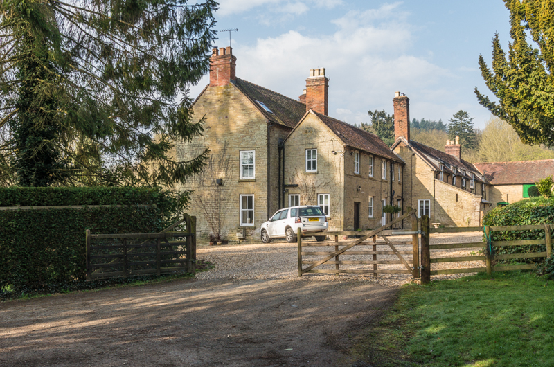
The valley is also home to a number of quaint villages and hamlets, each with its own unique character. Charming cottages and traditional stone houses dot the landscape, adding to the area's charm and appeal. The local community is warm and welcoming, and visitors can expect a friendly atmosphere during their stay.

In addition to its natural beauty, Mary Knoll Valley also has a rich historical heritage. The area is dotted with ancient landmarks, including historic churches, medieval castles, and archaeological sites. These attractions offer a glimpse into the valley's past and provide visitors with a deeper understanding of the region's cultural significance.

Overall, Mary Knoll Valley is a hidden gem in Herefordshire, offering visitors a chance to escape the hustle and bustle of everyday life and immerse themselves in the beauty of nature and history.

If you have any feedback on the listing, please let us know in the comments section below.

Mary Knoll Valley Images

Images are sourced within 2km of 52.354081/-2.7547152 or Grid Reference SO4873. Thanks to Geograph Open Source API. All images are credited.

Bridleway, Mortimer Forest The Mortimer Forest is the name given to the remnant of a Saxon Hunting forest on the Shropshire / Herefordshire border near Ludlow (Bringewood Forest). It is owned and managed by the Forestry Commission, who invented the name. The forest has car parks, information boards and trails.  The underlying rocks are Upper Silurian and the forest is the type site for these rocks (the Ludlovian).
Bridleway, Mortimer Forest
The Mortimer Forest is the name given to the remnant of a Saxon Hunting forest on the Shropshire / Herefordshire border near Ludlow (Bringewood Forest). It is owned and managed by the Forestry Commission, who invented the name. The forest has car parks, information boards and trails. The underlying rocks are Upper Silurian and the forest is the type site for these rocks (the Ludlovian).
Deer proof fence, Mortimer Forest The Mortimer Forest is the name given to the remnant of a Saxon Hunting forest on the Shropshire / Herefordshire border near Ludlow (Bringewood Forest). It is owned and managed by the Forestry Commission, who invented the name. The forest has car parks, information boards and trails.  The underlying rocks are Upper Silurian and the forest is the type site for these rocks (the Ludlovian).
Deer proof fence, Mortimer Forest
The Mortimer Forest is the name given to the remnant of a Saxon Hunting forest on the Shropshire / Herefordshire border near Ludlow (Bringewood Forest). It is owned and managed by the Forestry Commission, who invented the name. The forest has car parks, information boards and trails. The underlying rocks are Upper Silurian and the forest is the type site for these rocks (the Ludlovian).
Telecommunications, Mortimer Forest The Mortimer Forest is the name given to the remnant of a Saxon Hunting forest on the Shropshire / Herefordshire border near Ludlow (Bringewood Forest). It is owned and managed by the Forestry Commission, who invented the name. The forest has car parks, information boards and trails.  The underlying rocks are Upper Silurian and the forest is the type site for these rocks (the Ludlovian).
Telecommunications, Mortimer Forest
The Mortimer Forest is the name given to the remnant of a Saxon Hunting forest on the Shropshire / Herefordshire border near Ludlow (Bringewood Forest). It is owned and managed by the Forestry Commission, who invented the name. The forest has car parks, information boards and trails. The underlying rocks are Upper Silurian and the forest is the type site for these rocks (the Ludlovian).
Telecommunications Mast, Mortimer Forest The Mortimer Forest is the name given to the remnant of a Saxon Hunting forest on the Shropshire / Herefordshire border near Ludlow (Bringewood Forest). It is owned and managed by the Forestry Commission, who invented the name. The forest has car parks, information boards and trails.  The underlying rocks are Upper Silurian and the forest is the type site for these rocks (the Ludlovian).
Telecommunications Mast, Mortimer Forest
The Mortimer Forest is the name given to the remnant of a Saxon Hunting forest on the Shropshire / Herefordshire border near Ludlow (Bringewood Forest). It is owned and managed by the Forestry Commission, who invented the name. The forest has car parks, information boards and trails. The underlying rocks are Upper Silurian and the forest is the type site for these rocks (the Ludlovian).
Bridleway in the Mortimer Forest
Sunken Bridleway, Mortimer Forest The Mortimer Forest is the name given to the remnant of a Saxon Hunting forest on the Shropshire / Herefordshire border near Ludlow (Bringewood Forest). It is owned and managed by the Forestry Commission, who invented the name. The forest has car parks, information boards and trails.  The underlying rocks are Upper Silurian and the forest is the type site for these rocks (the Ludlovian).
Sunken Bridleway, Mortimer Forest
The Mortimer Forest is the name given to the remnant of a Saxon Hunting forest on the Shropshire / Herefordshire border near Ludlow (Bringewood Forest). It is owned and managed by the Forestry Commission, who invented the name. The forest has car parks, information boards and trails. The underlying rocks are Upper Silurian and the forest is the type site for these rocks (the Ludlovian).
Mortimer Forest The Mortimer Forest is the name given to the remnant of a Saxon Hunting forest on the Shropshire / Herefordshire border near Ludlow (Bringewood Forest). It is owned and managed by the Forestry Commission, who invented the name. The forest has car parks, information boards and trails.  The underlying rocks are Upper Silurian and the forest is the type site for these rocks (the Ludlovian).
Mortimer Forest
The Mortimer Forest is the name given to the remnant of a Saxon Hunting forest on the Shropshire / Herefordshire border near Ludlow (Bringewood Forest). It is owned and managed by the Forestry Commission, who invented the name. The forest has car parks, information boards and trails. The underlying rocks are Upper Silurian and the forest is the type site for these rocks (the Ludlovian).
Bridleway in Mortimer Forest The Mortimer Forest is the name given to the remnant of a Saxon Hunting forest on the Shropshire / Herefordshire border near Ludlow (Bringewood Forest). It is owned and managed by the Forestry Commission, who invented the name. The forest has car parks, information boards and trails.  The underlying rocks are Upper Silurian and the forest is the type site for these rocks (the Ludlovian).
Bridleway in Mortimer Forest
The Mortimer Forest is the name given to the remnant of a Saxon Hunting forest on the Shropshire / Herefordshire border near Ludlow (Bringewood Forest). It is owned and managed by the Forestry Commission, who invented the name. The forest has car parks, information boards and trails. The underlying rocks are Upper Silurian and the forest is the type site for these rocks (the Ludlovian).
Mortimer Forest The Mortimer Forest is the name given to the remnant of a Saxon Hunting forest on the Shropshire / Herefordshire border near Ludlow (Bringewood Forest). It is owned and managed by the Forestry Commission, who invented the name. The forest has car parks, information boards and trails.  The underlying rocks are Upper Silurian and the forest is the type site for these rocks (the Ludlovian).
Mortimer Forest
The Mortimer Forest is the name given to the remnant of a Saxon Hunting forest on the Shropshire / Herefordshire border near Ludlow (Bringewood Forest). It is owned and managed by the Forestry Commission, who invented the name. The forest has car parks, information boards and trails. The underlying rocks are Upper Silurian and the forest is the type site for these rocks (the Ludlovian).
Conifers, Mortimer Forest The Mortimer Forest is the name given to the remnant of a Saxon Hunting forest on the Shropshire / Herefordshire border near Ludlow (Bringewood Forest). It is owned and managed by the Forestry Commission, who invented the name. The forest has car parks, information boards and trails.  The underlying rocks are Upper Silurian and the forest is the type site for these rocks (the Ludlovian).
Conifers, Mortimer Forest
The Mortimer Forest is the name given to the remnant of a Saxon Hunting forest on the Shropshire / Herefordshire border near Ludlow (Bringewood Forest). It is owned and managed by the Forestry Commission, who invented the name. The forest has car parks, information boards and trails. The underlying rocks are Upper Silurian and the forest is the type site for these rocks (the Ludlovian).
Young trees, Bringewood Forest The Mortimer Forest is the name given to the remnant of a Saxon Hunting forest on the Shropshire / Herefordshire border near Ludlow (Bringewood Forest). It is owned and managed by the Forestry Commission, who invented the name. The forest has car parks, information boards and trails.  The underlying rocks are Upper Silurian and the forest is the type site for these rocks (the Ludlovian).
Young trees, Bringewood Forest
The Mortimer Forest is the name given to the remnant of a Saxon Hunting forest on the Shropshire / Herefordshire border near Ludlow (Bringewood Forest). It is owned and managed by the Forestry Commission, who invented the name. The forest has car parks, information boards and trails. The underlying rocks are Upper Silurian and the forest is the type site for these rocks (the Ludlovian).
Conifers, Mortimer Forest The Mortimer Forest is the name given to the remnant of a Saxon Hunting forest on the Shropshire / Herefordshire border near Ludlow (Bringewood Forest). It is owned and managed by the Forestry Commission, who invented the name. The forest has car parks, information boards and trails.  The underlying rocks are Upper Silurian and the forest is the type site for these rocks (the Ludlovian).
Conifers, Mortimer Forest
The Mortimer Forest is the name given to the remnant of a Saxon Hunting forest on the Shropshire / Herefordshire border near Ludlow (Bringewood Forest). It is owned and managed by the Forestry Commission, who invented the name. The forest has car parks, information boards and trails. The underlying rocks are Upper Silurian and the forest is the type site for these rocks (the Ludlovian).
Bringewood Forest (Mortimer Forest) The Mortimer Forest is the name given to the remnant of a Saxon Hunting forest on the Shropshire / Herefordshire border near Ludlow (Bringewood Forest). It is owned and managed by the Forestry Commission, who invented the name. The forest has car parks, information boards and trails.  The underlying rocks are Upper Silurian and the forest is the type site for these rocks (the Ludlovian).
Bringewood Forest (Mortimer Forest)
The Mortimer Forest is the name given to the remnant of a Saxon Hunting forest on the Shropshire / Herefordshire border near Ludlow (Bringewood Forest). It is owned and managed by the Forestry Commission, who invented the name. The forest has car parks, information boards and trails. The underlying rocks are Upper Silurian and the forest is the type site for these rocks (the Ludlovian).
Conifers, Mortimer Forest (Bringewood Forest)
The Mortimer Trail, Mortimer Forest The Mortimer Forest is the name given to the remnant of a Saxon Hunting forest on the Shropshire / Herefordshire border near Ludlow (Bringewood Forest). It is owned and managed by the Forestry Commission, who invented the name. The forest has car parks, information boards and trails.  The underlying rocks are Upper Silurian and the forest is the type site for these rocks (the Ludlovian).
The Mortimer Trail, Mortimer Forest
The Mortimer Forest is the name given to the remnant of a Saxon Hunting forest on the Shropshire / Herefordshire border near Ludlow (Bringewood Forest). It is owned and managed by the Forestry Commission, who invented the name. The forest has car parks, information boards and trails. The underlying rocks are Upper Silurian and the forest is the type site for these rocks (the Ludlovian).
Mortimer Forest (Bringewood Forest) The Mortimer Forest is the name given to the remnant of a Saxon Hunting forest on the Shropshire / Herefordshire border near Ludlow (Bringewood Forest). It is owned and managed by the Forestry Commission, who invented the name. The forest has car parks, information boards and trails.  The underlying rocks are Upper Silurian and the forest is the type site for these rocks (the Ludlovian).
Mortimer Forest (Bringewood Forest)
The Mortimer Forest is the name given to the remnant of a Saxon Hunting forest on the Shropshire / Herefordshire border near Ludlow (Bringewood Forest). It is owned and managed by the Forestry Commission, who invented the name. The forest has car parks, information boards and trails. The underlying rocks are Upper Silurian and the forest is the type site for these rocks (the Ludlovian).
Bridleway, Mortimer Forest, near Mary Knoll
Show me another place!

Mary Knoll Valley is located at Grid Ref: SO4873 (Lat: 52.354081, Lng: -2.7547152)

Unitary Authority: County of Herefordshire

Police Authority: West Mercia

What 3 Words

///embraced.mock.blush. Near Bromfield, Shropshire

Related Wikis

Mortimer Forest

Mortimer Forest is a forest on the Shropshire/Herefordshire border in England, near the town of Ludlow. It covers hilly terrain, including the marilyn...

High Vinnalls

High Vinnalls is a hill in the English county of Herefordshire, though commonly considered a member of the Shropshire Hills. It is located in the parish...

Overton, Shropshire

Overton is a small village in south Shropshire, England. Overton lies west of the River Teme, 1.5 miles (2.4 km) south of the town of Ludlow and close...

Moor Park School

Moor Park School is a coeducational preparatory day and boarding school in the village of Richard's Castle, near Ludlow, England. It educates about 300...

Nearby Amenities

Located within 500m of 52.354081,-2.7547152
Mary Knoll
Ele: 308
Natural: peak
Lat/Long: 52.3580046/-2.7564726
Direction: west
Tourism: viewpoint
Lat/Long: 52.3555557/-2.7509968
Bench
Source: GPS survey
Lat/Long: 52.3540091/-2.7551544
Bench
Lat/Long: 52.3556613/-2.7507958
Ford: yes
Lat/Long: 52.3525422/-2.7518792
The data included in this document is from www.openstreetmap.org. The data is made available under ODbL.

Have you been to Mary Knoll Valley?

Leave your review of Mary Knoll Valley below (or comments, questions and feedback).