Scarry Cleuch

Valley in Roxburghshire

Scotland

Scarry Cleuch

Hermitage Water at Gorrenberry
Hermitage Water at Gorrenberry Credit: Alan Reid

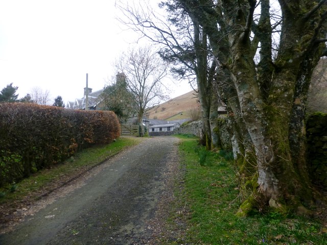
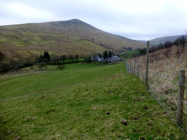
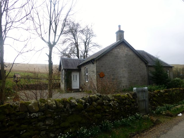
Scarry Cleuch is a picturesque valley located in Roxburghshire, Scotland. Nestled in the rolling hills of the Scottish Borders, this valley is known for its stunning natural beauty and rich history.

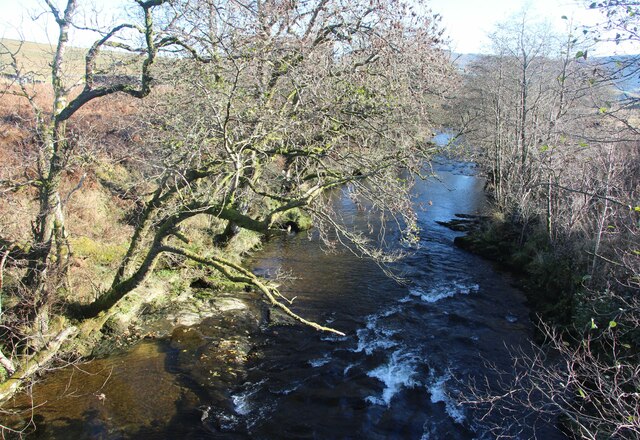
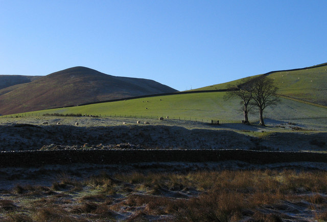
The valley is surrounded by lush greenery, with meandering streams and small waterfalls adding to its charm. The landscape is dotted with ancient ruins and historic sites, providing visitors with a glimpse into the area's past.

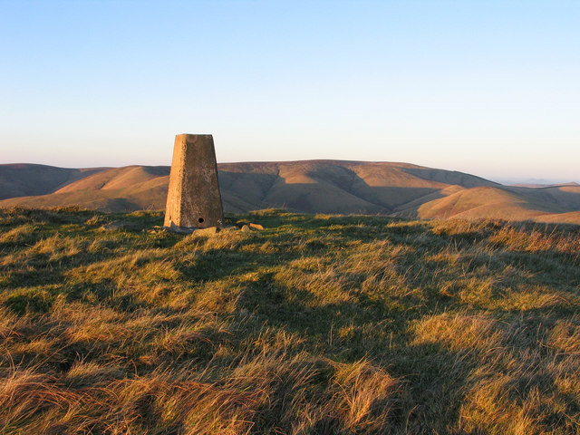
Scarry Cleuch is a popular destination for hikers and nature enthusiasts, with a network of walking trails that offer breathtaking views of the surrounding countryside. The valley is also home to a variety of wildlife, including red deer, foxes, and various bird species.

In addition to its natural beauty, Scarry Cleuch is also known for its cultural significance. The valley is home to several archaeological sites, including ancient burial grounds and stone circles, which provide insight into the lives of the people who once inhabited the area.

Overall, Scarry Cleuch is a hidden gem in the Scottish Borders, offering visitors a peaceful retreat in a stunning natural setting.

If you have any feedback on the listing, please let us know in the comments section below.

Scarry Cleuch Images

Images are sourced within 2km of 55.251522/-2.8426639 or Grid Reference NY4695. Thanks to Geograph Open Source API. All images are credited.

Hermitage Water at Gorrenberry
Field beside the Twislehope Burn The field is on the foot of the east ridge of Geordie's Hill and has according to OS mapping an ancient settlement within, or partly within it. Cockplay Hill lies at the left side of the image in the valley of the Twislehope Burn.
Field beside the Twislehope Burn
The field is on the foot of the east ridge of Geordie's Hill and has according to OS mapping an ancient settlement within, or partly within it. Cockplay Hill lies at the left side of the image in the valley of the Twislehope Burn.
Slope north of Haregrain Rig A view north-west from an estate road on Haregrain Rig has the deeply shadowed valley of Caulker Grain at the left side of the image with Ewe Hill rising above it to the right.
Slope north of Haregrain Rig
A view north-west from an estate road on Haregrain Rig has the deeply shadowed valley of Caulker Grain at the left side of the image with Ewe Hill rising above it to the right.
Summit area of Din Fell Late afternoon, autumn sunshine tinges red the summit area of Din Fell and its trig point; Cauldcleuch Head is in the distance.
Summit area of Din Fell
Late afternoon, autumn sunshine tinges red the summit area of Din Fell and its trig point; Cauldcleuch Head is in the distance.
View Of Lane To Gorrenberry Beech hedge and trees near the top of the lane to Gorrenberry.
View Of Lane To Gorrenberry
Beech hedge and trees near the top of the lane to Gorrenberry.
View Towards Din Fell A view from the bottom edge Dod Plantation towards Gorrenberry and the hill Din Fell.
View Towards Din Fell
A view from the bottom edge Dod Plantation towards Gorrenberry and the hill Din Fell.
Dry Stone Wall View Towards Bught Knowe A moss covered dry stone wall with a view towards Bught Knowe.
Dry Stone Wall View Towards Bught Knowe
A moss covered dry stone wall with a view towards Bught Knowe.
Dingley Riverside Cottage Dingley Riverside Cottage is situated beside the minor road opposite Hermitage Water.
Dingley Riverside Cottage
Dingley Riverside Cottage is situated beside the minor road opposite Hermitage Water.
Road at Dinley Riverside Cottage Looking south-eastward.
Road at Dinley Riverside Cottage
Looking south-eastward.
Ordnance Survey Flush Bracket 12083 This can be found on the wall of a cottage - private dwelling - at Dinley.
For more detail see : <span class="nowrap"><a title="http://www.bench-marks.org.uk/bm472" rel="nofollow ugc noopener" href="http://www.bench-marks.org.uk/bm472">Link</a><img style="margin-left:2px;" alt="External link" title="External link - shift click to open in new window" src="https://s1.geograph.org.uk/img/external.png" width="10" height="10"/></span>
Ordnance Survey Flush Bracket 12083
This can be found on the wall of a cottage - private dwelling - at Dinley. For more detail see : LinkExternal link
View of Dod Hill A field by Dinley, beside the Hermitage Water.
View of Dod Hill
A field by Dinley, beside the Hermitage Water.
Hermitage road Beside the Hermitage Water.
Hermitage road
Beside the Hermitage Water.
Hermitage road Ash trees between road and river.
Hermitage road
Ash trees between road and river.
Trees beside the Hermitage Water Scattered ashes beside the river near Gorrenberry.
Trees beside the Hermitage Water
Scattered ashes beside the river near Gorrenberry.
Din Fell Hill above the Hermitage Water.
Din Fell
Hill above the Hermitage Water.
Hermitage road Near Gorrenberry.
Hermitage road
Near Gorrenberry.
Hermitage Water Running beneath ash trees.
Hermitage Water
Running beneath ash trees.
The Hermitage road The road spends a lot of time following the river amongst ash trees. Here it makes a very brief visit to NY4696.
The Hermitage road
The road spends a lot of time following the river amongst ash trees. Here it makes a very brief visit to NY4696.
Show me another place!

Scarry Cleuch is located at Grid Ref: NY4695 (Lat: 55.251522, Lng: -2.8426639)

Unitary Authority: The Scottish Borders

Police Authority: The Lothians and Scottish Borders

What 3 Words

///dished.strongman.flooding. Near Teviothead, Scottish Borders

Nearby Locations

Scarry Cleuch

Related Wikis

Dinley

Dinley is a hamlet in the Scottish Borders through which Hermitage Water flows. == Etymology == The first element, din, seems to be the Cumbric word for...

Hermitage Castle

Hermitage Castle is a semi-ruined castle in the border region of Scotland. It stands in the remote valley of the Hermitage Water, part of Liddesdale in...

Hermitage, Scottish Borders

Hermitage is a village near Newcastleton, on the B6399, in the Scottish Borders area of Scotland. == See also == List of places in the Scottish Borders...

Hermitage Water

The Hermitage Water is a river in Liddesdale, in the Scottish Borders area of Scotland. Among its many feeder burns are Braidley Burn, Dinley Burn, Gorrenberry...

Nearby Amenities

Located within 500m of 55.251522,-2.8426639
Waterway: waterfall
Lat/Long: 55.2476496/-2.8408054
Waterway: waterfall
Lat/Long: 55.2474794/-2.8407286
Dinley Lins
Place: locality
Lat/Long: 55.2473952/-2.8405686
The data included in this document is from www.openstreetmap.org. The data is made available under ODbL.

Have you been to Scarry Cleuch?

Leave your review of Scarry Cleuch below (or comments, questions and feedback).