Homme Dingle

Valley in Herefordshire

England

Homme Dingle

The village of Weobley Taken from the A4112 road, the bell tower at St. Peter and St. Paul parish church can be seen in the distance.
The village of Weobley Credit: Fabian Musto

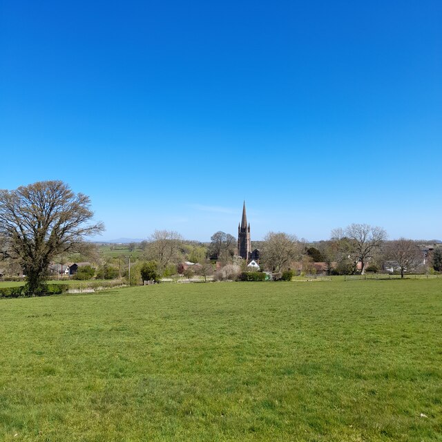
Homme Dingle is a picturesque valley located in the county of Herefordshire, England. Nestled amidst rolling hills and surrounded by lush greenery, it is renowned for its stunning natural beauty and tranquil atmosphere. The valley is situated just a few miles southwest of the market town of Leominster.

Homme Dingle is characterized by its idyllic landscape, with a meandering stream flowing through the heart of the valley. The stream, known as the Homme Brook, adds to the charm of the area, with its crystal-clear waters and abundance of wildlife. The valley is home to a diverse range of flora and fauna, making it a haven for nature enthusiasts and wildlife lovers.

The valley is also dotted with several historic buildings and landmarks, reflecting its rich heritage. Homme Court, a magnificent Grade II listed manor house, stands proudly in the valley, showcasing stunning architecture and beautiful gardens. This historic building adds to the allure of the area and attracts visitors from far and wide.

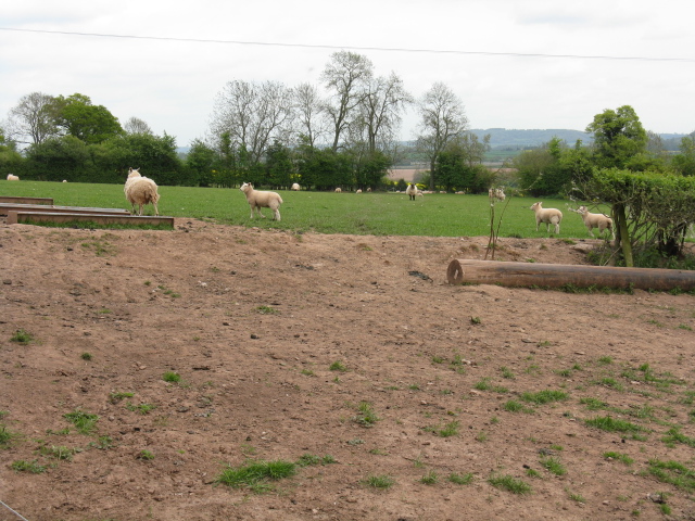
Homme Dingle offers numerous recreational opportunities for outdoor enthusiasts. The valley is crisscrossed by an extensive network of footpaths, providing ample opportunities for walking, hiking, and exploring the surrounding countryside. The valley is also a popular spot for fishing, with the Homme Brook teeming with various species of fish.

Overall, Homme Dingle is a hidden gem in Herefordshire, offering a peaceful retreat and an opportunity to immerse oneself in the beauty of nature. Whether it's a leisurely stroll along the brook, a visit to the historic manor house, or simply enjoying the tranquility of the surroundings, Homme Dingle is a destination that truly captivates its visitors.

If you have any feedback on the listing, please let us know in the comments section below.

Homme Dingle Images

Images are sourced within 2km of 52.169992/-2.862283 or Grid Reference SO4152. Thanks to Geograph Open Source API. All images are credited.

The village of Weobley Taken from the A4112 road, the bell tower at St. Peter and St. Paul parish church can be seen in the distance.
The village of Weobley
Taken from the A4112 road, the bell tower at St. Peter and St. Paul parish church can be seen in the distance.
A4112 north-east of Whitehill
Weobley church from afar The tall spire of Weobley church seen from the fields to the west of the village. The Titterstone Clee is visible in the distance to the left.
Weobley church from afar
The tall spire of Weobley church seen from the fields to the west of the village. The Titterstone Clee is visible in the distance to the left.
Timber Framed House known as Stawne <span class="nowrap"><a title="https://historicengland.org.uk/listing/the-list/list-entry/1166629?section=official-list-entry" rel="nofollow ugc noopener" href="https://historicengland.org.uk/listing/the-list/list-entry/1166629?section=official-list-entry">Link</a><img style="margin-left:2px;" alt="External link" title="External link - shift click to open in new window" src="https://s1.geograph.org.uk/img/external.png" width="10" height="10"/></span>
Timber Framed House known as Stawne
Timber-framed cottage, Weobley
Field near Newton Court The spire of Weobley church can be seen in the middle distance.
Field near Newton Court
The spire of Weobley church can be seen in the middle distance.
New electric poles near Acresfield, Weobley Two new electricity poles lie in a field near Acresfield, in the background the spire of Weobley church is visible.
New electric poles near Acresfield, Weobley
Two new electricity poles lie in a field near Acresfield, in the background the spire of Weobley church is visible.
The Stawne, Weobley Notable cottage on Kington Road at the entrance to the village. The wing on the left is only about 10 years old.
The Stawne, Weobley
Notable cottage on Kington Road at the entrance to the village. The wing on the left is only about 10 years old.
New planting near Newton Court
Lane near Newton Court
Sheep near Acresfield
Looking south near Acresfield
Flying the flag at Weobley Not long until the 2010 FIFA World Cup!
Flying the flag at Weobley
Not long until the 2010 FIFA World Cup!
Modern housing, Weobley
Utter Clutter A small reclamation business on the outskirts of Weobley.
Utter Clutter
A small reclamation business on the outskirts of Weobley.
St Thomas of Hereford, Weobley Roman Catholic church and priest's house, dating from 1834.
St Thomas of Hereford, Weobley
Roman Catholic church and priest's house, dating from 1834.
Utter Clutter, The Cwm, Weobley Recently opened 'collectables' emporium at The Cwm.
[Sadly in January 2016, now just a memory]
Utter Clutter, The Cwm, Weobley
Recently opened 'collectables' emporium at The Cwm. [Sadly in January 2016, now just a memory]
The Catholic Church of St Thomas of Hereford, Weobley Viewed across the B4230 Kington Road in Weobley. Consecrated in 1834, this is the oldest Catholic church in Herefordshire. Its plain, chapel-like exterior was designed to avoid attracting hostile attention at a time when Catholicism was still regarded with suspicion by many people in England. 
It was only 5 years earlier that The Roman Catholic Relief Act of 1829 had allowed Roman Catholics to sit in Parliament at Westminster.
The Catholic Church of St Thomas of Hereford, Weobley
Viewed across the B4230 Kington Road in Weobley. Consecrated in 1834, this is the oldest Catholic church in Herefordshire. Its plain, chapel-like exterior was designed to avoid attracting hostile attention at a time when Catholicism was still regarded with suspicion by many people in England. It was only 5 years earlier that The Roman Catholic Relief Act of 1829 had allowed Roman Catholics to sit in Parliament at Westminster.
Show me another place!

Homme Dingle is located at Grid Ref: SO4152 (Lat: 52.169992, Lng: -2.862283)

Unitary Authority: County of Herefordshire

Police Authority: West Mercia

What 3 Words

///tango.offers.chairing. Near Weobley, Herefordshire

Nearby Locations

Homme Dingle

Related Wikis

Weobley

Weobley ( WEB-lee) is an ancient settlement and civil parish in Herefordshire, England. Formerly a market town, the market is long defunct and the settlement...

Weobley Castle, Herefordshire

Weobley Castle was a ringwork and bailey castle in the English county of Herefordshire (grid reference SO40365135). The castle belonged to the De Lacy...

Weobley High School

Weobley High School is a mixed secondary school located in Weobley in the English county of Herefordshire.It is a community school administered by Herefordshire...

Dilwyn

Dilwyn is a village in Herefordshire, England located about 18 km (11 mi) from the city of Hereford and 9 km (6 mi) from its nearest town, Leominster....

King's Pyon

King's Pyon is a village and civil parish in the county of Herefordshire, England, and is approximately 8 miles (13 km) north-west from the city and county...

Church of St Mary the Virgin, King's Pyon

The Church of St Mary the Virgin, in King's Pyon, Herefordshire, England, is a medieval church dating from the 12th century. It is a Grade I listed building...

Bush Bank

Bush Bank is a hamlet partly in the civil parish of King's Pyon and partly in Birley with Upper Hill, in Herefordshire, England. It is on the A4110 road...

Sarnesfield

Sarnesfield (National Grid ref. SO374508) is a civil parish and village in Herefordshire, eleven miles north-west of Hereford. == Descent of the manor... ==

Nearby Amenities

Located within 500m of 52.169992,-2.862283
Generator Method: photovoltaic
Generator Output Electricity: yes
Generator Source: solar
Generator Type: solar_photovoltaic_panel
Location: ground
Power: generator
Lat/Long: 52.1658561/-2.8604418
Generator Method: photovoltaic
Generator Output Electricity: yes
Generator Source: solar
Generator Type: solar_photovoltaic_panel
Location: ground
Power: generator
Lat/Long: 52.1657837/-2.860423
Generator Method: photovoltaic
Generator Output Electricity: yes
Generator Source: solar
Generator Type: solar_photovoltaic_panel
Location: ground
Power: generator
Lat/Long: 52.1657492/-2.8608066
Generator Method: photovoltaic
Generator Output Electricity: yes
Generator Source: solar
Generator Type: solar_photovoltaic_panel
Location: ground
Power: generator
Lat/Long: 52.1656834/-2.8607959
Generator Method: photovoltaic
Generator Output Electricity: yes
Generator Source: solar
Generator Type: solar_photovoltaic_panel
Location: ground
Power: generator
Lat/Long: 52.1656307/-2.8611821
Generator Method: photovoltaic
Generator Output Electricity: yes
Generator Source: solar
Generator Type: solar_photovoltaic_panel
Location: ground
Power: generator
Lat/Long: 52.1655731/-2.8611875
Generator Method: photovoltaic
Generator Output Electricity: yes
Generator Source: solar
Generator Type: solar_photovoltaic_panel
Location: ground
Power: generator
Lat/Long: 52.1655353/-2.8615496
The data included in this document is from www.openstreetmap.org. The data is made available under ODbL.

Have you been to Homme Dingle?

Leave your review of Homme Dingle below (or comments, questions and feedback).