Craighall Den

Valley in Fife

Scotland

Craighall Den

Village of Ceres The Fife village of Ceres from the high ground to the east.
Village of Ceres Credit: Scott Cormie

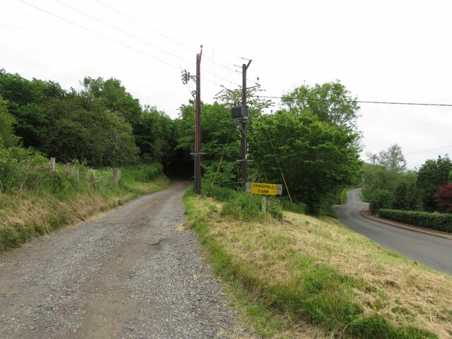
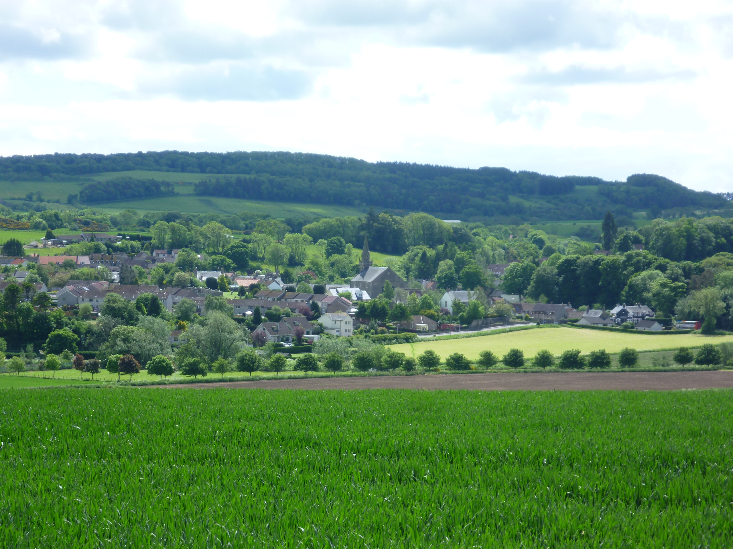
Craighall Den is a picturesque valley located in Fife, Scotland. Nestled between the towns of Cupar and Craigrothie, this tranquil and serene spot is a popular destination for nature enthusiasts and hikers.

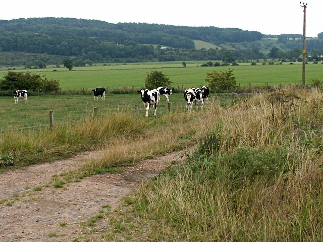
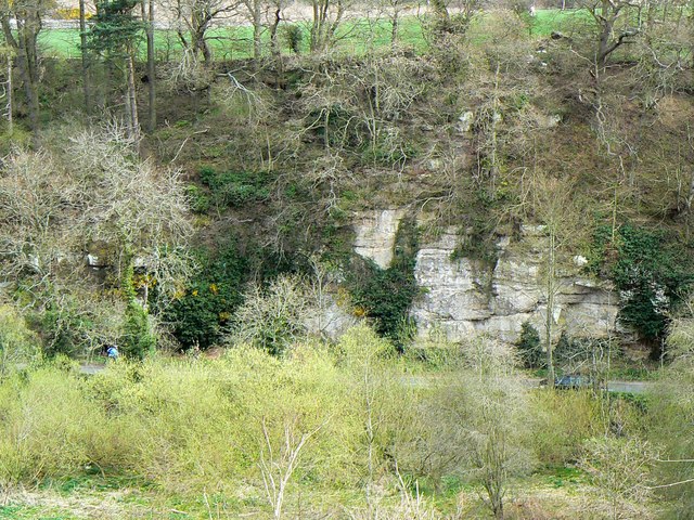
The den is characterized by its lush greenery, with a variety of trees and plants dotting the landscape. The valley is home to a diverse range of flora and fauna, including wildflowers, mosses, and various bird species. The babbling sound of the Craighall Burn, a small stream that runs through the den, adds to the peaceful ambiance of the area.

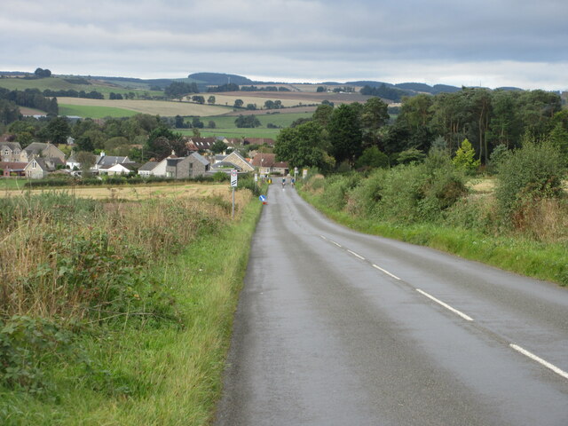
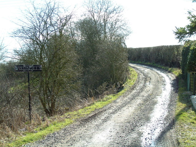
Visitors can explore the den by following a network of well-maintained footpaths that wind through the valley. These paths provide access to the various points of interest within Craighall Den, such as the picturesque waterfall and the enchanting bluebell woods. The den also offers stunning views of the surrounding countryside, with rolling hills and farmland stretching into the distance.

Craighall Den is a haven for wildlife, and visitors may encounter rabbits, squirrels, and even deer during their explorations. Birdwatchers will be delighted by the abundance of avian species that call this area home, including woodpeckers, owls, and various songbirds.

With its natural beauty and peaceful atmosphere, Craighall Den offers a true escape from the hustle and bustle of everyday life. Whether it's a leisurely stroll, a picnic by the stream, or a wildlife-spotting adventure, this hidden gem in Fife is sure to captivate visitors with its charm and tranquility.

If you have any feedback on the listing, please let us know in the comments section below.

Craighall Den Images

Images are sourced within 2km of 56.284495/-2.9707963 or Grid Reference NO3910. Thanks to Geograph Open Source API. All images are credited.

Village of Ceres The Fife village of Ceres from the high ground to the east.
Village of Ceres
The Fife village of Ceres from the high ground to the east.
Farm track to Craighall Farm
C8 (Fife) Road towards Ceres The C8 road heading down the hill south-westwards towards Ceres.
C8 (Fife) Road towards Ceres
The C8 road heading down the hill south-westwards towards Ceres.
Annotated benchmark, Woodburne Stables, Ceres Beautifully annotated cut benchmark, described on database at <span class="nowrap"><a title="https://www.bench-marks.org.uk/bm148058" rel="nofollow ugc noopener" href="https://www.bench-marks.org.uk/bm148058">Link</a><img style="margin-left:2px;" alt="External link" title="External link - shift click to open in new window" src="https://s1.geograph.org.uk/img/external.png" width="10" height="10"/></span>.
Annotated benchmark, Woodburne Stables, Ceres
Beautifully annotated cut benchmark, described on database at LinkExternal link.
Field at Curling Pond Road A rather large field, just north of Curling Pond Road at the outskirts of Ceres. Curling Pond Road leads to, surprise, the Curling Pond, then continues and ends at a wastewater treatment plant.
Field at Curling Pond Road
A rather large field, just north of Curling Pond Road at the outskirts of Ceres. Curling Pond Road leads to, surprise, the Curling Pond, then continues and ends at a wastewater treatment plant.
Ceres village from the West From where the B939 Craigrothie to St Andrews Road enters the village. The road out to the right leads to Teassesmill and on to Largo.
Ceres village from the West
From where the B939 Craigrothie to St Andrews Road enters the village. The road out to the right leads to Teassesmill and on to Largo.
Beside Craigrothie Burn A country house just east of Craigrothie village, close to the burn
Beside Craigrothie Burn
A country house just east of Craigrothie village, close to the burn
Road to Denhead Looking south
Road to Denhead
Looking south
Cassindilly farm road Looking south from near Teassesmill
Cassindilly farm road
Looking south from near Teassesmill
Above Ceres Right of way between Deanhead and Ceres
Above Ceres
Right of way between Deanhead and Ceres
Ceres Burn Looking up the burn towards the St Andrews/Craigrothie road bridge. The embankment is currently undergoing repairs with access provided to the burn bed for machinery. The area to the left is where the Ceres Games are held each year
Ceres Burn
Looking up the burn towards the St Andrews/Craigrothie road bridge. The embankment is currently undergoing repairs with access provided to the burn bed for machinery. The area to the left is where the Ceres Games are held each year
Yellow rape A field of oil-seed rape on Whitehill Farm
Yellow rape
A field of oil-seed rape on Whitehill Farm
Entering Ceres Cupar Road brings you into the village of Ceres when arriving from the direction of Ceres Moor
Entering Ceres
Cupar Road brings you into the village of Ceres when arriving from the direction of Ceres Moor
Towards Fleecefaulds Looking out across farmland by Cassindilly towards Bankhead/Fleecefaulds in the wooded slopes.
Towards Fleecefaulds
Looking out across farmland by Cassindilly towards Bankhead/Fleecefaulds in the wooded slopes.
Cassindilly Farm Farmland to the east of Cassindilly farm on the skyline.
Cassindilly Farm
Farmland to the east of Cassindilly farm on the skyline.
Ceres Memorial to Bannockburn Many villages have memorials to the wars of the 20C but how many have one for a battle in 1314.

To commemorate the vindication of Scotland's independence on the field of Bannockburn 24 June 1314 

and to perpetuate the tradition of the part taken therein by the men of Ceres
Ceres Memorial to Bannockburn
Many villages have memorials to the wars of the 20C but how many have one for a battle in 1314. To commemorate the vindication of Scotland's independence on the field of Bannockburn 24 June 1314 and to perpetuate the tradition of the part taken therein by the men of Ceres
Ceres Burn The burn and the games field to the side of it. Taken from the road bridge
Ceres Burn
The burn and the games field to the side of it. Taken from the road bridge
Ceres Burn The burn near Meldrum's and just up from it meeting with the Craigrothie Burn.
Ceres Burn
The burn near Meldrum's and just up from it meeting with the Craigrothie Burn.
Show me another place!

Craighall Den is located at Grid Ref: NO3910 (Lat: 56.284495, Lng: -2.9707963)

Unitary Authority: Fife

Police Authority: Fife

What 3 Words

///gossiped.piles.treaties. Near Cupar, Fife

Nearby Locations

Craighall Den

Related Wikis

Craighall Castle

Craighall Castle is located in Ceres, Fife, Scotland. It was built in 1637 by Sir Thomas Hope but there was a tower of previous land owners before 1637...

Ceres, Fife

Ceres is a village in Fife, Scotland, located in a small glen approximately 2 miles (3 km) over the Ceres Moor from Cupar and 7 mi (11 km) from St Andrews...

Hill of Tarvit

The Hill of Tarvit is a 20th-century mansion house and gardens in Fife, Scotland. They were designed by Sir Robert Lorimer and are today owned by the National...

Pitscottie

Pitscottie is a village in the Parish of Ceres, Fife, situated on the Ceres Burn at a road junction to the south of Dura Den and 3 miles (5 km) southeast...

Scotstarvit Tower

Scotstarvit Tower is a tower house in Fife, Scotland. It is situated 2 miles (3.2 km) south of Cupar, between Tarvit Hill and Walton Hill, south of the...

St Andrews Burghs (UK Parliament constituency)

St Andrews Burghs was a district of burghs constituency, representing various burghs of Fife, Scotland, in the House of Commons of the Parliament of the...

Dura Den

Dura Den is a small, 3 km-long wooded gorge that is located near Cupar in northeastern Fife, Scotland. This narrow cleft follows a course between the villages...

North East Fife (UK Parliament constituency)

North East Fife is a county constituency in Fife, Scotland, represented in the House of Commons of the UK Parliament by Wendy Chamberlain of the Liberal...

Nearby Amenities

Located within 500m of 56.284495,-2.9707963
Power: pole
Lat/Long: 56.2866323/-2.9706844
Power: pole
Lat/Long: 56.285225/-2.9678127
Power: pole
Lat/Long: 56.285425/-2.9632568
Power: pole
Lat/Long: 56.2878846/-2.974281
Power: pole
Lat/Long: 56.287625/-2.9726413
Power: pole
Lat/Long: 56.288012/-2.9752372
Power: pole
Lat/Long: 56.2877286/-2.9728506
Power: pole
Lat/Long: 56.2872027/-2.9717877
Power: pole
Lat/Long: 56.2859209/-2.96922
Power: pole
Lat/Long: 56.2853219/-2.9659667
Power: pole
Lat/Long: 56.2852136/-2.9668263
Power: pole
Lat/Long: 56.2852836/-2.9668263
Power: pole
Lat/Long: 56.285236/-2.9640207
Power: pole
Lat/Long: 56.2851786/-2.965457
Power: pole
Lat/Long: 56.2851325/-2.9667753
Power: pole
Lat/Long: 56.2850878/-2.9678522
Power: pole
Lat/Long: 56.2850737/-2.96885
Power: pole
Lat/Long: 56.2850536/-2.9710588
Power: pole
Lat/Long: 56.2850275/-2.9725877
Power: pole
Lat/Long: 56.2849725/-2.9741058
Power: pole
Lat/Long: 56.2849457/-2.9756735
Power: pole
Lat/Long: 56.284898/-2.9772037
Power: pole
Lat/Long: 56.2843591/-2.977826
Power: pole
Lat/Long: 56.2837948/-2.9784751
Power: pole
Lat/Long: 56.2875389/-2.9650264
Power: pole
Lat/Long: 56.2869969/-2.9644307
Power: pole
Lat/Long: 56.2864064/-2.9637904
Power: pole
Lat/Long: 56.2859138/-2.9634378
Power: pole
Lat/Long: 56.2879056/-2.9666738
Power: pole
Lat/Long: 56.2876627/-2.9677842
Power: pole
Lat/Long: 56.2873905/-2.9689878
Power: pole
Lat/Long: 56.2871318/-2.9701712
Power: pole
Lat/Long: 56.2867213/-2.9709088
Power: pole
Lat/Long: 56.2863828/-2.971547
Power: pole
Lat/Long: 56.2860735/-2.9721022
Power: pole
Lat/Long: 56.2860544/-2.9721488
Power: pole
Lat/Long: 56.2859554/-2.9731012
Power: pole
Lat/Long: 56.2853537/-2.9717821
The data included in this document is from www.openstreetmap.org. The data is made available under ODbL.

Have you been to Craighall Den?

Leave your review of Craighall Den below (or comments, questions and feedback).