Skipper's Cleuch

Valley in Dumfriesshire

Scotland

Skipper's Cleuch

Spire, bridge and tree in Langholm
Spire, bridge and tree in Langholm Credit: Peter Moore

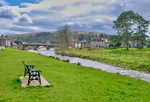
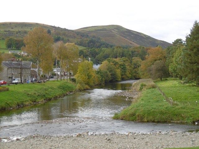
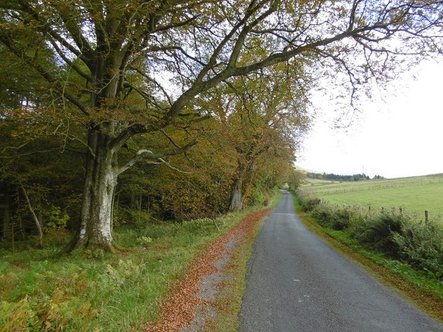
Skipper's Cleuch is a picturesque valley located in Dumfriesshire, Scotland. Nestled in the Southern Uplands, this scenic area is renowned for its natural beauty and tranquil surroundings. The valley is formed by the Skipper's Burn, a small stream that meanders through the landscape, creating a peaceful and idyllic environment.

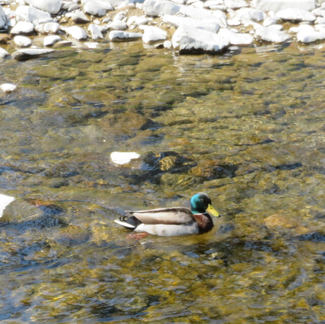
The valley is characterized by lush green meadows, rolling hills, and dense woodlands, making it a haven for nature enthusiasts and outdoor adventurers. The area is home to a diverse range of flora and fauna, including rare plant species and numerous bird species, making it a popular spot for birdwatching.

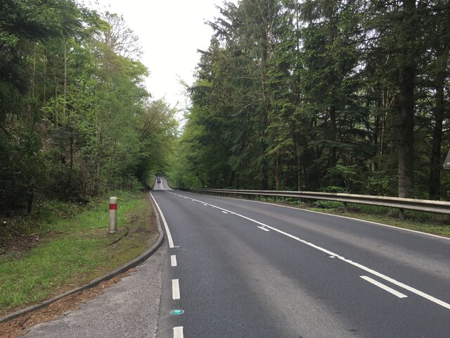
Skipper's Cleuch offers a variety of recreational activities for visitors to enjoy. Hiking and walking trails allow visitors to explore the stunning natural landscapes and take in breathtaking views of the surrounding countryside. The valley is also a popular destination for fishing, with the Skipper's Burn offering opportunities for anglers to catch trout and salmon.

In addition to its natural attractions, Skipper's Cleuch also boasts a rich history and cultural heritage. The area is dotted with ancient ruins and remnants of old settlements, providing a glimpse into the region's past. Visitors can explore these historical sites and learn about the area's fascinating history.

Overall, Skipper's Cleuch is a hidden gem in Dumfriesshire, offering visitors a chance to escape the hustle and bustle of everyday life and immerse themselves in the beauty of nature. Whether it's hiking, birdwatching, or simply enjoying the peace and tranquility, this valley has something for everyone.

If you have any feedback on the listing, please let us know in the comments section below.

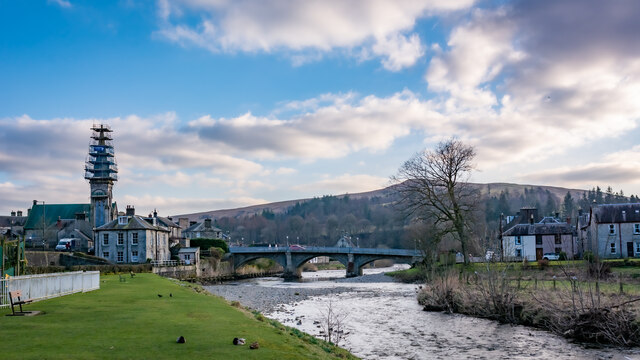
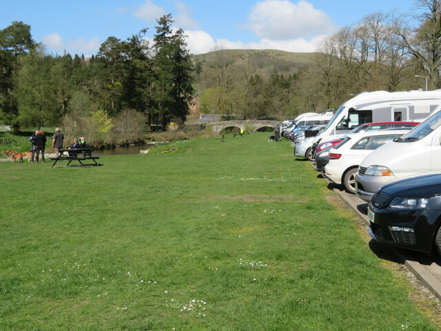
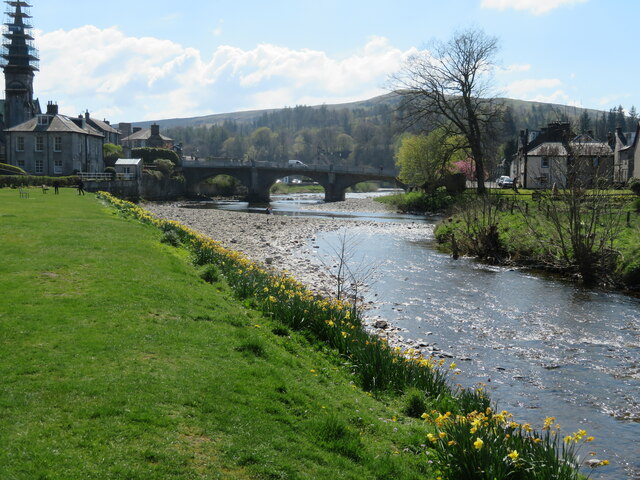
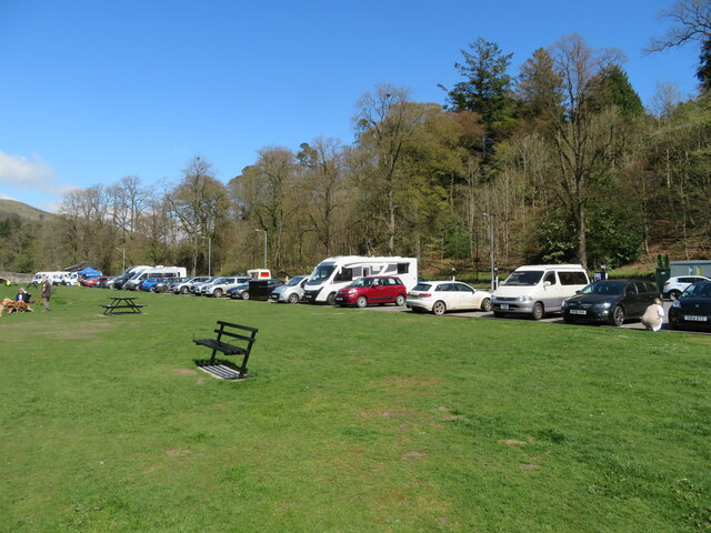
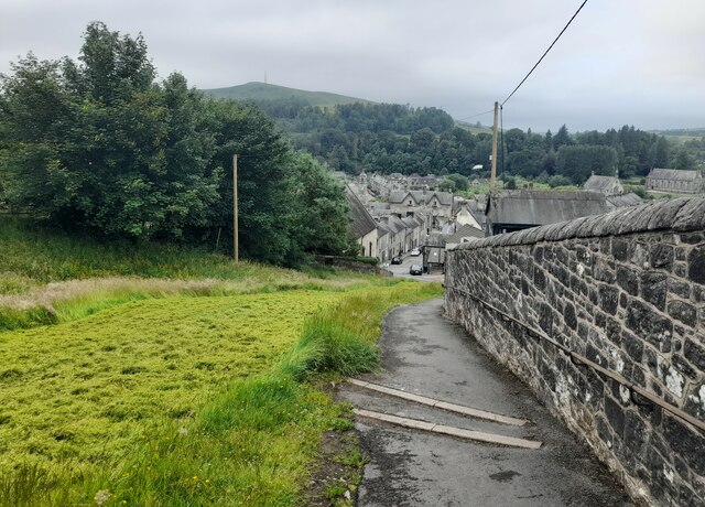
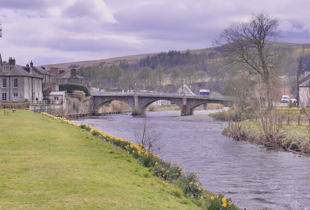
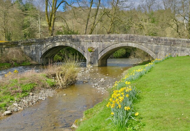
Skipper's Cleuch Images

Images are sourced within 2km of 55.139664/-2.9926928 or Grid Reference NY3683. Thanks to Geograph Open Source API. All images are credited.

Spire, bridge and tree in Langholm
Car park and picnic place at Langholm A handy stop on the A7 by the Ewes Water, just before it joins the River Esk.
Car park and picnic place at Langholm
A handy stop on the A7 by the Ewes Water, just before it joins the River Esk.
Drake Mallard at Langholm A male Anas platyrhynchos on the Ewes Water.
Drake Mallard at Langholm
A male Anas platyrhynchos on the Ewes Water.
The confluence of the River Esk and Ewes Water The River Esk comes in from the right, by the gravel spit, and the Ewes Water, in the foreground, loses its identity as it flows under the Townhead Bridge as part of the Esk.
The confluence of the River Esk and Ewes Water
The River Esk comes in from the right, by the gravel spit, and the Ewes Water, in the foreground, loses its identity as it flows under the Townhead Bridge as part of the Esk.
Car park at Langholm Conveniently situated on the A7 between the Ewes Water and Bar Wood.
Car park at Langholm
Conveniently situated on the A7 between the Ewes Water and Bar Wood.
Kirk Wynd View Taken from the top of Kirk Wynd looking over the town of Langholm.
Kirk Wynd View
Taken from the top of Kirk Wynd looking over the town of Langholm.
At Langholm Bridge over the river Esk
At Langholm
Bridge over the river Esk
Ewes Bridge Langholm
Ewes Bridge
Langholm
The River Esk Langholm
The River Esk
Langholm
A7 towards Langholm
A7 towards Langholm
Eskdale Hotel, Langholm
Pelosis Corner Cafe My spell checker keeps throwing in an apostrophe which is probably correct. Centre of Langholm.
Pelosis Corner Cafe
My spell checker keeps throwing in an apostrophe which is probably correct. Centre of Langholm.
Esk - Ewes confluence Ewes Water (right) joins the Esk in Langholm.
Esk - Ewes confluence
Ewes Water (right) joins the Esk in Langholm.
Langholm to Newcastleton road The climb up to Langholm Moor.
Langholm to Newcastleton road
The climb up to Langholm Moor.
Kirk Wynd, Langholm A side road leading up from the High Street, and start of the walk up Whita Hill. The bunting is up from the Common Riding event in the last week of July.
Kirk Wynd, Langholm
A side road leading up from the High Street, and start of the walk up Whita Hill. The bunting is up from the Common Riding event in the last week of July.
Whita Road above Langholm The track up Whita Hill passes the golf course to the right.
Whita Road above Langholm
The track up Whita Hill passes the golf course to the right.
Whita Road above Langholm (2) Looking downhill towards the town.
Whita Road above Langholm (2)
Looking downhill towards the town.
Path on Whita Hill This path cuts diagonally up from Whita Road to meet the track coming up from the hill road that crosses the ridge further north.
Path on Whita Hill
This path cuts diagonally up from Whita Road to meet the track coming up from the hill road that crosses the ridge further north.
Show me another place!

Skipper's Cleuch is located at Grid Ref: NY3683 (Lat: 55.139664, Lng: -2.9926928)

Unitary Authority: Dumfries and Galloway

Police Authority: Dumfries and Galloway

What 3 Words

///otter.adjuster.pocket. Near Langholm, Dumfries & Galloway

Related Wikis

Langholm railway station

Langholm railway station served the burgh of Langholm, Dumfries and Galloway, Scotland from 1864 to 1967 on the Border Union Railway. == History == The...

Battle of Arkinholm

The Battle of Arkinholm was fought on 1 May 1455, at Arkinholm near Langholm in Scotland, during the reign of King James II of Scotland. Although a small...

Langholm Town Hall

Langholm Town Hall is a municipal building in the High Street in Langholm, Dumfries and Galloway, Scotland. The structure, which is used as a community...

Thomas Hope Hospital

Thomas Hope Hospital is a health facility in Strand Street, Langholm, Dumfries and Galloway, Scotland. It is managed by NHS Dumfries and Galloway. ��2...

Nearby Amenities

Located within 500m of 55.139664,-2.9926928
Traffic Signals
Source: survey
Lat/Long: 55.1409772/-2.9882514
Skippers Br
Naptan AtcoCode: 680000638111
Naptan Bearing: N
Naptan BusStopType: CUS
Naptan CommonName: Skippers Br
Naptan Indicator: Murtholm
Naptan Landmark: Cemetry Road
Naptan NaptanCode: 34237546
Naptan Notes: none
Naptan Street: A7
Naptan Verified: no
Source: naptan_import
Lat/Long: 55.1407391/-2.9897023
Bus Stop
Skippers Bridge
Bus: yes
Naptan AtcoCode: 680000638222
Naptan Bearing: S
Naptan CommonName: Skippers Br
Naptan Indicator: opp Murtholm
Naptan NaptanCode: 34237547
Naptan Street: A7
Public Transport: platform
Ref: 680000638222
Source: NaPTAN
Lat/Long: 55.1406771/-2.9895909
Traffic Signals
Source: survey
Lat/Long: 55.1408699/-2.9892142
Skippers Bridge
Rapids: 3
Waterway: rapids
Lat/Long: 55.1422866/-2.9892287
Power: pole
Lat/Long: 55.1406903/-2.9860489
Power: pole
Lat/Long: 55.1421386/-2.9943685
Power: pole
Lat/Long: 55.1430155/-2.9959805
Power: pole
Lat/Long: 55.1416787/-2.9935075
Power: pole
Lat/Long: 55.1414955/-2.9921436
Power: pole
Lat/Long: 55.1415446/-2.99084
Power: pole
Lat/Long: 55.1408325/-2.9874269
Power: pole
Lat/Long: 55.1411763/-2.9907656
Power: pole
Lat/Long: 55.1414476/-2.9933029
Power: pole
Lat/Long: 55.1419144/-2.9943852
Power: pole
Lat/Long: 55.1423414/-2.9954487
Power: pole
Lat/Long: 55.1429346/-2.9964224
Power: pole
Lat/Long: 55.1422536/-2.9982442
Power: pole
Lat/Long: 55.141484/-2.9978526
Power: pole
Lat/Long: 55.1407704/-2.9971995
Power: pole
Lat/Long: 55.1399916/-2.996478
Power: pole
Lat/Long: 55.1393845/-2.995904
Power: pole
Lat/Long: 55.1386042/-2.996014
Power: pole
Lat/Long: 55.13804/-2.9960864
Power: pole
Lat/Long: 55.1374497/-2.996183
Power: pole
Lat/Long: 55.136608/-2.9959442
Power: pole
Lat/Long: 55.1358429/-2.9957967
Power: pole
Lat/Long: 55.1390054/-2.9851357
Power: pole
Lat/Long: 55.1397107/-2.9857472
Power: pole
Lat/Long: 55.1425863/-2.9868435
Power: pole
Lat/Long: 55.1402116/-2.9861703
Power: pole
Lat/Long: 55.141107/-2.9869129
Power: pole
Lat/Long: 55.1415913/-2.9894748
Power: pole
Lat/Long: 55.1416802/-2.987415
Power: pole
Lat/Long: 55.1417209/-2.9869012
Information: guidepost
Tourism: information
Lat/Long: 55.140062/-2.9900113
Power: pole
Lat/Long: 55.1424566/-2.9949531
Power: pole
Lat/Long: 55.1422373/-2.9955737
Power: pole
Lat/Long: 55.141965/-2.9963204
Power: pole
Lat/Long: 55.1413204/-2.9967891
Power: pole
Lat/Long: 55.1406625/-2.996184
Power: pole
Lat/Long: 55.1399502/-2.9955325
Power: pole
Lat/Long: 55.1392761/-2.9949222
Power: pole
Lat/Long: 55.1385505/-2.9944356
Power: pole
Lat/Long: 55.1378514/-2.9940081
Power: pole
Lat/Long: 55.1371243/-2.9935189
Power: pole
Lat/Long: 55.136487/-2.993076
Power: pole
Lat/Long: 55.135832/-2.992628
Power: pole
Lat/Long: 55.1351799/-2.9922031
Power: pole
Lat/Long: 55.1431865/-2.9902732
Power: pole
Lat/Long: 55.1410236/-2.9892822
Power: pole
Lat/Long: 55.1408798/-2.9878861
The data included in this document is from www.openstreetmap.org. The data is made available under ODbL.

Have you been to Skipper's Cleuch?

Leave your review of Skipper's Cleuch below (or comments, questions and feedback).