Bents Cleuch
Valley in Roxburghshire
Scotland
Bents Cleuch

Bents Cleuch is a picturesque valley located in Roxburghshire, a historic county in the Scottish Borders region of Scotland. Situated between the villages of Denholm and Minto, this idyllic valley is known for its natural beauty and tranquil surroundings.
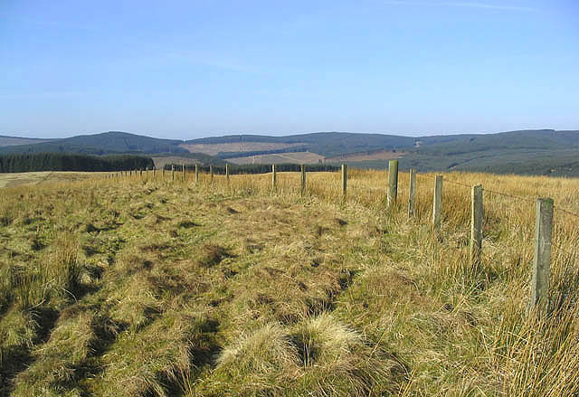
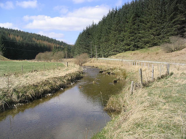
The valley is formed by the Bents Cleuch Burn, a small river that meanders through the landscape, creating a charming and serene atmosphere. Lush green hillsides surround the valley, providing a stunning backdrop to the meandering river.
Bents Cleuch is a haven for wildlife enthusiasts and nature lovers. The valley is home to a diverse range of flora and fauna, including various bird species, small mammals, and wildflowers. Walking along the banks of the river, visitors may have the chance to spot otters, herons, and other wildlife that call this area home.
The valley is also steeped in history and folklore. There are ancient stone structures and ruins scattered throughout the area, with some dating back to the Iron Age. These remnants of the past add to the mystique and charm of Bents Cleuch, allowing visitors to step back in time and imagine the lives of those who lived here centuries ago.
Whether for a leisurely stroll, a picnic by the riverside, or a chance to immerse oneself in the natural beauty of the Scottish countryside, Bents Cleuch offers a peaceful and enchanting escape from the hustle and bustle of modern life.
If you have any feedback on the listing, please let us know in the comments section below.
Bents Cleuch Images
Images are sourced within 2km of 55.306468/-3.0167522 or Grid Reference NT3501. Thanks to Geograph Open Source API. All images are credited.


Bents Cleuch is located at Grid Ref: NT3501 (Lat: 55.306468, Lng: -3.0167522)
Unitary Authority: The Scottish Borders
Police Authority: The Lothians and Scottish Borders
What 3 Words
///nudge.blocking.planet. Near Teviothead, Scottish Borders
Nearby Locations
Related Wikis

River Teviot
The River Teviot (; Scottish Gaelic: Abhainn Tìbhiot), or Teviot Water, is a river of the Scottish Borders area of Scotland, and is the largest tributary...

Falnash
Falnash (Scots: Fawenesh) is a village in the Scottish Borders of Scotland. It is near Teviothead, in the former Roxburghshire, and in the parish of Teviothead...
Caerlanrig
Caerlanrig - also spelled 'Carlenrig' - (Gaelic: Cathair Lannraig) is a hamlet in the parish of Cavers, Borders, Scotland, lying on the River Teviot, 6...

Teviothead
Teviothead (Scottish Gaelic: Ceann Tìbhiot) is a small village and civil parish in Teviotdale in the Scottish Borders, known locally as Teviotheid. It...

Craik, Scottish Borders
Craik is a hamlet in Craik Forest, by the Airhouse Burn in the Scottish Borders area of Scotland, close to Roberton, Scottish Borders (grid reference NT348084...

Unthank, Dumfries and Galloway
Unthank is a village in Dumfries and Galloway, Scotland. == References == The geographic coordinates are from the Ordnance Survey.
Craik Forest
Craik Forest is a forest near Hawick in the Scottish Borders area of Scotland, and managed by the Forestry Commission. It is adjoined to the south-west...
Have you been to Bents Cleuch?
Leave your review of Bents Cleuch below (or comments, questions and feedback).