Flesh Cleuch

Valley in Peeblesshire

Scotland

Flesh Cleuch

Western slopes of Scawd Law Looking down to the Walker Burn and over to Priesthope Hill (right) and Kirnie Law (left).
Western slopes of Scawd Law Credit: Gordon Brown

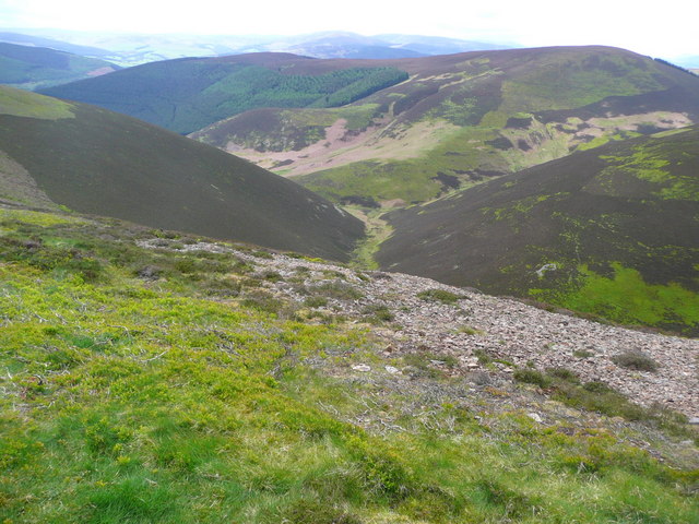
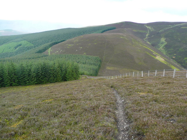
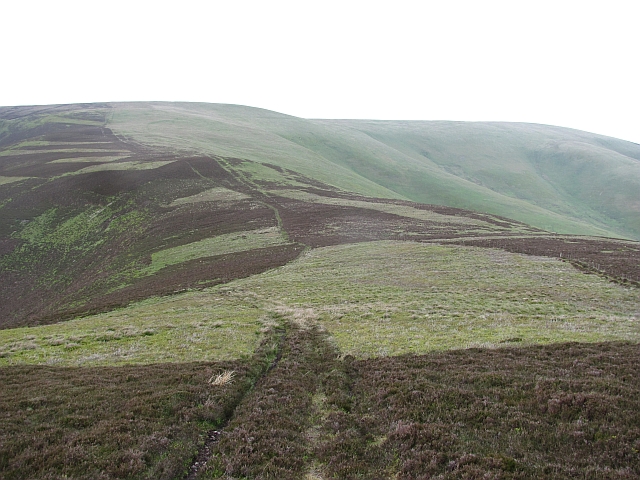
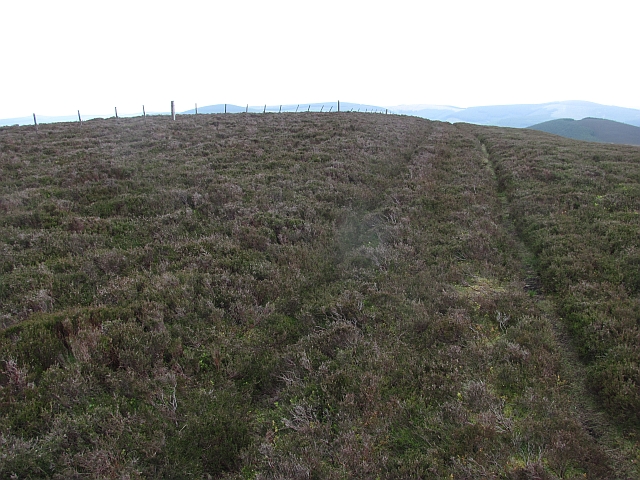
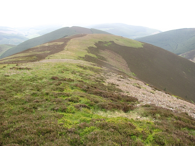
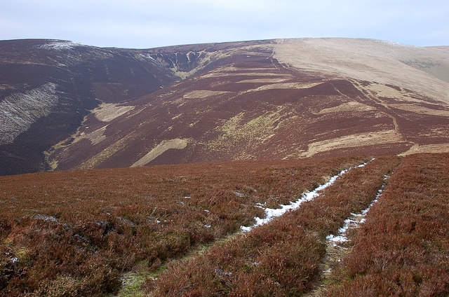
Flesh Cleuch is a picturesque valley located in Peeblesshire, Scotland. Situated in the southern part of the country, it is renowned for its stunning natural beauty and rich history. The valley is nestled between rolling hills and vast expanses of lush greenery, providing a tranquil and serene environment for visitors and locals alike.

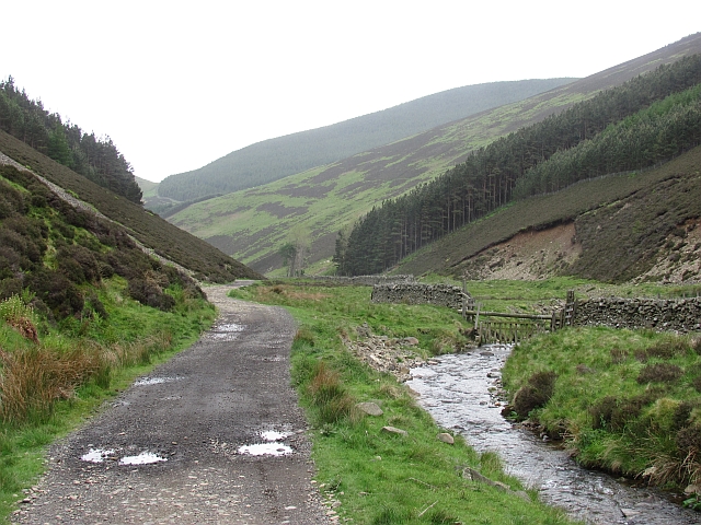
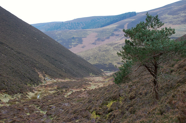
The name "Flesh Cleuch" derives from the Scottish Gaelic language, with "cleuch" meaning a narrow valley or ravine. Indeed, the valley is characterized by its narrow and steep-sided nature, carved out over centuries by the meandering Flesh Cleuch Burn, a small river that flows through the heart of the valley. This river adds to the charm of the landscape, creating small cascades and waterfalls as it winds its way through the valley floor.

The valley is home to a variety of flora and fauna, with its diverse ecosystem supporting a range of plant and animal species. It is particularly known for its vibrant wildflowers, which bloom in abundance during the spring and summer months, creating a colorful tapestry across the valley floor.

Flesh Cleuch is also steeped in history, with evidence of human habitation dating back thousands of years. Archaeological sites and standing stones can be found throughout the valley, providing a glimpse into the lives of ancient inhabitants. Additionally, remnants of old settlements and ruins of historic buildings can be explored, adding an element of intrigue for history enthusiasts.

Overall, Flesh Cleuch is a hidden gem in Peeblesshire, offering a haven of natural beauty and historical significance for those who venture into its charming embrace.

If you have any feedback on the listing, please let us know in the comments section below.

Flesh Cleuch Images

Images are sourced within 2km of 55.646584/-3.0256437 or Grid Reference NT3539. Thanks to Geograph Open Source API. All images are credited.

Western slopes of Scawd Law Looking down to the Walker Burn and over to Priesthope Hill (right) and Kirnie Law (left).
Western slopes of Scawd Law
Looking down to the Walker Burn and over to Priesthope Hill (right) and Kirnie Law (left).
Fence on Scawd Law south ridge Cairn Hill is the summit in the distance with tree planting on each side.
Fence on Scawd Law south ridge
Cairn Hill is the summit in the distance with tree planting on each side.
Fence on the SW ridge of Windlestraw Law
Soggy ground on the west ridge of Glede Knowe
Struggling up Corby Craigs The path here is indistinct and morale is damaged by losing a lot of height from Priesthope Hill.  The initial descent is on the forest side of the fence and the path is eroded and awkward - cross the fence as soon as possible!
Struggling up Corby Craigs
The path here is indistinct and morale is damaged by losing a lot of height from Priesthope Hill. The initial descent is on the forest side of the fence and the path is eroded and awkward - cross the fence as soon as possible!
The approach to Glede Knowe from Priesthope Hill The path descending here becomes eroded and awkward as it closes the forest - cross the fence to the other side as soon as possible!
The approach to Glede Knowe from Priesthope Hill
The path descending here becomes eroded and awkward as it closes the forest - cross the fence to the other side as soon as possible!
Gate Hope Steep sided glen to the south of Windlestraw Law. The road serves Caberstongrains and Seathope as well as the surrounding hills.
Gate Hope
Steep sided glen to the south of Windlestraw Law. The road serves Caberstongrains and Seathope as well as the surrounding hills.
North ridge, Scawd Law The ridge continues over Plover Knowe towards Windlestraw Law. It is quite dry underfoot.
North ridge, Scawd Law
The ridge continues over Plover Knowe towards Windlestraw Law. It is quite dry underfoot.
Scawd Law The heathery summit. Scawd Law is a very distinctive top with two steep sides south of Windlestraw Law.
Scawd Law
The heathery summit. Scawd Law is a very distinctive top with two steep sides south of Windlestraw Law.
Plover Knowe A ridge off Windlestraw Law towards Scawd Law
Plover Knowe
A ridge off Windlestraw Law towards Scawd Law
South ridge, Scawd Law The ridge descends gently towards Cairn Hill.
South ridge, Scawd Law
The ridge descends gently towards Cairn Hill.
Priesthope Sware from Scawd Law Patterns in the heather and bracken give added interest to this profile of the col on the ridge from Priesthope Hill to Corby Craigs.
Priesthope Sware from Scawd Law
Patterns in the heather and bracken give added interest to this profile of the col on the ridge from Priesthope Hill to Corby Craigs.
Scawd Law summit This gently rounded heathery top will be a favourite for walkers who are uneasy with the craggy exposure on the more celebrated summits in the Highlands. In the background are the windswept grasslands of Windlestraw Law.
Scawd Law summit
This gently rounded heathery top will be a favourite for walkers who are uneasy with the craggy exposure on the more celebrated summits in the Highlands. In the background are the windswept grasslands of Windlestraw Law.
Track north of Scawd Law summit The ridge runs N over Plover Knowe to join Windlestraw Law, with the cleuch of East Grain on the left.
Track north of Scawd Law summit
The ridge runs N over Plover Knowe to join Windlestraw Law, with the cleuch of East Grain on the left.
The head of East Grain The steep slopes on the SE flank of the ridge to Windlestraw Law where the headstreams unite to form the burn of East Grain. West Grain is on the other side of the left-hand ridge of Middle Hill.
The head of East Grain
The steep slopes on the SE flank of the ridge to Windlestraw Law where the headstreams unite to form the burn of East Grain. West Grain is on the other side of the left-hand ridge of Middle Hill.
East Grain below Middle Hill A view upstream by this burn that has cut down between steep slopes on either side.
East Grain below Middle Hill
A view upstream by this burn that has cut down between steep slopes on either side.
The lower end of East Grain The burn joins West Grain just downstream where they form Priesthope Burn.
The lower end of East Grain
The burn joins West Grain just downstream where they form Priesthope Burn.
Valley of the Gatehopeknowe Burn The track up the glen on an icy wet day with the cottage of Caberstongrains ahead.
Valley of the Gatehopeknowe Burn
The track up the glen on an icy wet day with the cottage of Caberstongrains ahead.
Show me another place!

Flesh Cleuch is located at Grid Ref: NT3539 (Lat: 55.646584, Lng: -3.0256437)

Unitary Authority: The Scottish Borders

Police Authority: The Lothians and Scottish Borders

What 3 Words

///unionists.flitting.blunders. Near Innerleithen, Scottish Borders

Related Wikis

Walkerburn

Walkerburn (Scottish Gaelic: Allt an Fhùcadair) is a small village in the Scottish Borders area of Scotland, on the A72 about 8 miles (13 km) from Peebles...

The Kirna

The Kirna, known locally as Kirna House (previously also as Grangehill), is a Category A listed villa in Walkerburn, Peeblesshire, Scotland. It is one...

Walkerburn railway station

Walkerburn railway station served the village of Walkerburn, Scottish Borders, Scotland from 1867 to 1962 on the Peebles Railway. == History == The station...

Innerleithen

Innerleithen (Scottish Gaelic: Inbhir Leitheann) is a civil parish and a small town in the committee area of Tweeddale, in the Scottish Borders. It was...

Have you been to Flesh Cleuch?

Leave your review of Flesh Cleuch below (or comments, questions and feedback).