Darky Dale

Valley in Shropshire

England

Darky Dale

Ancient Oak Tree, Fowlet Farm, Hollybush This tree is on the site of an old settlement.It is frequently decorated with many votive offerings.
Ancient Oak Tree, Fowlet Farm, Hollybush Credit: Jerry Fryman

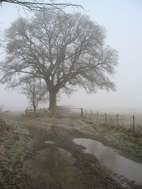
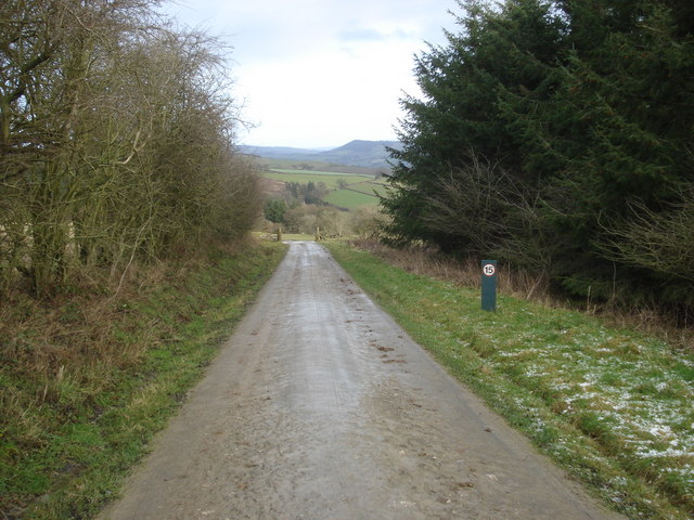
Darky Dale is a picturesque valley located in the county of Shropshire, England. Nestled in the heart of the Shropshire Hills, this tranquil and enchanting valley is a haven for nature enthusiasts and those seeking a peaceful retreat.

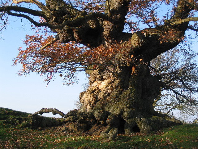
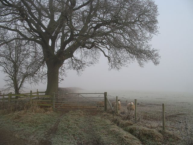
The valley is characterized by its lush green meadows, rolling hills, and meandering streams. Darky Dale is surrounded by densely wooded areas, predominantly consisting of oak and beech trees, which provide a rich habitat for a variety of flora and fauna. The valley is known for its diverse wildlife, with sightings of deer, foxes, badgers, and numerous bird species being common.

Visitors to Darky Dale can explore the area through a network of walking trails that crisscross the valley, offering stunning views of the surrounding countryside. The valley is particularly renowned for its scenic viewpoints, with spots like Dale's Edge and Sunset Hill providing breathtaking panoramas of the Shropshire landscape.

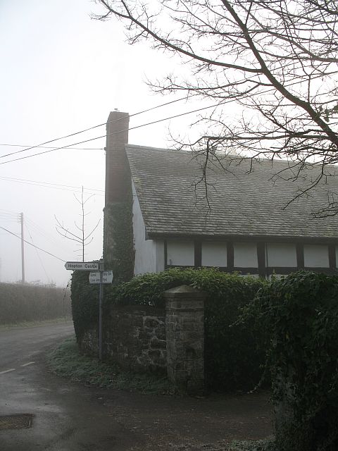
Darky Dale also boasts a number of historical and cultural attractions. The valley is home to several ancient sites, including burial mounds and stone circles, which provide a fascinating glimpse into the region's ancient past. Additionally, there are charming villages and market towns nearby, where visitors can experience traditional Shropshire hospitality and sample local produce.

In conclusion, Darky Dale is a hidden gem in the heart of Shropshire. Its natural beauty, diverse wildlife, and rich history make it a captivating destination for nature lovers and history enthusiasts alike. Whether hiking through its idyllic landscapes or immersing oneself in its ancient heritage, Darky Dale offers a truly unforgettable experience.

If you have any feedback on the listing, please let us know in the comments section below.

Darky Dale Images

Images are sourced within 2km of 52.379611/-2.9506304 or Grid Reference SO3576. Thanks to Geograph Open Source API. All images are credited.

Ancient Oak Tree, Fowlet Farm, Hollybush This tree is on the site of an old settlement.It is frequently decorated with many votive offerings.
Ancient Oak Tree, Fowlet Farm, Hollybush
This tree is on the site of an old settlement.It is frequently decorated with many votive offerings.
The lane from Bucknell to Chapel Lawn
Farm track, Bedstone An access track to a couple of fields, with the usual oak in the hedge. Hungry sheep waiting on the right.
Farm track, Bedstone
An access track to a couple of fields, with the usual oak in the hedge. Hungry sheep waiting on the right.
Mynd Scrubs Forestry Commission woodland on Bucknell Hill. The name suggests that this was mountain land once. There is little moorland left in Shropshire now.
Mynd Scrubs
Forestry Commission woodland on Bucknell Hill. The name suggests that this was mountain land once. There is little moorland left in Shropshire now.
Hungry sheep, Bedstone Midwinter, and the grazing is lean. Sheep await the hay delivery.
Hungry sheep, Bedstone
Midwinter, and the grazing is lean. Sheep await the hay delivery.
Mynd Farm entrance No through road. Beyond a forested hillside.
Mynd Farm entrance
No through road. Beyond a forested hillside.
Mynd Bedstone - Mynd road.
Mynd
Bedstone - Mynd road.
Bedstone Signpost in the centre of Bedstone
Bedstone
Signpost in the centre of Bedstone
Open grazing land near Hill Coppice From the edge of Hill Coppice looking eastwards down the valley. The woods at Hopton Titterhill to the right.
Open grazing land near Hill Coppice
From the edge of Hill Coppice looking eastwards down the valley. The woods at Hopton Titterhill to the right.
Feeding time near Hill Coppice View north-west along the track with Hill Coppice to the left. This machine dismantles a large 'toilet-roll' of hay and shoots it into the sheep feeders. The pointed View Wood in the distance to the left.
Feeding time near Hill Coppice
View north-west along the track with Hill Coppice to the left. This machine dismantles a large 'toilet-roll' of hay and shoots it into the sheep feeders. The pointed View Wood in the distance to the left.
Hillside west of Hopton Castle From the edge of the large Hopton Wood looking westwards down the hill to Hopton Castle village. Several hedges here have been left to grow and just form rows of hawthorn bushes across the open grazing area.
Hillside west of Hopton Castle
From the edge of the large Hopton Wood looking westwards down the hill to Hopton Castle village. Several hedges here have been left to grow and just form rows of hawthorn bushes across the open grazing area.
Track from Hopton Wood Looking north-east as it emerges from the wood. This whole hillside is managed by the Forestry Commission, including the open space in view here.
Track from Hopton Wood
Looking north-east as it emerges from the wood. This whole hillside is managed by the Forestry Commission, including the open space in view here.
Forestry track at Hopton Wood View north-east as the track emerges from the woodland.
Forestry track at Hopton Wood
View north-east as the track emerges from the woodland.
Forestry track in Hopton Wood Looking south-west along the track to the car park. Hopton Wood covers almost the whole of this square and its hilly terrain provides a range of biking routes at all levels of difficulty.
<span class="nowrap"><a title="http://www.forestresearch.gov.uk/website/recreation.nsf/LUWebDocsByKey/EnglandHerefordshireTheMarchesHoptonWood" rel="nofollow ugc noopener" href="http://www.forestresearch.gov.uk/website/recreation.nsf/LUWebDocsByKey/EnglandHerefordshireTheMarchesHoptonWood">Link</a><img style="margin-left:2px;" alt="External link" title="External link - shift click to open in new window" src="https://s1.geograph.org.uk/img/external.png" width="10" height="10"/></span>
Forestry track in Hopton Wood
Looking south-west along the track to the car park. Hopton Wood covers almost the whole of this square and its hilly terrain provides a range of biking routes at all levels of difficulty. LinkExternal link
Farmland near Hopton Wood From the edge of the wood looking north-east towards Hill Coppice. The snow from the previous evening is only slowly melting on the shady north side of the hill.
Farmland near Hopton Wood
From the edge of the wood looking north-east towards Hill Coppice. The snow from the previous evening is only slowly melting on the shady north side of the hill.
Forest track in Hopton Wood View south-west as the track heads to the car park.
Forest track in Hopton Wood
View south-west as the track heads to the car park.
Bike trail start point in Hopton Wood View south-west along the forest track. The car park is to the right and the large sign on the left shows all the well-laid-out bike routes. No entry for vehicles straight ahead.
<span class="nowrap"><a title="http://www.forestresearch.gov.uk/website/recreation.nsf/LUWebDocsByKey/EnglandHerefordshireTheMarchesHoptonWood" rel="nofollow ugc noopener" href="http://www.forestresearch.gov.uk/website/recreation.nsf/LUWebDocsByKey/EnglandHerefordshireTheMarchesHoptonWood">Link</a><img style="margin-left:2px;" alt="External link" title="External link - shift click to open in new window" src="https://s1.geograph.org.uk/img/external.png" width="10" height="10"/></span>
Bike trail start point in Hopton Wood
View south-west along the forest track. The car park is to the right and the large sign on the left shows all the well-laid-out bike routes. No entry for vehicles straight ahead. LinkExternal link
Car park and picnic site at Hopton Wood Looking north-west along the forest track with parking spaces each side.
Car park and picnic site at Hopton Wood
Looking north-west along the forest track with parking spaces each side.
Show me another place!

Darky Dale is located at Grid Ref: SO3576 (Lat: 52.379611, Lng: -2.9506304)

Unitary Authority: Shropshire

Police Authority: West Mercia

What 3 Words

///tonsils.armrests.feels. Near Bucknell, Shropshire

Nearby Locations

Darky Dale

Related Wikis

Bedstone Court

Bedstone Court is an imposing 19th-century country house at Bedstone, Shropshire, England. It is occupied by Bedstone College, an independent educational...

Bedstone

Bedstone is a small village and civil parish in south Shropshire, England, close to the border with Herefordshire. The village is approximately 1+1⁄2 miles...

Bucknell, Shropshire

Bucknell is a village and civil parish in south Shropshire, England. The village lies on the River Redlake, within 660 yards (600 m) of the River Teme...
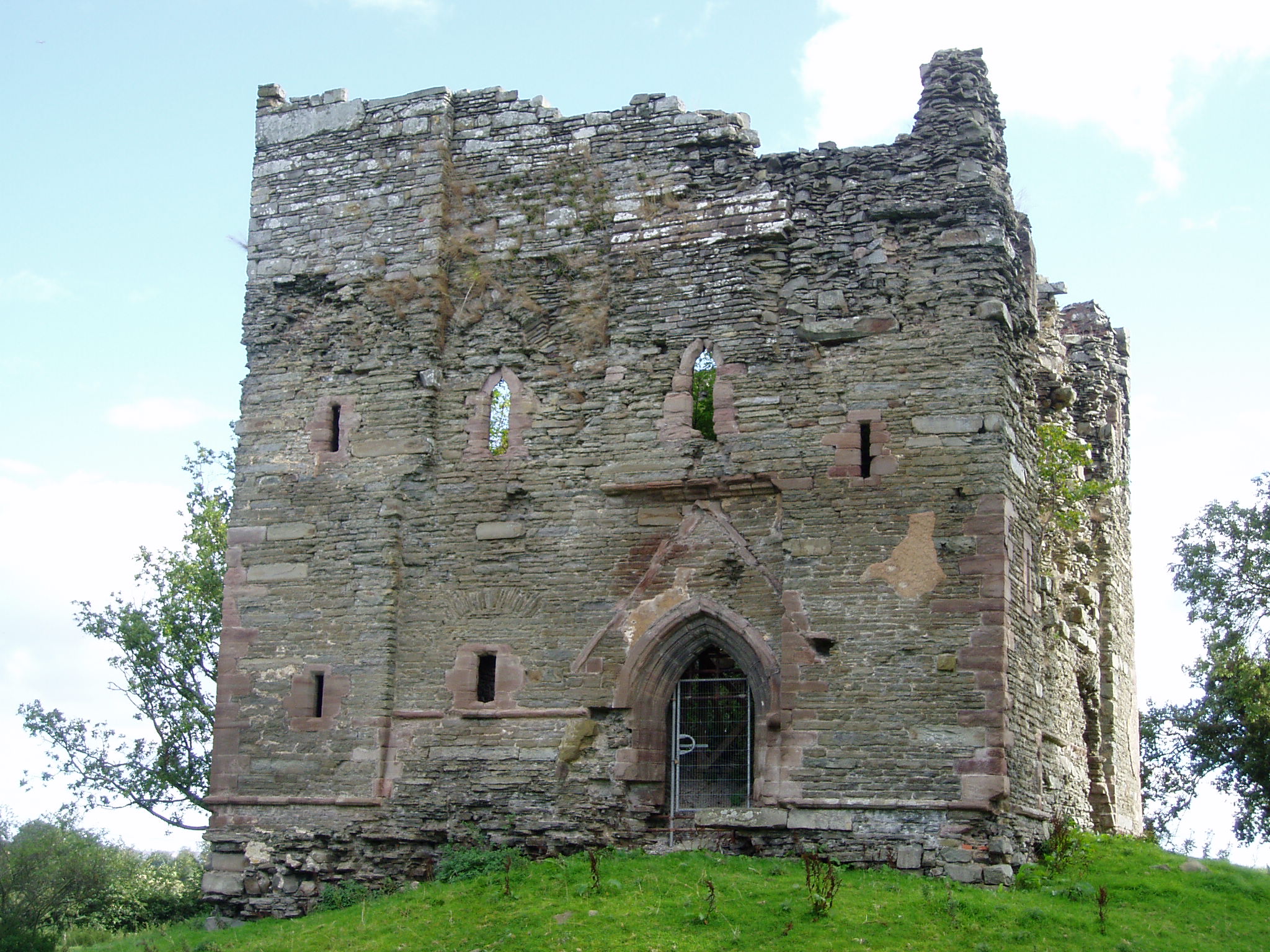
Hopton Castle

Hopton Castle is situated in the village of the same name which lies approximately halfway between Knighton and Craven Arms, in the English county of Shropshire...

Have you been to Darky Dale?

Leave your review of Darky Dale below (or comments, questions and feedback).