Guns Cleuch
Valley in Midlothian
Scotland
Guns Cleuch

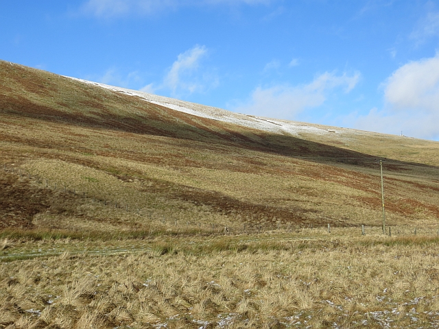
Guns Cleuch is a picturesque valley located in the Midlothian region of Scotland. Situated in the Southern Uplands, the valley is surrounded by rolling hills and dense woodlands, offering visitors a stunning natural landscape to explore.
The name "Guns Cleuch" is derived from the Scots word "cleuch," which means a narrow valley or ravine. The valley extends for approximately 3 miles and is traversed by a small stream that meanders through its center. The stream is fed by numerous springs along its course, adding to the overall charm and tranquility of the area.
The valley is a haven for wildlife enthusiasts and nature lovers alike. It is home to a diverse range of flora and fauna, including rare species such as the Scottish wildcat, red squirrels, and various bird species. The woodlands surrounding Guns Cleuch are a mix of native species such as oak, birch, and rowan, creating a rich and vibrant habitat for many woodland creatures.
For outdoor enthusiasts, Guns Cleuch offers various recreational activities. Hiking and walking trails crisscross the valley, allowing visitors to explore the area's natural beauty at their own pace. The valley's peaceful atmosphere and breathtaking scenic views make it an ideal spot for picnics, photography, or simply enjoying a moment of solitude.
Overall, Guns Cleuch in Midlothian is a hidden gem that showcases the natural splendor of the Scottish countryside. Its untouched beauty and diverse wildlife make it a must-visit destination for those seeking an escape from the hustle and bustle of city life.
If you have any feedback on the listing, please let us know in the comments section below.
Guns Cleuch Images
Images are sourced within 2km of 55.727824/-3.0447784 or Grid Reference NT3448. Thanks to Geograph Open Source API. All images are credited.


Guns Cleuch is located at Grid Ref: NT3448 (Lat: 55.727824, Lng: -3.0447784)
Unitary Authority: The Scottish Borders
Police Authority: The Lothians and Scottish Borders
What 3 Words
///countries.anthems.page. Near Innerleithen, Scottish Borders
Nearby Locations
Related Wikis

Dewar, Scottish Borders
Dewar is a village by the Dewar Burn and Peatrig Hill, in the Scottish Borders area of Scotland. Places nearby include Allanshaugh, Borthwick Hall, Fountainhall...

Peatrig Hill
Peatrig Hill is a minor hill in Scotland, located about 15 km south-southeast of Edinburgh. One of the Moorfoot Hills, it is located in the parish of Heriot...

Moorfoot Hills
The Moorfoot Hills are a range of hills south of Edinburgh in east central Scotland, one of the ranges which collectively form the Southern Uplands....
Garvald, Scottish Borders
Garvald (Scots: Garvit) is a hamlet on the B7007, near Dewar, by the Dewar Burn, in the Moorfoot Hills, in the Scottish Borders area of Scotland, in the...
Have you been to Guns Cleuch?
Leave your review of Guns Cleuch below (or comments, questions and feedback).