Brown's Hope

Valley in Roxburghshire

Scotland

Brown's Hope

Ride by Stock Knowe A short distance from a ruined fence on the Roxburghshire - Dumfriesshire march and East-West watershed.
Ride by Stock Knowe Credit: Richard Webb

Brown's Hope is a small valley located in the heart of Roxburghshire, a scenic region in the Scottish Borders. Situated amidst rolling hills and lush greenery, this tranquil valley is often regarded as a hidden gem by locals and visitors alike.

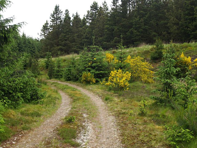
The main attraction of Brown's Hope is its breathtaking natural beauty. The valley is adorned with picturesque landscapes, including meandering rivers, dense forests, and charming meadows. The stunning views and peaceful atmosphere make it an ideal destination for nature lovers and hikers.

Historically, Brown's Hope was known for its agricultural significance. The fertile soil and favorable climate allowed for successful farming, particularly sheep rearing and crop cultivation. While the valley's economy has diversified over the years, agriculture continues to play a crucial role in sustaining the local community.

Although small in size, the valley boasts a strong sense of community spirit. The residents of Brown's Hope are known for their warm hospitality and close-knit relationships. The valley has a few scattered houses and farms, creating a close community where neighbors support and look out for one another.

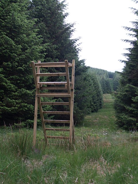
Visitors to Brown's Hope can explore its enchanting surroundings through various walking trails and nature hikes. The valley is also home to a wide array of wildlife, including red deer, otters, and various bird species, providing nature enthusiasts with ample opportunities for wildlife spotting and birdwatching.

Overall, Brown's Hope is a charming destination that offers a peaceful retreat amidst the beauty of nature. It is a place where visitors can immerse themselves in the tranquility of the Scottish countryside and experience the warmth of a close-knit community.

If you have any feedback on the listing, please let us know in the comments section below.

Brown's Hope Images

Images are sourced within 2km of 55.318521/-3.0441333 or Grid Reference NT3303. Thanks to Geograph Open Source API. All images are credited.

Ride by Stock Knowe A short distance from a ruined fence on the Roxburghshire - Dumfriesshire march and East-West watershed.
Ride by Stock Knowe
A short distance from a ruined fence on the Roxburghshire - Dumfriesshire march and East-West watershed.
Powerline ride, Stock Knowe Signs warn of buried power cables.
Powerline ride, Stock Knowe
Signs warn of buried power cables.
On Stock Hill The forest here was not shown on the 1979 edition of the 1:50,000 Ordnance Survey map.  There is a wide unplanted strip here which is very unpleasant to walk on due to the deep moss and heather.
On Stock Hill
The forest here was not shown on the 1979 edition of the 1:50,000 Ordnance Survey map. There is a wide unplanted strip here which is very unpleasant to walk on due to the deep moss and heather.
Stock Hill Deep moss and heather on rough unplanted ground. Tough!
Stock Hill
Deep moss and heather on rough unplanted ground. Tough!
Summit, Stock Hill An unplanted area on the East-West watershed. Horrible terrain for walking.
Summit, Stock Hill
An unplanted area on the East-West watershed. Horrible terrain for walking.
Triangulation pillar, Stock Hill On the edge of the big ride. Horrendous place to get to.
Triangulation pillar, Stock Hill
On the edge of the big ride. Horrendous place to get to.
Forestry access track at Mid Rig A block remains in the distance, surrounded by clearfell.

This photograph was taken during the Coronavirus (COVID-19) pandemic of 2020.
Forestry access track at Mid Rig
A block remains in the distance, surrounded by clearfell. This photograph was taken during the Coronavirus (COVID-19) pandemic of 2020.
In the forest at Lamblair Edge A dense plantation, nearing the edge of the block, at Lamblair Edge.

This photograph was taken during the Coronavirus (COVID-19) pandemic of 2020.
In the forest at Lamblair Edge
A dense plantation, nearing the edge of the block, at Lamblair Edge. This photograph was taken during the Coronavirus (COVID-19) pandemic of 2020.
Self-seeding of the Craik Forest at Lamblair Edge This part of the Craik Forest is subject to strong winds, with significant windthrow left of shot.  The forest has self-seeded in the boggy firebreak.

This photograph was taken during the Coronavirus (COVID-19) pandemic of 2020.
Self-seeding of the Craik Forest at Lamblair Edge
This part of the Craik Forest is subject to strong winds, with significant windthrow left of shot. The forest has self-seeded in the boggy firebreak. This photograph was taken during the Coronavirus (COVID-19) pandemic of 2020.
Moss festooned forestry on Lamblair Edge Damp, dark Sitka plantations featuring extensive moss growth.

This photograph was taken during the Coronavirus (COVID-19) pandemic of 2020.
Moss festooned forestry on Lamblair Edge
Damp, dark Sitka plantations featuring extensive moss growth. This photograph was taken during the Coronavirus (COVID-19) pandemic of 2020.
Upland grazing Rough grazing for hill sheep to the southeast of Byehass Fell and the edge of Craik Forest on the left.
Upland grazing
Rough grazing for hill sheep to the southeast of Byehass Fell and the edge of Craik Forest on the left.
Forest track, Stock Hill The left bank is showing some signs of erosion.  Taken from near the point where a small burn forms the top of Foul Cleugh.
Forest track, Stock Hill
The left bank is showing some signs of erosion. Taken from near the point where a small burn forms the top of Foul Cleugh.
Forest Track, Lamblair Edge Some small seedlings have escaped from the main forest and established themselves along the track.
Forest Track, Lamblair Edge
Some small seedlings have escaped from the main forest and established themselves along the track.
White Holm The upper reaches of the Howpasley Burn
White Holm
The upper reaches of the Howpasley Burn
Howpasley Hope If you're looking for a nice quiet country cottage, all this needs is a lick of paint and a few slates fixing...  though it is 3km from the nearest road with no path.
Howpasley Hope
If you're looking for a nice quiet country cottage, all this needs is a lick of paint and a few slates fixing... though it is 3km from the nearest road with no path.
Forest Track and broom Near the col to the SW of Mid Rig
Forest Track and broom
Near the col to the SW of Mid Rig
Forest watchtower It's not clear what one would watch for from here, it's too short for a firewatch.  Wildlife perhaps?  But this sort of forest doesn't seem to support much except for the odd buzzard or heron.
Forest watchtower
It's not clear what one would watch for from here, it's too short for a firewatch. Wildlife perhaps? But this sort of forest doesn't seem to support much except for the odd buzzard or heron.
Forest Track, Mid Rig After a steep pull up from the Hedley Burn, the angle eases along the side of Mid Rig.
Forest Track, Mid Rig
After a steep pull up from the Hedley Burn, the angle eases along the side of Mid Rig.
Show me another place!

Brown's Hope is located at Grid Ref: NT3303 (Lat: 55.318521, Lng: -3.0441333)

Unitary Authority: The Scottish Borders

Police Authority: The Lothians and Scottish Borders

What 3 Words

///procured.straws.combines. Near Teviothead, Scottish Borders

Nearby Locations

Brown's Hope

Related Wikis

Craik, Scottish Borders

Craik is a hamlet in Craik Forest, by the Airhouse Burn in the Scottish Borders area of Scotland, close to Roberton, Scottish Borders (grid reference NT348084...

Falnash

Falnash (Scots: Fawenesh) is a village in the Scottish Borders of Scotland. It is near Teviothead, in the former Roxburghshire, and in the parish of Teviothead...

River Teviot

The River Teviot (; Scottish Gaelic: Abhainn Tìbhiot), or Teviot Water, is a river of the Scottish Borders area of Scotland, and is the largest tributary...

Caerlanrig

Caerlanrig - also spelled 'Carlenrig' - (Gaelic: Cathair Lannraig) is a hamlet in the parish of Cavers, Borders, Scotland, lying on the River Teviot, 6...

Craik Forest

Craik Forest is a forest near Hawick in the Scottish Borders area of Scotland, and managed by the Forestry Commission. It is adjoined to the south-west...

Teviothead

Teviothead (Scottish Gaelic: Ceann Tìbhiot) is a small village and civil parish in Teviotdale in the Scottish Borders, known locally as Teviotheid. It...

Kagyu Samye Ling Monastery and Tibetan Centre

Kagyu Samye Ling Monastery and Tibetan Centre is a Tibetan Buddhist complex associated with the Karma Kagyu school located at Eskdalemuir, Scotland....

Unthank, Dumfries and Galloway

Unthank is a village in Dumfries and Galloway, Scotland. == References == The geographic coordinates are from the Ordnance Survey.

Have you been to Brown's Hope?

Leave your review of Brown's Hope below (or comments, questions and feedback).