Flesh Cleuch

Valley in Peeblesshire

Scotland

Flesh Cleuch

Glentress Not the forest, but the house and the Glentress Water. As this is Glen Tress, I can only surmise that the plans for the forest were somewhat larger than what was finally planted and this glen was to be part of it. The actual Glentress Forest is close by.
Glentress Credit: Richard Webb

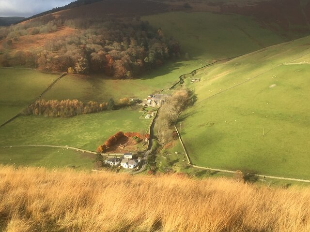
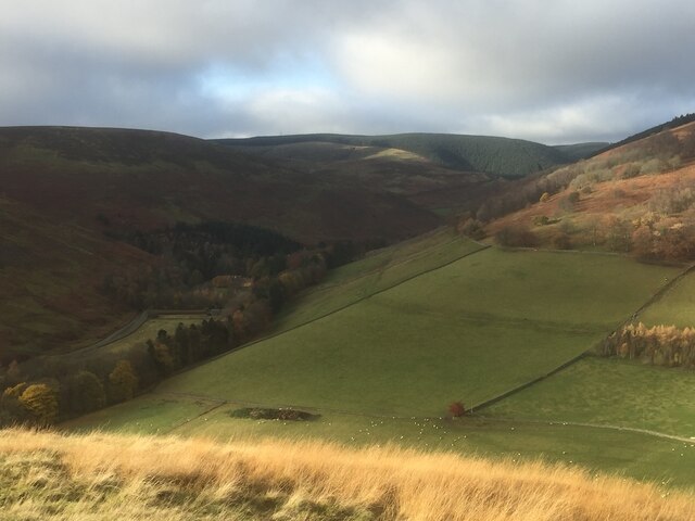
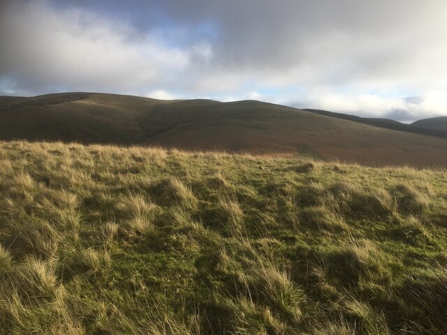
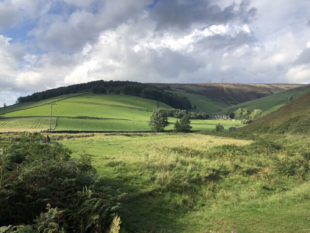
Flesh Cleuch is a picturesque valley located in Peeblesshire, Scotland. Situated in the southern uplands, it is characterized by its rugged beauty and tranquil atmosphere. The valley is located near the village of Broughton, approximately 22 miles south of the town of Peebles.

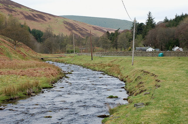
Flesh Cleuch is surrounded by rolling hills and is intersected by a small river, which adds to the charm of the landscape. The valley is known for its rich biodiversity, with an abundance of plant and animal species. Lush greenery, including heather, ferns, and mosses, covers the valley floor, creating a vibrant and colorful setting.

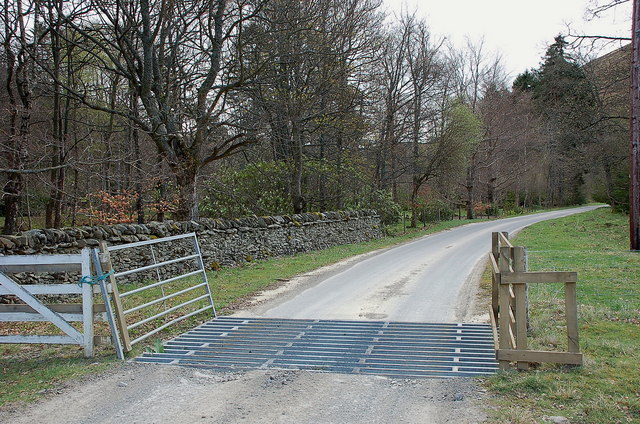
The area is a haven for outdoor enthusiasts, offering a range of activities such as hiking, birdwatching, and fishing. The valley boasts several walking trails, providing visitors with the opportunity to explore its natural wonders at their own pace. The river that meanders through the valley is home to various trout species, making it a popular destination for anglers.

Flesh Cleuch is also steeped in history, with traces of ancient settlements and structures scattered throughout the area. Archaeological sites, including burial cairns and standing stones, provide a glimpse into the valley's past and offer a fascinating insight into the lives of its former inhabitants.

Overall, Flesh Cleuch is a hidden gem, offering visitors a chance to immerse themselves in the tranquility of nature while exploring the rich history and diverse wildlife of this beautiful valley in Peeblesshire.

If you have any feedback on the listing, please let us know in the comments section below.

Flesh Cleuch Images

Images are sourced within 2km of 55.680588/-3.0581975 or Grid Reference NT3343. Thanks to Geograph Open Source API. All images are credited.

Glentress Not the forest, but the house and the Glentress Water. As this is Glen Tress, I can only surmise that the plans for the forest were somewhat larger than what was finally planted and this glen was to be part of it. The actual Glentress Forest is close by.
Glentress
Not the forest, but the house and the Glentress Water. As this is Glen Tress, I can only surmise that the plans for the forest were somewhat larger than what was finally planted and this glen was to be part of it. The actual Glentress Forest is close by.
Whitehope View from Dod Hill.
Whitehope
View from Dod Hill.
Looking up the Leithen Water Towards the conifers of Glentress Forest. The background block were newly planted when I walked down that slope in 1987. The name Glentress suggests that the forest was going to be a lot larger, including Dod Hill where I was standing. Glen Tress itself is below and right of the picture and remained unplanted.
Looking up the Leithen Water
Towards the conifers of Glentress Forest. The background block were newly planted when I walked down that slope in 1987. The name Glentress suggests that the forest was going to be a lot larger, including Dod Hill where I was standing. Glen Tress itself is below and right of the picture and remained unplanted.
Leithen Hopes The southern slopes of Whitehope Law in the Moorfoot Hills.
Leithen Hopes
The southern slopes of Whitehope Law in the Moorfoot Hills.
Summit, Dod Hill
Summit, Dod Hill
Ridge off Dod Hill View towards the south top of Windlestraw Law.
Ridge off Dod Hill
View towards the south top of Windlestraw Law.
Glentress and the B709 Not the forest, but the house and the Glentress Water. As this is Glen Tress, I can only surmise that the plans for the forest were somewhat larger than what was finally planted and this glen was to be part of it. The actual Glentress Forest is close by.
Glentress and the B709
Not the forest, but the house and the Glentress Water. As this is Glen Tress, I can only surmise that the plans for the forest were somewhat larger than what was finally planted and this glen was to be part of it. The actual Glentress Forest is close by.
House at Glentress
House at Glentress
Sheep pens near Blackhopebyre
Cairn on summit of Whitehope Law near Innerleithen There are no paths to the summit.
Cairn on summit of Whitehope Law near Innerleithen
There are no paths to the summit.
Descending NE by fence from Whitehope Law near Innerleithen
Glentress, Innerleithen
Burnside and Whitehope Burn Moorfoot Hills.
Burnside and Whitehope Burn
Moorfoot Hills.
Glentress Water Glentress Water joins the Leithen Water 500m downstream. The white cottage is Burnside, just below Whitehope farm. <a href="https://www.geograph.org.uk/photo/129932">NT3342 : Glentress Water</a> shows the same view in 2006.
Glentress Water
Glentress Water joins the Leithen Water 500m downstream. The white cottage is Burnside, just below Whitehope farm. NT3342 : Glentress Water shows the same view in 2006.
Leithen Water The Leithen Water rises on the southern slopes of Bowbeat Rig and runs in a substantial valley along the E side of the ridge of hills between Innerleithen and Peebles. This view is just SE of the imposing house of Leithen Lodge.
Leithen Water
The Leithen Water rises on the southern slopes of Bowbeat Rig and runs in a substantial valley along the E side of the ridge of hills between Innerleithen and Peebles. This view is just SE of the imposing house of Leithen Lodge.
Edge of the woodland at Leithen Lodge The cattle grid marks the edge of the enclosed woodland beyond which the track continues up the Leithen Water valley.
Edge of the woodland at Leithen Lodge
The cattle grid marks the edge of the enclosed woodland beyond which the track continues up the Leithen Water valley.
Leithen Lodge An ornate lodge, centre of the estate by the Leithen Water. Part of the house can be booked for self-catering accommodation.
Leithen Lodge
An ornate lodge, centre of the estate by the Leithen Water. Part of the house can be booked for self-catering accommodation.
Show me another place!

Flesh Cleuch is located at Grid Ref: NT3343 (Lat: 55.680588, Lng: -3.0581975)

Unitary Authority: The Scottish Borders

Police Authority: The Lothians and Scottish Borders

What 3 Words

///lights.investor.calibrate. Near Innerleithen, Scottish Borders

Nearby Locations

Flesh Cleuch Windside Hill

Related Wikis

Windlestraw Law

Windlestraw Law is a hill in the Moorfoot Hills range, part of the Southern Uplands of Scotland. It is the highest peak of the range, and lies north of...

Glentress Forest

Glentress Forest is located near Peebles in the Scottish Borders, about 30 miles south of Edinburgh. Part of the Tweed Valley Forest Park along with Traquair...

Nether Horsburgh Castle

Nether Horsburgh Castle is a ruined tower house near Cardrona, in the Scottish Borders, in the former county of Peebleshire. It is situated at the back...

Blackhope Scar

Blackhope Scar is a hill in the Moorfoot Hills range, part of the Southern Uplands of Scotland. It lies to the northeast of the town of Peebles and is...

Bowbeat Hill

Bowbeat Hill is a hill in the Moorfoot Hills range, part of the Southern Uplands of Scotland. It lends its name to Bowbeat Onshore Wind Farm built on the...

Dewar, Scottish Borders

Dewar is a village by the Dewar Burn and Peatrig Hill, in the Scottish Borders area of Scotland. Places nearby include Allanshaugh, Borthwick Hall, Fountainhall...

Cardrona, Scottish Borders

Cardrona is a village on the A72 and B7062, between Peebles and Innerleithen, in the Scottish Borders area of Scotland. Places nearby include Glentress...

Cardrona railway station

Cardrona railway station served the village of Cardrona, Scottish Borders, Scotland from 1864 to 1962 on the Peebles Railway. == History == The station...

Nearby Amenities

Located within 500m of 55.680588,-3.0581975
Windside Hill
Ele: 432
Natural: peak
Lat/Long: 55.6806024/-3.0630828
Power: pole
Lat/Long: 55.6815037/-3.0504411
Power: pole
Lat/Long: 55.6810911/-3.0510841
Power: pole
Lat/Long: 55.680849/-3.0514649
Power: pole
Lat/Long: 55.6804518/-3.0520889
Power: pole
Lat/Long: 55.6799712/-3.0528293
Power: pole
Lat/Long: 55.6795073/-3.0530789
Power: pole
Lat/Long: 55.6789443/-3.0533877
Power: pole
Lat/Long: 55.6784935/-3.0536268
Power: pole
Lat/Long: 55.6778375/-3.0539504
Power: pole
Lat/Long: 55.6774379/-3.0545046
Power: pole
Lat/Long: 55.6770908/-3.0550059
Power: pole
Lat/Long: 55.6766245/-3.055685
Power: pole
Lat/Long: 55.6761223/-3.0572334
The data included in this document is from www.openstreetmap.org. The data is made available under ODbL.

Have you been to Flesh Cleuch?

Leave your review of Flesh Cleuch below (or comments, questions and feedback).