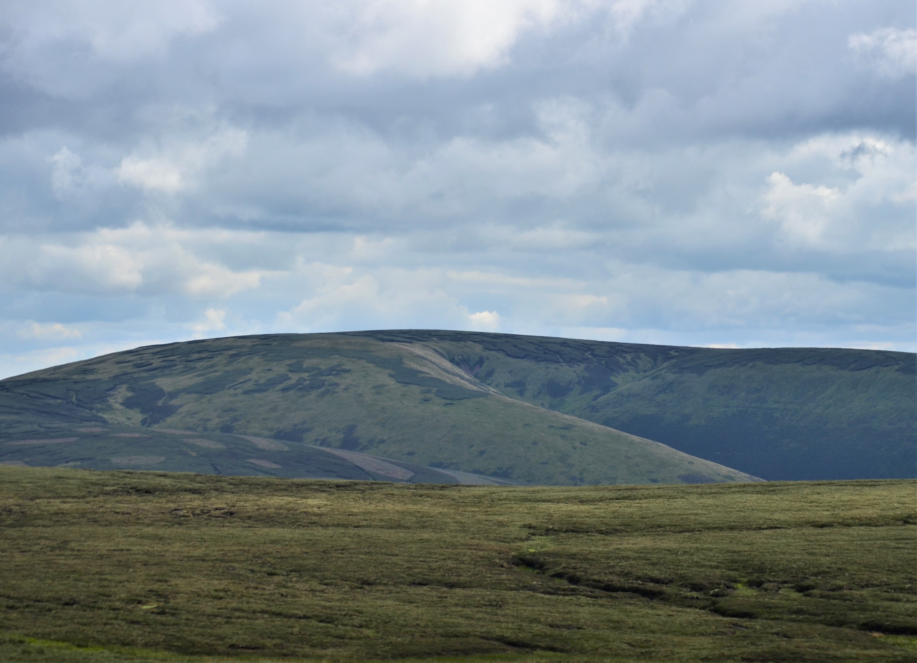
Blackside

Valley in Midlothian

Scotland

Blackside

Fenceline on Blackhope Scar Rough ground with peat hags north-west of the summit of Blackhope Scar.
Fenceline on Blackhope Scar Credit: Alan O'Dowd

Blackside, Midlothian (Valley) is a small suburban neighborhood located in Midlothian, a town situated in the Midlothian Council area of Scotland. Nestled in the scenic countryside, this idyllic community offers a peaceful and picturesque setting for residents and visitors alike.

The neighborhood of Blackside is predominantly residential, characterized by charming traditional houses and well-maintained gardens. The area boasts a close-knit community feel, with friendly neighbors and a strong sense of pride in the local heritage. The valley setting adds to the area's appeal, offering stunning views of rolling hills and lush greenery.

Despite its tranquil atmosphere, Blackside is conveniently located close to essential amenities. Within a short drive, residents can access a range of shops, supermarkets, and restaurants in Midlothian town center. The area also benefits from excellent transportation links, with easy access to major roads and public transport services, making commuting to nearby cities like Edinburgh relatively effortless.

For those seeking recreational activities, Blackside provides ample opportunities. The beautiful surrounding countryside invites residents to explore nature through hiking, cycling, or simply enjoying leisurely walks. Nearby attractions, such as the impressive Midlothian Snowsports Centre and the historic Newbattle Abbey, offer further options for entertainment and cultural enrichment.

In conclusion, Blackside, Midlothian (Valley) offers a serene and welcoming environment for residents seeking a peaceful suburban lifestyle. With its scenic views, close-knit community, and easy access to amenities and recreational activities, this neighborhood is a charming place to call home.

If you have any feedback on the listing, please let us know in the comments section below.

Blackside Images

Images are sourced within 2km of 55.729724/-3.0816443 or Grid Reference NT3249. Thanks to Geograph Open Source API. All images are credited.

Fenceline on Blackhope Scar Rough ground with peat hags north-west of the summit of Blackhope Scar.
Fenceline on Blackhope Scar
Rough ground with peat hags north-west of the summit of Blackhope Scar.
Bogs and peat hags on Blackhope Scar Difficult terrain north-west of the summit of Blackhope Scar.
Bogs and peat hags on Blackhope Scar
Difficult terrain north-west of the summit of Blackhope Scar.
Trig pillar on Blackhope Scar A boggy summit at the junction of three straggly fences, with wind turbines on Bowbeat Hill visible in the distance.
Trig pillar on Blackhope Scar
A boggy summit at the junction of three straggly fences, with wind turbines on Bowbeat Hill visible in the distance.
Eroded gullies on Blackhope Scar At the headwaters of the Blackhope Water in the Moorfoot Hills.
Eroded gullies on Blackhope Scar
At the headwaters of the Blackhope Water in the Moorfoot Hills.
Gullies at the head of the Blackhope Water On Blackhope Scar in the Moorfoot Hills.
Gullies at the head of the Blackhope Water
On Blackhope Scar in the Moorfoot Hills.
Small footbridge and metal shed by the Blackhope Water At the confluence of the Wooly Burn and the Blackhope Water.
Small footbridge and metal shed by the Blackhope Water
At the confluence of the Wooly Burn and the Blackhope Water.
Misty summit of Blackhope Scar, Moorfoot Hills
Bowbeat Wind Farm from Kings Road Nick, Moorfoot Hills
Old metal shed or bothy below Wooly Law By the side of the Blackhope Water, a tiny burn at this point in the midst of the Moorfoot Hills.
Old metal shed or bothy below Wooly Law
By the side of the Blackhope Water, a tiny burn at this point in the midst of the Moorfoot Hills.
North Grain North Grain drains the peat moorland of Garvald Punks and flows down through the forestry plantations to join the Williamslee Burn, a tributary of the Leithen Water.
North Grain
North Grain drains the peat moorland of Garvald Punks and flows down through the forestry plantations to join the Williamslee Burn, a tributary of the Leithen Water.
North Grain The track turns sharply here, ahead lies the infamous Garvald Punks which is a very rough and vast bog.
North Grain
The track turns sharply here, ahead lies the infamous Garvald Punks which is a very rough and vast bog.
On Blackhope Scar The highest point in Midlothian [651m], a dissected plateau of rough grassy moorland. The fence marks the boundary between Midlothian [left] and the Scottish Borders [right], but it curves round to the right so that the middle distance moorland is in Midlothian. Edinburgh and the Pentland Hills are on the horizon, about 20km away.
On Blackhope Scar
The highest point in Midlothian [651m], a dissected plateau of rough grassy moorland. The fence marks the boundary between Midlothian [left] and the Scottish Borders [right], but it curves round to the right so that the middle distance moorland is in Midlothian. Edinburgh and the Pentland Hills are on the horizon, about 20km away.
Blackhope Scar Parked 1 km south of Dewar, easy track until ridge line then through gate and onto vehicle track to gain further height. Path missing in middle bit then picked up again by fence on Blackhope Scar. Dry clear but cloudy conditions. Lothian (1974) administrative county top, Midlothian historic county top and Midlothian current county/UA top.
Name: Blackhope Scar
Hill number: 1802
Height: 651m / 2136ft
Area: 28A: Firth of Forth to the River Tweed
Class: Ma,G,D,CoH, CoU,CoA
Grid ref: NT 31511 48324
Summit feature: no feature 15m SW of trig point
Drop: 282m
Col: 369m  NT347465
Blackhope Scar
Parked 1 km south of Dewar, easy track until ridge line then through gate and onto vehicle track to gain further height. Path missing in middle bit then picked up again by fence on Blackhope Scar. Dry clear but cloudy conditions. Lothian (1974) administrative county top, Midlothian historic county top and Midlothian current county/UA top. Name: Blackhope Scar Hill number: 1802 Height: 651m / 2136ft Area: 28A: Firth of Forth to the River Tweed Class: Ma,G,D,CoH, CoU,CoA Grid ref: NT 31511 48324 Summit feature: no feature 15m SW of trig point Drop: 282m Col: 369m NT347465
Valley of a stream draining New Moss One of many streams flowing into the River South Esk. The sheep have found a good spot to enjoy the Sunday sunshine.
Valley of a stream draining New Moss
One of many streams flowing into the River South Esk. The sheep have found a good spot to enjoy the Sunday sunshine.
Moorland and Peat Hags on Wooly Law
Fence and Moorland above Little Cleave The clouds are low enough to hide the usual view of the wind turbines
Fence and Moorland above Little Cleave
The clouds are low enough to hide the usual view of the wind turbines
Fence on Blackhope Scar On the north west side looking towards the summit
Fence on Blackhope Scar
On the north west side looking towards the summit
Moorland and lone tree South of Blackhope Scar
Moorland and lone tree
South of Blackhope Scar
Show me another place!

Blackside is located at Grid Ref: NT3249 (Lat: 55.729724, Lng: -3.0816443)

Unitary Authority: The Scottish Borders

Police Authority: The Lothians and Scottish Borders

What 3 Words

///influence.launched.store. Near Peebles, Scottish Borders

Nearby Locations

Blackside

Related Wikis

Moorfoot Hills

The Moorfoot Hills are a range of hills south of Edinburgh in east central Scotland, one of the ranges which collectively form the Southern Uplands....

Blackhope Scar

Blackhope Scar is a hill in the Moorfoot Hills range, part of the Southern Uplands of Scotland. It lies to the northeast of the town of Peebles and is...

Dewar, Scottish Borders

Dewar is a village by the Dewar Burn and Peatrig Hill, in the Scottish Borders area of Scotland. Places nearby include Allanshaugh, Borthwick Hall, Fountainhall...

Bowbeat Hill

Bowbeat Hill is a hill in the Moorfoot Hills range, part of the Southern Uplands of Scotland. It lends its name to Bowbeat Onshore Wind Farm built on the...

Have you been to Blackside?

Leave your review of Blackside below (or comments, questions and feedback).