Brockie Cleuch

Valley in Peeblesshire

Scotland

Brockie Cleuch

Peebles Rig from Dunslair Heights Whitehope Law (623m) is in view across the valley of the Leithen Water.
Peebles Rig from Dunslair Heights Credit: Jim Barton

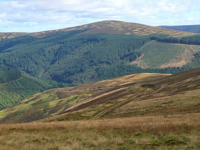
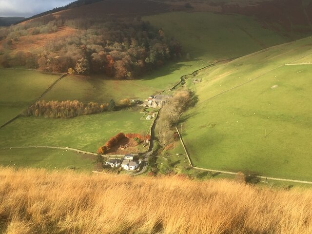
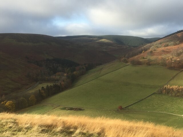
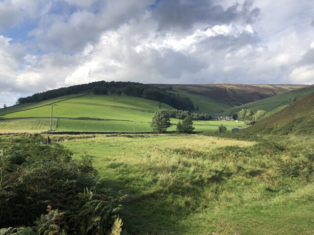
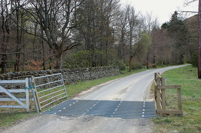
Brockie Cleuch is a picturesque valley located in Peeblesshire, Scotland. Situated in the southern part of the country, it is known for its stunning natural beauty and tranquil atmosphere. The valley is nestled within the rolling hills of the Scottish Borders region and is surrounded by lush greenery, making it a popular destination for nature lovers and outdoor enthusiasts.

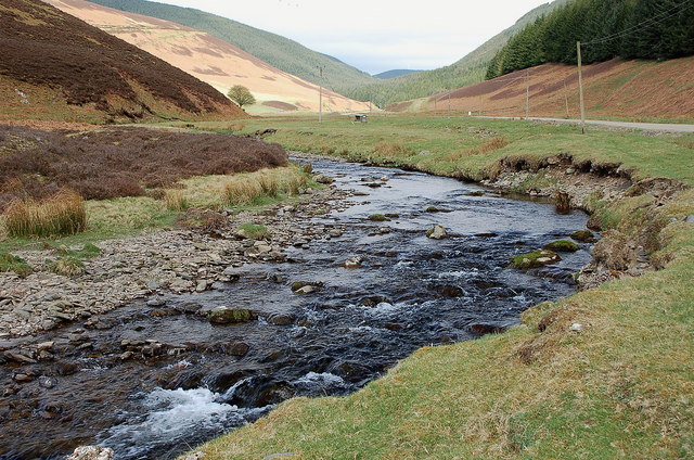
The main feature of Brockie Cleuch is the meandering river that runs through it, adding to its charm and providing a peaceful backdrop. This river is fed by several smaller streams and tributaries, enhancing the overall aesthetics of the valley. The water is crystal clear and often dotted with rocks and pebbles, making it a great spot for fishing and picnicking.

The vegetation in Brockie Cleuch is rich and diverse, comprising of various types of trees, shrubs, and wildflowers. The valley is particularly beautiful during the spring and summer months when the flora is in full bloom, creating a vibrant and colorful display.

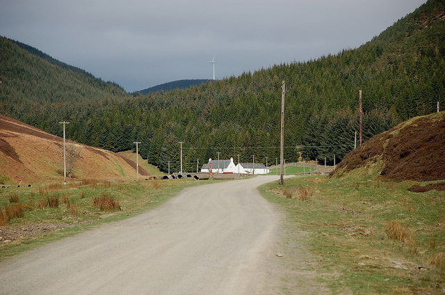
The valley is also home to a variety of wildlife, including birds, small mammals, and insects. Birdwatchers will delight in the opportunity to spot different species in their natural habitat, while walkers and hikers can enjoy the numerous trails and paths that crisscross the area.

Overall, Brockie Cleuch offers a peaceful and idyllic escape from the hustle and bustle of everyday life. Whether you're seeking a quiet retreat or a place to explore the great outdoors, this valley has something to offer for everyone.

If you have any feedback on the listing, please let us know in the comments section below.

Brockie Cleuch Images

Images are sourced within 2km of 55.689755/-3.0837854 or Grid Reference NT3144. Thanks to Geograph Open Source API. All images are credited.

Peebles Rig from Dunslair Heights Whitehope Law (623m) is in view across the valley of the Leithen Water.
Peebles Rig from Dunslair Heights
Whitehope Law (623m) is in view across the valley of the Leithen Water.
Whitehope View from Dod Hill.
Whitehope
View from Dod Hill.
Looking up the Leithen Water Towards the conifers of Glentress Forest. The background block were newly planted when I walked down that slope in 1987. The name Glentress suggests that the forest was going to be a lot larger, including Dod Hill where I was standing. Glen Tress itself is below and right of the picture and remained unplanted.
Looking up the Leithen Water
Towards the conifers of Glentress Forest. The background block were newly planted when I walked down that slope in 1987. The name Glentress suggests that the forest was going to be a lot larger, including Dod Hill where I was standing. Glen Tress itself is below and right of the picture and remained unplanted.
Leithen Hopes The southern slopes of Whitehope Law in the Moorfoot Hills.
Leithen Hopes
The southern slopes of Whitehope Law in the Moorfoot Hills.
Cairn on summit of Whitehope Law near Innerleithen There are no paths to the summit.
Cairn on summit of Whitehope Law near Innerleithen
There are no paths to the summit.
Descending NE by fence from Whitehope Law near Innerleithen
Burnside and Whitehope Burn Moorfoot Hills.
Burnside and Whitehope Burn
Moorfoot Hills.
Edge of the woodland at Leithen Lodge The cattle grid marks the edge of the enclosed woodland beyond which the track continues up the Leithen Water valley.
Edge of the woodland at Leithen Lodge
The cattle grid marks the edge of the enclosed woodland beyond which the track continues up the Leithen Water valley.
Leithen Water below Lamb Law The valley is partly open hillside for sheep grazing and partly forested.
Leithen Water below Lamb Law
The valley is partly open hillside for sheep grazing and partly forested.
Road by the Leithen Water The road serves the farms and forestry around the Leithen Water and Wiliamslee Burn. The white cottage is Hunter's Knowe and one of the Bowbeat wind turbines is on the skyline.
Road by the Leithen Water
The road serves the farms and forestry around the Leithen Water and Wiliamslee Burn. The white cottage is Hunter's Knowe and one of the Bowbeat wind turbines is on the skyline.
Track junction at Hunters Knowe The track to the right is not shown on the 1:25,000 map, but it is likely to have been put in before bringing in the wind turbines to Bowbeat. The sign advises that the road is 'liable to icing'.
Track junction at Hunters Knowe
The track to the right is not shown on the 1:25,000 map, but it is likely to have been put in before bringing in the wind turbines to Bowbeat. The sign advises that the road is 'liable to icing'.
Leithen Water at Hunters Knowe The cottage at Hunters Knowe; two pied wagtails were close by.
Leithen Water at Hunters Knowe
The cottage at Hunters Knowe; two pied wagtails were close by.
Clear-felled area, Leithenwater Forest Trees felled here have revealed a view of the Leithen Water and Williamslee to the left. The heather-clad ridge across the valley is Lamb Law.
Clear-felled area, Leithenwater Forest
Trees felled here have revealed a view of the Leithen Water and Williamslee to the left. The heather-clad ridge across the valley is Lamb Law.
Felled area above Williamslee Burn A view down the hillside along the edge of a felled area - most of this valley has been planted and logging is taking place further up the glen.
Felled area above Williamslee Burn
A view down the hillside along the edge of a felled area - most of this valley has been planted and logging is taking place further up the glen.
Upgraded forest road, Williamslee Hope The road surface has been spread with crushed stone and compacted in preparation for logging work.
Upgraded forest road, Williamslee Hope
The road surface has been spread with crushed stone and compacted in preparation for logging work.
Fauld Cleuch Rig A section of clear felled forest on Fauld Cleuch Rig in Williamslee Hope.
Fauld Cleuch Rig
A section of clear felled forest on Fauld Cleuch Rig in Williamslee Hope.
Fauld Cleuch Contrasting sides of the forestry by the small burn in Fauld Cleuch.
Fauld Cleuch
Contrasting sides of the forestry by the small burn in Fauld Cleuch.
Forest road in Williamslee Hope The road climbs at a gentle gradient around the 450m contour on the W side of Williamslee Hope. The distinctive steep col (centre) is Leithen Door, Glentress Forest.
Forest road in Williamslee Hope
The road climbs at a gentle gradient around the 450m contour on the W side of Williamslee Hope. The distinctive steep col (centre) is Leithen Door, Glentress Forest.
Show me another place!

Brockie Cleuch is located at Grid Ref: NT3144 (Lat: 55.689755, Lng: -3.0837854)

Unitary Authority: The Scottish Borders

Police Authority: The Lothians and Scottish Borders

What 3 Words

///bounding.targeted.beak. Near Peebles, Scottish Borders

Related Wikis

Glentress Forest

Glentress Forest is located near Peebles in the Scottish Borders, about 30 miles south of Edinburgh. Part of the Tweed Valley Forest Park along with Traquair...

Bowbeat Hill

Bowbeat Hill is a hill in the Moorfoot Hills range, part of the Southern Uplands of Scotland. It lends its name to Bowbeat Onshore Wind Farm built on the...

Blackhope Scar

Blackhope Scar is a hill in the Moorfoot Hills range, part of the Southern Uplands of Scotland. It lies to the northeast of the town of Peebles and is...

Moorfoot Hills

The Moorfoot Hills are a range of hills south of Edinburgh in east central Scotland, one of the ranges which collectively form the Southern Uplands....

Nearby Amenities

Located within 500m of 55.689755,-3.0837854
Woodlandslee Tower
Canmore ID: 53228
Historic: ruins
Website: http://canmore.rcahms.gov.uk/en/site/53228/details/woolandslee+tower/
Lat/Long: 55.6921218/-3.0867249
The data included in this document is from www.openstreetmap.org. The data is made available under ODbL.

Have you been to Brockie Cleuch?

Leave your review of Brockie Cleuch below (or comments, questions and feedback).