Dunslair Hope

Valley in Peeblesshire

Scotland

Dunslair Hope

Edge of the woodland at Leithen Lodge The cattle grid marks the edge of the enclosed woodland beyond which the track continues up the Leithen Water valley.
Edge of the woodland at Leithen Lodge Credit: Jim Barton

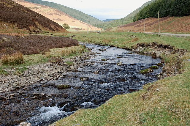
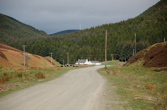
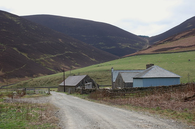
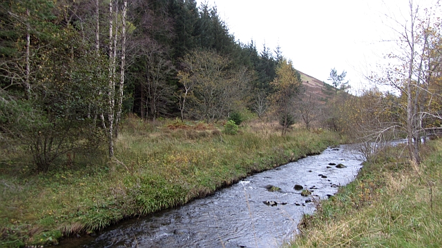
Dunslair Hope is a picturesque valley located in the Peeblesshire region of Scotland. Situated amidst the rolling hills and lush greenery, it is a haven for nature enthusiasts and those seeking tranquility. The valley stretches for several miles, encompassing a diverse landscape that includes meadows, woodlands, and a meandering river.

The valley's name, Dunslair Hope, originates from the Old English words "dun" meaning hill and "slaer" meaning slope, accurately describing the topography of the area. The hills surrounding the valley offer breathtaking panoramic views and are a popular spot for hikers and photographers.

The valley is home to a variety of wildlife, including red deer, badgers, and numerous bird species. Nature lovers can enjoy exploring the extensive network of walking trails that wind through the valley, offering glimpses of its flora and fauna.

Dunslair Hope also boasts a rich historical heritage. Ruins of ancient castles and fortified towers dot the landscape, reminding visitors of the area's storied past. The valley has witnessed centuries of human habitation, and remnants of prehistoric settlements have been discovered in the vicinity.

The village of Dunslair Hope, located at the heart of the valley, is a small and close-knit community. It offers a range of amenities for visitors, including cozy accommodations, traditional pubs, and locally owned shops. The village hosts various events throughout the year, such as farmers' markets and cultural festivals, providing a glimpse into the vibrant local culture.

Overall, Dunslair Hope is a captivating destination that combines natural beauty, historical significance, and a warm community atmosphere, making it an ideal place for those seeking a peaceful retreat in the heart of Scotland.

If you have any feedback on the listing, please let us know in the comments section below.

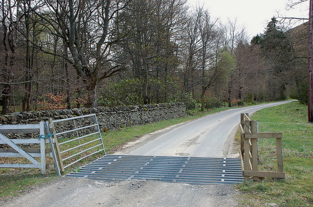
Dunslair Hope Images

Images are sourced within 2km of 55.681752/-3.1125412 or Grid Reference NT3043. Thanks to Geograph Open Source API. All images are credited.

Edge of the woodland at Leithen Lodge The cattle grid marks the edge of the enclosed woodland beyond which the track continues up the Leithen Water valley.
Edge of the woodland at Leithen Lodge
The cattle grid marks the edge of the enclosed woodland beyond which the track continues up the Leithen Water valley.
Leithen Water below Lamb Law The valley is partly open hillside for sheep grazing and partly forested.
Leithen Water below Lamb Law
The valley is partly open hillside for sheep grazing and partly forested.
Road by the Leithen Water The road serves the farms and forestry around the Leithen Water and Wiliamslee Burn. The white cottage is Hunter's Knowe and one of the Bowbeat wind turbines is on the skyline.
Road by the Leithen Water
The road serves the farms and forestry around the Leithen Water and Wiliamslee Burn. The white cottage is Hunter's Knowe and one of the Bowbeat wind turbines is on the skyline.
Track junction at Hunters Knowe The track to the right is not shown on the 1:25,000 map, but it is likely to have been put in before bringing in the wind turbines to Bowbeat. The sign advises that the road is 'liable to icing'.
Track junction at Hunters Knowe
The track to the right is not shown on the 1:25,000 map, but it is likely to have been put in before bringing in the wind turbines to Bowbeat. The sign advises that the road is 'liable to icing'.
Leithen Water at Hunters Knowe The cottage at Hunters Knowe; two pied wagtails were close by.
Leithen Water at Hunters Knowe
The cottage at Hunters Knowe; two pied wagtails were close by.
Clear-felled area, Leithenwater Forest Trees felled here have revealed a view of the Leithen Water and Williamslee to the left. The heather-clad ridge across the valley is Lamb Law.
Clear-felled area, Leithenwater Forest
Trees felled here have revealed a view of the Leithen Water and Williamslee to the left. The heather-clad ridge across the valley is Lamb Law.
Felled area above Williamslee Burn A view down the hillside along the edge of a felled area - most of this valley has been planted and logging is taking place further up the glen.
Felled area above Williamslee Burn
A view down the hillside along the edge of a felled area - most of this valley has been planted and logging is taking place further up the glen.
Upgraded forest road, Williamslee Hope The road surface has been spread with crushed stone and compacted in preparation for logging work.
Upgraded forest road, Williamslee Hope
The road surface has been spread with crushed stone and compacted in preparation for logging work.
The ruins of  Woolandslee Tower The ruins (centre) comprise an archway vault roofed over a small enclosure, with some surrounding low walls. <a href="https://www.geograph.org.uk/photo/260890">NT3144 : Woolandslee Tower (remains of)</a> shows a closer view. 

The original name of Williamslee Burn could have been Woolandslee Water, according to an article by William Douglas in 1892 describing several walks over the Moorfoot Hills (see <span class="nowrap"><a title="http://gdl.cdlr.strath.ac.uk/smcj/smcj007/smcj00706.htm" rel="nofollow ugc noopener" href="http://gdl.cdlr.strath.ac.uk/smcj/smcj007/smcj00706.htm">Link</a><img style="margin-left:2px;" alt="External link" title="External link - shift click to open in new window" src="https://s1.geograph.org.uk/img/external.png" width="10" height="10"/></span> ) published in the Scottish Mountaineering Club Journal, vol. 2 p 26, 1892.
The ruins of Woolandslee Tower
The ruins (centre) comprise an archway vault roofed over a small enclosure, with some surrounding low walls. NT3144 : Woolandslee Tower (remains of) shows a closer view. The original name of Williamslee Burn could have been Woolandslee Water, according to an article by William Douglas in 1892 describing several walks over the Moorfoot Hills (see LinkExternal link ) published in the Scottish Mountaineering Club Journal, vol. 2 p 26, 1892.
Sheepfold, Williamslee Hope A well-built circular sheepfold, now surrounded by trees.
Sheepfold, Williamslee Hope
A well-built circular sheepfold, now surrounded by trees.
Williamslee farm The steep pass of Leithen Door is on the skyline, beyond the pastures at the foot of Peebles Rig.
Williamslee farm
The steep pass of Leithen Door is on the skyline, beyond the pastures at the foot of Peebles Rig.
Leithen Water The river flows through woodland and past a wooded garden at Leithen Lodge.
Leithen Water
The river flows through woodland and past a wooded garden at Leithen Lodge.
Leithen Door Burn A tributary of the Leithen Water. There is a pass at the head into Glentress Forest.
Leithen Door Burn
A tributary of the Leithen Water. There is a pass at the head into Glentress Forest.
The Peebles Rig A truncated spur above the Leithen Water, covered in moorland rather than the usual conifer forest. There is a road running across the hill which connects with the forest road network on Dunslair Heights.
The Peebles Rig
A truncated spur above the Leithen Water, covered in moorland rather than the usual conifer forest. There is a road running across the hill which connects with the forest road network on Dunslair Heights.
Road beside the Leithen Water The road is the main access route for the power station on Bowbeat Hill and the vast conifer plantations around the Leithen Water. It now runs on a new course to the right of Hunter's Knowe (the white building), and the hairpin shown on the maps has become overgrown.
Road beside the Leithen Water
The road is the main access route for the power station on Bowbeat Hill and the vast conifer plantations around the Leithen Water. It now runs on a new course to the right of Hunter's Knowe (the white building), and the hairpin shown on the maps has become overgrown.
Road, Hunter's Knowe The road has been rerouted and takes a single go at the gradient to the north of Hunter's Knowe rather than the mapped hairpin. It is still an easy gradient. The road is used as a logging road for the forest and is the main access to the Bowbeat Hill power station.
Road, Hunter's Knowe
The road has been rerouted and takes a single go at the gradient to the north of Hunter's Knowe rather than the mapped hairpin. It is still an easy gradient. The road is used as a logging road for the forest and is the main access to the Bowbeat Hill power station.
Logging equipment, Leithen Water A log carrier is parked up for the weekend. A block is being harvested high in Craig Hope.
Logging equipment, Leithen Water
A log carrier is parked up for the weekend. A block is being harvested high in Craig Hope.
Forest road, Leithen Water This road has been recently upgraded. Much of the forest is ready for felling and a lot of timber will be carried out.
Forest road, Leithen Water
This road has been recently upgraded. Much of the forest is ready for felling and a lot of timber will be carried out.
Show me another place!

Dunslair Hope is located at Grid Ref: NT3043 (Lat: 55.681752, Lng: -3.1125412)

Unitary Authority: The Scottish Borders

Police Authority: The Lothians and Scottish Borders

What 3 Words

///tissue.splat.whirlpool. Near Peebles, Scottish Borders

Nearby Locations

White Cleuch Dunslair Hope

Related Wikis

Glentress Forest

Glentress Forest is located near Peebles in the Scottish Borders, about 30 miles south of Edinburgh. Part of the Tweed Valley Forest Park along with Traquair...

Bowbeat Hill

Bowbeat Hill is a hill in the Moorfoot Hills range, part of the Southern Uplands of Scotland. It lends its name to Bowbeat Onshore Wind Farm built on the...

Nether Horsburgh Castle

Nether Horsburgh Castle is a ruined tower house near Cardrona, in the Scottish Borders, in the former county of Peebleshire. It is situated at the back...

Cardrona, Scottish Borders

Cardrona is a village on the A72 and B7062, between Peebles and Innerleithen, in the Scottish Borders area of Scotland. Places nearby include Glentress...

Nearby Amenities

Located within 500m of 55.681752,-3.1125412
Power: pole
Lat/Long: 55.68542/-3.1085046
Power: pole
Lat/Long: 55.6849144/-3.1086379
Power: pole
Lat/Long: 55.6844219/-3.1087754
Power: pole
Lat/Long: 55.683809/-3.1092598
Power: pole
Lat/Long: 55.6832008/-3.1097294
Power: pole
Lat/Long: 55.6825938/-3.1102117
Power: pole
Lat/Long: 55.6819998/-3.1106898
Power: pole
Lat/Long: 55.6816123/-3.1118236
Power: pole
Lat/Long: 55.6813153/-3.1127078
Power: pole
Lat/Long: 55.681165/-3.1133508
Power: pole
Lat/Long: 55.6809337/-3.1143218
Power: pole
Lat/Long: 55.6806236/-3.115519
Power: pole
Lat/Long: 55.6803445/-3.1166444
Power: pole
Lat/Long: 55.6800976/-3.1176259
Power: pole
Lat/Long: 55.6798901/-3.1184784
Power: pole
Lat/Long: 55.6796838/-3.1193478
The data included in this document is from www.openstreetmap.org. The data is made available under ODbL.

Have you been to Dunslair Hope?

Leave your review of Dunslair Hope below (or comments, questions and feedback).