Clinty Cleugh

Valley in Midlothian

Scotland

Clinty Cleugh

Fenceline on Blackhope Scar Rough ground with peat hags north-west of the summit of Blackhope Scar.
Fenceline on Blackhope Scar Credit: Alan O'Dowd

Clinty Cleugh is a small valley located in Midlothian, Scotland. Situated in the picturesque countryside, the valley is renowned for its natural beauty and tranquil atmosphere. Surrounded by rolling hills and lush greenery, Clinty Cleugh offers a peaceful retreat away from the hustle and bustle of city life.

The valley is home to a diverse range of flora and fauna, making it an ideal destination for nature lovers and wildlife enthusiasts. Visitors can spot various bird species, including pheasants, owls, and wild ducks, as well as encounter small mammals like rabbits and squirrels.

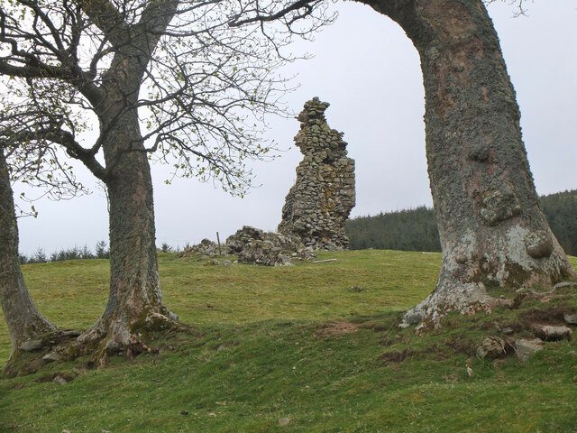
Clinty Cleugh is also known for its rich history and archaeological significance. The valley is dotted with ancient sites, including Bronze Age burial mounds and remnants of a medieval settlement. These remnants provide a glimpse into the area's past, offering an opportunity for visitors to explore and learn about the region's long history.

Outdoor activities are popular in Clinty Cleugh, with many hiking and walking trails crisscrossing the valley. The paths lead visitors through stunning landscapes, allowing them to take in the breathtaking views of the surrounding countryside. Additionally, the river that runs through the valley provides opportunities for fishing and picnicking along its banks.

For those seeking a peaceful and idyllic getaway, Clinty Cleugh in Midlothian offers a perfect destination. With its natural beauty, historical significance, and outdoor activities, the valley provides a memorable experience for visitors of all ages.

If you have any feedback on the listing, please let us know in the comments section below.

Clinty Cleugh Images

Images are sourced within 2km of 55.735477/-3.1184968 or Grid Reference NT2949. Thanks to Geograph Open Source API. All images are credited.

Fenceline on Blackhope Scar Rough ground with peat hags north-west of the summit of Blackhope Scar.
Fenceline on Blackhope Scar
Rough ground with peat hags north-west of the summit of Blackhope Scar.
Bogs and peat hags on Blackhope Scar Difficult terrain north-west of the summit of Blackhope Scar.
Bogs and peat hags on Blackhope Scar
Difficult terrain north-west of the summit of Blackhope Scar.
View down track at Clinty Cleugh, Moorfoot Hills
Gladhouse Cottage A polite request to fork left onto the track through to the South Esk.
Gladhouse Cottage
A polite request to fork left onto the track through to the South Esk.
Brick sheepfold, Hirenden Burn An unusual brick sheepfold just below the ruins of Hirendean Castle. Perhaps the sheepfold was built as part of the works by the water company when Gladhouse Reservoir was under construction in the late 1870s. There are other similar brick sheds in the South Esk valley nearby. 

The wall is starting to crumble - compare with <a href="https://www.geograph.org.uk/photo/5264453">NT2951 : Brick sheepfold, Hirendean Burn</a> taken in 2017.
Brick sheepfold, Hirenden Burn
An unusual brick sheepfold just below the ruins of Hirendean Castle. Perhaps the sheepfold was built as part of the works by the water company when Gladhouse Reservoir was under construction in the late 1870s. There are other similar brick sheds in the South Esk valley nearby. The wall is starting to crumble - compare with NT2951 : Brick sheepfold, Hirendean Burn taken in 2017.
Hirendean Castle In view is the highest part of the remaining ruin at the SW corner.

The ruins are thought to date back to the 16th century when the castle was built for Mark Kerr, Abbott of Newbattle. It is possible that it replaced an earlier structure on the site. See <span class="nowrap"><a title="http://www.stravaiging.com/history/castle/hirendean-castle/" rel="nofollow ugc noopener" href="http://www.stravaiging.com/history/castle/hirendean-castle/">Link</a><img style="margin-left:2px;" alt="External link" title="External link - shift click to open in new window" src="https://s1.geograph.org.uk/img/external.png" width="10" height="10"/></span> for more background.
Hirendean Castle
In view is the highest part of the remaining ruin at the SW corner. The ruins are thought to date back to the 16th century when the castle was built for Mark Kerr, Abbott of Newbattle. It is possible that it replaced an earlier structure on the site. See LinkExternal link for more background.
South Wall, Hirendean Castle The wall comprises most of the remaining ruin and has a window opening.

More on the history of the castle can be found at <span class="nowrap"><a title="http://www.stravaiging.com/history/castle/hirendean-castle/" rel="nofollow ugc noopener" href="http://www.stravaiging.com/history/castle/hirendean-castle/">Link</a><img style="margin-left:2px;" alt="External link" title="External link - shift click to open in new window" src="https://s1.geograph.org.uk/img/external.png" width="10" height="10"/></span>.
South Wall, Hirendean Castle
The wall comprises most of the remaining ruin and has a window opening. More on the history of the castle can be found at LinkExternal link.
Hirenden Burn The burn drains NW from the Moorfoot Hills.
Hirenden Burn
The burn drains NW from the Moorfoot Hills.
Track by the South Esk A track up the almost level valley of the South Esk - sheep grazing and the Bowbeat wind turbines just in view on the skyline.
Track by the South Esk
A track up the almost level valley of the South Esk - sheep grazing and the Bowbeat wind turbines just in view on the skyline.
Ruins of Hirendean Castle from bridge below Gladhouse Cottage
On Blackhope Scar The highest point in Midlothian [651m], a dissected plateau of rough grassy moorland. The fence marks the boundary between Midlothian [left] and the Scottish Borders [right], but it curves round to the right so that the middle distance moorland is in Midlothian. Edinburgh and the Pentland Hills are on the horizon, about 20km away.
On Blackhope Scar
The highest point in Midlothian [651m], a dissected plateau of rough grassy moorland. The fence marks the boundary between Midlothian [left] and the Scottish Borders [right], but it curves round to the right so that the middle distance moorland is in Midlothian. Edinburgh and the Pentland Hills are on the horizon, about 20km away.
Valley of a stream draining New Moss One of many streams flowing into the River South Esk. The sheep have found a good spot to enjoy the Sunday sunshine.
Valley of a stream draining New Moss
One of many streams flowing into the River South Esk. The sheep have found a good spot to enjoy the Sunday sunshine.
Moorland and Peat Hags on Wooly Law
Fence and Moorland above Little Cleave The clouds are low enough to hide the usual view of the wind turbines
Fence and Moorland above Little Cleave
The clouds are low enough to hide the usual view of the wind turbines
Fence on Blackhope Scar On the north west side looking towards the summit
Fence on Blackhope Scar
On the north west side looking towards the summit
Northwest from Huntly Cot Hills It's worth a pause to stop and look round when climbing these hills for the fine view to Gladhouse Reservoir and the Pentland Hills skyline. A new plantation is visible in the foreground.
Northwest from Huntly Cot Hills
It's worth a pause to stop and look round when climbing these hills for the fine view to Gladhouse Reservoir and the Pentland Hills skyline. A new plantation is visible in the foreground.
Moorland, Huntly Cot This must be moorland for the connoisseur with a range of plant species including bog cotton.
Moorland, Huntly Cot
This must be moorland for the connoisseur with a range of plant species including bog cotton.
Trees on the Huntly Cot Hills Seeds must have escaped (by birds or windborne?) from plantations hereabouts for these hardy specimens to take root at about 500m on this rather exposed moorland.
Trees on the Huntly Cot Hills
Seeds must have escaped (by birds or windborne?) from plantations hereabouts for these hardy specimens to take root at about 500m on this rather exposed moorland.
Show me another place!

Clinty Cleugh is located at Grid Ref: NT2949 (Lat: 55.735477, Lng: -3.1184968)

Unitary Authority: Midlothian

Police Authority: The Lothians and Scottish Borders

What 3 Words

///tickets.enforced.decimals. Near Peebles, Scottish Borders

Nearby Locations

Clinty Cleugh

Related Wikis

Blackhope Scar

Blackhope Scar is a hill in the Moorfoot Hills range, part of the Southern Uplands of Scotland. It lies to the northeast of the town of Peebles and is...

Moorfoot Hills

The Moorfoot Hills are a range of hills south of Edinburgh in east central Scotland, one of the ranges which collectively form the Southern Uplands....

Bowbeat Hill

Bowbeat Hill is a hill in the Moorfoot Hills range, part of the Southern Uplands of Scotland. It lends its name to Bowbeat Onshore Wind Farm built on the...

Gladhouse Reservoir

Gladhouse Reservoir, formerly known as Moorfoot Loch, is a reservoir in Midlothian, Scotland, five miles (8 km) south of Penicuik. It is the most southerly...

Have you been to Clinty Cleugh?

Leave your review of Clinty Cleugh below (or comments, questions and feedback).