Moss Cleuch

Valley in Peeblesshire

Scotland

Moss Cleuch

Peebles Rig from Dunslair Heights Whitehope Law (623m) is in view across the valley of the Leithen Water.
Peebles Rig from Dunslair Heights Credit: Jim Barton

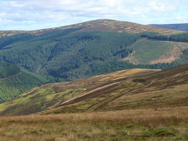
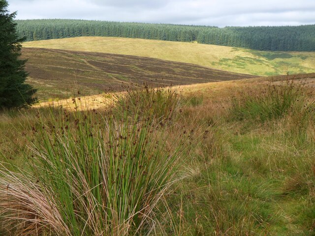
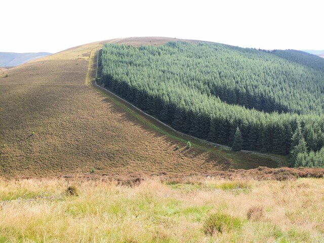
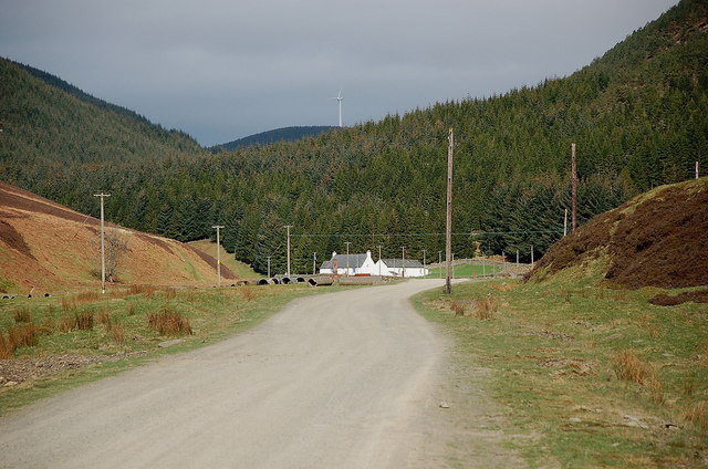
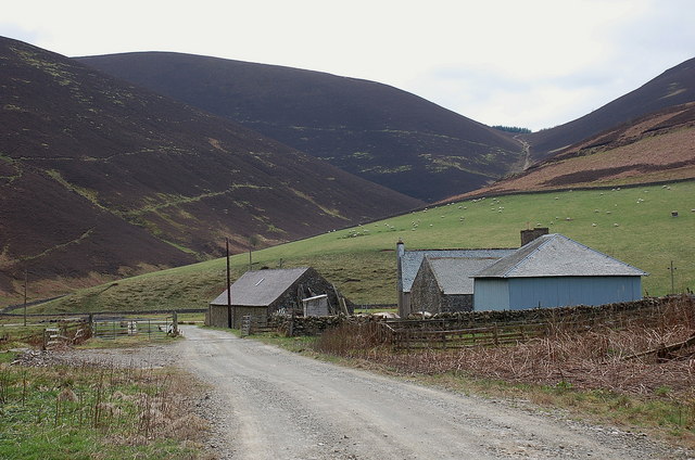
Moss Cleuch is a picturesque valley located in Peeblesshire, a historic county in the Scottish Borders region of Scotland. Known for its breathtaking natural beauty, Moss Cleuch is situated amidst the rolling hills and verdant countryside, offering visitors a tranquil and idyllic retreat.

The valley is characterized by its lush green meadows, dotted with colorful wildflowers in the warmer months. Framed by towering hills and dense woodlands, Moss Cleuch boasts a diverse range of flora and fauna, making it a haven for nature enthusiasts and wildlife lovers. The area is home to various bird species, such as peregrine falcons and red kites, as well as small mammals like red squirrels and badgers.

The centerpiece of Moss Cleuch is a gently meandering river that flows through the valley, adding to its charm and providing a peaceful soundtrack to the surrounding scenery. The river offers opportunities for leisurely walks along its banks or for fishing enthusiasts to try their luck.

For those seeking outdoor adventures, Moss Cleuch provides ample opportunities for hiking and biking. The valley is crisscrossed by a network of trails that lead visitors through enchanting woodlands and up to panoramic viewpoints. These trails cater to all levels of fitness and offer a chance to explore the area's unspoiled beauty.

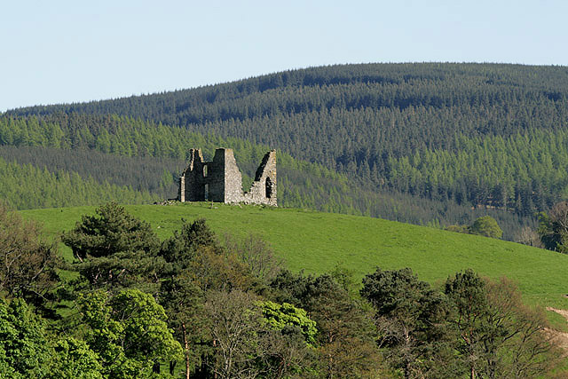
Moss Cleuch is also steeped in history and folklore, with ancient standing stones and ruins of old settlements scattered across the valley. Exploring these remnants of the past can transport visitors to a bygone era and offer glimpses into the lives of those who once called this valley home.

In summary, Moss Cleuch is a captivating valley in Peeblesshire, Scotland, renowned for its natural splendor, abundant wildlife, and rich history. Whether seeking tranquility, outdoor pursuits, or a glimpse into the past, Moss Cleuch has something to offer for everyone.

If you have any feedback on the listing, please let us know in the comments section below.

Moss Cleuch Images

Images are sourced within 2km of 55.681478/-3.1218532 or Grid Reference NT2943. Thanks to Geograph Open Source API. All images are credited.

Peebles Rig from Dunslair Heights Whitehope Law (623m) is in view across the valley of the Leithen Water.
Peebles Rig from Dunslair Heights
Whitehope Law (623m) is in view across the valley of the Leithen Water.
Summit of Leithen Door Hill Clumps of rushes on the grassy summit with the forest edge on Dunslair Heights in view across Peebles Rig.
Summit of Leithen Door Hill
Clumps of rushes on the grassy summit with the forest edge on Dunslair Heights in view across Peebles Rig.
Black Law across Leithen Door Leithen Door is a steep 60m drop and re-ascent on the ridge walk from Dunslair Heights to Lee Pen.
Black Law across Leithen Door
Leithen Door is a steep 60m drop and re-ascent on the ridge walk from Dunslair Heights to Lee Pen.
Road by the Leithen Water The road serves the farms and forestry around the Leithen Water and Wiliamslee Burn. The white cottage is Hunter's Knowe and one of the Bowbeat wind turbines is on the skyline.
Road by the Leithen Water
The road serves the farms and forestry around the Leithen Water and Wiliamslee Burn. The white cottage is Hunter's Knowe and one of the Bowbeat wind turbines is on the skyline.
Track junction at Hunters Knowe The track to the right is not shown on the 1:25,000 map, but it is likely to have been put in before bringing in the wind turbines to Bowbeat. The sign advises that the road is 'liable to icing'.
Track junction at Hunters Knowe
The track to the right is not shown on the 1:25,000 map, but it is likely to have been put in before bringing in the wind turbines to Bowbeat. The sign advises that the road is 'liable to icing'.
Leithen Water at Hunters Knowe The cottage at Hunters Knowe; two pied wagtails were close by.
Leithen Water at Hunters Knowe
The cottage at Hunters Knowe; two pied wagtails were close by.
Clear-felled area, Leithenwater Forest Trees felled here have revealed a view of the Leithen Water and Williamslee to the left. The heather-clad ridge across the valley is Lamb Law.
Clear-felled area, Leithenwater Forest
Trees felled here have revealed a view of the Leithen Water and Williamslee to the left. The heather-clad ridge across the valley is Lamb Law.
Felled area above Williamslee Burn A view down the hillside along the edge of a felled area - most of this valley has been planted and logging is taking place further up the glen.
Felled area above Williamslee Burn
A view down the hillside along the edge of a felled area - most of this valley has been planted and logging is taking place further up the glen.
Williamslee farm The steep pass of Leithen Door is on the skyline, beyond the pastures at the foot of Peebles Rig.
Williamslee farm
The steep pass of Leithen Door is on the skyline, beyond the pastures at the foot of Peebles Rig.
Leithen Door Burn A tributary of the Leithen Water. There is a pass at the head into Glentress Forest.
Leithen Door Burn
A tributary of the Leithen Water. There is a pass at the head into Glentress Forest.
The Peebles Rig A truncated spur above the Leithen Water, covered in moorland rather than the usual conifer forest. There is a road running across the hill which connects with the forest road network on Dunslair Heights.
The Peebles Rig
A truncated spur above the Leithen Water, covered in moorland rather than the usual conifer forest. There is a road running across the hill which connects with the forest road network on Dunslair Heights.
Road beside the Leithen Water The road is the main access route for the power station on Bowbeat Hill and the vast conifer plantations around the Leithen Water. It now runs on a new course to the right of Hunter's Knowe (the white building), and the hairpin shown on the maps has become overgrown.
Road beside the Leithen Water
The road is the main access route for the power station on Bowbeat Hill and the vast conifer plantations around the Leithen Water. It now runs on a new course to the right of Hunter's Knowe (the white building), and the hairpin shown on the maps has become overgrown.
Road, Hunter's Knowe The road has been rerouted and takes a single go at the gradient to the north of Hunter's Knowe rather than the mapped hairpin. It is still an easy gradient. The road is used as a logging road for the forest and is the main access to the Bowbeat Hill power station.
Road, Hunter's Knowe
The road has been rerouted and takes a single go at the gradient to the north of Hunter's Knowe rather than the mapped hairpin. It is still an easy gradient. The road is used as a logging road for the forest and is the main access to the Bowbeat Hill power station.
Logging equipment, Leithen Water A log carrier is parked up for the weekend. A block is being harvested high in Craig Hope.
Logging equipment, Leithen Water
A log carrier is parked up for the weekend. A block is being harvested high in Craig Hope.
Upgraded forest road, Williamslee Hope A lot of work has recently been done on the logging roads. Soon a lot of timber will be removed from the forest.
Upgraded forest road, Williamslee Hope
A lot of work has recently been done on the logging roads. Soon a lot of timber will be removed from the forest.
Lee Pen in view, Leithen Door Hill On a post-New-Year walk from Peebles to Innerleithen, with the final summit of Lee Pen now in sight.
Lee Pen in view, Leithen Door Hill
On a post-New-Year walk from Peebles to Innerleithen, with the final summit of Lee Pen now in sight.
Descending to Leithen Door Leithen Door is a deep col on the undulating ridge of moorland running SE from Peebles to Innerleithen. Walkers here are about to descend 70m steeply then climb nearly 100m to the summit of Black Law opposite.
Descending to Leithen Door
Leithen Door is a deep col on the undulating ridge of moorland running SE from Peebles to Innerleithen. Walkers here are about to descend 70m steeply then climb nearly 100m to the summit of Black Law opposite.
Descending the steep side of Leithen Door Walkers descending the eastern side of this deep pass on the ridge on a post-New-Year walk from Peebles to Innerleithen.
Descending the steep side of Leithen Door
Walkers descending the eastern side of this deep pass on the ridge on a post-New-Year walk from Peebles to Innerleithen.
Show me another place!

Moss Cleuch is located at Grid Ref: NT2943 (Lat: 55.681478, Lng: -3.1218532)

Unitary Authority: The Scottish Borders

Police Authority: The Lothians and Scottish Borders

What 3 Words

///revised.slept.tile. Near Peebles, Scottish Borders

Related Wikis

Glentress Forest

Glentress Forest is located near Peebles in the Scottish Borders, about 30 miles south of Edinburgh. Part of the Tweed Valley Forest Park along with Traquair...

Bowbeat Hill

Bowbeat Hill is a hill in the Moorfoot Hills range, part of the Southern Uplands of Scotland. It lends its name to Bowbeat Onshore Wind Farm built on the...

Nether Horsburgh Castle

Nether Horsburgh Castle is a ruined tower house near Cardrona, in the Scottish Borders, in the former county of Peebleshire. It is situated at the back...

Horsburgh Castle

Horsburgh Castle, also known as Horsbrugh Castle or Horsbrugh Tower, is a ruined tower house castle by the River Tweed, on the A72 road from Peebles to...

Nearby Amenities

Located within 500m of 55.681478,-3.1218532
Sherra Law
Ele: 562
Natural: peak
Lat/Long: 55.6846032/-3.1239924
Power: pole
Lat/Long: 55.6809337/-3.1143218
Power: pole
Lat/Long: 55.6806236/-3.115519
Power: pole
Lat/Long: 55.6803445/-3.1166444
Power: pole
Lat/Long: 55.6800976/-3.1176259
Power: pole
Lat/Long: 55.6798901/-3.1184784
Power: pole
Lat/Long: 55.6796838/-3.1193478
Power: pole
Lat/Long: 55.6794715/-3.1202087
Power: pole
Lat/Long: 55.6792616/-3.1210887
Power: pole
Lat/Long: 55.6790397/-3.1220448
Power: pole
Lat/Long: 55.6788239/-3.1229756
Power: pole
Lat/Long: 55.6786116/-3.1238936
Power: pole
Lat/Long: 55.67841/-3.1247694
Power: pole
Lat/Long: 55.6782156/-3.1256409
Power: pole
Lat/Long: 55.677915/-3.1263728
The data included in this document is from www.openstreetmap.org. The data is made available under ODbL.

Have you been to Moss Cleuch?

Leave your review of Moss Cleuch below (or comments, questions and feedback).