Glen Dean

Valley in Peeblesshire

Scotland

Glen Dean

Signposted route to Peebles, Bught Rig Signposts send you up a boggy ride (still wet in the driest of Summers). The going is easier once you get here.
Signposted route to Peebles, Bught Rig Credit: Richard Webb

Glen Dean is a picturesque valley located in Peeblesshire, Scotland. Nestled within the Southern Uplands, this enchanting glen is known for its stunning natural beauty and tranquil atmosphere. The valley stretches for several miles, encompassing lush green meadows, rolling hills, and meandering streams.

The landscape of Glen Dean is characterized by its rugged terrain and dramatic scenery. Towering hills surround the valley, providing a breathtaking backdrop for outdoor enthusiasts and nature lovers. The glen is a haven for hikers, offering a variety of trails that cater to different levels of difficulty. From leisurely strolls along the riverside to challenging climbs up steep slopes, there is something for everyone to enjoy.

The verdant meadows of Glen Dean are home to a diverse range of flora and fauna. The valley boasts a rich biodiversity, with numerous species of plants, birds, and animals residing in the area. Rare wildflowers, such as orchids and bluebells, can be spotted during the spring and summer months, adding a burst of color to the landscape.

In addition to its natural beauty, Glen Dean also boasts a rich cultural heritage. The valley is dotted with historical sites and ancient ruins, providing a glimpse into Scotland's past. Visitors can explore ancient castles, stone circles, and archaeological sites, immersing themselves in the region's fascinating history.

Overall, Glen Dean is a hidden gem in Peeblesshire, offering a serene escape from the hustle and bustle of everyday life. Whether you are seeking adventure in the great outdoors or a peaceful retreat amidst nature, this captivating valley is sure to leave a lasting impression.

If you have any feedback on the listing, please let us know in the comments section below.

Glen Dean Images

Images are sourced within 2km of 55.560945/-3.143847 or Grid Reference NT2730. Thanks to Geograph Open Source API. All images are credited.

Signposted route to Peebles, Bught Rig Signposts send you up a boggy ride (still wet in the driest of Summers). The going is easier once you get here.
Signposted route to Peebles, Bught Rig
Signposts send you up a boggy ride (still wet in the driest of Summers). The going is easier once you get here.
Upgraded road, Brakehope Burn There has been some timber extraction further up the road.
Upgraded road, Brakehope Burn
There has been some timber extraction further up the road.
Douglas Burn to The Glen path An old route but utterly horrible within the forest. Ruts to start with then deep bog.
Douglas Burn to The Glen path
An old route but utterly horrible within the forest. Ruts to start with then deep bog.
Signpost, Brakehope Burn Left up a waterlogged (even in the driest of Summers) ride. Not pleasant. I don't know if the mapped path straight ahead goes or not.
Signpost, Brakehope Burn
Left up a waterlogged (even in the driest of Summers) ride. Not pleasant. I don't know if the mapped path straight ahead goes or not.
Wet ride Signposted route between the Yarrow Water and Peebles via Blackhouse. These could be the driest conditions in living memory but the ride is still a swamp. The trees are mature, and roads upgraded so there will be changes through harvesting and replanting.
Wet ride
Signposted route between the Yarrow Water and Peebles via Blackhouse. These could be the driest conditions in living memory but the ride is still a swamp. The trees are mature, and roads upgraded so there will be changes through harvesting and replanting.
Fence and ride, Whiteknowe Head A remnant of past use for sheep farming.
Fence and ride, Whiteknowe Head
A remnant of past use for sheep farming.
Signposted route to Peebles Signposted route between the Yarrow Water and Peebles via Blackhouse. These could be the driest conditions in living memory but the ride is still a swamp in places. Tyre tracks show evidence of past suffering (I was on foot).The trees are mature, and roads upgraded so there will be changes through harvesting and replanting.
Signposted route to Peebles
Signposted route between the Yarrow Water and Peebles via Blackhouse. These could be the driest conditions in living memory but the ride is still a swamp in places. Tyre tracks show evidence of past suffering (I was on foot).The trees are mature, and roads upgraded so there will be changes through harvesting and replanting.
Sitka Dense plantation above the Douglas Burn.
Sitka
Dense plantation above the Douglas Burn.
The Southern Upland Way near Middle Rig
The Southern Upland Way near Kinchie Cleuch Burn
A stone setting on Bught Rig This stone circle marked on the Explorer map is located in a small clearing in Sitka forestry on Bught Rig. I counted eight stones which are mostly moss-covered but there could be more underground. The largest stone at the top left is approximately 550mm high and 400mm wide at the base tapering up to 500mm at the top.
A stone setting on Bught Rig
This stone circle marked on the Explorer map is located in a small clearing in Sitka forestry on Bught Rig. I counted eight stones which are mostly moss-covered but there could be more underground. The largest stone at the top left is approximately 550mm high and 400mm wide at the base tapering up to 500mm at the top.
A standing stone on Bught Rig This is the largest stone in a setting on Bught Rig. The stone is approximately 550mm high and 400mm wide at the base tapering up to 500mm at the top. The stones are difficult to photograph in this small clearing in Sitka forestry but for a wider view, see <a href="https://www.geograph.org.uk/photo/2804517">NT2628 : A stone setting on Bught Rig</a>.
A standing stone on Bught Rig
This is the largest stone in a setting on Bught Rig. The stone is approximately 550mm high and 400mm wide at the base tapering up to 500mm at the top. The stones are difficult to photograph in this small clearing in Sitka forestry but for a wider view, see NT2628 : A stone setting on Bught Rig.
A watch tower at Bught Rig This forestry observation hide is in a small clearing to the northeast of the Bught Rig standing stones.
A watch tower at Bught Rig
This forestry observation hide is in a small clearing to the northeast of the Bught Rig standing stones.
The Douglas Stones at Bught Rig This small stone setting in a clearing in Sitka forestry is marked on the Explorer map. Three Sitka trees have fallen over the site and although there should be eight stones I could only count five. This is the largest stone which measured approximately 800mm x 500mm x 550mm high.
The Douglas Stones at Bught Rig
This small stone setting in a clearing in Sitka forestry is marked on the Explorer map. Three Sitka trees have fallen over the site and although there should be eight stones I could only count five. This is the largest stone which measured approximately 800mm x 500mm x 550mm high.
The Douglas Stones at Bught Rig This small stone setting in a clearing in Sitka forestry is marked on the Explorer map. Unfortunately three Sitka trees have fallen over the site and although there should be eight stones I could only see five stones.
The Douglas Stones at Bught Rig
This small stone setting in a clearing in Sitka forestry is marked on the Explorer map. Unfortunately three Sitka trees have fallen over the site and although there should be eight stones I could only see five stones.
Forest break Looking across the Brakehope Burn onto Brakehope Rig.
Forest break
Looking across the Brakehope Burn onto Brakehope Rig.
Path through the forest The mapped path leading onto Whiteknowe Head doesn't exist, if it ever did.  There is a path, but it follows the line of the forest break, mapped at 1:25000 scale.

The path the signposted in places.
Path through the forest
The mapped path leading onto Whiteknowe Head doesn't exist, if it ever did. There is a path, but it follows the line of the forest break, mapped at 1:25000 scale. The path the signposted in places.
Show me another place!

Glen Dean is located at Grid Ref: NT2730 (Lat: 55.560945, Lng: -3.143847)

Unitary Authority: The Scottish Borders

Police Authority: The Lothians and Scottish Borders

What 3 Words

///spotted.ratio.bogus. Near Innerleithen, Scottish Borders

Nearby Locations

Glen Dean

Related Wikis

Dun Rig

Dun Rig is a hill in the Manor Hills range, part of the Southern Uplands of Scotland. It is the highest hill in the northernmost cluster of the Manor Hills...

The Glen, Scottish Borders

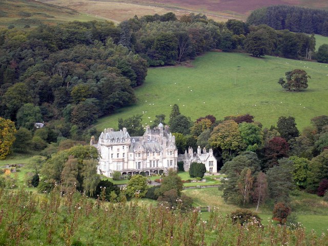
The Glen, also known as Glen House, is an estate and country house in the parish of Traquair, southern Scotland. It is located in the glen of the Quair...

Manor Hills

The Manor Hills, also known as the Tweedsmuir Hills, are a range of hills south of Peebles in the Scottish Borders, one of the ranges which collectively...
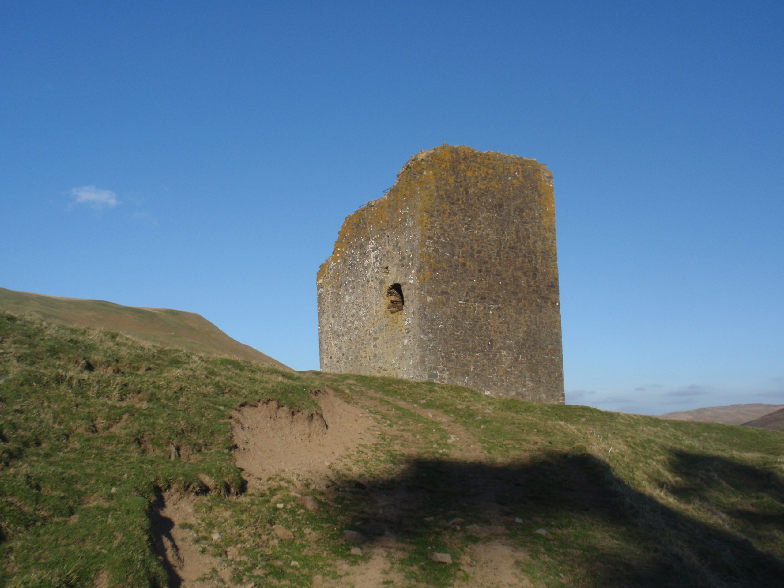
Dryhope Tower

Dryhope Tower is a ruined Scottish peel tower in the valley of the Yarrow Water, in the historic county of Selkirkshire, now part of the Scottish Borders...

Have you been to Glen Dean?

Leave your review of Glen Dean below (or comments, questions and feedback).