Gums Cleuch

Valley in Peeblesshire

Scotland

Gums Cleuch

Signposted route to Peebles, Bught Rig Signposts send you up a boggy ride (still wet in the driest of Summers). The going is easier once you get here.
Signposted route to Peebles, Bught Rig Credit: Richard Webb

Gums Cleuch is a picturesque valley located in the county of Peeblesshire, Scotland. Situated in the southern part of the country, this valley offers stunning natural beauty and a rich historical background.

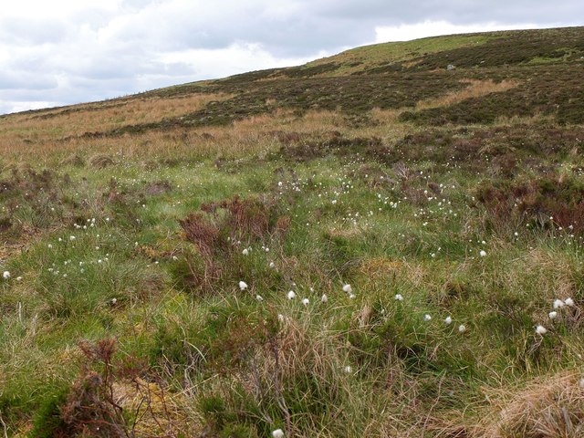
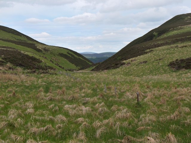
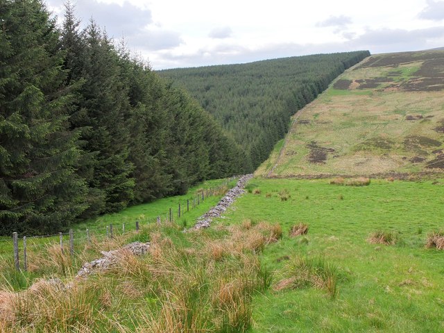
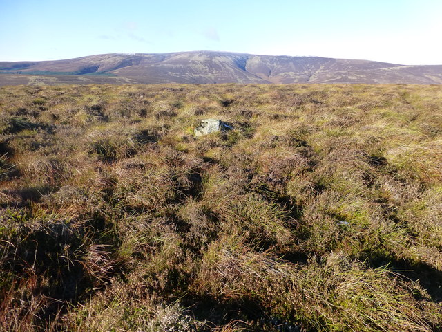
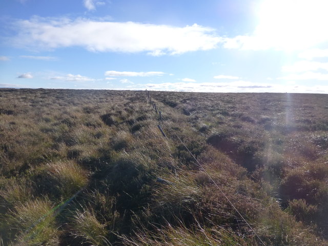
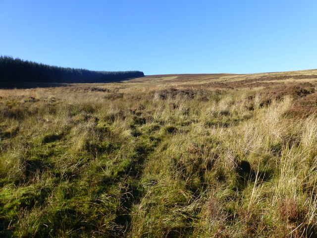
Surrounded by rolling hills and lush greenery, Gums Cleuch is known for its tranquil atmosphere and breathtaking landscapes. The valley is traversed by a small stream, which adds to its charm and provides a soothing sound as it meanders through the valley floor. The area is abundant in wildlife, with various bird species, deer, and other small animals often spotted in the vicinity.

Gums Cleuch has a long and storied history, with evidence of human settlement dating back thousands of years. The valley contains several ancient archaeological sites, including prehistoric burial mounds and remnants of old settlements, providing a glimpse into the lives of past civilizations.

For outdoor enthusiasts, Gums Cleuch offers numerous activities such as hiking, cycling, and nature walks. The valley is crisscrossed by a network of trails that cater to different skill levels, allowing visitors to explore the area at their own pace. The surrounding countryside offers breathtaking views, making it a popular destination for photographers and nature lovers alike.

In summary, Gums Cleuch is a beautiful valley in Peeblesshire, Scotland, known for its natural beauty, rich history, and recreational opportunities. Whether one seeks tranquility, outdoor adventures, or a glimpse into the past, this valley has something to offer for everyone.

If you have any feedback on the listing, please let us know in the comments section below.

Gums Cleuch Images

Images are sourced within 2km of 55.56506/-3.1620911 or Grid Reference NT2630. Thanks to Geograph Open Source API. All images are credited.

Signposted route to Peebles, Bught Rig Signposts send you up a boggy ride (still wet in the driest of Summers). The going is easier once you get here.
Signposted route to Peebles, Bught Rig
Signposts send you up a boggy ride (still wet in the driest of Summers). The going is easier once you get here.
Signpost, Brakehope Burn Left up a waterlogged (even in the driest of Summers) ride. Not pleasant. I don't know if the mapped path straight ahead goes or not.
Signpost, Brakehope Burn
Left up a waterlogged (even in the driest of Summers) ride. Not pleasant. I don't know if the mapped path straight ahead goes or not.
Wet ride Signposted route between the Yarrow Water and Peebles via Blackhouse. These could be the driest conditions in living memory but the ride is still a swamp. The trees are mature, and roads upgraded so there will be changes through harvesting and replanting.
Wet ride
Signposted route between the Yarrow Water and Peebles via Blackhouse. These could be the driest conditions in living memory but the ride is still a swamp. The trees are mature, and roads upgraded so there will be changes through harvesting and replanting.
Fence and ride, Whiteknowe Head A remnant of past use for sheep farming.
Fence and ride, Whiteknowe Head
A remnant of past use for sheep farming.
Signposted route to Peebles Signposted route between the Yarrow Water and Peebles via Blackhouse. These could be the driest conditions in living memory but the ride is still a swamp in places. Tyre tracks show evidence of past suffering (I was on foot).The trees are mature, and roads upgraded so there will be changes through harvesting and replanting.
Signposted route to Peebles
Signposted route between the Yarrow Water and Peebles via Blackhouse. These could be the driest conditions in living memory but the ride is still a swamp in places. Tyre tracks show evidence of past suffering (I was on foot).The trees are mature, and roads upgraded so there will be changes through harvesting and replanting.
Sitka Dense plantation above the Douglas Burn.
Sitka
Dense plantation above the Douglas Burn.
A stone setting on Bught Rig This stone circle marked on the Explorer map is located in a small clearing in Sitka forestry on Bught Rig. I counted eight stones which are mostly moss-covered but there could be more underground. The largest stone at the top left is approximately 550mm high and 400mm wide at the base tapering up to 500mm at the top.
A stone setting on Bught Rig
This stone circle marked on the Explorer map is located in a small clearing in Sitka forestry on Bught Rig. I counted eight stones which are mostly moss-covered but there could be more underground. The largest stone at the top left is approximately 550mm high and 400mm wide at the base tapering up to 500mm at the top.
A standing stone on Bught Rig This is the largest stone in a setting on Bught Rig. The stone is approximately 550mm high and 400mm wide at the base tapering up to 500mm at the top. The stones are difficult to photograph in this small clearing in Sitka forestry but for a wider view, see <a href="https://www.geograph.org.uk/photo/2804517">NT2628 : A stone setting on Bught Rig</a>.
A standing stone on Bught Rig
This is the largest stone in a setting on Bught Rig. The stone is approximately 550mm high and 400mm wide at the base tapering up to 500mm at the top. The stones are difficult to photograph in this small clearing in Sitka forestry but for a wider view, see NT2628 : A stone setting on Bught Rig.
A watch tower at Bught Rig This forestry observation hide is in a small clearing to the northeast of the Bught Rig standing stones.
A watch tower at Bught Rig
This forestry observation hide is in a small clearing to the northeast of the Bught Rig standing stones.
A forestry road at Bught Rig
Path through the forest The mapped path leading onto Whiteknowe Head doesn't exist, if it ever did.  There is a path, but it follows the line of the forest break, mapped at 1:25000 scale.

The path the signposted in places.
Path through the forest
The mapped path leading onto Whiteknowe Head doesn't exist, if it ever did. There is a path, but it follows the line of the forest break, mapped at 1:25000 scale. The path the signposted in places.
Top of the forest The Craig Douglas to Glen Sax path emerges out of the forest at this point.  The route becomes a little indistinct across the moorland.
Top of the forest
The Craig Douglas to Glen Sax path emerges out of the forest at this point. The route becomes a little indistinct across the moorland.
Cotton grass on Peat Hill A rough area of flat boggy ground, heather and tussocks with cotton grass as a warning of conditions underfoot. It's clear from the GPS location here that your photographer has wandered off the 'path' in a fruitless attempt to find easier ground.
Cotton grass on Peat Hill
A rough area of flat boggy ground, heather and tussocks with cotton grass as a warning of conditions underfoot. It's clear from the GPS location here that your photographer has wandered off the 'path' in a fruitless attempt to find easier ground.
Col at the head of Glendean Banks An old fence runs from the forest edge towards the steep-sided valley of Glendean Banks.
Col at the head of Glendean Banks
An old fence runs from the forest edge towards the steep-sided valley of Glendean Banks.
Forest edge to Whiteknowe Head This forest is less than 35 years old - it does not appear on the Harvey Map Services 1:40,000 map produced in 1978 for the Karrimor International Mountain Marathon. An area SE of Deuchar Law is shown as 'new plantation'. 

More on the KIMM event is given in <a href="https://www.geograph.org.uk/photo/3508914">NT2730 : Glenshiel Banks cottage</a>.
Forest edge to Whiteknowe Head
This forest is less than 35 years old - it does not appear on the Harvey Map Services 1:40,000 map produced in 1978 for the Karrimor International Mountain Marathon. An area SE of Deuchar Law is shown as 'new plantation'. More on the KIMM event is given in NT2730 : Glenshiel Banks cottage.
Deuchar Law Parked passed Kirkhouse to use the Southern Upland Way to Blake Muir, Deuhar Law, Whiteknowe Head, Dun Rig, Stake Law and Birkscairn Hill before descending to Glen House Estate Farm to use the minor road back to Kirkhouse.
Name: Deuchar Law
Hill number: 1923
Height: 543m / 1781ft
Area: 28B: The River Tweed to the English Border
Class: Ma,5D
Grid ref: NT 28499 29698
Summit feature: small pile of stones
Drop: 155m
Col: 388m  NT276293
Deuchar Law
Parked passed Kirkhouse to use the Southern Upland Way to Blake Muir, Deuhar Law, Whiteknowe Head, Dun Rig, Stake Law and Birkscairn Hill before descending to Glen House Estate Farm to use the minor road back to Kirkhouse. Name: Deuchar Law Hill number: 1923 Height: 543m / 1781ft Area: 28B: The River Tweed to the English Border Class: Ma,5D Grid ref: NT 28499 29698 Summit feature: small pile of stones Drop: 155m Col: 388m NT276293
Whiteknowe Head Ticked flat moorland plateau with Chris Watson. Parked passed Kirkhouse to use the Southern Upland Way to Blake Muir, Deuhar Law, Whiteknowe Head, Dun Rig, Stake Law and Birkscairn Hill before descending to Glen House Estate Farm to use the minor road back to Kirkhouse.  Summit is on the right of the fence looking towards the sun but very flat heathery plateau.
Name: Whiteknowe Head
Hill number: 7437
Height: 513m / 1683ft
Area: 28B: The River Tweed to the English Border
Class: s5D
Grid ref: NT 26880 29693
Summit feature: no feature: heather
Drop: 28m
Col: 485m  NT265303
Whiteknowe Head
Ticked flat moorland plateau with Chris Watson. Parked passed Kirkhouse to use the Southern Upland Way to Blake Muir, Deuhar Law, Whiteknowe Head, Dun Rig, Stake Law and Birkscairn Hill before descending to Glen House Estate Farm to use the minor road back to Kirkhouse. Summit is on the right of the fence looking towards the sun but very flat heathery plateau. Name: Whiteknowe Head Hill number: 7437 Height: 513m / 1683ft Area: 28B: The River Tweed to the English Border Class: s5D Grid ref: NT 26880 29693 Summit feature: no feature: heather Drop: 28m Col: 485m NT265303
Heading For Whiteknowe Head A view along the forest edge and rising moorland towards Whiteknowe Head.
Heading For Whiteknowe Head
A view along the forest edge and rising moorland towards Whiteknowe Head.
Show me another place!

Gums Cleuch is located at Grid Ref: NT2630 (Lat: 55.56506, Lng: -3.1620911)

Unitary Authority: The Scottish Borders

Police Authority: The Lothians and Scottish Borders

What 3 Words

///asserts.taxed.reseller. Near Innerleithen, Scottish Borders

Nearby Locations

Gums Cleuch

Related Wikis

Dun Rig

Dun Rig is a hill in the Manor Hills range, part of the Southern Uplands of Scotland. It is the highest hill in the northernmost cluster of the Manor Hills...

Manor Hills

The Manor Hills, also known as the Tweedsmuir Hills, are a range of hills south of Peebles in the Scottish Borders, one of the ranges which collectively...

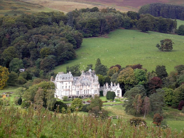
The Glen, Scottish Borders

The Glen, also known as Glen House, is an estate and country house in the parish of Traquair, southern Scotland. It is located in the glen of the Quair...

Black Law (hill)

Black Law is a hill in the Manor Hills range, part of the Southern Uplands of Scotland. One of the more remote Donalds, it does not easily combine into...

Nearby Amenities

Located within 500m of 55.56506,-3.1620911
Glenshiel Banks
Place: locality
Lat/Long: 55.5669895/-3.1562791
The data included in this document is from www.openstreetmap.org. The data is made available under ODbL.

Have you been to Gums Cleuch?

Leave your review of Gums Cleuch below (or comments, questions and feedback).