Glen of Gilliegonger

Valley in Orkney

Scotland

Glen of Gilliegonger

Grassland below Ward Hill
Grassland below Ward Hill Credit: David Medcalf

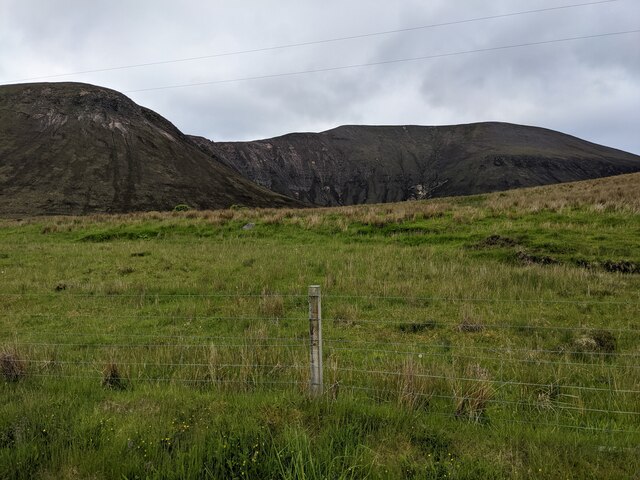
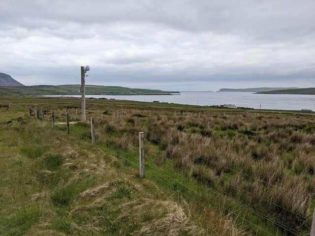
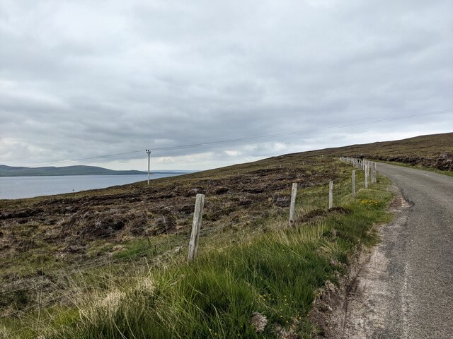
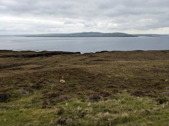
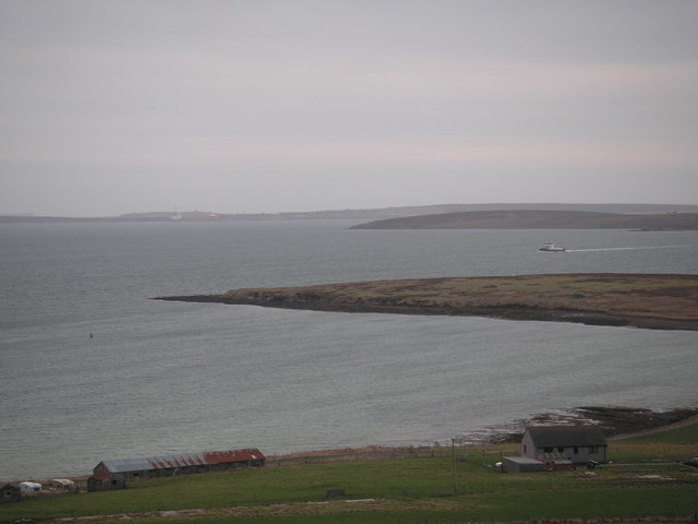
The Glen of Gilliegonger, Orkney, is a picturesque valley located in the northern part of Scotland, specifically in the Orkney Islands. This valley is renowned for its stunning natural beauty and rich historical significance. Nestled amidst rolling hills and lush green landscapes, it offers a truly idyllic setting for visitors.

The Glen of Gilliegonger is known for its diverse flora and fauna, with a variety of wildflowers, trees, and animals calling it home. The valley is particularly famous for its vibrant display of heather, which blankets the hillsides in a stunning purple hue during the summer months. The area is a haven for birdwatchers, as it is home to a wide range of bird species, including puffins, guillemots, and razorbills.

In addition to its natural beauty, the Glen of Gilliegonger also boasts a rich historical heritage. The valley is dotted with ancient archaeological sites, such as tomb cairns and standing stones, which provide valuable insights into the region's past. These sites are believed to date back to the Neolithic period and are a testament to the early inhabitants' ingenuity and craftsmanship.

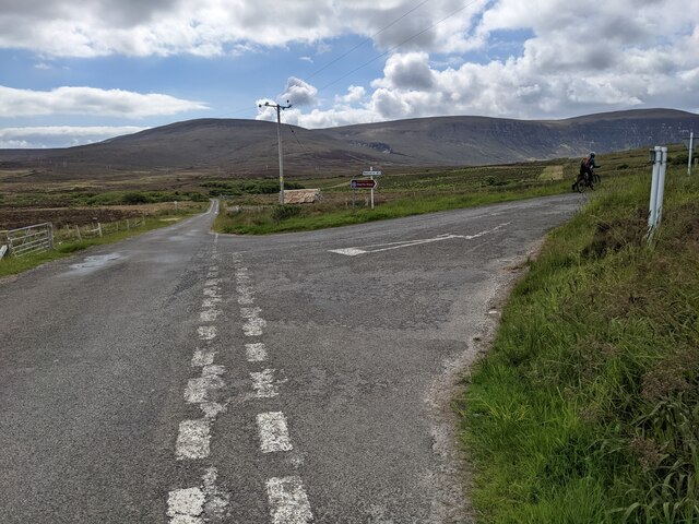
Visitors to the Glen of Gilliegonger can enjoy a range of outdoor activities, including hiking, birdwatching, and photography. The valley offers numerous walking trails that lead through its enchanting landscapes, allowing visitors to fully immerse themselves in the tranquility of the surroundings.

Overall, the Glen of Gilliegonger in Orkney is a destination that combines breathtaking natural beauty with a rich historical heritage, making it a must-visit location for nature enthusiasts and history buffs alike.

If you have any feedback on the listing, please let us know in the comments section below.

Glen of Gilliegonger Images

Images are sourced within 2km of 58.899268/-3.2860185 or Grid Reference HY2602. Thanks to Geograph Open Source API. All images are credited.

Grassland below Ward Hill
The road to Rackwick
Not exactly a forest This is shown as a wooded area on the OS map. It's more scrubland than wood.
Not exactly a forest
This is shown as a wooded area on the OS map. It's more scrubland than wood.
The power lines to Rackwick
The long straight road at Quoyness
Rough fields above Burgar
The local communications centre A radio dish to receive the signal from Orkney Mainland.
The local communications centre
A radio dish to receive the signal from Orkney Mainland.
The minor road and moorland.   Orkney has some great names. The moorland is between the Glen of Gilliegonger and the Green Noses.
The minor road and moorland.
Orkney has some great names. The moorland is between the Glen of Gilliegonger and the Green Noses.
Moorland and powerlines
Moorland above the road The map, and the aerial view, show a network of old tracks across this area. Presumably military in origin.
Moorland above the road
The map, and the aerial view, show a network of old tracks across this area. Presumably military in origin.
Moorland below the road The burn is not named on the map, but it leads down to The Bring.
Moorland below the road
The burn is not named on the map, but it leads down to The Bring.
The Burn of the Sale This interestingly named burn has eroded a way through the peat, shown as a black line, centre left. A fish farm is just visible near the coast on the left.
The Burn of the Sale
This interestingly named burn has eroded a way through the peat, shown as a black line, centre left. A fish farm is just visible near the coast on the left.
Old Milestone by the B9047, Candle of the Sale, Hoy and Graemsay Parish By the B9047, in parish of Hoy and Graemsay (Hoy District), on straight, on verge, south west side of road.

Surveyed

Milestone Society National ID: OR_HYHYNN03
Old Milestone by the B9047, Candle of the Sale, Hoy and Graemsay Parish
By the B9047, in parish of Hoy and Graemsay (Hoy District), on straight, on verge, south west side of road. Surveyed Milestone Society National ID: OR_HYHYNN03
Hoy: roadworks on the Rackwick road Looking through my windscreen after pulling into a passing place. The chap is repairing the edges of the road by shovelling tarmacky grit along the parts that need replenishing and it must be a frustrating job. Every time a car wants to pass, he will have to manoeuvre into a passing place to allow the car to proceed, and then return to his position. Although there isn't much traffic along here, there are a good 4 or so miles from here to Rackwick and I would see him about three hours later, as I was leaving Rackwick and he hadn't quite got there.
Hoy: roadworks on the Rackwick road
Looking through my windscreen after pulling into a passing place. The chap is repairing the edges of the road by shovelling tarmacky grit along the parts that need replenishing and it must be a frustrating job. Every time a car wants to pass, he will have to manoeuvre into a passing place to allow the car to proceed, and then return to his position. Although there isn't much traffic along here, there are a good 4 or so miles from here to Rackwick and I would see him about three hours later, as I was leaving Rackwick and he hadn't quite got there.
Hoy: Whiteglen and Quoyawa A house, Whiteglen, is dwarfed by the mighty slopes of Quoyawa, the eastern side of Ward Hill which peaks at 479m above sea level. The house is named after White Glen, which is the glen carved out by a stream visible down the centre of the picture.
Hoy: Whiteglen and Quoyawa
A house, Whiteglen, is dwarfed by the mighty slopes of Quoyawa, the eastern side of Ward Hill which peaks at 479m above sea level. The house is named after White Glen, which is the glen carved out by a stream visible down the centre of the picture.
Hoy: view over Graemsay The B9047 descends towards northern Hoy and the island of Graemsay is spread out in its entirety before us. The town of Stromness is discernible beyond.
Hoy: view over Graemsay
The B9047 descends towards northern Hoy and the island of Graemsay is spread out in its entirety before us. The town of Stromness is discernible beyond.
Milestone south of Whaness bridge
The melancholy of the gloaming on Hoy Like the dew on a spider's web the light of the gloaming ices the wires on the lonely moor when right on cue a curlew cried.
The melancholy of the gloaming on Hoy
Like the dew on a spider's web the light of the gloaming ices the wires on the lonely moor when right on cue a curlew cried.
Show me another place!

Glen of Gilliegonger is located at Grid Ref: HY2602 (Lat: 58.899268, Lng: -3.2860185)

Unitary Authority: Orkney Islands

Police Authority: Highlands and Islands

What 3 Words

///blazers.splits.corrupted. Near Stromness, Orkney Islands

Related Wikis

Dwarfie Stane

The Dwarfie Stane is a megalithic chambered tomb carved out of a titanic block of Devonian Old Red Sandstone located in a steep-sided glaciated valley...

Ward Hill, Hoy

Ward Hill is a hill on the island of Hoy in Orkney, Scotland. It lies at the north of the island between Moaness and Rackwick, and is the highest point...

Graemsay

Graemsay () is an island in the western approaches to Scapa Flow, in the Orkney Islands of Scotland. The island has two lighthouses. Graemsay lies within...

Clestrain Sound

Clestrain Sound is a strait between Mainland Orkney and the Isle of Graemsay within the Orkney Islands, Scotland.Clestrain Sound lies in the western entrance...

Hoy, Orkney

Hoy (Scots: Hoy; from Old Norse Háey, meaning "high island") is an island in Orkney, Scotland, measuring 143 square kilometres (55 sq mi) – the second...

Holm of Houton

The Holm of Houton is one of the southern Orkney islands. == Geography == The Holm is in Midland Harbour, part of Scapa Flow. It is south of the Mainland...

Scuttling of the German fleet at Scapa Flow

Shortly after the end of the First World War, the Imperial German Navy was scuttled by its sailors while held off the harbour of the British Royal Navy...

Houton

Houton is a settlement 5 miles (8.0 km) southeast of Stromness on the island of Mainland, Orkney, Scotland. The settlement is within the parish of Orphir...

Nearby Amenities

Located within 500m of 58.899268,-3.2860185
Power: pole
Lat/Long: 58.9033546/-3.284778
Power: pole
Lat/Long: 58.9033962/-3.2856712
Power: pole
Lat/Long: 58.9025899/-3.2836729
Power: pole
Lat/Long: 58.9024819/-3.2839412
Power: pole
Lat/Long: 58.9021729/-3.28455
Power: pole
Lat/Long: 58.9017961/-3.2853359
Power: pole
Lat/Long: 58.9012045/-3.2866609
Power: pole
Lat/Long: 58.900746/-3.2876426
Power: pole
Lat/Long: 58.9002181/-3.2887584
Power: pole
Lat/Long: 58.9003691/-3.2899573
Power: pole
Lat/Long: 58.9005506/-3.2911965
Power: pole
Lat/Long: 58.9007044/-3.2924143
Power: pole
Lat/Long: 58.9008554/-3.2938412
Power: pole
Lat/Long: 58.9033006/-3.2837534
Power: pole
Lat/Long: 58.9025788/-3.2841557
Power: pole
Lat/Long: 58.9022879/-3.2847726
Power: pole
Lat/Long: 58.9019208/-3.2855746
Power: pole
Lat/Long: 58.9016118/-3.2862076
Power: pole
Lat/Long: 58.9012918/-3.2868433
Power: pole
Lat/Long: 58.9008346/-3.2878652
Power: pole
Lat/Long: 58.9003844/-3.2888496
Power: pole
Lat/Long: 58.9004966/-3.2899144
Power: pole
Lat/Long: 58.9006504/-3.2911482
Power: pole
Lat/Long: 58.9008291/-3.2923177
Power: pole
Lat/Long: 58.9009759/-3.29375
Power: pole
Lat/Long: 58.9018751/-3.2836702
Power: pole
Lat/Long: 58.9012586/-3.2836407
Power: pole
Lat/Long: 58.9005672/-3.2836166
Power: pole
Lat/Long: 58.8999105/-3.2835951
Power: pole
Lat/Long: 58.8993522/-3.2835978
Power: pole
Lat/Long: 58.8986705/-3.2835764
Power: pole
Lat/Long: 58.8982424/-3.2835764
Power: pole
Lat/Long: 58.8978739/-3.2825786
Power: pole
Lat/Long: 58.8974998/-3.2814333
Power: pole
Lat/Long: 58.8966934/-3.2790434
The data included in this document is from www.openstreetmap.org. The data is made available under ODbL.

Have you been to Glen of Gilliegonger?

Leave your review of Glen of Gilliegonger below (or comments, questions and feedback).