Corrie of Fee

Valley in Angus

Scotland

Corrie of Fee

Corrie Fee
Corrie Fee Credit: Steven Brown

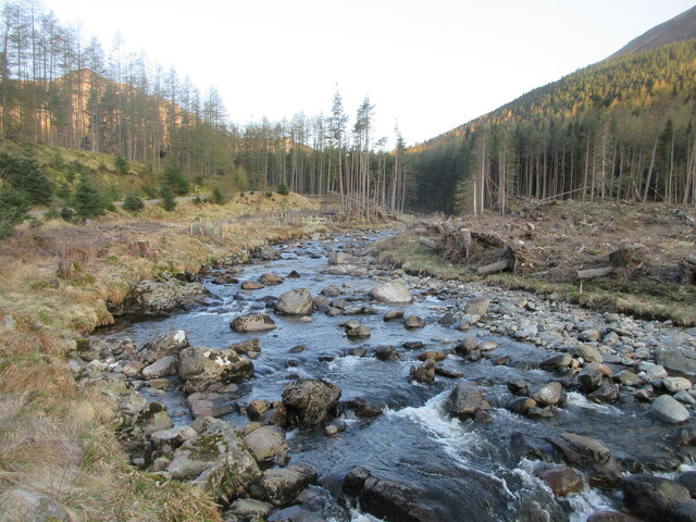
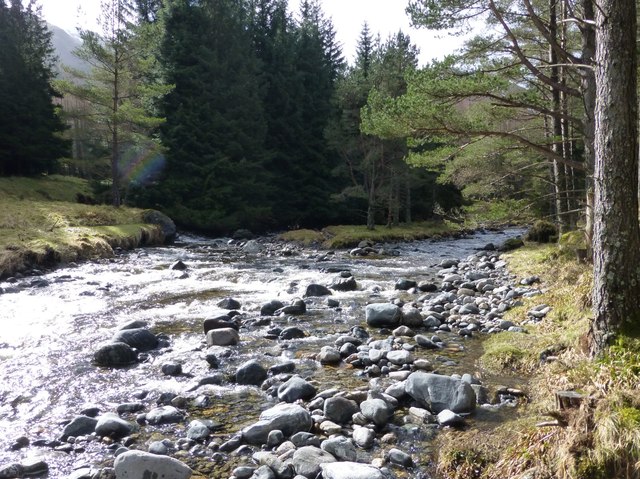
Corrie of Fee is a picturesque, glacial valley located in the Angus region of Scotland. Nestled within the Cairngorms National Park, it is renowned for its stunning natural beauty and diverse wildlife.

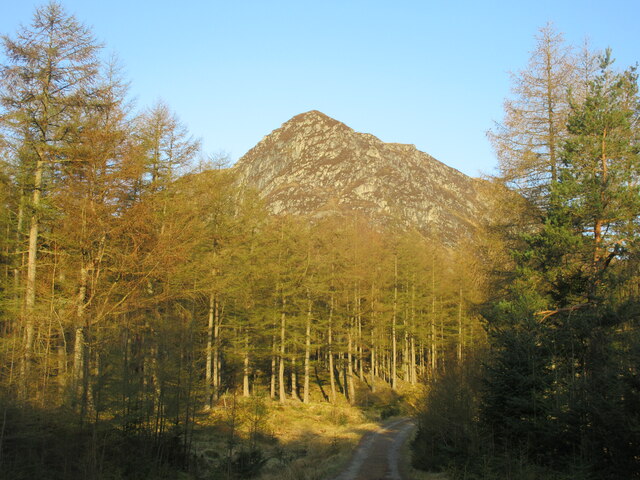
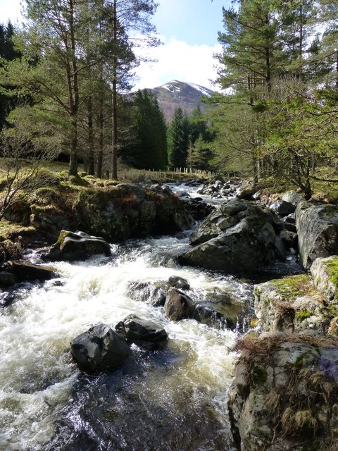
The valley is formed by the Fee Burn, a meandering river that flows through the heart of Corrie of Fee. The river is fed by melting snow and rainfall, creating a lush and fertile landscape. The surrounding mountains, including the prominent Munro peaks of Mayar and Driesh, provide a breathtaking backdrop to the valley.

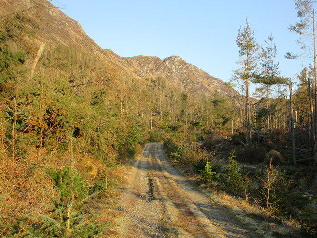
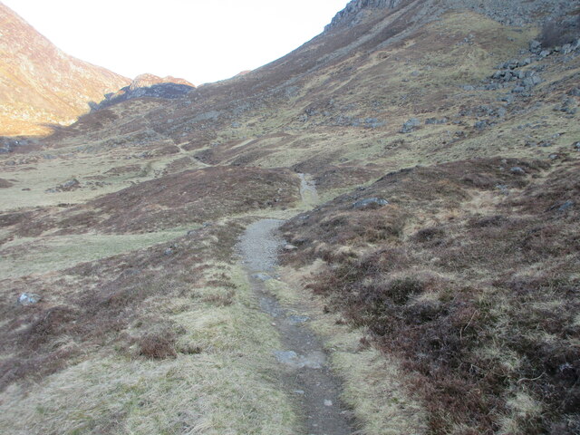
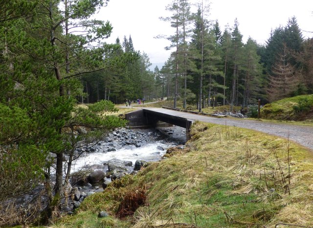
Corrie of Fee is a haven for outdoor enthusiasts, offering a range of activities such as hiking, mountain biking, and wildlife spotting. The valley boasts several well-marked trails, catering to all levels of fitness and experience. One of the most popular routes is the circular walk that takes visitors through the dramatic corrie and up to the summit of Mayar.

Wildlife enthusiasts will be delighted by the abundance of flora and fauna in Corrie of Fee. The valley is home to a variety of bird species, including ptarmigans, golden eagles, and red grouse. Lucky visitors may also catch a glimpse of elusive mountain hares and red deer grazing on the hillsides.

For those seeking tranquility and a connection with nature, Corrie of Fee offers a serene and secluded environment. Its unspoiled beauty and peaceful atmosphere make it a perfect destination for those looking to escape the hustle and bustle of everyday life.

If you have any feedback on the listing, please let us know in the comments section below.

Corrie of Fee Images

Images are sourced within 2km of 56.861355/-3.2331556 or Grid Reference NO2475. Thanks to Geograph Open Source API. All images are credited.

Corrie Fee
Corrie Fee
Waterfall high in Corrie Fee
Cairn atop Mayar
Cairn atop Mayar
Summit of Mayar Cairn on the summit of the Munro.
Summit of Mayar
Cairn on the summit of the Munro.
Corrie Kilbo Seen from the top of the corrie, on the path towards Driesh that crosses the bealach.
Corrie Kilbo
Seen from the top of the corrie, on the path towards Driesh that crosses the bealach.
Going downhill The slope from Little Driesh towards the top of Corrie Kilbo.
Going downhill
The slope from Little Driesh towards the top of Corrie Kilbo.
Decisions on the hillside The path splits. The right hand version cuts across the slope, but the left hand track leads to the rocks that offer a nice spot to sit and rest.
Decisions on the hillside
The path splits. The right hand version cuts across the slope, but the left hand track leads to the rocks that offer a nice spot to sit and rest.
Corrie Kilbo from the bottom The two patches of woodland provide good protection for a large herd of deer.
Corrie Kilbo from the bottom
The two patches of woodland provide good protection for a large herd of deer.
The Summit of Mayar 928m A Munro defined as a mountain in Scotland with a height over 3,000 feet (914.4 m), and which is on the Scottish Mountaineering Club (SMC) official list of Munros; there is no explicit topographical prominence requirement.
The Summit of Mayar 928m
A Munro defined as a mountain in Scotland with a height over 3,000 feet (914.4 m), and which is on the Scottish Mountaineering Club (SMC) official list of Munros; there is no explicit topographical prominence requirement.
Corrie  of Fee panoramic
Corrie of Fee panoramic
White Water The White Water in Glen Doll, looking upstream through the storm damaged forest.
White Water
The White Water in Glen Doll, looking upstream through the storm damaged forest.
Craig Rennet Craig Rennet viewed from the east on the Dounault Road in Glen Doll.
Craig Rennet
Craig Rennet viewed from the east on the Dounault Road in Glen Doll.
Dounalt Road The Dounalt Road in Glen Doll with Craig Maud in the distance, used as an alternative route to the storm damaged forest section of Jock's Road.
Dounalt Road
The Dounalt Road in Glen Doll with Craig Maud in the distance, used as an alternative route to the storm damaged forest section of Jock's Road.
Jock's Road The beginning of Jock's Road beyond the forest section in Glen Doll.
Jock's Road
The beginning of Jock's Road beyond the forest section in Glen Doll.
White Water in Glen Doll An island in mid stream.
White Water in Glen Doll
An island in mid stream.
Forestry bridge over the White Water In Glen Doll.
Forestry bridge over the White Water
In Glen Doll.
Cascade on the White Water Shank of Drumfollow in the distance.
Cascade on the White Water
Shank of Drumfollow in the distance.
The Corrie of Fee in winter
Show me another place!

Corrie of Fee is located at Grid Ref: NO2475 (Lat: 56.861355, Lng: -3.2331556)

Unitary Authority: Angus

Police Authority: Tayside

What 3 Words

///wipes.rods.agency. Near Inverey, Aberdeenshire

Nearby Locations

Corrie of Fee

Related Wikis

Corrie Fee

Corrie Fee is a glacier-carved corrie situated at the head of Glen Clova in the Angus Glens of Scotland. It forms part of Corrie Fee National Nature Reserve...

Glen Doll

Glen Doll, also sometimes spelt Glendoll, lies within the Cairngorms National Park, Scotland, at the top of Glen Clova, in an area of steep hills, corries...

Mayar (mountain)

Mayar is a mountain in the Grampians, in Angus, Scotland. It is usually climbed together with its near neighbour, Driesh. At an elevation of 928 m, it...

Driesh

Driesh (Gaelic: Dris) is a mountain located in the Grampians of Scotland. Apart from Mount Keen (939 m/3,080 ft), it is the most easterly of the Munro...

Nearby Amenities

Located within 500m of 56.861355,-3.2331556
Corrie Fee
Name Gd: Coire Fiadh
Natural: valley
Valley: cirque
Wikidata: Q5172957
Wikipedia: en:Corrie Fee
Lat/Long: 56.861131/-3.2339987
Direction: 247
Tourism: viewpoint
Lat/Long: 56.8627879/-3.2260029
The data included in this document is from www.openstreetmap.org. The data is made available under ODbL.

Have you been to Corrie of Fee?

Leave your review of Corrie of Fee below (or comments, questions and feedback).