Raven Crag Gully

Valley in Cumberland Allerdale

England

Raven Crag Gully

Blackmoss Pot Langstrath Beck, in spate, passes through a narrow cleft in a band of rocks.
Blackmoss Pot Credit: Ian Taylor

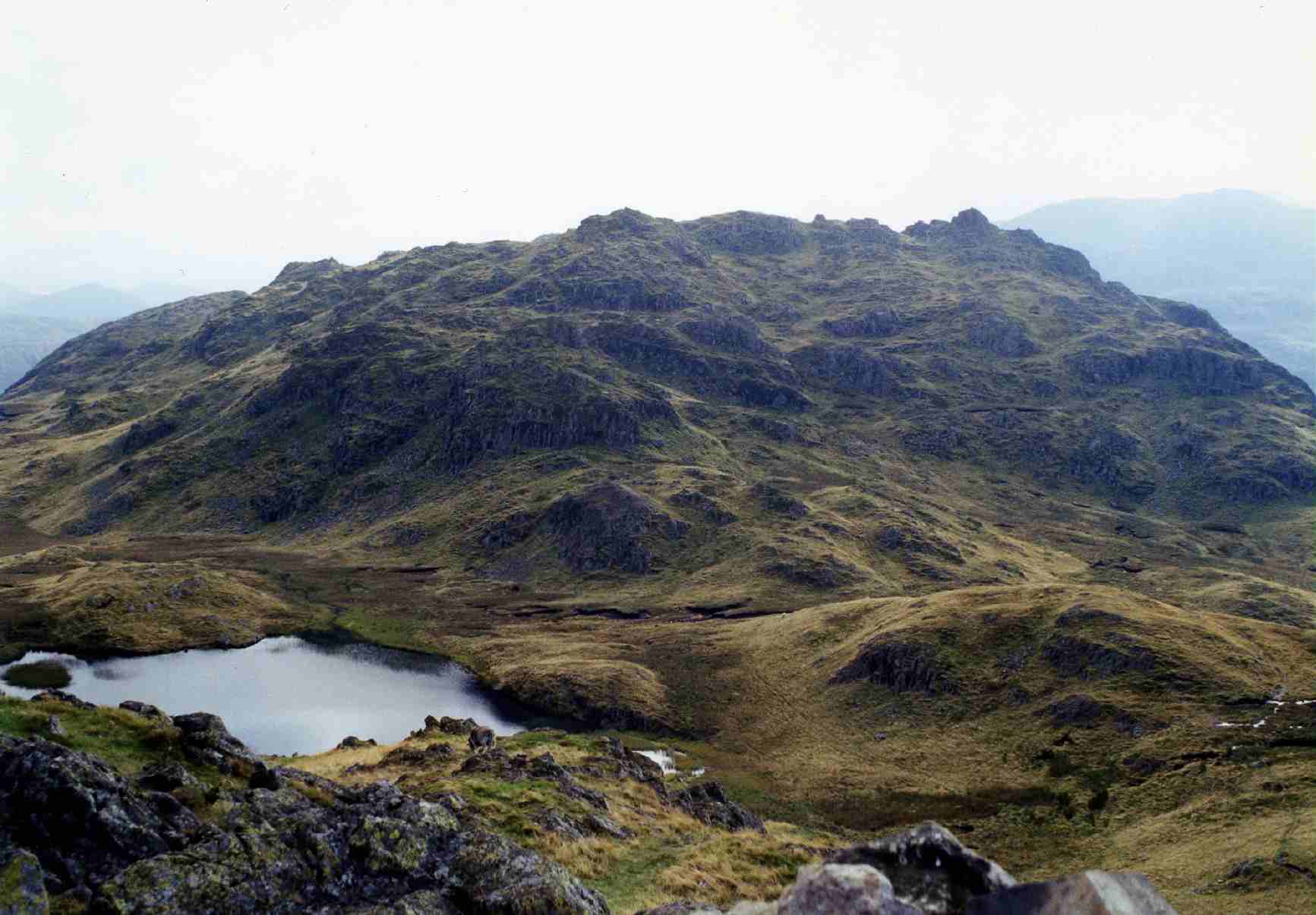
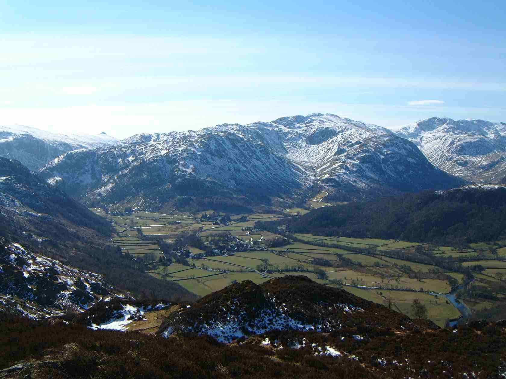
Raven Crag Gully, located in Cumberland Valley, is a prominent geological feature nestled amidst the picturesque landscape of the Lake District National Park in Cumbria, England. This natural wonder is a deep, narrow ravine that has been sculpted over millions of years by the relentless forces of nature.

The gully is characterized by towering craggy cliffs that rise steeply on either side, reaching heights of up to 200 feet. These towering rock formations are composed mainly of volcanic ash and tuff, which have been weathered and eroded over time, creating a dramatic and awe-inspiring spectacle.

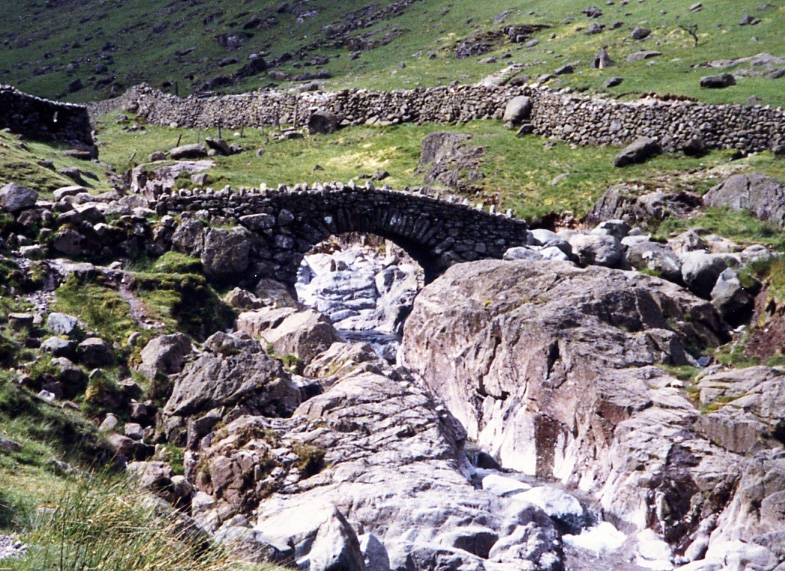
At the bottom of the gully, a small stream flows through, adding to the enchanting ambiance of the location. The crystal-clear water cascades down moss-covered rocks, creating small waterfalls and tranquil pools. The gully is also home to a diverse range of flora and fauna, including ferns, mosses, and wildflowers, providing a haven for various species of insects and birds.

Raven Crag Gully is a popular destination for hikers and nature enthusiasts, offering breathtaking views and a challenging terrain. The gully provides an opportunity for adventurous souls to explore its depths, navigating through narrow passages and rocky paths. It is important for visitors to exercise caution and be well-prepared, as the terrain can be treacherous in certain areas.

Overall, Raven Crag Gully is a captivating natural wonder that showcases the remarkable beauty and geological history of Cumberland Valley. Its rugged cliffs, cascading waterfalls, and diverse ecosystem make it a must-visit location for those seeking an immersive experience in the heart of the Lake District.

If you have any feedback on the listing, please let us know in the comments section below.

Raven Crag Gully Images

Images are sourced within 2km of 54.495133/-3.1631959 or Grid Reference NY2411. Thanks to Geograph Open Source API. All images are credited.

Blackmoss Pot Langstrath Beck, in spate, passes through a narrow cleft in a band of rocks.
Blackmoss Pot
Langstrath Beck, in spate, passes through a narrow cleft in a band of rocks.
Path above Old Mill Cottage On the path from Strands Bridge to Glaramara.
Path above Old Mill Cottage
On the path from Strands Bridge to Glaramara.
Approaching The Combe On the path from Strands Bridge to Glaramara. Ahead is the intake wall and gate into The Combe. On the skyline ahead is Raven Crag and to the left, through the branches of the hawthorn, the pinnacle of Combe Head can be seen.
Approaching The Combe
On the path from Strands Bridge to Glaramara. Ahead is the intake wall and gate into The Combe. On the skyline ahead is Raven Crag and to the left, through the branches of the hawthorn, the pinnacle of Combe Head can be seen.
In The Combe A bunch of Herdwicks are sizing up their visitors.
In The Combe
A bunch of Herdwicks are sizing up their visitors.
Raven Crag Heading for Glaramara, but the summit ahead is Combe Head - Glaramara cannot be seen yet.
Raven Crag
Heading for Glaramara, but the summit ahead is Combe Head - Glaramara cannot be seen yet.
Glaramara Having walked the path from Strands Bridge, the objective of the summit is a short distance (and a bit of a scramble) ahead.
Glaramara
Having walked the path from Strands Bridge, the objective of the summit is a short distance (and a bit of a scramble) ahead.
Cairn on Glaramara A quirky cairn on the summit with a view along Borrowdale, and Skiddaw and Blencathra on the skyline.
Cairn on Glaramara
A quirky cairn on the summit with a view along Borrowdale, and Skiddaw and Blencathra on the skyline.
Waterfall on Sour Milk Gill
View of Seathwaite
View of Seathwaite
Waterfall on Sour Milk Gill
Stockley Bridge
Stockley Bridge
River Derwent
River Derwent
Lone tree in The Combe The Combe is the upper valley of Combe Gill in Borrowdale. The tree is just beyond the groove of Rottenstone Gill.
Raven Crag is the cliff at the valley head.
Lone tree in The Combe
The Combe is the upper valley of Combe Gill in Borrowdale. The tree is just beyond the groove of Rottenstone Gill. Raven Crag is the cliff at the valley head.
Confluence of Grains Gill with Styhead Gill Grains Gill is in the foreground, Styhead Gill is approaching from the distant trees.
Confluence of Grains Gill with Styhead Gill
Grains Gill is in the foreground, Styhead Gill is approaching from the distant trees.
River Derwent at Seathwaite The river looking upstream from a bridge crossing, west of Seathwaite Farm.
The hill at the centre of the image is Seathwaite Fell, Grains Gill is to the left of that and the slopes of Base Brown rise to the right.
River Derwent at Seathwaite
The river looking upstream from a bridge crossing, west of Seathwaite Farm. The hill at the centre of the image is Seathwaite Fell, Grains Gill is to the left of that and the slopes of Base Brown rise to the right.
Coniferous trees about Taylorgill Force Styhead Gill disappears in the middle distance to slide down a rockface creating the waterfall of Taylorgill Force - out of view in the image of course.
The mountain slopes beyond rise to Thornytthwaite Fell which is effectively a north ridge of Glaramara.
Coniferous trees about Taylorgill Force
Styhead Gill disappears in the middle distance to slide down a rockface creating the waterfall of Taylorgill Force - out of view in the image of course. The mountain slopes beyond rise to Thornytthwaite Fell which is effectively a north ridge of Glaramara.
Trees in vicinity of Greenhow Knott The sunlit slope extends towards the coniferous trees which are above Taylorgill Force. There's a small crag in the area which is presumably Greenhow Knott.
Beyond the trees in a deep slot flows Styhead Gill; the farther steep slopes are those of Base Brown.
Trees in vicinity of Greenhow Knott
The sunlit slope extends towards the coniferous trees which are above Taylorgill Force. There's a small crag in the area which is presumably Greenhow Knott. Beyond the trees in a deep slot flows Styhead Gill; the farther steep slopes are those of Base Brown.
Show me another place!

Raven Crag Gully is located at Grid Ref: NY2411 (Lat: 54.495133, Lng: -3.1631959)

Administrative County: Cumbria

District: Allerdale

Police Authority: Cumbria

What 3 Words

///normal.delight.highlight. Near Keswick, Cumbria

Related Wikis

Lake District

The Lake District, also known as the Lakes or Lakeland, is a mountainous region and national park in North West England. It is primarily famous for its...

Rosthwaite Fell

Rosthwaite Fell is a fell in the English Lake District. It is situated some 12 kilometres (7+1⁄2 miles) due south of Keswick and 2 kilometres (1+1⁄4 miles...

Seathwaite, Cumberland

Seathwaite is a small hamlet in the Borrowdale civil parish of Cumberland, Cumbria, North West England. It is in the Lake District near Scafell Pike and...

Glaramara

Glaramara is a fell in the English Lake District in Cumbria. It is a substantial fell that is part of a long ridge that stretches for over six kilometres...

Nearby Amenities

Located within 500m of 54.495133,-3.1631959
Raven Crag Gully
Place: locality
Lat/Long: 54.4952255/-3.1622149
The Comb
Place: locality
Lat/Long: 54.4951785/-3.1566795
The data included in this document is from www.openstreetmap.org. The data is made available under ODbL.

Have you been to Raven Crag Gully?

Leave your review of Raven Crag Gully below (or comments, questions and feedback).