Cwm Milaid
Valley in Brecknockshire
Wales
Cwm Milaid

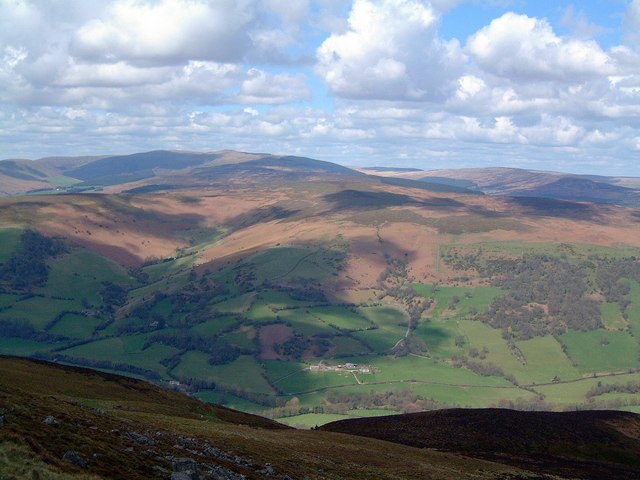
Cwm Milaid is a picturesque valley located in the county of Brecknockshire, Wales. Nestled within the breathtaking Brecon Beacons National Park, this tranquil valley offers visitors a stunning natural landscape and a rich history.
Surrounded by rolling hills and lush greenery, Cwm Milaid is known for its remarkable beauty. The valley is carved by a meandering river, which adds to its charm. Its name, "Cwm Milaid," translates to "Valley of the Soldiers," alluding to its historical significance. It is believed that this valley was once a strategic location during battles in ancient times.
The valley is home to a diverse range of flora and fauna, making it a haven for nature enthusiasts. Visitors can explore the numerous walking trails that wind through the valley, offering breathtaking views of the surrounding countryside and the opportunity to spot wildlife such as red kites and otters.
In addition to its natural beauty, Cwm Milaid also boasts a rich cultural heritage. There are several historical sites and landmarks in the area, including ancient burial mounds and remnants of Iron Age settlements. These archaeological sites provide a glimpse into the valley's past and its significance in the region's history.
For those seeking a peaceful retreat or an outdoor adventure, Cwm Milaid offers a serene and captivating destination. Whether it's hiking, birdwatching, or simply immersing oneself in the beauty of nature, visitors to this valley are sure to be enthralled by its charm and tranquility.
If you have any feedback on the listing, please let us know in the comments section below.
Cwm Milaid Images
Images are sourced within 2km of 51.893779/-3.0960975 or Grid Reference SO2422. Thanks to Geograph Open Source API. All images are credited.


Cwm Milaid is located at Grid Ref: SO2422 (Lat: 51.893779, Lng: -3.0960975)
Unitary Authority: Powys
Police Authority: Dyfed Powys
What 3 Words
///symphonic.airfields.owner. Near Crickhowell, Powys
Nearby Locations
Related Wikis
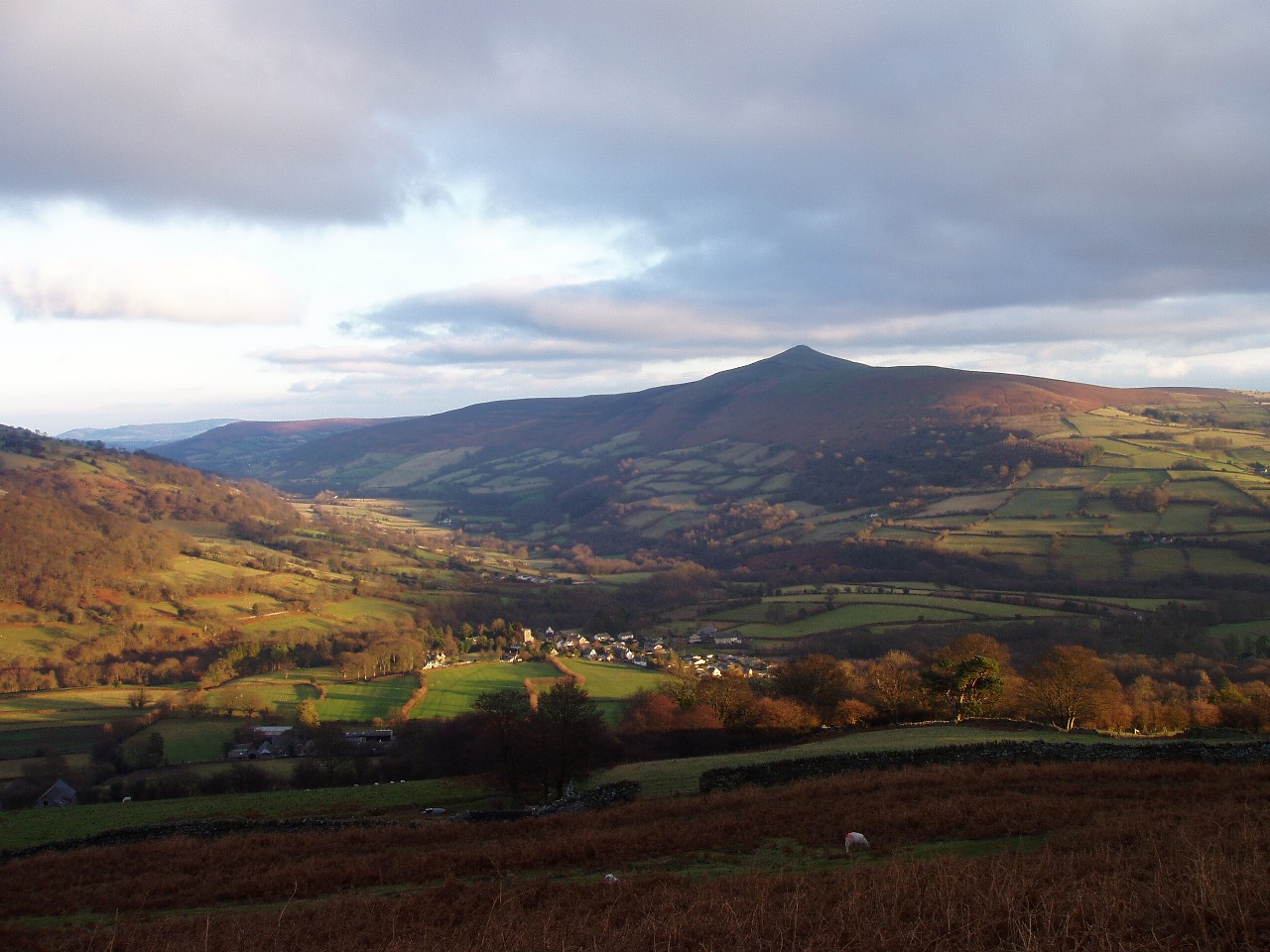
Crug Mawr
Crug Mawr is a hill in the Black Mountains in the Brecon Beacons National Park in southern Powys, Wales. Its summit at a height of 550 m (1,805 ft) is...
Llanbedr, Crickhowell
Llanbedr is a small village 2 miles (3 km) northeast of Crickhowell in the county of Powys, Wales and the community of Vale of Grwyney. It lies above the...
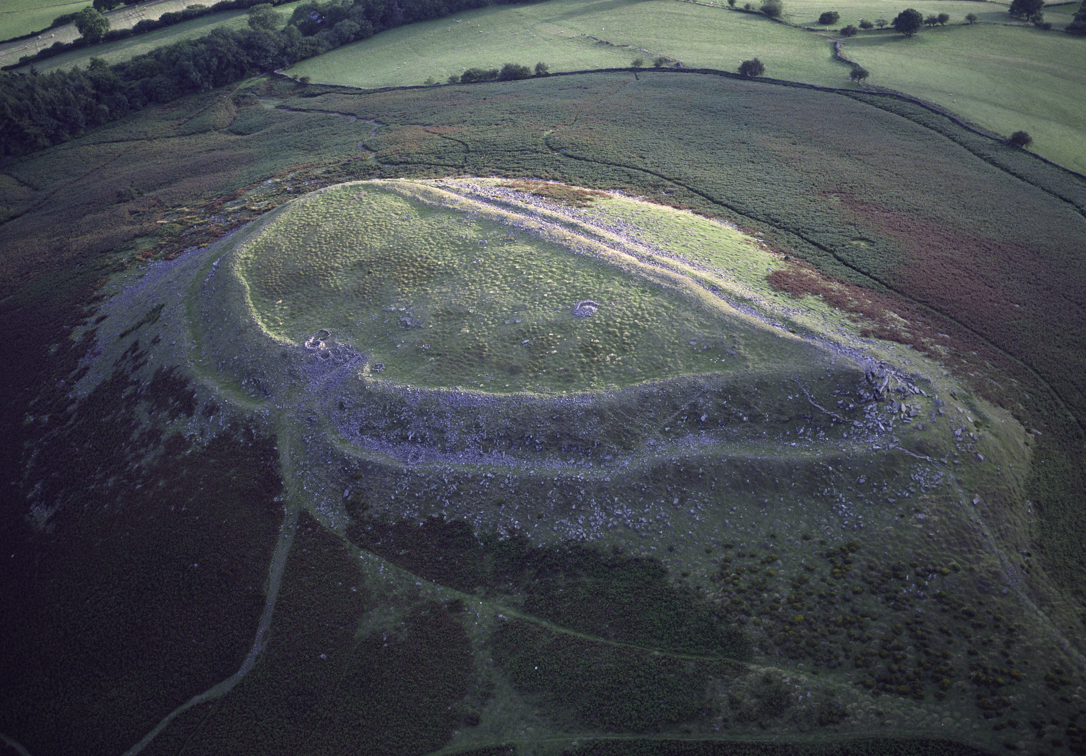
Crug Hywel
Crug Hywel is an Iron Age Celtic hillfort, with a clearly visible earth and stone ditch and rampart. Crug Hywel is approached by a couple of public footpaths...

Pen Cerrig-calch
Pen Cerrig-calch is a subsidiary summit of Waun Fach in the Black Mountains in the Brecon Beacons National Park in southern Powys, Wales. Its summit, at...
Nearby Amenities
Located within 500m of 51.893779,-3.0960975Have you been to Cwm Milaid?
Leave your review of Cwm Milaid below (or comments, questions and feedback).