Fash Cleuch

Valley in Peeblesshire

Scotland

Fash Cleuch

The col to the east of White Cleuch A cold night
The col to the east of White Cleuch Credit: Pip Rolls

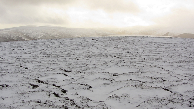
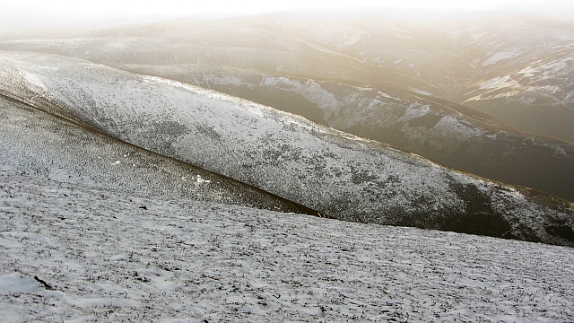
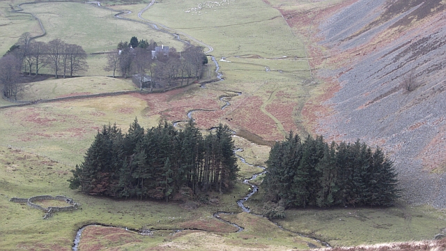
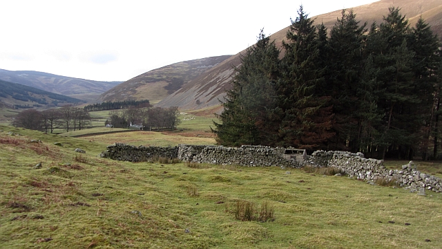
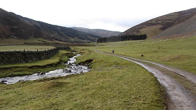
Fash Cleuch is a picturesque valley located in Peeblesshire, Scotland. Nestled in the heart of the Scottish Borders, this valley is known for its stunning natural beauty and tranquil atmosphere.

Surrounded by rolling hills and lush greenery, Fash Cleuch offers breathtaking views and a sense of serenity to all who visit. The valley is characterized by its meandering river, which flows through the center and adds to the charm of the landscape. The river is a popular spot for fishing enthusiasts, attracting anglers from near and far.

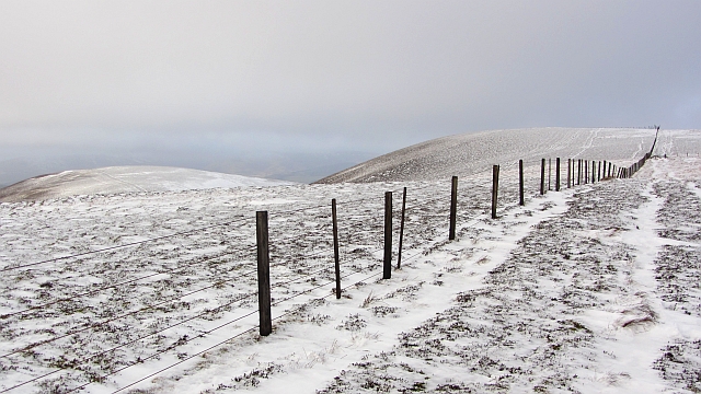
The area is also home to a variety of wildlife, making it a haven for nature lovers. Visitors may spot red deer, otters, and a wide range of bird species while exploring the valley. The diverse flora and fauna add to the area's allure and provide ample opportunities for outdoor activities such as hiking and wildlife watching.

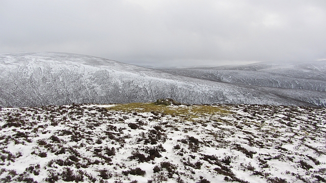
Fash Cleuch is rich in history, with remnants of old settlements and ruins dotting the landscape. These archaeological sites offer a glimpse into the area's past and provide a fascinating insight into the lives of the people who once inhabited the valley.

For those seeking a peaceful retreat away from the hustle and bustle of city life, Fash Cleuch is the perfect destination. The idyllic scenery, combined with the tranquility of the surroundings, creates an ideal environment for relaxation and rejuvenation. Whether it's a leisurely stroll along the riverbank or a challenging hike up the surrounding hills, Fash Cleuch offers something for everyone to enjoy.

If you have any feedback on the listing, please let us know in the comments section below.

Fash Cleuch Images

Images are sourced within 2km of 55.570768/-3.2128986 or Grid Reference NT2331. Thanks to Geograph Open Source API. All images are credited.

The col to the east of White Cleuch A cold night
The col to the east of White Cleuch
A cold night
White Cleuch looking south east
White Cleuch A few trees on the steep-sided banks have escaped the attentions of the sheep. Half way down, a side cleuch joins on the right.
White Cleuch
A few trees on the steep-sided banks have escaped the attentions of the sheep. Half way down, a side cleuch joins on the right.
Head of Slate Cleuch The new bulldozed road continues over a shoulder of Dun Rig to Glenrath.
Head of Slate Cleuch
The new bulldozed road continues over a shoulder of Dun Rig to Glenrath.
Moorland above the Douglas Burn Spurs and cleuchs at the headwaters of the Douglas Burn, Selkirkshire.  View from below the ridge fence in an area of very rough going.  The glen here is planted with conifers.
Moorland above the Douglas Burn
Spurs and cleuchs at the headwaters of the Douglas Burn, Selkirkshire. View from below the ridge fence in an area of very rough going. The glen here is planted with conifers.
Summit of Stob Law An unmarked heathery summit (there has been an attempt at a cairn, but it is not at the highest point).
Summit of Stob Law
An unmarked heathery summit (there has been an attempt at a cairn, but it is not at the highest point).
Glenrath Heights The western slopes fall steeply to Glenrathhope by a series of heathery spurs. The far spur gives an easy way up or down.
Glenrath Heights
The western slopes fall steeply to Glenrathhope by a series of heathery spurs. The far spur gives an easy way up or down.
Glenrath Heights A fence, still after many years, unmapped by the Ordnance Survey, runs southwards through heather moorland towards Middle Hill.
Glenrath Heights
A fence, still after many years, unmapped by the Ordnance Survey, runs southwards through heather moorland towards Middle Hill.
Bogs on Dun Rig Dun Rig is the highest hill east of the Manor Water. This is the upper end of Glen Sax and appears to be an area of peat bog, which is how I remember it from the one time I have been up there nearly thirty years earlier.
Bogs on Dun Rig
Dun Rig is the highest hill east of the Manor Water. This is the upper end of Glen Sax and appears to be an area of peat bog, which is how I remember it from the one time I have been up there nearly thirty years earlier.
Cairn, Glenrath Heights A cairn sits amongst moss on the spur between Fash Cleuch and Whitson's Cleuch. The cairn has probably attracted perching birds which have affected the local vegetation.  
Cairns like this are used for navigation by shepherds. I once met somebody who admitted to having got lost on his hill farm, even though he had worked there for thirty years.
Cairn, Glenrath Heights
A cairn sits amongst moss on the spur between Fash Cleuch and Whitson's Cleuch. The cairn has probably attracted perching birds which have affected the local vegetation. Cairns like this are used for navigation by shepherds. I once met somebody who admitted to having got lost on his hill farm, even though he had worked there for thirty years.
Woodland, Glenrath Hope Shepherds are moving a ewe which escaped when the hill sheep were being gathered earlier. The woodland has suffered recent storm damage.
Woodland, Glenrath Hope
Shepherds are moving a ewe which escaped when the hill sheep were being gathered earlier. The woodland has suffered recent storm damage.
Stell, Glenrath Hope A ruined fank and sheep shelter beside a small woodland.
Stell, Glenrath Hope
A ruined fank and sheep shelter beside a small woodland.
Road building, Glenrathhope Another hill road has been built up Black Cleuch. Suspiciously large scale but unlikely to be wind farmers as they would come in from the south off a bigger road. There are none of the dreaded masts visible.
Road building, Glenrathhope
Another hill road has been built up Black Cleuch. Suspiciously large scale but unlikely to be wind farmers as they would come in from the south off a bigger road. There are none of the dreaded masts visible.
Glenrathope road Access road to Glenrathope beside the Back Burn.
Glenrathope road
Access road to Glenrathope beside the Back Burn.
Broom Hill Looking over Door Hass towards Broom Hill on the Glenrath Heights. The southern side is free of snow.
Broom Hill
Looking over Door Hass towards Broom Hill on the Glenrath Heights. The southern side is free of snow.
Door Hass A col between Stob Law and the main bulk of hills around Glenrath Hope and Glen Sax. The next rise is up to Broom Hill.
Door Hass
A col between Stob Law and the main bulk of hills around Glenrath Hope and Glen Sax. The next rise is up to Broom Hill.
Stob Law Contrasting north and south sides of the hill which is seen from the start of the climb up Broom Law. The col is Door Hass.
Stob Law
Contrasting north and south sides of the hill which is seen from the start of the climb up Broom Law. The col is Door Hass.
Fence, Broom Hill A long established fence, but not shown on the Ordnance Survey 1:25,000 map.
Fence, Broom Hill
A long established fence, but not shown on the Ordnance Survey 1:25,000 map.
Show me another place!

Fash Cleuch is located at Grid Ref: NT2331 (Lat: 55.570768, Lng: -3.2128986)

Unitary Authority: The Scottish Borders

Police Authority: The Lothians and Scottish Borders

What 3 Words

///clocking.pylons.dignity. Near Peebles, Scottish Borders

Nearby Locations

Fash Cleuch

Related Wikis

Manor Hills

The Manor Hills, also known as the Tweedsmuir Hills, are a range of hills south of Peebles in the Scottish Borders, one of the ranges which collectively...

Dun Rig

Dun Rig is a hill in the Manor Hills range, part of the Southern Uplands of Scotland. It is the highest hill in the northernmost cluster of the Manor Hills...

Posso Tower

Posso Tower is a 16th-century tower house, about 6.0 miles (9.7 km) south and west of Peebles, Scottish Borders, Scotland, and west of Manor Water. �...

Black Law (hill)

Black Law is a hill in the Manor Hills range, part of the Southern Uplands of Scotland. One of the more remote Donalds, it does not easily combine into...

Have you been to Fash Cleuch?

Leave your review of Fash Cleuch below (or comments, questions and feedback).