Gadd's Bottom

Valley in Somerset Somerset West and Taunton

England

Gadd's Bottom

Direction Sign – Signpost at Volis Cross, Broomfield parish Located at Volis Cross on the northeast side of the crossroads of Volis Hill, Volis Cross Road and Church Lane, in Broomfield parish. 4 arms and pyramid finial. See also <a title="https://www.geograph.org.uk/photo/2789239" href="https://www.geograph.org.uk/photo/2789239">Link</a> and <a title="https://www.geograph.org.uk/photo/2297532" href="https://www.geograph.org.uk/photo/2297532">Link</a>. 

Milestone Society National ID: SO_ST2330
Direction Sign – Signpost at Volis Cross, Broomfield parish Credit: J Dowding

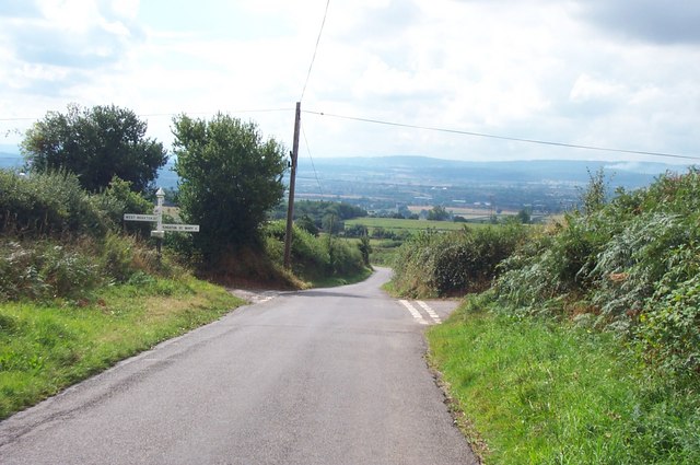
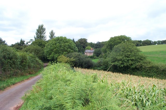
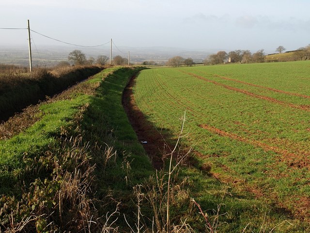
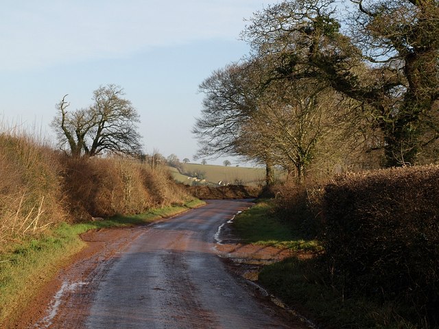
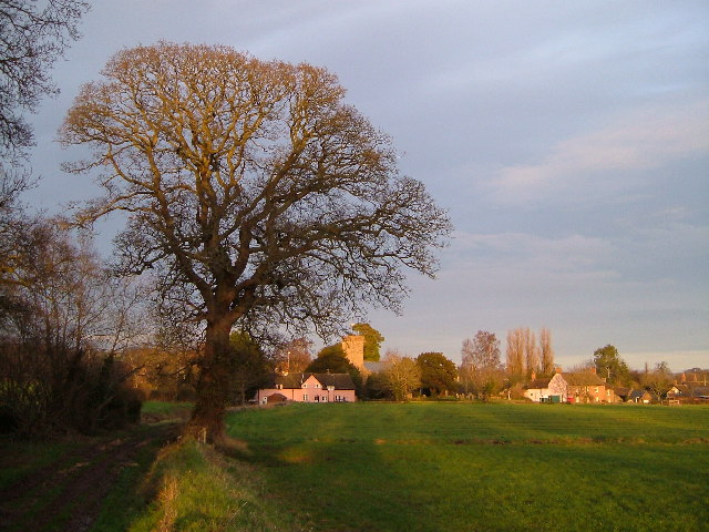
Gadd's Bottom is a small valley located in Somerset, England. Situated in the Mendip Hills, it is nestled between the villages of Cheddar and Axbridge. The valley is renowned for its picturesque landscapes, offering stunning views of rolling hills, lush green meadows, and charming farmlands.

Gadd's Bottom is characterized by its rural and tranquil atmosphere, making it a popular destination for nature enthusiasts and hikers. The valley is home to a diverse range of flora and fauna, including several rare and protected species. Visitors can explore the area on foot, following the numerous walking trails that crisscross the valley and lead to nearby attractions such as the Cheddar Gorge and the Cheddar Reservoir.

The valley's name, Gadd's Bottom, is thought to originate from the Old English word "gad" meaning a stick or pole, and "bottom" referring to a valley or hollow. This name reflects the topographical features of the area, with its gently sloping sides and a flat bottom.

Although predominantly rural, Gadd's Bottom is also home to a small community of residents who enjoy the peaceful countryside lifestyle. The valley boasts a few quaint cottages and farmhouses that add to its charm and character.

Overall, Gadd's Bottom in Somerset offers visitors a serene and idyllic escape, providing a glimpse into the natural beauty and tranquility of the English countryside.

If you have any feedback on the listing, please let us know in the comments section below.

Gadd's Bottom Images

Images are sourced within 2km of 51.059427/-3.0985341 or Grid Reference ST2329. Thanks to Geograph Open Source API. All images are credited.

Direction Sign – Signpost at Volis Cross, Broomfield parish Located at Volis Cross on the northeast side of the crossroads of Volis Hill, Volis Cross Road and Church Lane, in Broomfield parish. 4 arms and pyramid finial. See also <a title="https://www.geograph.org.uk/photo/2789239" href="https://www.geograph.org.uk/photo/2789239">Link</a> and <a title="https://www.geograph.org.uk/photo/2297532" href="https://www.geograph.org.uk/photo/2297532">Link</a>. 

Milestone Society National ID: SO_ST2330
Direction Sign – Signpost at Volis Cross, Broomfield parish
Located at Volis Cross on the northeast side of the crossroads of Volis Hill, Volis Cross Road and Church Lane, in Broomfield parish. 4 arms and pyramid finial. See also Link and Link. Milestone Society National ID: SO_ST2330
Sign for Tanyard Farm I think this appealing sign warns of cows, tractors and prams but I may be wrong! The farm nestles on the valley bottom, reached down a long track.
Sign for Tanyard Farm
I think this appealing sign warns of cows, tractors and prams but I may be wrong! The farm nestles on the valley bottom, reached down a long track.
The lower slopes of the Quantock Hills North of Kingston St.Mary,looking westwards.
The lower slopes of the Quantock Hills
North of Kingston St.Mary,looking westwards.
Volis Cross To the right for Kingston St. Mary, left for West Monkton and straight ahead for Taunton.
Volis Cross
To the right for Kingston St. Mary, left for West Monkton and straight ahead for Taunton.
"Standards", an isolated cottage near West Monkton
Broomfield Lane
Broomfield Lane
Field by Volis Cross Taken from a bank beside <a href="https://www.geograph.org.uk/photo/220701">ST2330 : Volis Cross</a>. On the left is the lane to Kingston St Mary.
Field by Volis Cross
Taken from a bank beside ST2330 : Volis Cross. On the left is the lane to Kingston St Mary.
Muddy gateway, Cheddon Down From the lane north of Volis Cross, with a pair of semi-detached barns along the track.
Muddy gateway, Cheddon Down
From the lane north of Volis Cross, with a pair of semi-detached barns along the track.
Barns, Cheddon Down A more detailed look at the semi-detached barns seen in <a href="https://www.geograph.org.uk/photo/1128186">ST2331 : Muddy gateway, Cheddon Down</a>. In the distance are the Quantock Hills around <a href="https://www.geograph.org.uk/photo/983271">ST1932 : Cothelstone Hill</a>.
Barns, Cheddon Down
A more detailed look at the semi-detached barns seen in ST2331 : Muddy gateway, Cheddon Down. In the distance are the Quantock Hills around ST1932 : Cothelstone Hill.
Lane approaching Rose Hill The lane northwards from Volis Cross approaches the valley of the King's Cliff stream, which cuts deeply in the eastern slopes of the Quantocks. At the T-junction ahead, the lane meets the lane from Broomfield to Clavelshay.
Lane approaching Rose Hill
The lane northwards from Volis Cross approaches the valley of the King's Cliff stream, which cuts deeply in the eastern slopes of the Quantocks. At the T-junction ahead, the lane meets the lane from Broomfield to Clavelshay.
Lane junction above Rose Hill The T-junction mentioned in <a href="https://www.geograph.org.uk/photo/1128876">ST2331 : Lane approaching Rose Hill</a>. In fact it is really an offset crossroads, as the junction with a steep lane called Rose Hill is a mere 10 metres or so to the left. This descends the King's Cliff stream valley ahead.
Lane junction above Rose Hill
The T-junction mentioned in ST2331 : Lane approaching Rose Hill. In fact it is really an offset crossroads, as the junction with a steep lane called Rose Hill is a mere 10 metres or so to the left. This descends the King's Cliff stream valley ahead.
Top of Rose Hill The second lane junction mentioned in <a href="https://www.geograph.org.uk/photo/1128986">ST2331 : Lane junction above Rose Hill</a>. The remains of a plastic bag make a poor substitute for a signpost on the tiny triangular green. The lane on the left runs along the crest of the King's Cliff stream valley towards Broomfield. On the right, Rose Hill descends into it. Wort Wood, across the fields, is in ST2231.
Top of Rose Hill
The second lane junction mentioned in ST2331 : Lane junction above Rose Hill. The remains of a plastic bag make a poor substitute for a signpost on the tiny triangular green. The lane on the left runs along the crest of the King's Cliff stream valley towards Broomfield. On the right, Rose Hill descends into it. Wort Wood, across the fields, is in ST2231.
Rose Hill The lane shown on the right of <a href="https://www.geograph.org.uk/photo/1129029">ST2331 : Top of Rose Hill</a>, dropping into a deep valley that cuts into the Quantocks.
Rose Hill
The lane shown on the right of ST2331 : Top of Rose Hill, dropping into a deep valley that cuts into the Quantocks.
Field beside Rose Hill The field to the west of <a href="https://www.geograph.org.uk/photo/1129045">ST2331 : Rose Hill</a>, dropping into the King's Cliff stream valley. The fields on the far side are in <a href="https://www.geograph.org.uk/gridref/ST2332">ST2332</a>.
Field beside Rose Hill
The field to the west of ST2331 : Rose Hill, dropping into the King's Cliff stream valley. The fields on the far side are in ST2332.
Field entrance above Kingston St Mary Looking towards Kingston Beacon
Field entrance above Kingston St Mary
Looking towards Kingston Beacon
Gates on the hill above Kingston St Mary
Field and hilltop above Kingston St Mary On the road to Broomfield
Field and hilltop above Kingston St Mary
On the road to Broomfield
Road from Kingston to Broomfield
Show me another place!

Gadd's Bottom is located at Grid Ref: ST2329 (Lat: 51.059427, Lng: -3.0985341)

Administrative County: Somerset

District: Somerset West and Taunton

Police Authority: Avon and Somerset

What 3 Words

///perky.jets.ropes. Near Taunton, Somerset

Related Wikis

Kingston St Mary

Kingston St Mary is a village and parish in Somerset, England, situated at the southern end of the Quantock Hills 4 miles (6.4 km) north of Taunton. The...

Hestercombe House

Hestercombe House is a historic country house in the parish of West Monkton in the Quantock Hills, near Taunton in Somerset, England. The house is a Grade...
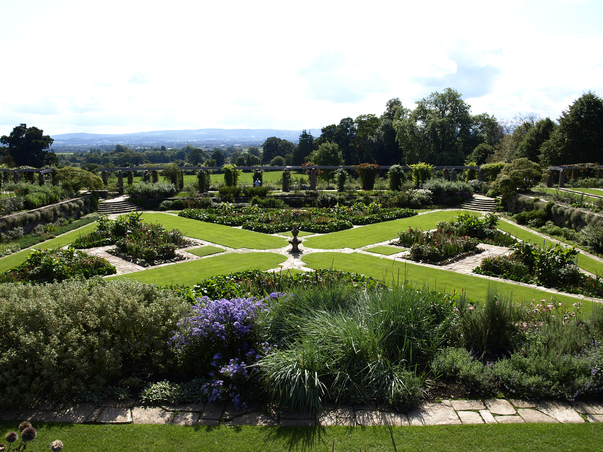
Hestercombe Gardens

Hestercombe Gardens is a garden complex situated on the grounds of Hestercombe House in the southwestern English county of Somerset. The entire garden...

King's College Preparatory School

King's College Preparatory School is a co-educational preparatory school that provides day and boarding school. The school is located within the parish...

Pyrland Hall

Pyrland Hall is a country house near Cheddon Fitzpaine in the English county of Somerset. It is a Grade II* listed building. == History == Pyrland Hall...

Cheddon Fitzpaine

Cheddon Fitzpaine is a village and civil parish in Somerset, England, situated on the Quantock Hills 2 miles (3.2 km) north of Taunton. The village is...

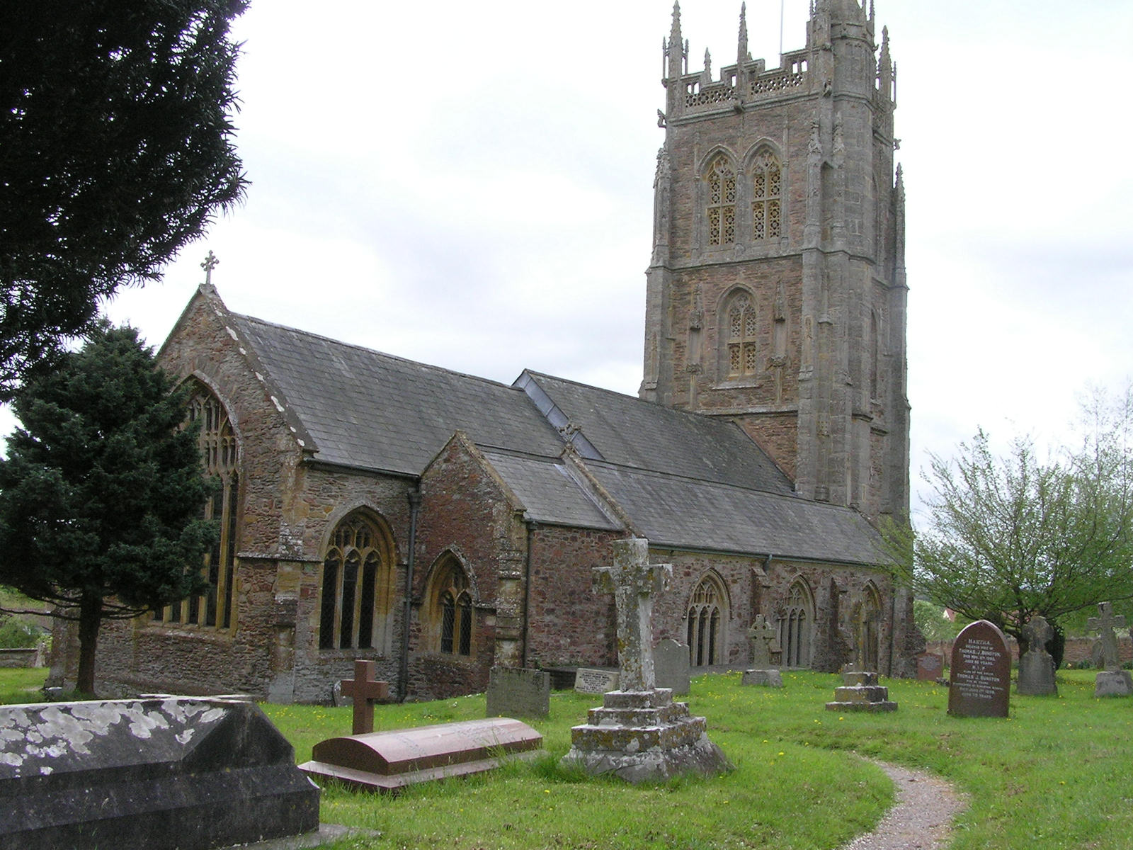
Church of St Mary, Cheddon Fitzpaine

The Anglican Church of St Mary in Cheddon Fitzpaine, Somerset, England was built in the late 13th century. It is a Grade II* listed building. == History... ==

The Taunton Academy

Pyrland School (formerly The Taunton Academy) is a school with academy status in Taunton, Somerset, England. The school was formed by the merger of The...

Nearby Amenities

Located within 500m of 51.059427,-3.0985341
Brand: National Grid
Brand Wikidata: Q1465461
Colour: grey
Design: asymmetric
Line Attachment: suspension
Material: metal
Operator: National Grid Electricity Distribution Plc
Operator Old: Western Power Distribution
Operator Wikidata: Q7988183
Owner: National Grid Electricity Distribution (South West) Plc
Owner Wikidata: Q114397866
Power: tower
Source Ref: bing
Structure: lattice
Lat/Long: 51.0555515/-3.0954324
Colour: grey
Design: three-level
Height: 124.55
Line Attachment: suspension
Material: metal
Operator: National Grid
Operator Wikidata: Q1465461
Power: tower
Ref: ZZ061
Source Ref: bing
Start Date: 1965
Structure: lattice
Lat/Long: 51.0592953/-3.0966351
Colour: grey
Design: three-level
Height: 111.14
Line Attachment: suspension
Material: metal
Operator: National Grid
Operator Wikidata: Q1465461
Power: tower
Ref: ZZ062
Source Ref: bing
Start Date: 1965
Structure: lattice
Lat/Long: 51.0572741/-3.0991
Colour: grey
Design: three-level
Height: 133.33
Line Attachment: suspension
Material: metal
Operator: National Grid
Operator Wikidata: Q1465461
Power: tower
Ref: ZZ060
Source Ref: bing
Start Date: 1965
Structure: lattice
Lat/Long: 51.0608146/-3.0947822
Brand: National Grid
Brand Wikidata: Q1465461
Colour: grey
Design: triangle
Line Attachment: suspension
Material: metal
Operator: National Grid Electricity Distribution Plc
Operator Old: Western Power Distribution
Operator Wikidata: Q7988183
Owner: National Grid Electricity Distribution (South West) Plc
Owner Wikidata: Q114397866
Power: tower
Source Ref: bing
Structure: lattice
Lat/Long: 51.055887/-3.0954477
Post Box
Operator: Royal Mail
Operator Wikidata: Q638098
Post Box Type: lamp
Ref: TA2 578
Royal Cypher: EIIR
Royal Cypher Wikidata: Q33102113
Lat/Long: 51.0598659/-3.0929927
The data included in this document is from www.openstreetmap.org. The data is made available under ODbL.

Have you been to Gadd's Bottom?

Leave your review of Gadd's Bottom below (or comments, questions and feedback).