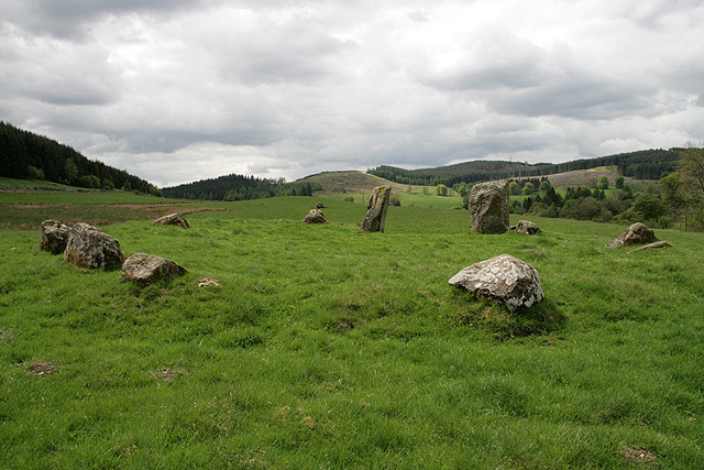
Thief Cleuch

Valley in Dumfriesshire

Scotland

Thief Cleuch

Forestry across the Black Esk The Ordnance Survey's annoying purple plague is proving almost useful in showing that the woodland on the hill is not managed by the Forestry Commission. I'd rather have clearer maps thanks.
Forestry across the Black Esk Credit: Richard Webb

Thief Cleuch is a picturesque valley located in Dumfriesshire, Scotland. Situated in the southern part of the country, it is nestled within the rolling hills and stunning natural landscapes that this region is renowned for. The valley can be found near the village of Wanlockhead, which is known for being the highest village in Scotland.

Thief Cleuch is characterized by its rugged beauty and tranquil atmosphere. The valley is surrounded by verdant hillsides, with a meandering stream running through its center. This stream is fed by numerous small waterfalls that cascade down the valley walls, adding to the area's charm.

The name "Thief Cleuch" is believed to have originated from the area's history as a hiding place for thieves and outlaws. The valley's secluded location and dense vegetation provided ideal cover for those seeking refuge.

Today, Thief Cleuch is a popular destination for outdoor enthusiasts and nature lovers. The valley offers a variety of activities such as hiking, birdwatching, and photography. The surrounding hills provide ample opportunities for hillwalking, with breathtaking views of the valley and the surrounding countryside.

In addition to its natural beauty, Thief Cleuch is also known for its rich wildlife. The valley is home to a diverse range of flora and fauna, including rare plant species and various bird species. Visitors may spot red grouse, peregrine falcons, and even the elusive golden eagle.

Overall, Thief Cleuch is a hidden gem within Dumfriesshire, offering a peaceful retreat in a stunning natural setting.

If you have any feedback on the listing, please let us know in the comments section below.

Thief Cleuch Images

Images are sourced within 2km of 55.216998/-3.2208493 or Grid Reference NY2292. Thanks to Geograph Open Source API. All images are credited.

Forestry across the Black Esk The Ordnance Survey's annoying purple plague is proving almost useful in showing that the woodland on the hill is not managed by the Forestry Commission. I'd rather have clearer maps thanks.
Forestry across the Black Esk
The Ordnance Survey's annoying purple plague is proving almost useful in showing that the woodland on the hill is not managed by the Forestry Commission. I'd rather have clearer maps thanks.
Castle O'er Hill A break from the Sitka with Scots pines on the hill a short distance north of the hill fort.
Castle O'er Hill
A break from the Sitka with Scots pines on the hill a short distance north of the hill fort.
Castle O'er Hill The hill fort and surrounding ground has either not been planted by the Forestry Commission or left to self seeded trees after a past clearfell.
Castle O'er Hill
The hill fort and surrounding ground has either not been planted by the Forestry Commission or left to self seeded trees after a past clearfell.
Across the Black Burn A brief view from the road beside the hill fort on Castle O'er Hill.
Across the Black Burn
A brief view from the road beside the hill fort on Castle O'er Hill.
Castle O'er Hill The conifers were not replanted near the hill fort. There is a waymarked path from a car park near Castle O'er village to the fort.
Castle O'er Hill
The conifers were not replanted near the hill fort. There is a waymarked path from a car park near Castle O'er village to the fort.
Forest track below Castle O'er Hill Bluebells adding interest and colour by the track that circles around the ridge south of the hill fort.
Forest track below Castle O'er Hill
Bluebells adding interest and colour by the track that circles around the ridge south of the hill fort.
Forest track below Castle O'er Hill The track regains height after dipping down towards the Black Burn.
Forest track below Castle O'er Hill
The track regains height after dipping down towards the Black Burn.
Path to Castle O'er hill fort Waymarks indicate the path up from the forest road with a return to the road on the NE side.
Path to Castle O'er hill fort
Waymarks indicate the path up from the forest road with a return to the road on the NE side.
Castle O'er hill fort Looking south from the path up from the forest road. There is a comprehensive summary of the fort's history on the Canmore website: <span class="nowrap"><a title="https://canmore.org.uk/site/67376/castle-oer" rel="nofollow ugc noopener" href="https://canmore.org.uk/site/67376/castle-oer">Link</a><img style="margin-left:2px;" alt="External link" title="External link - shift click to open in new window" src="https://s1.geograph.org.uk/img/external.png" width="10" height="10"/></span>. Sites of at least 29 timber round houses were identified in a 1993 archaeological visit.
Castle O'er hill fort
Looking south from the path up from the forest road. There is a comprehensive summary of the fort's history on the Canmore website: LinkExternal link. Sites of at least 29 timber round houses were identified in a 1993 archaeological visit.
A monument on Tanlawhill Rig This tower, overlooking the Black Esk river and Castle O'er Forest, is marked on the O.S. map as a monument. It is cylindrical in shape and constructed of granite blocks with a splayed 360 degree glazed viewing screen, topped with a conical copper roof. There is a tiled walkway around the tower enclosed in a metal fence. The external wall contains a timber door and 3 narrow boarded-up windows. This photo was taken in 2008 and I’m not sure what condition the building will be in 12 years later.
A monument on Tanlawhill Rig
This tower, overlooking the Black Esk river and Castle O'er Forest, is marked on the O.S. map as a monument. It is cylindrical in shape and constructed of granite blocks with a splayed 360 degree glazed viewing screen, topped with a conical copper roof. There is a tiled walkway around the tower enclosed in a metal fence. The external wall contains a timber door and 3 narrow boarded-up windows. This photo was taken in 2008 and I’m not sure what condition the building will be in 12 years later.
Part of the earthworks of Castle O'er iron age hill fort This impressive hill fort was probably occupied by an important branch of the Selgovae tribe.
Part of the earthworks of Castle O'er iron age hill fort
This impressive hill fort was probably occupied by an important branch of the Selgovae tribe.
New forest track Built to facilitate clearing activities in the Castle O'er Forest.
New forest track
Built to facilitate clearing activities in the Castle O'er Forest.
Rough grazing near Tanlawhill Cottages Viewed from the road to Tanlawhill Farm.
Rough grazing near Tanlawhill Cottages
Viewed from the road to Tanlawhill Farm.
Monument on Tanlawhill Rig This tower, overlooking the Black Esk river and Castle O'er Forest, is marked on the O.S. map as a monument. It is cylindrical in shape and constructed of granite blocks with a splayed 360 degree glazed viewing screen, topped with a conical copper roof. There is a tiled walkway around the tower enclosed in a metal fence. The external wall contains a timber door and 3 narrow boarded-up windows.
Monument on Tanlawhill Rig
This tower, overlooking the Black Esk river and Castle O'er Forest, is marked on the O.S. map as a monument. It is cylindrical in shape and constructed of granite blocks with a splayed 360 degree glazed viewing screen, topped with a conical copper roof. There is a tiled walkway around the tower enclosed in a metal fence. The external wall contains a timber door and 3 narrow boarded-up windows.
The Black Esk at Tanlawhill Farm The tower on the horizon is marked on the O.S. map as a monument <a href="https://www.geograph.org.uk/photo/799470">NY2391 : Monument on Tanlawhill Rig</a>.
The Black Esk at Tanlawhill Farm
The tower on the horizon is marked on the O.S. map as a monument NY2391 : Monument on Tanlawhill Rig.
Rough grazing by the Black Esk Viewed from Tanlawhill Rig with Castle O'er Forest in the background.
Rough grazing by the Black Esk
Viewed from Tanlawhill Rig with Castle O'er Forest in the background.
Forestry clear fell A recently cleared area at The Knock.
Forestry clear fell
A recently cleared area at The Knock.
Blackhouse Hill Remnants of pine trees are scattered around near the site of a settlement.
Blackhouse Hill
Remnants of pine trees are scattered around near the site of a settlement.
Show me another place!

Thief Cleuch is located at Grid Ref: NY2292 (Lat: 55.216998, Lng: -3.2208493)

Unitary Authority: Dumfries and Galloway

Police Authority: Dumfries and Galloway

What 3 Words

///wanted.slurping.chaos. Near Bentpath, Dumfries & Galloway

Related Wikis

Castle O'er Forest

Castle O'er Forest is a forest south of Eskdalemuir, Dumfries and Galloway, in southern Scotland.It is bisected by the River Esk. Eskdalemuir Forest adjoins...

Whitcastles stone circle

Whitcastles or Little Hartfell (grid reference NY 2240 8806) is a stone circle 6½ miles NE of Lockerbie, Dumfries and Galloway. Nine fallen stones lie...

Girdle Stanes

The Girdle Stanes (grid reference NY 25351 96153) is a stone circle near Eskdalemuir, Dumfries and Galloway. The western portion of the circle has been...

Loupin Stanes

The Loupin Stanes (grid reference NY25709663) is a stone circle near Eskdalemuir, Dumfries and Galloway. Oval in shape, it consists of twelve stones set...

Have you been to Thief Cleuch?

Leave your review of Thief Cleuch below (or comments, questions and feedback).