Glen Cally

Valley in Angus

Scotland

Glen Cally

V junction The right path leads up Mid Hill. The left path further into Glen Cally. The dog clearly wants to go where the deer are.
V junction Credit: Aleks Scholz

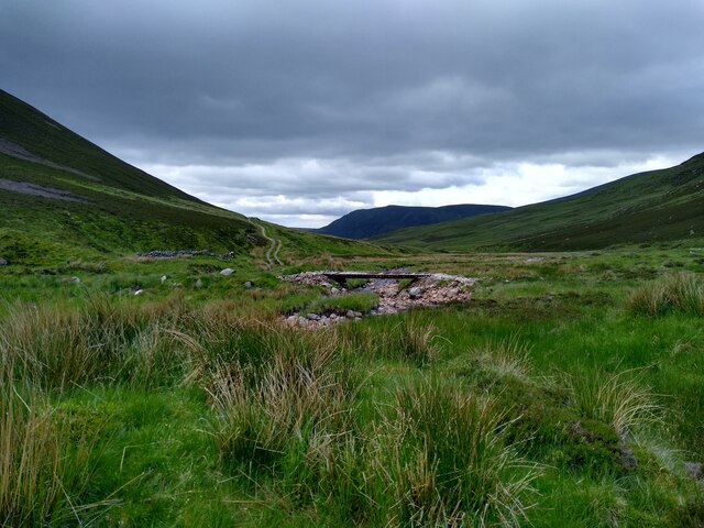
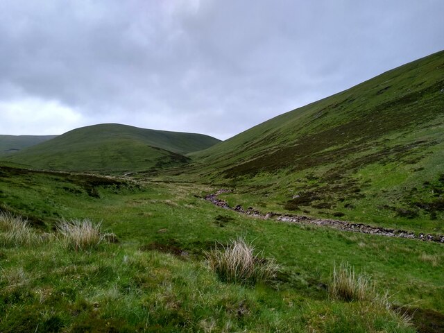
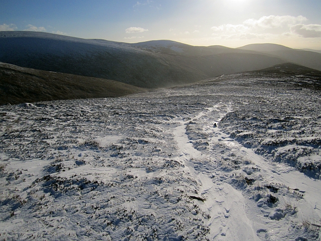
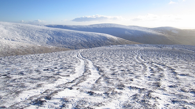
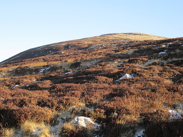
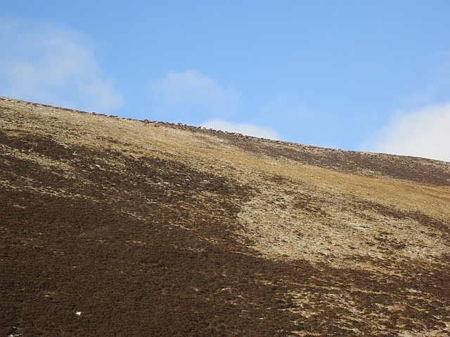
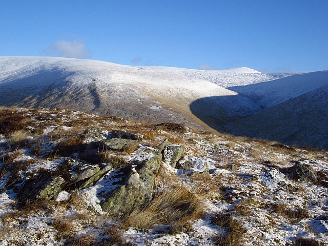
Glen Cally, located in the Angus region of Scotland, is a picturesque valley nestled amidst the stunning natural beauty of the Scottish Highlands. Situated near the village of Bridge of Cally, this idyllic glen is known for its tranquil ambiance and breathtaking landscapes.

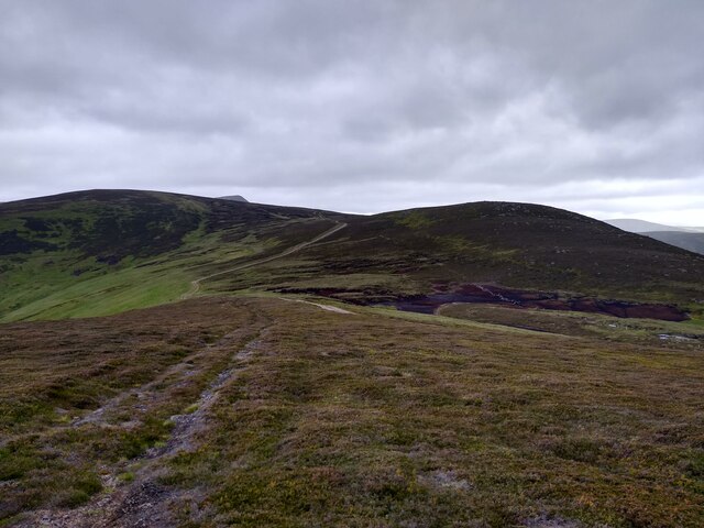
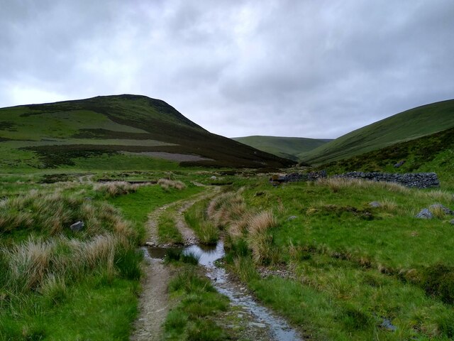
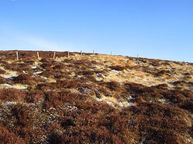
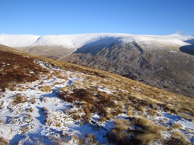
The valley is characterized by rolling hills, verdant meadows, and dense forests that are home to a diverse range of flora and fauna. Glen Cally is particularly renowned for its ancient Caledonian pine forests, which provide a habitat for a variety of rare and protected species, including the capercaillie, Scottish wildcat, and red squirrel.

The River Ardle gracefully meanders through the heart of the glen, adding to its charm and offering opportunities for fishing and other water-based activities. The glen's rich natural resources have been utilized by humans for centuries, with evidence of prehistoric settlements and ancient burial sites scattered throughout the area.

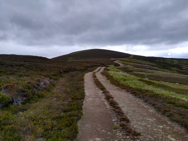
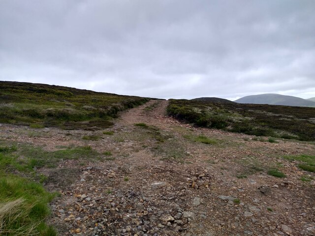
For outdoor enthusiasts, Glen Cally offers a plethora of recreational activities. The valley is crisscrossed by numerous hiking trails, providing ample opportunities for exploring the surrounding hills and enjoying breathtaking views of the surrounding countryside. Additionally, the glen is a popular destination for birdwatching, with a wide array of avian species inhabiting the area.

Glen Cally's location, just a short distance from the Cairngorms National Park, further enhances its appeal. Visitors can easily access the park's extensive network of walking and cycling trails, as well as its ski resorts during the winter months.

Overall, Glen Cally, Angus is a haven for nature lovers and outdoor enthusiasts, offering a serene escape into the beauty of the Scottish Highlands.

If you have any feedback on the listing, please let us know in the comments section below.

Glen Cally Images

Images are sourced within 2km of 56.836214/-3.2921383 or Grid Reference NO2172. Thanks to Geograph Open Source API. All images are credited.

V junction The right path leads up Mid Hill. The left path further into Glen Cally. The dog clearly wants to go where the deer are.
V junction
The right path leads up Mid Hill. The left path further into Glen Cally. The dog clearly wants to go where the deer are.
A look down Glen Cally The bridge crosses from one side of the stream to the other. Some ruined shielings are seen around that point.
A look down Glen Cally
The bridge crosses from one side of the stream to the other. Some ruined shielings are seen around that point.
View up Glen Cally This is the very northern end of Glen Cally, the burn to the right. It divides in two just a hundred metres further up, and then peters out. Or rather springs into existence. The same happens to the path. The spur in the middle of the image leads straight onto the Mayar plateau. Just two miles from here and you are in Corrie Fee, which seems so far away when you are walking in Glen Isla.
View up Glen Cally
This is the very northern end of Glen Cally, the burn to the right. It divides in two just a hundred metres further up, and then peters out. Or rather springs into existence. The same happens to the path. The spur in the middle of the image leads straight onto the Mayar plateau. Just two miles from here and you are in Corrie Fee, which seems so far away when you are walking in Glen Isla.
The plateau at the end of Glen Isla Coming down Mid Hill this is the view towards the next hills, Tarmach Cairn and Bawhelps, which are just little bumps in the large plateau that extends from here to Loch Muick in the north, Glen Shee in the west and who knows what in the east. The nose that shows up in the background is, if I'm not mistaken, part of Mayar.
The plateau at the end of Glen Isla
Coming down Mid Hill this is the view towards the next hills, Tarmach Cairn and Bawhelps, which are just little bumps in the large plateau that extends from here to Loch Muick in the north, Glen Shee in the west and who knows what in the east. The nose that shows up in the background is, if I'm not mistaken, part of Mayar.
Summit of Mid Hill This, I think, is the summit cairn of Mid Hill, a pretty non-descript hill at the end of Glen Isla, which leads onto a large plateau. This cairn is fairly small, not really a cairn. A bit further west is a larger stony structure, but this seems slightly higher.
Summit of Mid Hill
This, I think, is the summit cairn of Mid Hill, a pretty non-descript hill at the end of Glen Isla, which leads onto a large plateau. This cairn is fairly small, not really a cairn. A bit further west is a larger stony structure, but this seems slightly higher.
Track up Mid Hill The last kilometre of the track up Mid Hill. This is a very boring track, bulldozed onto the hill, but it gives easy access to the hills beyond.
Track up Mid Hill
The last kilometre of the track up Mid Hill. This is a very boring track, bulldozed onto the hill, but it gives easy access to the hills beyond.
Four way crossroads The rare four way crossroads of bulldozed hill tracks. The track to the left leads onto the summit of Mid Hill. The one straight circumvents the summit and leads further onto the plateau. The one on the right leads to Craig Lair, and can then be used to get back to Glen Isla.
Four way crossroads
The rare four way crossroads of bulldozed hill tracks. The track to the left leads onto the summit of Mid Hill. The one straight circumvents the summit and leads further onto the plateau. The one on the right leads to Craig Lair, and can then be used to get back to Glen Isla.
Shielings in Glen Cally Some of the two-wheel tracks in this area actually develop quite nicely into beautiful paths. This one is a good example. Others will stay eyesores for many years.
Shielings in Glen Cally
Some of the two-wheel tracks in this area actually develop quite nicely into beautiful paths. This one is a good example. Others will stay eyesores for many years.
Road up Glen Cally One of the older of the many roads bulldozed over these moors.
Road up Glen Cally
One of the older of the many roads bulldozed over these moors.
Road in Glen Cally A view up the glen towards Finalty Hill.
Road in Glen Cally
A view up the glen towards Finalty Hill.
Sròn Meadhonach A fence running across a moorland ridge. There is a very rough track running up the ridge.
Sròn Meadhonach
A fence running across a moorland ridge. There is a very rough track running up the ridge.
Track on Sròn Meadhonach A very muddy churned up vehicle track on a ridge above Glen Cally. It was frozen solid.
Track on Sròn Meadhonach
A very muddy churned up vehicle track on a ridge above Glen Cally. It was frozen solid.
Sròn Meadhonach Looking along a gently sloping and very boggy section of ridge above Sròn Meadhonach. A crude all terrain vehicle track uses the ridge, running up to Finalty Hill.
Sròn Meadhonach
Looking along a gently sloping and very boggy section of ridge above Sròn Meadhonach. A crude all terrain vehicle track uses the ridge, running up to Finalty Hill.
Vehicle tracks on Finalty Hill These tracks run up the ridge from Tom Dubh na Cabair.
Vehicle tracks on Finalty Hill
These tracks run up the ridge from Tom Dubh na Cabair.
Moorland, Glencally Heather moorland with a view of Monameanach.
Moorland, Glencally
Heather moorland with a view of Monameanach.
Bada na Bresoch Steep end of a moorland spur seen from Glen Cally.
Bada na Bresoch
Steep end of a moorland spur seen from Glen Cally.
The Call A large herd of deer just below the ridgeline.
The Call
A large herd of deer just below the ridgeline.
Cairn on Sròn Meadhonach A cairn at the top of the steep pull up Sròn Meadhonach. There is a view over to Mayar just beyond an attractive curved shadow.
Cairn on Sròn Meadhonach
A cairn at the top of the steep pull up Sròn Meadhonach. There is a view over to Mayar just beyond an attractive curved shadow.
Show me another place!

Glen Cally is located at Grid Ref: NO2172 (Lat: 56.836214, Lng: -3.2921383)

Unitary Authority: Angus

Police Authority: Tayside

What 3 Words

///divides.glares.postings. Near Inverey, Aberdeenshire

Related Wikis

Mayar (mountain)

Mayar is a mountain in the Grampians, in Angus, Scotland. It is usually climbed together with its near neighbour, Driesh. At an elevation of 928 m, it...

Caenlochan

Caenlochan (Scottish Gaelic: Cadha an Lochain) is a glen in the Grampian Mountains of Scotland. Under EU Natura 2000 legislation it is a Special Area of...

Corrie Fee

Corrie Fee is a glacier-carved corrie situated at the head of Glen Clova in the Angus Glens of Scotland. It forms part of Corrie Fee National Nature Reserve...

Glen Doll

Glen Doll, also sometimes spelt Glendoll, lies within the Cairngorms National Park, Scotland, at the top of Glen Clova, in an area of steep hills, corries...

Nearby Amenities

Located within 500m of 56.836214,-3.2921383
Sròn Meadhonach
Place: locality
Lat/Long: 56.8387054/-3.2950374
The data included in this document is from www.openstreetmap.org. The data is made available under ODbL.

Have you been to Glen Cally?

Leave your review of Glen Cally below (or comments, questions and feedback).