Cour Hope

Valley in Peeblesshire

Scotland

Cour Hope

Hillwalker in the mist on Wether Law Quite a contrast with the bright winter sunshine down in the valley.
Hillwalker in the mist on Wether Law Credit: Alan O'Dowd

Cour Hope is a picturesque valley located in Peeblesshire, Scotland. Nestled amidst the stunning Scottish Borders, this tranquil valley is known for its breathtaking natural beauty and rich historical significance. The valley is situated near the village of Stobo, about 10 miles south of the town of Peebles.

The landscape of Cour Hope is characterized by rolling hills, lush greenery, and meandering streams. It is surrounded by the majestic peaks of the Scottish Highlands, offering visitors a truly awe-inspiring panorama. The valley is renowned for its diverse wildlife, making it a popular destination for nature enthusiasts and birdwatchers.

In addition to its natural splendor, Cour Hope also boasts a fascinating history. The valley is home to several ancient archaeological sites, including a well-preserved Iron Age fort. These remnants provide glimpses into the lives of the early inhabitants of the area.

Visitors to Cour Hope can enjoy a range of outdoor activities, such as hiking, cycling, and fishing. The valley is crisscrossed by a network of scenic walking trails, allowing visitors to explore its hidden gems and enjoy the tranquility of the Scottish countryside. The nearby Stobo Castle, a luxurious spa hotel, offers a relaxing retreat for those seeking pampering and rejuvenation.

Overall, Cour Hope is a captivating destination that combines natural beauty with historical intrigue. Whether it's immersing oneself in the stunning landscapes or delving into the valley's rich past, visitors are sure to be enchanted by the charm and serenity of Cour Hope.

If you have any feedback on the listing, please let us know in the comments section below.
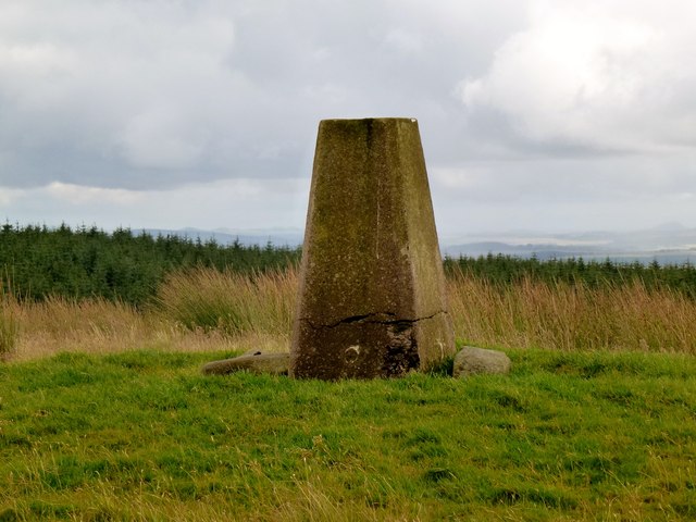
Cour Hope Images

Images are sourced within 2km of 55.712985/-3.2578592 or Grid Reference NT2147. Thanks to Geograph Open Source API. All images are credited.

Hillwalker in the mist on Wether Law Quite a contrast with the bright winter sunshine down in the valley.
Hillwalker in the mist on Wether Law
Quite a contrast with the bright winter sunshine down in the valley.
Wether Law
Wether Law
Wether Law Revisited to celebrate Colin's 600th Marilyn (second round) "Hall of Mirrors" and Rick Salter's 700th Marilyn, with Colin Crawford, Bernie Hughes, Jenny Hatfield, Rick Salter and Alan Dawson from Newlands Church, via sub-Hump Drum Maw on an initially grey day, improving to good visibility and sunshine. A fine summit party was had due to goods found in Colin's rucksack. Then onto a sub Marilyn and a P30.
Name: Wether Law
Hill number: 1817
Height: 479m / 1572ft
Area: 28A: Firth of Forth to the River Tweed
Class: Ma
Grid ref: NT 19467 48374
Summit feature: trig point
Drop: 212m
Col: 267m  NT252549
Wether Law
Revisited to celebrate Colin's 600th Marilyn (second round) "Hall of Mirrors" and Rick Salter's 700th Marilyn, with Colin Crawford, Bernie Hughes, Jenny Hatfield, Rick Salter and Alan Dawson from Newlands Church, via sub-Hump Drum Maw on an initially grey day, improving to good visibility and sunshine. A fine summit party was had due to goods found in Colin's rucksack. Then onto a sub Marilyn and a P30. Name: Wether Law Hill number: 1817 Height: 479m / 1572ft Area: 28A: Firth of Forth to the River Tweed Class: Ma Grid ref: NT 19467 48374 Summit feature: trig point Drop: 212m Col: 267m NT252549
Fingland Cottage under Wether Law.
Fingland
Cottage under Wether Law.
Gate south of Fingland A gate on the access track to the remote cottage at Fingland with Cloich Forest on the background.
Gate south of Fingland
A gate on the access track to the remote cottage at Fingland with Cloich Forest on the background.
Fingland A remote cottage on the slopes of Hag Law to the west of Cloich Forest.
Fingland
A remote cottage on the slopes of Hag Law to the west of Cloich Forest.
Summit trig point, Wether Law The Pentland Hills and Arthur's Seat from the summit, seen across the plain of Auchencorth Moss and Deepsyke Forest, with Grassfield Forest in the foreground. The Fife coast was also visible.
Summit trig point, Wether Law
The Pentland Hills and Arthur's Seat from the summit, seen across the plain of Auchencorth Moss and Deepsyke Forest, with Grassfield Forest in the foreground. The Fife coast was also visible.
West Linton from Wether Law The village of West Linton seen over the ridge of Broomlee Hill.
West Linton from Wether Law
The village of West Linton seen over the ridge of Broomlee Hill.
Southwest from Wether Law A view over the neighbouring top of Drum Maw (445m) to the distant Tinto (707m).
Southwest from Wether Law
A view over the neighbouring top of Drum Maw (445m) to the distant Tinto (707m).
Cloich Forest track On the route of the old Drove Road to Peebles.
Cloich Forest track
On the route of the old Drove Road to Peebles.
Fingland The house at Fingland as it was in January 2001. It seemed then to be secure and substantially intact and cared about - The section of gutter at the near end of the building, loose in the image, had been secured when Calum Black made a visit in 2006 - <a title="https://www.geograph.org.uk/photo/120891" href="https://www.geograph.org.uk/photo/120891">Link</a>
The sunlit slope at the left side of the image rises to Wether Law.
Fingland
The house at Fingland as it was in January 2001. It seemed then to be secure and substantially intact and cared about - The section of gutter at the near end of the building, loose in the image, had been secured when Calum Black made a visit in 2006 - Link The sunlit slope at the left side of the image rises to Wether Law.
Fingland Farm Now hill grazing but the site of ancient settlements and field systems.
Fingland Farm
Now hill grazing but the site of ancient settlements and field systems.
Wether Law trig point Looking north.
Wether Law trig point
Looking north.
Wall and forest Looking east to the forest on Ewe Hill that dominates the east of the square.  A path leads south from the photographers position to join the marked track at Fingland.
Wall and forest
Looking east to the forest on Ewe Hill that dominates the east of the square. A path leads south from the photographers position to join the marked track at Fingland.
Fingland Wether Law beyond.
Fingland
Wether Law beyond.
Path from Fingland New trees have been planted on the opposite side of the valley.
Path from Fingland
New trees have been planted on the opposite side of the valley.
Wether Law Summit The final pull onto the summit of Wether Law from the south west.
Wether Law Summit
The final pull onto the summit of Wether Law from the south west.
Wether Law trig The trig point on the summit of Wether Law, looking towards the south west.
Wether Law trig
The trig point on the summit of Wether Law, looking towards the south west.
Show me another place!

Cour Hope is located at Grid Ref: NT2147 (Lat: 55.712985, Lng: -3.2578592)

Unitary Authority: The Scottish Borders

Police Authority: The Lothians and Scottish Borders

What 3 Words

///stands.escapades.moderated. Near West Linton, Scottish Borders

Related Wikis

Black Barony

Barony Castle, also and formerly known as Black Barony, and Darnhall, is a historic house at Eddleston in the Scottish Borders area of Scotland. The house...

Great Polish Map of Scotland

The Great Polish Map of Scotland is a large (50 m x 40 m) three-dimensional, outdoor concrete scale model of Scotland, located in the grounds of the Barony...

Eddleston railway station

Eddleston railway station served the village of Eddleston, Scottish Borders, Scotland from 1855 to 1962 on the Peebles Railway. == History == The station...

Darnhall Mains

Darnhall Mains is a farm and settlement off the A703, near Eddleston and the Eddleston Water in the Scottish Borders area of Scotland, in the former Peeblesshire...

Have you been to Cour Hope?

Leave your review of Cour Hope below (or comments, questions and feedback).