Glack Hope

Valley in Peeblesshire

Scotland

Glack Hope

Bankend Plantation. This section of the Tweed is largely free from big forest blocks. There are plenty of more modest areas of woodland mixed with the farmland, and a steep north facing slope is ideal for growing timber.  A line of alders marks the Tweed running through more productive land. Taken from NT193389.
Bankend Plantation. Credit: Richard Webb

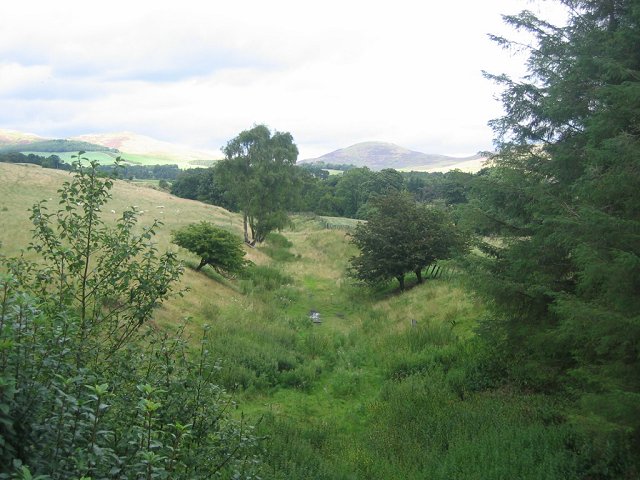
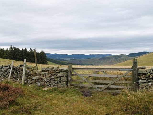
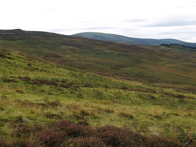
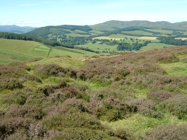
Glack Hope is a picturesque valley located in Peeblesshire, Scotland. Nestled amidst the rolling hills and lush greenery of the Scottish Borders, it offers a serene and tranquil escape for nature enthusiasts and outdoor adventurers alike.

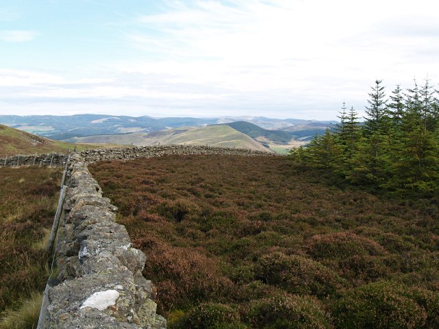
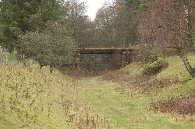
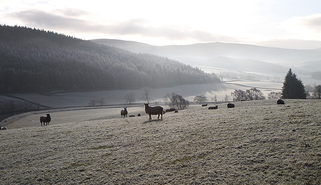
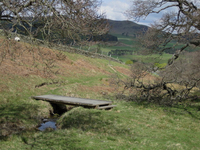
The valley is renowned for its stunning landscapes, characterized by sweeping meadows, babbling brooks, and towering trees. It is particularly famous for its vibrant wildflower displays, with a myriad of colors painting the valley during spring and summer months.

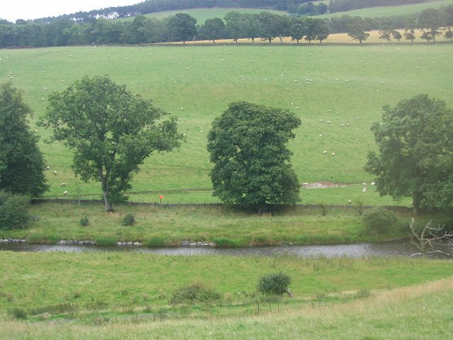
Glack Hope is also home to a diverse array of wildlife. Nature lovers can spot a variety of bird species, including buzzards, kestrels, and pheasants, soaring through the skies above. The valley is also inhabited by roe deer, rabbits, and the occasional red squirrel, making it a haven for animal enthusiasts.

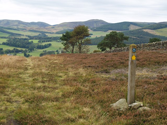
For those seeking outdoor activities, Glack Hope offers numerous opportunities. Hiking and walking trails crisscross the valley, allowing visitors to explore its enchanting beauty at their own pace. The nearby Glack Hill provides a challenging climb, rewarding hikers with breathtaking panoramic views of the surrounding countryside.

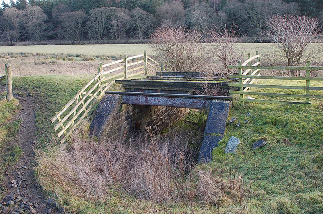
Additionally, the valley is intersected by the Glack Water, a meandering river that offers fishing opportunities for anglers. The crystal-clear waters are home to salmon and trout, luring fishing enthusiasts from far and wide.

Overall, Glack Hope in Peeblesshire is a haven of natural beauty and tranquility. Whether you seek a peaceful retreat or an adventure in the great outdoors, this valley is sure to captivate and inspire.

If you have any feedback on the listing, please let us know in the comments section below.

Glack Hope Images

Images are sourced within 2km of 55.626639/-3.2649383 or Grid Reference NT2037. Thanks to Geograph Open Source API. All images are credited.

Bankend Plantation. This section of the Tweed is largely free from big forest blocks. There are plenty of more modest areas of woodland mixed with the farmland, and a steep north facing slope is ideal for growing timber.  A line of alders marks the Tweed running through more productive land. Taken from NT193389.
Bankend Plantation.
This section of the Tweed is largely free from big forest blocks. There are plenty of more modest areas of woodland mixed with the farmland, and a steep north facing slope is ideal for growing timber. A line of alders marks the Tweed running through more productive land. Taken from NT193389.
Symington and Peebles Branch. The trackbed of a railway which once linked the Borders towns directly with Lanarkshire and Glasgow. Looking downstream and out of the square from a bridge providing access to farmland beside the Tweed.
Symington and Peebles Branch.
The trackbed of a railway which once linked the Borders towns directly with Lanarkshire and Glasgow. Looking downstream and out of the square from a bridge providing access to farmland beside the Tweed.
River Tweed. At Easter Happrew with a pipeline marker.  Looking south from NT195395, shows a lot of the square and its main land use, raising sheep.
River Tweed.
At Easter Happrew with a pipeline marker. Looking south from NT195395, shows a lot of the square and its main land use, raising sheep.
Forest corner, Hallmanor Forest The square is mostly a shallow heather bowl, but also contains a small corner of the Hallmanor Forest.
Forest corner, Hallmanor Forest
The square is mostly a shallow heather bowl, but also contains a small corner of the Hallmanor Forest.
John Buchan Way, near Easter Dawyck More details on this 22km track from Peebles to Broughton will be found at 
<span class="nowrap"><a title="http://walking.visitscotland.com/walks/southscotland/213763" rel="nofollow ugc noopener" href="http://walking.visitscotland.com/walks/southscotland/213763">Link</a><img style="margin-left:2px;" alt="External link" title="External link - shift click to open in new window" src="https://s1.geograph.org.uk/img/external.png" width="10" height="10"/></span> .
John Buchan Way, near Easter Dawyck
More details on this 22km track from Peebles to Broughton will be found at LinkExternal link .
Gate and stile, John Buchan Way
Rough grazing, White Knowe A mix of heather, grass and bracken on the E slopes of White Knowe.
Rough grazing, White Knowe
A mix of heather, grass and bracken on the E slopes of White Knowe.
Stobo, near Peebles Entering the sleepy hamlet, coming from Lyne Station
Stobo, near Peebles
Entering the sleepy hamlet, coming from Lyne Station
Site of fort and settlement above Stobo The site is just above the John Buchan Way and has a commanding view of the Tweed valley. The rampart enclosing the area can be seen curving away to the right.
Site of fort and settlement above Stobo
The site is just above the John Buchan Way and has a commanding view of the Tweed valley. The rampart enclosing the area can be seen curving away to the right.
Old railway bridge near Stobo A small bridge, probably for access to the fields, on the now dismantled Peebles to Broughton railway line.
Old railway bridge near Stobo
A small bridge, probably for access to the fields, on the now dismantled Peebles to Broughton railway line.
Bridge over Peebles - Broughton railway The trackbed is obstructed by a dump of rubble a short way past the south side of this bridge, but is clear beyond that.
Bridge over Peebles - Broughton railway
The trackbed is obstructed by a dump of rubble a short way past the south side of this bridge, but is clear beyond that.
Frosted farmland Viewed from the B712 near Stobo with Bankend Plantation in the background.
Frosted farmland
Viewed from the B712 near Stobo with Bankend Plantation in the background.
Burn at Easter Happrew in Peebbleshire One of the many, if tiny, tributaries of the river Tweed.
Burn at Easter Happrew in Peebbleshire
One of the many, if tiny, tributaries of the river Tweed.
The B712 heading in a northerly direction Near Easter Happrew.
The B712 heading in a northerly direction
Near Easter Happrew.
The B712 heading for Easterknowe Farm In Peeblesshire.
The B712 heading for Easterknowe Farm
In Peeblesshire.
John Buchan Way, Easter Dawyck The Way leaves the track here to skirt above the farm before climbing to cross the pass into Glack Hope in the Manor Valley.
John Buchan Way, Easter Dawyck
The Way leaves the track here to skirt above the farm before climbing to cross the pass into Glack Hope in the Manor Valley.
On the John Buchan Way above Stobo The Way is routed through the fields S of Easter Dawyck Farm; here the highest point visible is Trahenna Hill across the Tweed Valley.
On the John Buchan Way above Stobo
The Way is routed through the fields S of Easter Dawyck Farm; here the highest point visible is Trahenna Hill across the Tweed Valley.
Footbridge on the John Buchan Way The path here leaves the track above Easter Dawyck to climb to the pass above Glack Hope.
Footbridge on the John Buchan Way
The path here leaves the track above Easter Dawyck to climb to the pass above Glack Hope.
Show me another place!

Glack Hope is located at Grid Ref: NT2037 (Lat: 55.626639, Lng: -3.2649383)

Unitary Authority: The Scottish Borders

Police Authority: The Lothians and Scottish Borders

What 3 Words

///interlude.save.norms. Near Peebles, Scottish Borders

Nearby Locations

Woodhouse Hill Glack Hope

Related Wikis

Lyne Water

The Lyne Water is a tributary of the River Tweed that rises in the Pentland Hills of southern Scotland at Baddinsgill Reservoir. It runs through West Linton...

Manor, Scottish Borders

Manor is a parish in Peeblesshire in the Scottish Borders, whose church lies on the west bank of Manor Water 3 miles south-west of Peebles.The parish...

Manor Water

Manor Water is a river in the parish of Manor, Peeblesshire in the Scottish Borders. It rises in the Ettrick Forest and flows down through the Maynor valley...

Stobo Kirk

Stobo Kirk is an ancient church of the Church of Scotland. It is dedicated to St Mungo and is situated near the B712 off the A72 just 6 miles south-west...

Nearby Amenities

Located within 500m of 55.626639,-3.2649383
Skye Hill
Ele: 350
Natural: peak
Lat/Long: 55.6296922/-3.2698027
The data included in this document is from www.openstreetmap.org. The data is made available under ODbL.

Have you been to Glack Hope?

Leave your review of Glack Hope below (or comments, questions and feedback).