Green Cleuch

Valley in Peeblesshire

Scotland

Green Cleuch

Megget Reservoir The reservoir was viewed on a beautiful early April morning.
Megget Reservoir Credit: Walter Baxter

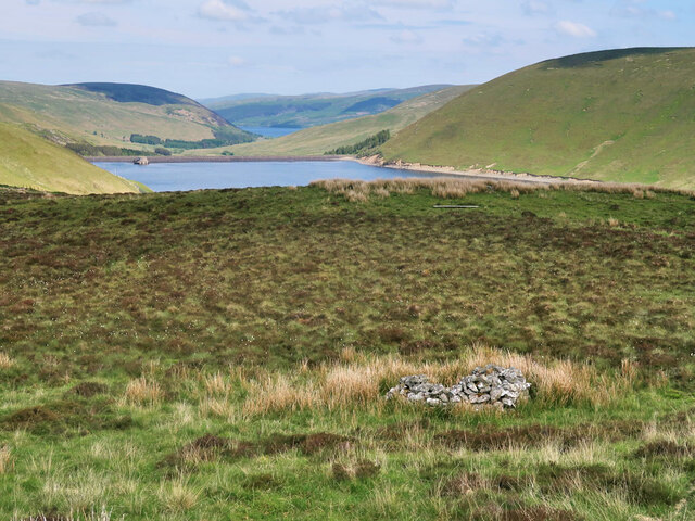
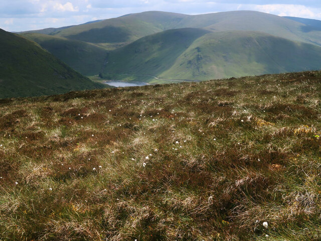
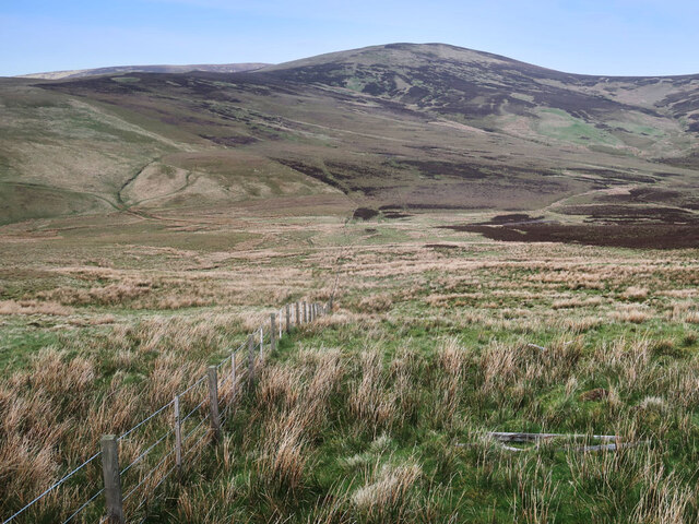
Green Cleuch is a picturesque valley located in Peeblesshire, Scotland. Situated near the charming town of Peebles, it is bordered by rolling hills and verdant forests, offering awe-inspiring natural beauty. The valley stretches for approximately 3 miles, providing a tranquil and idyllic setting for outdoor enthusiasts and nature lovers.

The lush landscape of Green Cleuch is characterized by its rich biodiversity. The valley is home to a variety of flora and fauna, including native Scottish plants such as heather, bluebells, and ferns. Wildlife thrives in this habitat, with sightings of red deer, otters, and various bird species being common.

Green Cleuch is intersected by a meandering river, which adds to the valley's charm. The river not only enhances the aesthetic appeal of the surroundings but also provides a habitat for freshwater species, including salmon and trout. It offers opportunities for fishing and is a popular spot for anglers seeking a peaceful retreat.

The valley is a haven for outdoor activities, attracting hikers, cyclists, and nature enthusiasts. A network of trails winds through the valley, offering stunning panoramic views of the surrounding countryside. Those seeking more adventurous pursuits can partake in mountain biking, horseback riding, or even paragliding, as the valley is known for its excellent conditions for these activities.

Green Cleuch is also steeped in history, with remnants of ancient settlements and stone circles scattered throughout the area. Archaeological excavations have unearthed artifacts dating back thousands of years, providing insights into the lives of the early inhabitants.

Overall, Green Cleuch in Peeblesshire is a captivating valley that combines natural beauty, recreational opportunities, and historical significance, making it a must-visit destination for those seeking a glimpse of Scotland's enchanting countryside.

If you have any feedback on the listing, please let us know in the comments section below.
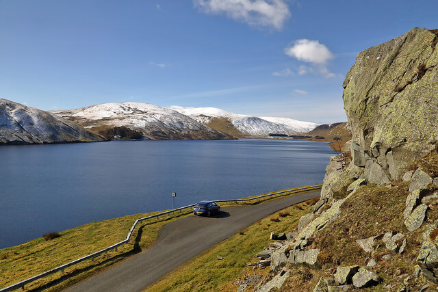
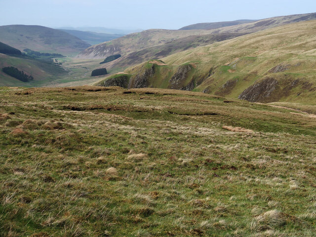
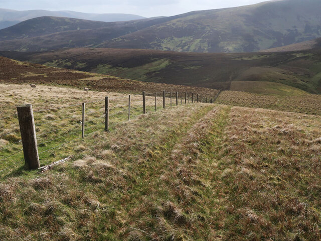
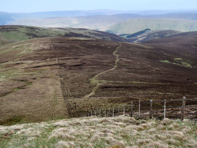
Green Cleuch Images

Images are sourced within 2km of 55.506391/-3.272289 or Grid Reference NT1924. Thanks to Geograph Open Source API. All images are credited.

Megget Reservoir The reservoir was viewed on a beautiful early April morning.
Megget Reservoir
The reservoir was viewed on a beautiful early April morning.
Moorland on Greenside Law Looking towards Bitch Craig and Manor Water valley.
Moorland on Greenside Law
Looking towards Bitch Craig and Manor Water valley.
Fence on Greenside Law Descending to Water Head.
Fence on Greenside Law
Descending to Water Head.
Fence and moorland on Notman Law Grassy moorland on the left of the fence and heather moorland with the Thief's Road on the right.
Fence and moorland on Notman Law
Grassy moorland on the left of the fence and heather moorland with the Thief's Road on the right.
Moorland above the Megget Reservoir With an old grouse butt on the right. Looking towards the Megget Dam and St Mary's Loch.
Moorland above the Megget Reservoir
With an old grouse butt on the right. Looking towards the Megget Dam and St Mary's Loch.
Heather moorland and cotton grass on Clockmore Looking towards Dead for Cauld at the western end of the Megget Reservoir.
Heather moorland and cotton grass on Clockmore
Looking towards Dead for Cauld at the western end of the Megget Reservoir.
Cotton grass and heather moorland On the east side of Cramalt Craig near the Cramalt Burn.
Cotton grass and heather moorland
On the east side of Cramalt Craig near the Cramalt Burn.
Track beside the Cramalt Burn On the east side of Cramalt Craig.
Track beside the Cramalt Burn
On the east side of Cramalt Craig.
Low water in the Megget Reservoir This reservoir - the main one supplying Edinburgh - is at a seriously low level after an extended dry spell.
Low water in the Megget Reservoir
This reservoir - the main one supplying Edinburgh - is at a seriously low level after an extended dry spell.
Craigie Rig This is an area of rough grazing with patches of heather. The high hill in the background is Cramalt Craig.
Craigie Rig
This is an area of rough grazing with patches of heather. The high hill in the background is Cramalt Craig.
Moorland fence on Foulbrig Looking towards Black Law.
Moorland fence on Foulbrig
Looking towards Black Law.
Megget Dam On Megget Dam looking towards the slopes of Syart Law.
Megget Dam
On Megget Dam looking towards the slopes of Syart Law.
The draw-off and overflow tower at Megget Reservoir The reservoir was opened on 30th September 1983 and under normal conditions has an area of surface water of 259 hectares (640 acres).
The draw-off and overflow tower at Megget Reservoir
The reservoir was opened on 30th September 1983 and under normal conditions has an area of surface water of 259 hectares (640 acres).
A frozen pool at Craigie Rig Broomy Law is the hill in the background.
A frozen pool at Craigie Rig
Broomy Law is the hill in the background.
The head of the Manor Valley The valley ends with a half-ring of 600-800m hilltops - Redsike Head, Greenside Law, Water Head, Notman Law and Fifescar Knowe.
The head of the Manor Valley
The valley ends with a half-ring of 600-800m hilltops - Redsike Head, Greenside Law, Water Head, Notman Law and Fifescar Knowe.
Scree and grass, upper Manor Valley Large blocky scree on the side of Greenside Law.
Scree and grass, upper Manor Valley
Large blocky scree on the side of Greenside Law.
Small sidestream, Manor Head A tiny tributary of the Manor Water in the upper part of the valley.
Small sidestream, Manor Head
A tiny tributary of the Manor Water in the upper part of the valley.
Notman Cleuch A steep-sided erosion feature on the east side of Notman Law.
Notman Cleuch
A steep-sided erosion feature on the east side of Notman Law.
Show me another place!

Green Cleuch is located at Grid Ref: NT1924 (Lat: 55.506391, Lng: -3.272289)

Unitary Authority: The Scottish Borders

Police Authority: The Lothians and Scottish Borders

What 3 Words

///divisible.kebabs.toolkit. Near Ettrick, Scottish Borders

Nearby Locations

Green Cleuch Rig Head

Related Wikis

Craigierig

Craigierig is a village on the Megget Reservoir, in the Scottish Borders area of Scotland, in the former Selkirkshire. Places nearby include the Glengaber...

Megget

Megget is a former chapelry or parish containing the valley of Megget Water, now forming the westernmost part of the parish of Yarrow, Selkirkshire in...

Megget Reservoir

Megget Reservoir is an impounding reservoir in the Megget valley in Ettrick Forest, in the Scottish Borders. The 259 hectares (640 acres) reservoir is...

Black Law (hill)

Black Law is a hill in the Manor Hills range, part of the Southern Uplands of Scotland. One of the more remote Donalds, it does not easily combine into...

Have you been to Green Cleuch?

Leave your review of Green Cleuch below (or comments, questions and feedback).