Deep Hope

Valley in Peeblesshire

Scotland

Deep Hope

Track on Green Knowe A view down the valley of the Flemington Burn, with the low winter sun highlighting old sheepfolds on the hillsides.
Track on Green Knowe Credit: Alan O'Dowd

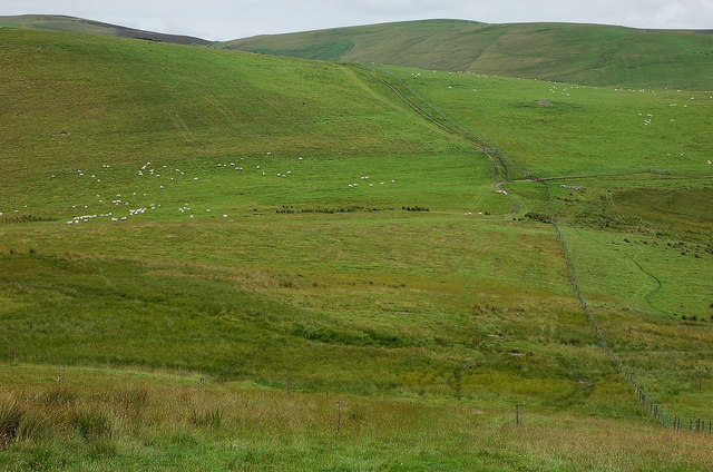
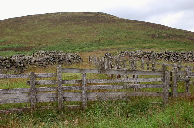
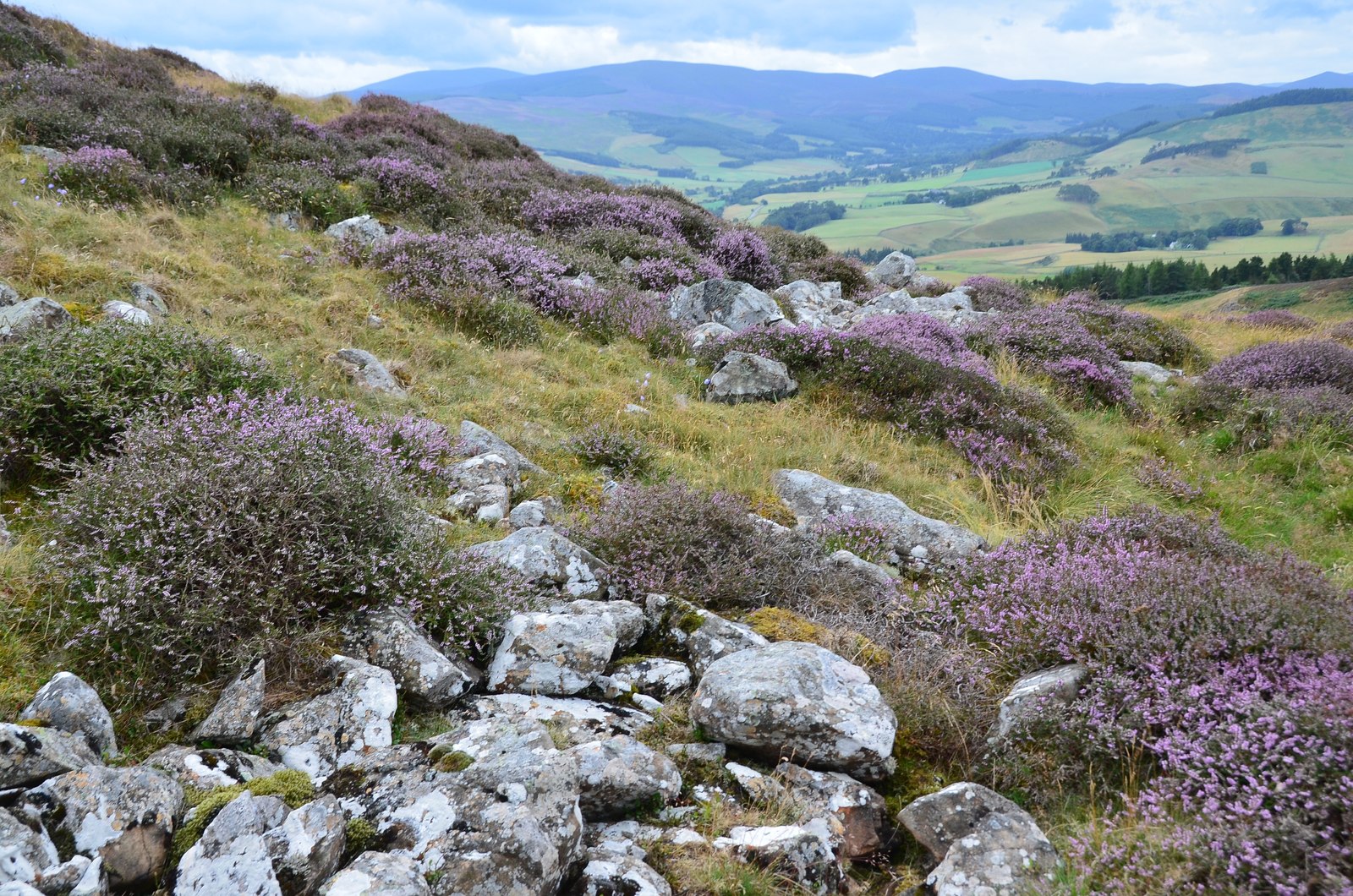
Deep Hope is a picturesque valley situated in Peeblesshire, Scotland. Nestled among rolling hills and lush greenery, it is renowned for its stunning natural beauty and tranquility. The valley is located approximately 8 miles south-east of Peebles, a charming town in the Scottish Borders region.

The name "Deep Hope" aptly describes the valley's deep, narrow gorge-like formation, carved out by the Hope Burn, a small river that runs through its heart. The steep sides of the valley are covered with dense forests, creating a serene and secluded atmosphere. The valley floor is adorned with meandering paths, providing visitors with the opportunity to explore and appreciate the area's scenic surroundings.

Deep Hope is home to a diverse range of flora and fauna, making it an ideal destination for nature enthusiasts and wildlife lovers. The valley is teeming with various species of birds, including buzzards, kestrels, and owls, which can often be spotted soaring above the treetops. The river is also home to otters and brown trout, adding to the area's natural charm.

The valley's natural landscape offers numerous recreational activities for visitors. Hiking and walking trails wind through the valley, offering breathtaking views and opportunities to discover hidden waterfalls and ancient ruins. Fishing is also a popular pastime, with the Hope Burn providing ample opportunities for anglers to cast their lines.

Deep Hope truly offers a peaceful retreat from the hustle and bustle of everyday life, allowing visitors to immerse themselves in the beauty of nature and enjoy a sense of tranquility in this idyllic Scottish valley.

If you have any feedback on the listing, please let us know in the comments section below.

Deep Hope Images

Images are sourced within 2km of 55.68595/-3.2930025 or Grid Reference NT1844. Thanks to Geograph Open Source API. All images are credited.

Track on Green Knowe A view down the valley of the Flemington Burn, with the low winter sun highlighting old sheepfolds on the hillsides.
Track on Green Knowe
A view down the valley of the Flemington Burn, with the low winter sun highlighting old sheepfolds on the hillsides.
Mist rolling over forested hillsides above the Flemington Burn It was a day of stark contrasts between bright winter sunshine and banks of mist.
Mist rolling over forested hillsides above the Flemington Burn
It was a day of stark contrasts between bright winter sunshine and banks of mist.
Valley of the Fingland Burn The burn rises on the western slopes of Wether Law in the Cloich Hills and joins the Flemington Burn a few hundred metres downstream.
Valley of the Fingland Burn
The burn rises on the western slopes of Wether Law in the Cloich Hills and joins the Flemington Burn a few hundred metres downstream.
Confluence of the Fingland and Flemington Burns The Flemington Burn rises on the east side of Wether Law in the Cloich Hills, here meets the Fingland Burn and flows southwest to the Lyne Water.
Confluence of the Fingland and Flemington Burns
The Flemington Burn rises on the east side of Wether Law in the Cloich Hills, here meets the Fingland Burn and flows southwest to the Lyne Water.
Gate into Cloich Forest On the path from Romannobridge, also on the Cross Borders Drove Road.
Gate into Cloich Forest
On the path from Romannobridge, also on the Cross Borders Drove Road.
Path in Cloich Forest The path from the Flemington Burn to the forest road near Courhope, also part of the Cross Borders Drove Road.
Path in Cloich Forest
The path from the Flemington Burn to the forest road near Courhope, also part of the Cross Borders Drove Road.
Forest ride, Harehope A view across the valley of the Lyne Burn to the grassy ridge above Deep Hope. The structures on the ridge are old road trailers now used for storing sheep feed. The Stobo hills are in the distance with Penvalla L of centre.
Forest ride, Harehope
A view across the valley of the Lyne Burn to the grassy ridge above Deep Hope. The structures on the ridge are old road trailers now used for storing sheep feed. The Stobo hills are in the distance with Penvalla L of centre.
Forest boundary, Crailzie Hill The western edge of Harehope Forest at the top of Wide Hope.
Forest boundary, Crailzie Hill
The western edge of Harehope Forest at the top of Wide Hope.
The col above Wide Hope Open hillside contrasts with the plantations of Harehope Forest on this col W of Crailzie Hill.
The col above Wide Hope
Open hillside contrasts with the plantations of Harehope Forest on this col W of Crailzie Hill.
Boundary wall, Wide Hope Shank Upland sheep walks on the ridge between the valleys of the Lyne Water and the Meldon.
Boundary wall, Wide Hope Shank
Upland sheep walks on the ridge between the valleys of the Lyne Water and the Meldon.
Wall junction, Stevenson Hill New fencing has been put in alongside both walls - compare with <a href="https://www.geograph.org.uk/photo/166538">NT1744 : Stevenson Hill</a> taken in 2006. Another addition is a small mast on the top of the hill, probably carrying an anemometer for a wind survey.
Wall junction, Stevenson Hill
New fencing has been put in alongside both walls - compare with NT1744 : Stevenson Hill taken in 2006. Another addition is a small mast on the top of the hill, probably carrying an anemometer for a wind survey.
From the southwest top of Wide Hope Shank Looking from the 462m spot height to the glen of Wester Happrew Burn and the part-forested ridge up to Ladyurd Hill with Penvalla to the left. The distant conical peak is possibly Worm Hill south of Broughton.
From the southwest top of Wide Hope Shank
Looking from the 462m spot height to the glen of Wester Happrew Burn and the part-forested ridge up to Ladyurd Hill with Penvalla to the left. The distant conical peak is possibly Worm Hill south of Broughton.
Storage trailers above Deep Hope There are half a dozen of these old NCL (National Carriers Ltd) road trailers on the hillside, used as storage for sheep feed. The heather moors around Hundleshope Heights are on the skyline.
Storage trailers above Deep Hope
There are half a dozen of these old NCL (National Carriers Ltd) road trailers on the hillside, used as storage for sheep feed. The heather moors around Hundleshope Heights are on the skyline.
Hill pasture above Deep Hope A look back along the fence towards the plantations of Harehope Forest.
Hill pasture above Deep Hope
A look back along the fence towards the plantations of Harehope Forest.
Hillside with sheep On the ridge above Haggin Hope, with mixed grass and boggy land.
Hillside with sheep
On the ridge above Haggin Hope, with mixed grass and boggy land.
Old sheepfold below Black Meldon Wooden fencing within a larger area enclosed by a partly ruined stone wall.
Old sheepfold below Black Meldon
Wooden fencing within a larger area enclosed by a partly ruined stone wall.
Stevenson Hill Looking along the ridge towards the unwelcome and sinister wind survey mast on the highest point at the north of the ridge. Such a large unmessed up area like Tweeddale is obviously intolerable and will be dealt with.
Stevenson Hill
Looking along the ridge towards the unwelcome and sinister wind survey mast on the highest point at the north of the ridge. Such a large unmessed up area like Tweeddale is obviously intolerable and will be dealt with.
Stevenson Hill Looking towards the summit and the extremely unwelcome sight of an anemometer mast. This bit of Tweeddale is in extreme danger.
Stevenson Hill
Looking towards the summit and the extremely unwelcome sight of an anemometer mast. This bit of Tweeddale is in extreme danger.
Show me another place!

Deep Hope is located at Grid Ref: NT1844 (Lat: 55.68595, Lng: -3.2930025)

Unitary Authority: The Scottish Borders

Police Authority: The Lothians and Scottish Borders

What 3 Words

///concluded.winks.dignify. Near Peebles, Scottish Borders

Nearby Locations

Wide Hope Shank Deep Hope

Related Wikis

Black Meldon

Black Meldon is a prehistoric site, a hillfort near the village of Lyne and about 4 miles (6 km) west of Peebles, in the Scottish Borders, Scotland. It...

Tarth Water

The Tarth Water is a river in Peebleshire, in the Scottish Borders. It forms part of the River Tweed system. The river with a total length of 7.1 miles...

Drochil Castle

Drochil Castle is a ruined castle in the Scottish Borders. It is located above the Lyne Water, 10 kilometres (6.2 mi) north-west of Peebles, and 8 kilometres...

White Meldon

White Meldon is a prehistoric site, a hillfort near the village of Lyne and about 4 miles (6 km) west of Peebles, in the Scottish Borders, Scotland. It...

Nearby Amenities

Located within 500m of 55.68595,-3.2930025
Wide Hope Shank
Ele: 465
Natural: peak
Lat/Long: 55.6892242/-3.2963673
The data included in this document is from www.openstreetmap.org. The data is made available under ODbL.

Have you been to Deep Hope?

Leave your review of Deep Hope below (or comments, questions and feedback).