Cowie Cleuch

Valley in Peeblesshire

Scotland

Cowie Cleuch

View along boundary fence from Long Grain Knowe towards Grey Weather Law These small peat hags were the only sheltered spot to have lunch on this windy day.
View along boundary fence from Long Grain Knowe towards Grey Weather Law Credit: Colin Park

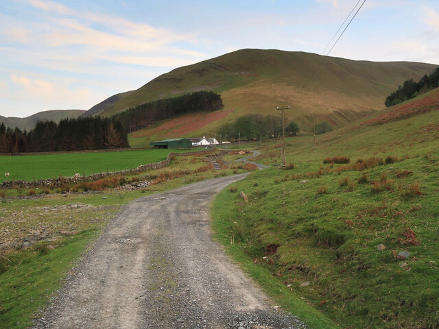
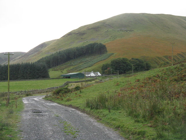
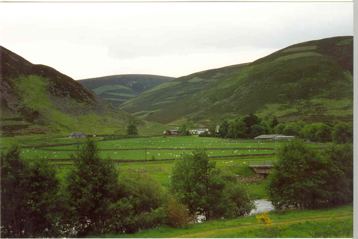
Cowie Cleuch is a picturesque valley located in Peeblesshire, a historic county in the southern region of Scotland. Nestled amidst rolling hills and lush greenery, this valley is renowned for its natural beauty and tranquil atmosphere.

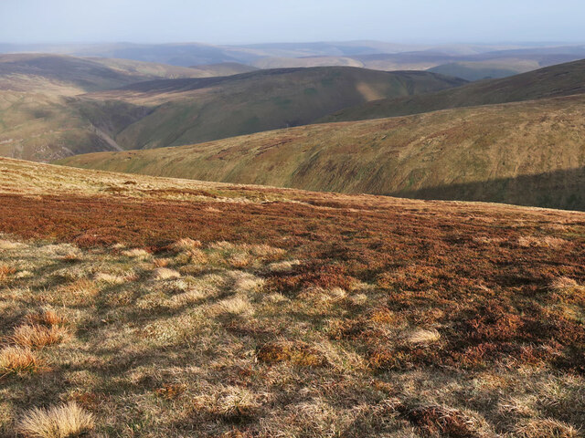
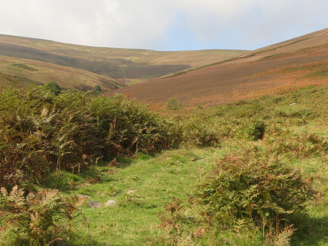
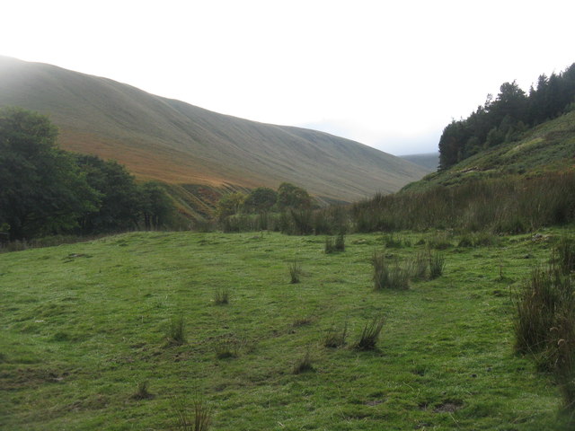
Stretching over several miles, Cowie Cleuch is traversed by a sparkling stream that meanders through the heart of the valley. The stream is fed by numerous smaller tributaries, resulting in a network of babbling brooks and gentle waterfalls that add to the valley's charm. The surrounding landscape is dominated by sprawling meadows, verdant forests, and towering hills, creating a stunning backdrop for visitors and locals alike.

The valley is home to a diverse array of flora and fauna, with wildflowers dotting the meadows and a variety of bird species soaring through the skies. The area is particularly popular among nature enthusiasts, who can enjoy leisurely walks along the well-maintained paths that wind through the valley, offering stunning vistas at every turn.

Cowie Cleuch also holds historical significance, with remnants of ancient settlements and structures scattered throughout the area. These archaeological sites provide glimpses into the valley's rich past and offer a fascinating insight into the lives of those who once called this place home.

Visitors to Cowie Cleuch can expect a tranquil and serene experience, with ample opportunities for hiking, birdwatching, and simply immersing oneself in the beauty of nature. Whether seeking a peaceful retreat or an outdoor adventure, this valley in Peeblesshire is sure to captivate all who venture into its idyllic surroundings.

If you have any feedback on the listing, please let us know in the comments section below.

Cowie Cleuch Images

Images are sourced within 2km of 55.545556/-3.3027803 or Grid Reference NT1728. Thanks to Geograph Open Source API. All images are credited.

View along boundary fence from Long Grain Knowe towards Grey Weather Law These small peat hags were the only sheltered spot to have lunch on this windy day.
View along boundary fence from Long Grain Knowe towards Grey Weather Law
These small peat hags were the only sheltered spot to have lunch on this windy day.
Heading towards Middle Hill from Long Grain Knowe There is a faint ATV track to follow in places along this stretch.
Heading towards Middle Hill from Long Grain Knowe
There is a faint ATV track to follow in places along this stretch.
The Thief's Road on Fifescar Knowe Looking towards Notman Law.
The Thief's Road on Fifescar Knowe
Looking towards Notman Law.
Fence and old dyke on Dollar Law Looking towards Fifescar Knowe with Broad Law on the right.
Fence and old dyke on Dollar Law
Looking towards Fifescar Knowe with Broad Law on the right.
Fence and moorland on Dollar Law Descending to Newholm Cairns Hill.
Fence and moorland on Dollar Law
Descending to Newholm Cairns Hill.
Moorland on Dollar Law East of the summit looking over Ugly Grain to Manor Rig.
Moorland on Dollar Law
East of the summit looking over Ugly Grain to Manor Rig.
Fence and old dyke descending Dollar Law A steep descent off the hill to Manorhead.
Fence and old dyke descending Dollar Law
A steep descent off the hill to Manorhead.
Track to Manorhead The old telephone poles are carrying a new fibre optic cable.
Track to Manorhead
The old telephone poles are carrying a new fibre optic cable.
The track to Manorhead From the end of the public road.
The track to Manorhead
From the end of the public road.
Kirkhope Rig path Crossing the Kirkhope Burn, the track turns into a very fine zigzag up to the ridge.
Kirkhope Rig path
Crossing the Kirkhope Burn, the track turns into a very fine zigzag up to the ridge.
Old Kirkhope
Old Kirkhope
Road down Kirkhope
Road down Kirkhope
Head of Kirkhope Between Pikestone Hill and Grey Wether Law.
Head of Kirkhope
Between Pikestone Hill and Grey Wether Law.
Ugly Grain at Manorhead Mostly in the shadow of Manor Rig.
Ugly Grain at Manorhead
Mostly in the shadow of Manor Rig.
The road to Manorhead  Ugly Grain burn flows past the house from the right, to join the main Manor Water valley on the left.
The road to Manorhead
Ugly Grain burn flows past the house from the right, to join the main Manor Water valley on the left.
Farm track to Manorhead A barn at Manorhead farm is just visible R of centre.
Farm track to Manorhead
A barn at Manorhead farm is just visible R of centre.
Manorhead farm A hill farm near the head of this beautiful Borders valley.
Manorhead farm
A hill farm near the head of this beautiful Borders valley.
Aircraft wreckage, Dollar Law Remains of an aircraft crash about 350m east of the summit. There are rusted metal tubes, smaller debris and some aluminium components. 

The website 'Air Crash Sites Scotland' lists the following details: 

Crash date 28 February 1949
Aircraft type De Havilland Dominie, registration X7400, Royal Navy Air Squadron

The pilot survived the crash after the plane lost height due to port engine failure. More details are given at <span class="nowrap"><a title="http://www.aircrashsites-scotland.co.uk/dh-dominie-dollar-law.htm" rel="nofollow ugc noopener" href="http://www.aircrashsites-scotland.co.uk/dh-dominie-dollar-law.htm">Link</a><img style="margin-left:2px;" alt="External link" title="External link - shift click to open in new window" src="https://s1.geograph.org.uk/img/external.png" width="10" height="10"/></span>

Some further information from 'A Source of Manor' published locally by Lyne and Manor Youth Group, 1999: "The pilot crash landed and survived. He got out of the plane and walked down to Manorhead where he took the pony and trap to Posso to use the telephone, as it was one of the few in the valley at the time."
Aircraft wreckage, Dollar Law
Remains of an aircraft crash about 350m east of the summit. There are rusted metal tubes, smaller debris and some aluminium components. The website 'Air Crash Sites Scotland' lists the following details: Crash date 28 February 1949 Aircraft type De Havilland Dominie, registration X7400, Royal Navy Air Squadron The pilot survived the crash after the plane lost height due to port engine failure. More details are given at LinkExternal link Some further information from 'A Source of Manor' published locally by Lyne and Manor Youth Group, 1999: "The pilot crash landed and survived. He got out of the plane and walked down to Manorhead where he took the pony and trap to Posso to use the telephone, as it was one of the few in the valley at the time."
Show me another place!

Cowie Cleuch is located at Grid Ref: NT1728 (Lat: 55.545556, Lng: -3.3027803)

Unitary Authority: The Scottish Borders

Police Authority: The Lothians and Scottish Borders

What 3 Words

///sending.workshops.marmalade. Near Peebles, Scottish Borders

Related Wikis

Black Law (hill)

Black Law is a hill in the Manor Hills range, part of the Southern Uplands of Scotland. One of the more remote Donalds, it does not easily combine into...

Posso Tower

Posso Tower is a 16th-century tower house, about 6.0 miles (9.7 km) south and west of Peebles, Scottish Borders, Scotland, and west of Manor Water. �...

Stanhope, Peeblesshire

Stanhope is a small settlement in the Scottish Borders region. It is situated in the parish of Drumelzier in Peeblesshire, in the valley of the River...

Craigierig

Craigierig is a village on the Megget Reservoir, in the Scottish Borders area of Scotland, in the former Selkirkshire. Places nearby include the Glengaber...

Have you been to Cowie Cleuch?

Leave your review of Cowie Cleuch below (or comments, questions and feedback).