Clais a' Mharcaiche

Valley in Banffshire

Scotland

Clais a' Mharcaiche

Farm shed at Dell
Farm shed at Dell Credit: Alan Reid

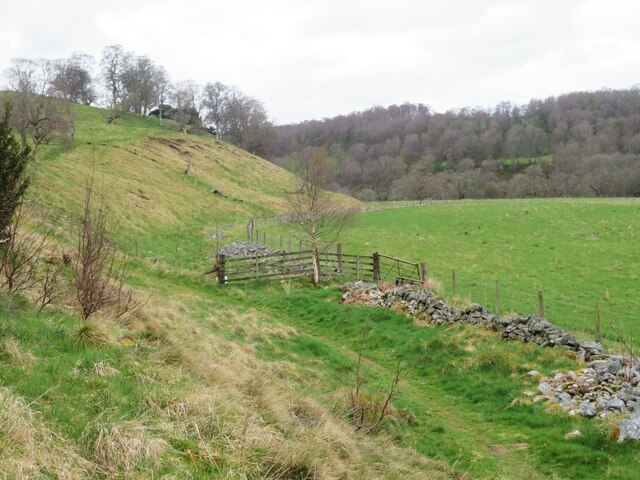
Clais a' Mharcaiche, also known as the Valley of the Horseman, is a scenic location situated in Banffshire, Scotland. Nestled amidst the stunning Scottish Highlands, this valley offers breathtaking natural beauty and a rich historical significance.

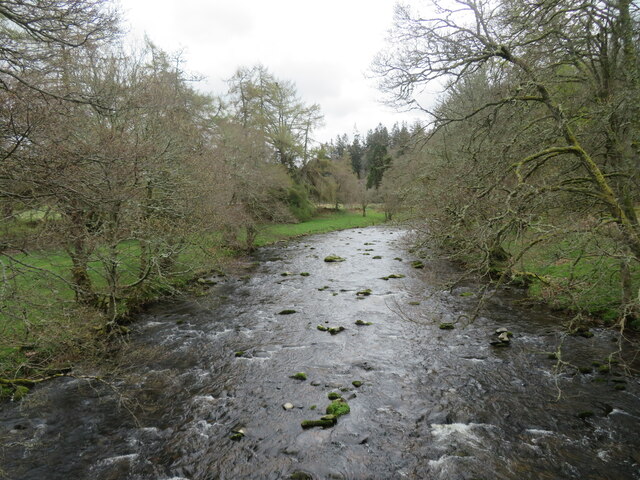
The valley is characterized by its rolling hills, lush green meadows, and crystal-clear streams, making it an idyllic spot for nature enthusiasts and outdoor adventurers. The surrounding landscape is dotted with an abundance of wildlife, including deer, birds of prey, and various species of plants and flowers, providing a haven for nature lovers and photographers.

In addition to its natural attractions, Clais a' Mharcaiche has a fascinating historical background. The valley got its name from the legend of a horseman who once roamed the area. According to local lore, this horseman was a notorious figure who protected the valley from invaders and played a crucial role in defending the region during ancient conflicts.

Today, visitors can explore the valley and immerse themselves in its rich history by visiting the nearby ruins of ancient castles and burial sites. The valley also offers a network of walking trails and hiking routes, allowing visitors to experience the beauty of the Scottish countryside firsthand.

Overall, Clais a' Mharcaiche is a must-visit destination for those seeking a blend of natural beauty and historical intrigue. Whether it's admiring the scenic vistas, spotting wildlife, or delving into the captivating legends of the valley, Clais a' Mharcaiche offers a unique and unforgettable experience for all who venture there.

If you have any feedback on the listing, please let us know in the comments section below.

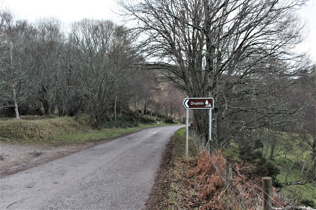
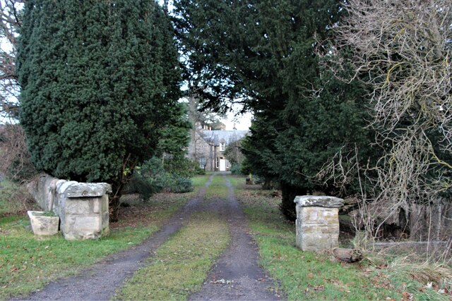
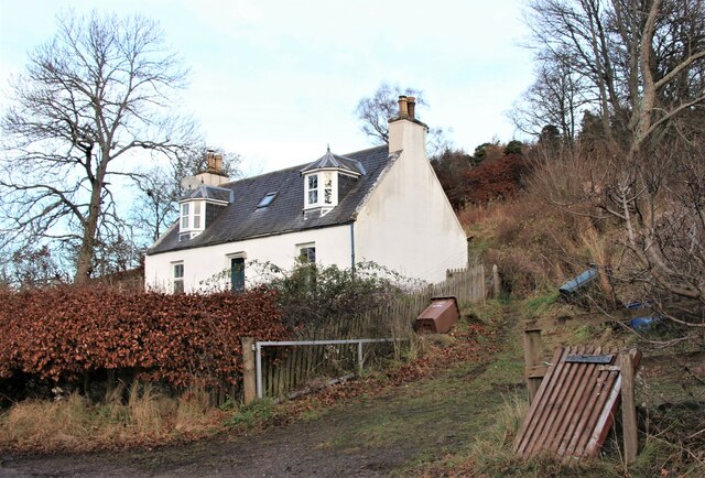
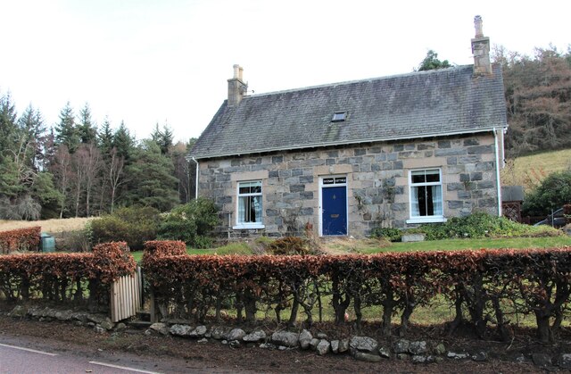
Clais a' Mharcaiche Images

Images are sourced within 2km of 57.347838/-3.3758712 or Grid Reference NJ1729. Thanks to Geograph Open Source API. All images are credited.

Farm shed at Dell
Farm shed at Dell
Suspension Footbridge across the Avon It gives access to Altnaha and Lyne on the west side of Strath Avon.
Suspension Footbridge across the Avon
It gives access to Altnaha and Lyne on the west side of Strath Avon.
An ancient birch above Dalrachie Loch
Little Dalrachie A lone cottage in Strath Avon.
Little Dalrachie
A lone cottage in Strath Avon.
Drumin picnic site By the B9136 through Strath Avon.
Drumin picnic site
By the B9136 through Strath Avon.
Dalrachie upon Avon Springer and Bracken chill out in the crystal clear waters of an Avon ford  just as their namesakes  have done years ago.
Dalrachie upon Avon
Springer and Bracken chill out in the crystal clear waters of an Avon ford just as their namesakes have done years ago.
Gateway to Drumin Farm
Cottage in Glenlivet By the B9008 road to Bridge of Avon.
Cottage in Glenlivet
By the B9008 road to Bridge of Avon.
Downan Cottage and Post Office Post Office services for Glenlivet and Ballindalloch.
Downan Cottage and Post Office
Post Office services for Glenlivet and Ballindalloch.
Path below Drumin Castle A circuitous path to the castle avoids a multitude of steps up from the car park, but as the castle was closed for some repair work, the whole exercise was rather pointless. Across the meadow to the right is the River Avon.
Path below Drumin Castle
A circuitous path to the castle avoids a multitude of steps up from the car park, but as the castle was closed for some repair work, the whole exercise was rather pointless. Across the meadow to the right is the River Avon.
River Livet from Drumin Bridge Glen Livet has a strong association with whisky distilleries, so I wonder if the river is around 2% proof from the distillery drainage?
River Livet from Drumin Bridge
Glen Livet has a strong association with whisky distilleries, so I wonder if the river is around 2% proof from the distillery drainage?
Site of the old Glenlivet distillery This cairn marks the site of the original Glenlivet Distillery. It was founded by George Smith and first licensed in 1824, though had probably been operating as an illicit still before this.
The distillery moved to its current site, further down the hill, in 1859.
Site of the old Glenlivet distillery
This cairn marks the site of the original Glenlivet Distillery. It was founded by George Smith and first licensed in 1824, though had probably been operating as an illicit still before this. The distillery moved to its current site, further down the hill, in 1859.
Milestone on the B9136 All the milestones on the Glenlivet Estate seem to have been painted.
Milestone on the B9136
All the milestones on the Glenlivet Estate seem to have been painted.
Little Dalrachie by the River Avon
Entrance to Shenval Wood The start of a landrover track going up to moorland east of Creag an Tarmachain.
Entrance to Shenval Wood
The start of a landrover track going up to moorland east of Creag an Tarmachain.
Gate, Shenval Wood A landrover track to moorland leaves the wood here.
Gate, Shenval Wood
A landrover track to moorland leaves the wood here.
View over Shenval Wood towards Glenlivet Steam from The Glenlivet Distillery can be seen at top right.
View over Shenval Wood towards Glenlivet
Steam from The Glenlivet Distillery can be seen at top right.
Hill track near Chapelton Going up from Shenval Wood to grouse moors east of Creag an Tarmachain.  Glenlivet in the distance.
Hill track near Chapelton
Going up from Shenval Wood to grouse moors east of Creag an Tarmachain. Glenlivet in the distance.
Show me another place!

Clais a' Mharcaiche is located at Grid Ref: NJ1729 (Lat: 57.347838, Lng: -3.3758712)

Unitary Authority: Moray

Police Authority: North East

What 3 Words

///earliest.eggshell.movie. Near Grantown-on-Spey, Highland

Nearby Locations

Clais a' Mharcaiche

Related Wikis

Drumin Castle

Drumin Castle is a ruined tower house near Glenlivet, Moray, Scotland. The castle is situated on a ridge above the junction of the Livet and Avon Rivers...

The Glenlivet distillery

The Glenlivet distillery is a distillery near Ballindalloch in Moray, Scotland that produces single malt Scotch whisky. It is the oldest legal distillery...

Glenlivet

Glenlivet (Scottish Gaelic: Gleann Lìobhait) is the glen in the Scottish Highlands through which the River Livet flows. The river rises high in the Ladder...

Blairfindy Castle

Blairfindy Castle is an L-plan tower house, dating from the 16th century, around 6.5 miles (10.5 km) north of Tomintoul, and west of the River Livet....

Deskie Castle

Deskie Castle was a medieval tower house that is thought to have been near Bridgend of Livet, Moray, Scotland. == History == Little is known of the castle...

Auchbreck

Auchbreck (Scottish Gaelic: An t-Achadh Breac, meaning the speckled field) is a village in Moray, Scotland.

Tomintoul distillery

Tomintoul distillery is a distillery in Kirkmichael, between Ballindalloch and Tomintoul in the Speyside region of Scotland, producing malt whisky for...

Kirkmichael, Moray

Kirkmichael is a parish and hamlet in Moray, Scotland. Kirkmichael was historically part of Banffshire.The hamlet lies approximately 8 miles south of Ballindalloch...

Nearby Amenities

Located within 500m of 57.347838,-3.3758712
Power: pole
Lat/Long: 57.3442835/-3.3748691
Height: 5
Material: wood
Power: pole
Lat/Long: 57.3517496/-3.3730721
Height: 5
Material: wood
Power: pole
Lat/Long: 57.351063/-3.3731192
Height: 5
Material: wood
Power: pole
Lat/Long: 57.3503142/-3.3731823
Height: 5
Material: wood
Power: pole
Lat/Long: 57.3499785/-3.3738448
Height: 5
Material: wood
Power: pole
Lat/Long: 57.349514/-3.3747661
Height: 5
Material: wood
Power: pole
Lat/Long: 57.3491399/-3.3755104
Height: 5
Material: wood
Power: pole
Lat/Long: 57.3487976/-3.376177
Height: 5
Material: wood
Power: pole
Lat/Long: 57.3482919/-3.3771801
Height: 5
Material: wood
Power: pole
Lat/Long: 57.347883/-3.3779754
Height: 5
Material: wood
Power: pole
Lat/Long: 57.3474995/-3.3787063
Height: 5
Material: wood
Power: pole
Lat/Long: 57.3468533/-3.3799655
Height: 5
Material: wood
Power: pole
Lat/Long: 57.3464105/-3.3808735
Height: 5
Material: wood
Power: pole
Lat/Long: 57.3459663/-3.3817412
Height: 5
Material: wood
Power: pole
Lat/Long: 57.3455191/-3.3826103
Height: 5
Material: wood
Power: pole
Lat/Long: 57.3474995/-3.378709
Burial Cist (approximate location)
Archaeological Site: megalith
Description: a stone-lined coffin or cist discovered on the lands of Dalrachie farm around 1885, some 0.5m square, with a cremation burial had been placed inside. Canmore gives a location "centred on" that shown. Canmore Permalink http://canmore.org.uk/site/15972
Historic: archaeological_site
Megalith Type: cist
Lat/Long: 57.347642/-3.369217
Power: pole
Lat/Long: 57.3445962/-3.3738478
Power: pole
Lat/Long: 57.3492582/-3.3689969
Power: pole
Lat/Long: 57.3494245/-3.3700787
Power: pole
Lat/Long: 57.3496082/-3.3713262
Power: pole
Lat/Long: 57.3498465/-3.3727705
The data included in this document is from www.openstreetmap.org. The data is made available under ODbL.

Have you been to Clais a' Mharcaiche?

Leave your review of Clais a' Mharcaiche below (or comments, questions and feedback).